Andrea Ballatore | King's College London (original) (raw)
Journal Articles by Andrea Ballatore

ACM Journal on Computing and Cultural Heritage, 2023
The COVID-19 pandemic led to the temporary closure of all museums in the UK, closing buildings an... more The COVID-19 pandemic led to the temporary closure of all museums in the UK, closing buildings and suspending all on-site activities. Museum agencies aim at mitigating and managing these impacts on the sector, in a context of chronic data scarcity. "Museums in the Pandemic" is an interdisciplinary project that utilises content scraped from museums' websites and social media posts in order to understand how the UK museum sector, currently comprising over 3,300 museums, has responded and is currently responding to the pandemic. A major part of the project has been the design of computational techniques to provide the project's museum studies experts with appropriate data and tools for undertaking this research, leveraging web analytics, natural language processing, and machine learning. In this methodological contribution, firstly, we developed techniques to retrieve and identify museum official websites and social media accounts (Facebook and Twitter). This supported the automated capture of large-scale online data about the entire UK museum sector. Secondly, we harnessed convolutional neural networks to extract activity indicators from unstructured text in order to detect museum behaviours, including openings, closures, fundraising, and staffing. This dynamic dataset is enabling the museum studies experts in the team to study patterns in the online presence of museums before, during, and after the pandemic, according to museum size, governance, accreditation, and location 1. CCS Concepts: • Applied computing → Arts and humanities; • Information systems → Digital libraries and archives; • Computing methodologies → Knowledge representation and reasoning.

Transactions of the Institute of British Geographers, 2023
Museums are important centres of heritage, culture, education, and tourism. These diverse institu... more Museums are important centres of heritage, culture, education, and tourism. These diverse institutions operate in different ways, reaching different audiences and managing varied collections. Thanks to a novel database of unprecedented completeness produced by the project, this study provides a quantitative geography of museums in the UK, showing how about half of the sector had not been surveyed before. The presence of museums is mapped across several attributes, including museum size (estimated as yearly visits) and governance (government‐led, independent, or university‐led). Firstly, observing a snapshot of the sector in December 2017, we quantify and interpret the spatial distribution of museums, discussing its implications for access to museums, public service provision, resource allocation, and cultural tourism. Then, in a regional analysis, we study their density in relation to the local population, at the regional and Local Authority District scale, providing new evidence of the extent of spatial inequalities in the cultural sector, particularly relevant to a sector in which funding is mostly allocated at the regional level. At the crossing between human geography and museum studies, this inquiry reveals the centres and peripheries of this cultural sphere, providing fresh evidence of the presences and absences that shape cultural life across the UK.

Transactions in GIS, 2019
Online representations of places are becoming pivotal in informing our understanding of urban lif... more Online representations of places are becoming pivotal in informing our understanding of urban life. Content production on online platforms is grounded in the geography of their users and their digital infrastructure. These constraints shape place representation, that is the amount, quality, and type of digital information available in a geographic area. In this article, we study the place representation of user-generated content (UGC) in Los Angeles County, relating the spatial distribution of the data to its geo-demographic context. Adopting a comparative and multiplatform approach, this quantitative analysis investigates the spatial relationship between four diverse UGC datasets and their context at the census tract level (about 685,000 geo-located tweets, 9,700 Wikipedia pages, 4M OSM objects, and 180,000 Foursquare venues). The context includes the ethnicity, age, income, education, and deprivation of residents, as well as public infrastructure. An exploratory spatial analysis and regression-based models indicate that the four UGC platforms possess distinct geographies of place representation. To a moderate extent, the presence of Twitter, OpenStreetMap, and Foursquare data is influenced by population density, ethnicity, education, and income. However, each platform responds to different socio-economic factors and clusters emerge in disparate hotspots. Unexpectedly, Twitter data tends to be located in more dense, deprived areas, and the geography of Wikipedia appears peculiar and harder to explain. These trends are compared with previous findings for the area of Greater London.

ACM Journal on Computing and Cultural Heritage, 2019
Several studies have highlighted the absence of an integrated comprehensive dataset covering all ... more Several studies have highlighted the absence of an integrated comprehensive dataset covering all of the UK’s museums, hence impeding research into the emergence, evolution and wider impact of the UK’s museums sector. “Mapping Museums” is an interdisciplinary project aiming to develop a comprehensive database of UK museums in existence since 1960, and to use this to undertake an evidence-based analysis of the development of the UK’s museum sector during 1960-2020 and the links to wider cultural, social, and political concerns. A major part of the project has been the iterative, participatory design of a new RDF/S Knowledge Base to store data and metadata relating to the UK’s museums, and a Web Application for the project’s humanities scholars to browse, search and visualise the data in order to investigate their research questions. This paper presents the challenges we faced in developing the Knowledge Base and Web Application, our methodology and methods, the design and implementation of the system, and the design, outcomes and implications of a user trial undertaken with a group of experts from the UK’s museums sector.

Cultural Trends, 2019
Surveys of the UK museum sector have all had subtly different remits and so represent the sector ... more Surveys of the UK museum sector have all had subtly different remits and so represent the sector in a variety of ways. In the last three decades, surveys have almost invariably focused on accredited institutions, thereby omitting almost half of the museums in the UK. In this article we examine how data collection became tied to the accreditation scheme, and its effects on how the museum sector was and is represented as a professionalised sphere. Yet, while is important to understand the role of surveys in constructing the museum sector, this article goes beyond critique to show how the inclusion of unaccredited museums drastically changes the profile of the museum sector. We outline the inclusive approach that the Mapping Museums project team has taken with regards to data collection, and compare our findings with those that are produced when a survey is limited to accredited museums. In so doing, we sketch out an alternative, heterogeneous version of the UK museum sector and make recommendations based on that evidence.

International Journal of Geographical Information Science, 2018
Wikimapia is a major privately-owned volunteered geographic information (VGI) project to collect ... more Wikimapia is a major privately-owned volunteered geographic information (VGI) project to collect information about places. Over the past ten years, Wikimapia has attracted hundreds of thousands of contributors and collected millions of data points, including towns, restaurants, lakes, and tourist attractions (http://wikimapia.org). Unlike OpenStreetMap, Wikimapia adopts a "placial" perspective, favouring rich descriptions over detailed geometries and encouraging the collection of textual and visual content about places with approximate footprints. In this article, we first trace the origin and development of Wikimapia as a for-profit project, intimately linked with search engine advertising. Drawing on an in-depth interview with a former developer, we analyse project's data model and characteristics of its community. As Wikimapia discussions are rife with copyright issues, we discuss the project's intellectual property, as well as its strategies for quality management. Second, we focus on the popularity of the project, which is crucial to the longevity and sustainability of VGI projects. Using behavioural data from Google Trends, we trace a geography of interest in Wikimapia, comparing with that in OpenStreetMap, from a temporal and spatial perspective. While OpenStreetMap attracts more interest in high-income countries, Wikimapia emerges as relatively more popular in low-and middle-income countries, countering the received notion of VGI as a Global North phenomenon. Our study suggests that Wikimapia's popularity is steadily declining.

Convergence
This article discusses the role of technological myths in the development of Artificial Intellige... more This article discusses the role of technological myths in the development of Artificial Intelligence (AI) technologies from 1950s to the early 1970s. It shows how the rise of AI was accompanied by the construction of a powerful cultural myth: the creation of a thinking machine, which would be able to perfectly simulate the cognitive faculties of the human mind. Based on a content analysis of articles on Artificial Intelligence published in two magazines, the Scientific American and the New Scientist, which were aimed at a broad readership of scientists, engineers, and technologists, three dominant patterns in the construction of the AI myth are identified: (1) the recurrence of analogies and discursive shifts, by which ideas and concepts from other fields were employed to describe the functioning of AI technologies; (2) a rhetorical use of the future, imagining that present shortcomings and limitations will shortly be overcome; (3) the relevance of controversies around the claims of AI, which we argue should be considered as an integral part of the discourse surrounding the AI myth.

Every day, billions of Internet users rely on search engines to find information about places to ... more Every day, billions of Internet users rely on search engines to find information about places to make decisions about tourism, shopping, and countless other economic activities. In an opaque process, search engines assemble digital content produced in a variety of locations around the world and make it available to large cohorts of consumers. Although these representations of place are increasingly important and consequential, little is known about their characteristics and possible biases. Analyzing a corpus of Google search results generated for 188 capital cities, this article investigates the geographic dimension of search results, focusing on searches such as “Lagos” and “Rome” on different localized versions of the engine. This study answers these questions: To what degree is this city-related information locally produced and diverse? Which countries are producing their own representations and which are represented by others? Through a new indicator of localness of search results, we identify the factors that contribute to shape this uneven digital geography, combining several development indicators. The development of the publishing industry and scientific production appears as a fairly strong predictor of localness of results. This empirical knowledge will support efforts to curb the digital divide, promoting a more inclusive, democratic information society.
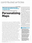
Geographic maps constitute a ubiquitous medium through which we understand, construct, and naviga... more Geographic maps constitute a ubiquitous medium through which we understand, construct, and navigate our natural and built surroundings. At the intersection of the explosion of geographic information online, data-mining techniques, and the increasing popularity of Web maps, a novel possibility has emerged: Instead of generating one map for large numbers of users, user pro ling and implicit feedback analysis can support creation of a different map for each person. The automated personalization of the map-making process is still in its infancy but has the potential to provide more relevant maps to millions of users worldwide.

International Journal of Geographical Information Science, 2015
In crowdsourced cartographic projects, mappers coordinate their efforts through online tools to p... more In crowdsourced cartographic projects, mappers coordinate their efforts through online tools to produce digital geospatial artefacts, such as maps and gazetteers, which were once the exclusive territory of professional surveyors and cartographers. In order to produce meaningful and coherent data, contributors need to negotiate a shared conceptualisation that defines the domain concepts, such as road, building, train station, forest, and lake, enabling the communication of geographic knowledge. Considering the OpenStreetMap Wiki website as a case study, this article investigates the nature of this negotiation, driven by a small group of mappers in a context of high contribution inequality. Despite the apparent consensus on the conceptualisation, the negotiation keeps unfolding in a tension between alternative representations, which are often incommensurable, i.e., hard to integrate and reconcile. In this study, we identify six complementary dimensions of incommensurability that recur in the negotiation: (i) ontology, (ii) cartography, (iii) culture and language, (iv) lexical definitions, (v) granularity, and (vi) semantic overload and duplication.

First Monday, Jul 2015
Search engine results influence the visibility of different viewpoints in political, cultural, an... more Search engine results influence the visibility of different viewpoints in political, cultural, and scientific debates. Treating search engines as editorial products with intrinsic biases can help understand the structure of information flows in new media. This paper outlines an empirical methodology to analyze the representation of topics in search engines, reducing the spatial and temporal biases in the results. As a case study, the methodology is applied to 15 popular conspiracy theories, examining type of content and ideological bias, demonstrating how this approach can inform debates in this field, specifically in relation to the representation of non?mainstream positions, the suppression of controversies and relativism.

Graphs have become ubiquitous structures to encode geographic knowledge online. The Semantic Web’... more Graphs have become ubiquitous structures to encode geographic knowledge online. The Semantic Web’s linked open data, folksonomies, wiki websites and open gazetteers can be seen as geo-knowledge graphs, that is labeled graphs whose vertices represent geographic concepts and whose edges encode the relations between concepts. To compute the semantic similarity of concepts in such structures, this article defines the network-lexical similarity measure (NLS). This measure estimates similarity by combining two complementary sources of information: the network similarity of vertices and the semantic similarity of the lexical definitions. NLS is evaluated on the OpenStreetMap Semantic Network, a crowdsourced geo-knowledge graph that describes geographic concepts. The hybrid approach outperforms both network and lexical measures, obtaining very strong correlation with the similarity judgments of human subjects.

New Media & Society , 2016
The recent emergence of e-readers and e-books has brought the death of the book to the centre of ... more The recent emergence of e-readers and e-books has brought the death of the book to the centre of current debates on new media. In this article, we analyse alternative narratives that surround the possibility of the disappearance of print books, dominated by fetishism, fears about the end of humanism, and ideas of techno-fundamentalist progress. We argue that, in order to comprehend such narratives, we need to inscribe them in the broader history of media. The emergence of new media, in fact, has often been accompanied by narratives about the possible disappearance of older media: the introduction of television, for instance, inspired claims about the forthcoming death of film and radio. As a recurrent narrative shaping the reception of media innovation, the myth of the disappearing medium helps us to make sense of the transformations that media change provokes in our everyday life.


Daring predictions of the proximate future can establish shared discursive frameworks, mobilize c... more Daring predictions of the proximate future can establish shared discursive frameworks, mobilize capital, and steer complex processes. Among the prophetic visions that encouraged and accompanied the development of new communication technologies was the “Digital Earth,” described in a 1998 speech by Al Gore as a high-resolution representation of the planet to share and analyze detailed information about its state. This article traces a genealogy of the Digital Earth as a techno-scientific myth, locating it in a constellation of media futures, arguing that a common subtext of these envisionments consists of a dream of wholeness, an afflatus to overcome perceived fragmentation among humans, and between humans and the Earth.

Journal of Spatial Information Science, 2013
Computational measures of semantic similarity between geographic terms pro- vide valuable support... more Computational measures of semantic similarity between geographic terms pro- vide valuable support across geographic information retrieval, data mining, and information integration. To date, a wide variety of approaches to geo-semantic similarity have been devised. A judgment of similarity is not intrinsically right or wrong, but obtains a certain degree of cognitive plausibility, depending on how closely it mimics human behavior. Thus selecting the most appropriate measure for a specific task is a significant challenge. To address this issue, we make an analogy between computational similarity measures and soliciting domain expert opinions, which incorporate a subjective set of beliefs, perceptions, hypotheses, and epistemic biases. Following this analogy, we define the semantic similarity ensemble (SSE) as a composition of different similarity measures, acting as a panel of experts having to reach a decision on the semantic similarity of a set of geographic terms. The ap- proach is evaluated in comparison to human judgments, and results indicate that an SSE performs better than the average of its parts. Although the best member tends to outperform the ensemble, all ensembles outperform the average performance of each ensemble’s member. Hence, in contexts where the best measure is unknown, the ensemble provides a more cognitively plausible approach.

This article addresses the emergent phenomenon of carto-vandalism, the intentional defacement of ... more This article addresses the emergent phenomenon of carto-vandalism, the intentional defacement of collaborative cartographic digital artefacts in the context of volunteered geographic information. Through a qualitative analysis of reported incidents in WikiMapia and OpenStreetMap, a typology of this kind of vandalism is outlined, including play, ideological, fantasy, artistic and industrial carto-vandalism, as well as carto-spam. Two families of counter-strategies deployed in amateur mapping communities are discussed. First, the contributors organize forms of policing, based on volunteered community involvement, patrolling the maps and reporting incidents. Second, the detection of carto-vandalism can be supported by automated tools, based either on explicit rules or on machine learning.

Annals of GIS, 2014
The linked open data (LOD) paradigm has emerged as a promising approach to structuring and sharin... more The linked open data (LOD) paradigm has emerged as a promising approach to structuring and sharing geospatial information. One of the major obstacles to this vision lies in the difficulties found in the automatic integration between heterogeneous vocabularies and ontologies that provides the semantic backbone of the growing constellation of open geo-knowledge bases. In this article, we show how to utilize WordNet as a semantic hub to increase the integration of LOD. With this purpose in mind, we devise Voc2WordNet, an unsupervised mapping technique between a given vocabulary and WordNet, combining intensional and extensional aspects of the geographic terms. Voc2WordNet is evaluated against a sample of human-generated alignments with the OpenStreetMap (OSM) Semantic Network, a crowdsourced geospatial resource, and the GeoNames ontology, the vocabulary of a large digital gazetteer. These empirical results indicate that the approach can obtain high precision and recall.

GeoInformatica, Jan 2014
In geographic information science and semantics, the computation of semantic similarity is widely... more In geographic information science and semantics, the computation of semantic similarity is widely recognised as key to supporting a vast number of tasks in information integration and retrieval. By contrast, the role of geo-semantic relatedness has been largely ignored. In natural language processing, semantic relatedness is often confused with the more specific semantic similarity. In this article, we discuss a notion of geo-semantic relatedness based on Lehrer’s semantic fields, and we compare it with geo-semantic similarity. We then describe and validate the Geo Relatedness and Similarity Dataset (GeReSiD), a new open dataset designed to evaluate computational measures of geo-semantic relatedness and similarity. This dataset is larger than existing datasets of this kind, and includes 97 geographic terms combined into 50 term pairs rated by 203 human subjects. GeReSiD is available online and can be used as an evaluation baseline to determine empirically to what degree a given computational model approximates geo-semantic relatedness and similarity.

Media, Culture & Society, Jan 2014
This article examines the role of discourses about new media technology and the web in the rise o... more This article examines the role of discourses about new media technology and the web in the rise of the 5-Star Movement (Movimento 5 Stelle, or M5S) in Italy. Founded by comedian and activist Beppe Grillo and web entrepreneur Gianroberto Casaleggio in 2009, this movement succeeded in becoming the second largest party at the 2013 national elections in Italy. This article aims to discuss how elements of digital utopia and web-centric discourses have been inserted into the movement’s political message, and how the construction of the web as a myth has shaped the movement’s discourse and political practice. The 5-Star Movement is compared and contrasted with other social and political movements in western countries which have displayed a similar emphasis on new media, such as the Occupy movement, the Indignados movement, and the Pirate Parties in Sweden and Germany. By adopting and mutating cyber-utopian discourses from the so-called Californian ideology, the movement symbolically identifies itself with the web. The traditional political establishment is associated with “old” media (television, radio, and the printed press), and represented as a “walking dead,” doomed to be superseded and buried by a web-based direct democracy.

International Journal of Geographical Information Science, Sep 2013
Volunteered geographic information (VGI) is generated by heterogenous ‘information communities’ t... more Volunteered geographic information (VGI) is generated by heterogenous ‘information communities’ that co-operate to produce reusable units of geographic knowledge. A consensual lexicon is a key factor to enable this open production model. Lexical definitions help demarcate the boundaries of terms, forming a thin semantic ground on which knowledge can travel. In VGI, lexical definitions often appear to be inconsistent, circular, noisy and highly idiosyncratic. Computing the semantic similarity of these ‘volunteered lexical definitions’ has a wide range of applications in GIScience, including information retrieval, data mining and information integration. This article describes a knowledge-based approach to quantify the semantic similarity of lexical definitions. Grounded in the recursive intuition that similar terms are described using similar terms, the approach relies on paraphrase-detection techniques and the lexical database WordNet. The cognitive plausibility of the approach is evaluated in the context of the OpenStreetMap (OSM) Semantic Network, obtaining high correlation with human judgements. Guidelines are provided for the practical usage of the approach.
ACM Journal on Computing and Cultural Heritage, 2023
The COVID-19 pandemic led to the temporary closure of all museums in the UK, closing buildings an... more The COVID-19 pandemic led to the temporary closure of all museums in the UK, closing buildings and suspending all on-site activities. Museum agencies aim at mitigating and managing these impacts on the sector, in a context of chronic data scarcity. "Museums in the Pandemic" is an interdisciplinary project that utilises content scraped from museums' websites and social media posts in order to understand how the UK museum sector, currently comprising over 3,300 museums, has responded and is currently responding to the pandemic. A major part of the project has been the design of computational techniques to provide the project's museum studies experts with appropriate data and tools for undertaking this research, leveraging web analytics, natural language processing, and machine learning. In this methodological contribution, firstly, we developed techniques to retrieve and identify museum official websites and social media accounts (Facebook and Twitter). This supported the automated capture of large-scale online data about the entire UK museum sector. Secondly, we harnessed convolutional neural networks to extract activity indicators from unstructured text in order to detect museum behaviours, including openings, closures, fundraising, and staffing. This dynamic dataset is enabling the museum studies experts in the team to study patterns in the online presence of museums before, during, and after the pandemic, according to museum size, governance, accreditation, and location 1. CCS Concepts: • Applied computing → Arts and humanities; • Information systems → Digital libraries and archives; • Computing methodologies → Knowledge representation and reasoning.
Transactions of the Institute of British Geographers, 2023
Museums are important centres of heritage, culture, education, and tourism. These diverse institu... more Museums are important centres of heritage, culture, education, and tourism. These diverse institutions operate in different ways, reaching different audiences and managing varied collections. Thanks to a novel database of unprecedented completeness produced by the project, this study provides a quantitative geography of museums in the UK, showing how about half of the sector had not been surveyed before. The presence of museums is mapped across several attributes, including museum size (estimated as yearly visits) and governance (government‐led, independent, or university‐led). Firstly, observing a snapshot of the sector in December 2017, we quantify and interpret the spatial distribution of museums, discussing its implications for access to museums, public service provision, resource allocation, and cultural tourism. Then, in a regional analysis, we study their density in relation to the local population, at the regional and Local Authority District scale, providing new evidence of the extent of spatial inequalities in the cultural sector, particularly relevant to a sector in which funding is mostly allocated at the regional level. At the crossing between human geography and museum studies, this inquiry reveals the centres and peripheries of this cultural sphere, providing fresh evidence of the presences and absences that shape cultural life across the UK.
Transactions in GIS, 2019
Online representations of places are becoming pivotal in informing our understanding of urban lif... more Online representations of places are becoming pivotal in informing our understanding of urban life. Content production on online platforms is grounded in the geography of their users and their digital infrastructure. These constraints shape place representation, that is the amount, quality, and type of digital information available in a geographic area. In this article, we study the place representation of user-generated content (UGC) in Los Angeles County, relating the spatial distribution of the data to its geo-demographic context. Adopting a comparative and multiplatform approach, this quantitative analysis investigates the spatial relationship between four diverse UGC datasets and their context at the census tract level (about 685,000 geo-located tweets, 9,700 Wikipedia pages, 4M OSM objects, and 180,000 Foursquare venues). The context includes the ethnicity, age, income, education, and deprivation of residents, as well as public infrastructure. An exploratory spatial analysis and regression-based models indicate that the four UGC platforms possess distinct geographies of place representation. To a moderate extent, the presence of Twitter, OpenStreetMap, and Foursquare data is influenced by population density, ethnicity, education, and income. However, each platform responds to different socio-economic factors and clusters emerge in disparate hotspots. Unexpectedly, Twitter data tends to be located in more dense, deprived areas, and the geography of Wikipedia appears peculiar and harder to explain. These trends are compared with previous findings for the area of Greater London.
ACM Journal on Computing and Cultural Heritage, 2019
Several studies have highlighted the absence of an integrated comprehensive dataset covering all ... more Several studies have highlighted the absence of an integrated comprehensive dataset covering all of the UK’s museums, hence impeding research into the emergence, evolution and wider impact of the UK’s museums sector. “Mapping Museums” is an interdisciplinary project aiming to develop a comprehensive database of UK museums in existence since 1960, and to use this to undertake an evidence-based analysis of the development of the UK’s museum sector during 1960-2020 and the links to wider cultural, social, and political concerns. A major part of the project has been the iterative, participatory design of a new RDF/S Knowledge Base to store data and metadata relating to the UK’s museums, and a Web Application for the project’s humanities scholars to browse, search and visualise the data in order to investigate their research questions. This paper presents the challenges we faced in developing the Knowledge Base and Web Application, our methodology and methods, the design and implementation of the system, and the design, outcomes and implications of a user trial undertaken with a group of experts from the UK’s museums sector.
Cultural Trends, 2019
Surveys of the UK museum sector have all had subtly different remits and so represent the sector ... more Surveys of the UK museum sector have all had subtly different remits and so represent the sector in a variety of ways. In the last three decades, surveys have almost invariably focused on accredited institutions, thereby omitting almost half of the museums in the UK. In this article we examine how data collection became tied to the accreditation scheme, and its effects on how the museum sector was and is represented as a professionalised sphere. Yet, while is important to understand the role of surveys in constructing the museum sector, this article goes beyond critique to show how the inclusion of unaccredited museums drastically changes the profile of the museum sector. We outline the inclusive approach that the Mapping Museums project team has taken with regards to data collection, and compare our findings with those that are produced when a survey is limited to accredited museums. In so doing, we sketch out an alternative, heterogeneous version of the UK museum sector and make recommendations based on that evidence.
International Journal of Geographical Information Science, 2018
Wikimapia is a major privately-owned volunteered geographic information (VGI) project to collect ... more Wikimapia is a major privately-owned volunteered geographic information (VGI) project to collect information about places. Over the past ten years, Wikimapia has attracted hundreds of thousands of contributors and collected millions of data points, including towns, restaurants, lakes, and tourist attractions (http://wikimapia.org). Unlike OpenStreetMap, Wikimapia adopts a "placial" perspective, favouring rich descriptions over detailed geometries and encouraging the collection of textual and visual content about places with approximate footprints. In this article, we first trace the origin and development of Wikimapia as a for-profit project, intimately linked with search engine advertising. Drawing on an in-depth interview with a former developer, we analyse project's data model and characteristics of its community. As Wikimapia discussions are rife with copyright issues, we discuss the project's intellectual property, as well as its strategies for quality management. Second, we focus on the popularity of the project, which is crucial to the longevity and sustainability of VGI projects. Using behavioural data from Google Trends, we trace a geography of interest in Wikimapia, comparing with that in OpenStreetMap, from a temporal and spatial perspective. While OpenStreetMap attracts more interest in high-income countries, Wikimapia emerges as relatively more popular in low-and middle-income countries, countering the received notion of VGI as a Global North phenomenon. Our study suggests that Wikimapia's popularity is steadily declining.
Convergence
This article discusses the role of technological myths in the development of Artificial Intellige... more This article discusses the role of technological myths in the development of Artificial Intelligence (AI) technologies from 1950s to the early 1970s. It shows how the rise of AI was accompanied by the construction of a powerful cultural myth: the creation of a thinking machine, which would be able to perfectly simulate the cognitive faculties of the human mind. Based on a content analysis of articles on Artificial Intelligence published in two magazines, the Scientific American and the New Scientist, which were aimed at a broad readership of scientists, engineers, and technologists, three dominant patterns in the construction of the AI myth are identified: (1) the recurrence of analogies and discursive shifts, by which ideas and concepts from other fields were employed to describe the functioning of AI technologies; (2) a rhetorical use of the future, imagining that present shortcomings and limitations will shortly be overcome; (3) the relevance of controversies around the claims of AI, which we argue should be considered as an integral part of the discourse surrounding the AI myth.
Every day, billions of Internet users rely on search engines to find information about places to ... more Every day, billions of Internet users rely on search engines to find information about places to make decisions about tourism, shopping, and countless other economic activities. In an opaque process, search engines assemble digital content produced in a variety of locations around the world and make it available to large cohorts of consumers. Although these representations of place are increasingly important and consequential, little is known about their characteristics and possible biases. Analyzing a corpus of Google search results generated for 188 capital cities, this article investigates the geographic dimension of search results, focusing on searches such as “Lagos” and “Rome” on different localized versions of the engine. This study answers these questions: To what degree is this city-related information locally produced and diverse? Which countries are producing their own representations and which are represented by others? Through a new indicator of localness of search results, we identify the factors that contribute to shape this uneven digital geography, combining several development indicators. The development of the publishing industry and scientific production appears as a fairly strong predictor of localness of results. This empirical knowledge will support efforts to curb the digital divide, promoting a more inclusive, democratic information society.
Geographic maps constitute a ubiquitous medium through which we understand, construct, and naviga... more Geographic maps constitute a ubiquitous medium through which we understand, construct, and navigate our natural and built surroundings. At the intersection of the explosion of geographic information online, data-mining techniques, and the increasing popularity of Web maps, a novel possibility has emerged: Instead of generating one map for large numbers of users, user pro ling and implicit feedback analysis can support creation of a different map for each person. The automated personalization of the map-making process is still in its infancy but has the potential to provide more relevant maps to millions of users worldwide.
International Journal of Geographical Information Science, 2015
In crowdsourced cartographic projects, mappers coordinate their efforts through online tools to p... more In crowdsourced cartographic projects, mappers coordinate their efforts through online tools to produce digital geospatial artefacts, such as maps and gazetteers, which were once the exclusive territory of professional surveyors and cartographers. In order to produce meaningful and coherent data, contributors need to negotiate a shared conceptualisation that defines the domain concepts, such as road, building, train station, forest, and lake, enabling the communication of geographic knowledge. Considering the OpenStreetMap Wiki website as a case study, this article investigates the nature of this negotiation, driven by a small group of mappers in a context of high contribution inequality. Despite the apparent consensus on the conceptualisation, the negotiation keeps unfolding in a tension between alternative representations, which are often incommensurable, i.e., hard to integrate and reconcile. In this study, we identify six complementary dimensions of incommensurability that recur in the negotiation: (i) ontology, (ii) cartography, (iii) culture and language, (iv) lexical definitions, (v) granularity, and (vi) semantic overload and duplication.
First Monday, Jul 2015
Search engine results influence the visibility of different viewpoints in political, cultural, an... more Search engine results influence the visibility of different viewpoints in political, cultural, and scientific debates. Treating search engines as editorial products with intrinsic biases can help understand the structure of information flows in new media. This paper outlines an empirical methodology to analyze the representation of topics in search engines, reducing the spatial and temporal biases in the results. As a case study, the methodology is applied to 15 popular conspiracy theories, examining type of content and ideological bias, demonstrating how this approach can inform debates in this field, specifically in relation to the representation of non?mainstream positions, the suppression of controversies and relativism.
Graphs have become ubiquitous structures to encode geographic knowledge online. The Semantic Web’... more Graphs have become ubiquitous structures to encode geographic knowledge online. The Semantic Web’s linked open data, folksonomies, wiki websites and open gazetteers can be seen as geo-knowledge graphs, that is labeled graphs whose vertices represent geographic concepts and whose edges encode the relations between concepts. To compute the semantic similarity of concepts in such structures, this article defines the network-lexical similarity measure (NLS). This measure estimates similarity by combining two complementary sources of information: the network similarity of vertices and the semantic similarity of the lexical definitions. NLS is evaluated on the OpenStreetMap Semantic Network, a crowdsourced geo-knowledge graph that describes geographic concepts. The hybrid approach outperforms both network and lexical measures, obtaining very strong correlation with the similarity judgments of human subjects.
New Media & Society , 2016
The recent emergence of e-readers and e-books has brought the death of the book to the centre of ... more The recent emergence of e-readers and e-books has brought the death of the book to the centre of current debates on new media. In this article, we analyse alternative narratives that surround the possibility of the disappearance of print books, dominated by fetishism, fears about the end of humanism, and ideas of techno-fundamentalist progress. We argue that, in order to comprehend such narratives, we need to inscribe them in the broader history of media. The emergence of new media, in fact, has often been accompanied by narratives about the possible disappearance of older media: the introduction of television, for instance, inspired claims about the forthcoming death of film and radio. As a recurrent narrative shaping the reception of media innovation, the myth of the disappearing medium helps us to make sense of the transformations that media change provokes in our everyday life.
Daring predictions of the proximate future can establish shared discursive frameworks, mobilize c... more Daring predictions of the proximate future can establish shared discursive frameworks, mobilize capital, and steer complex processes. Among the prophetic visions that encouraged and accompanied the development of new communication technologies was the “Digital Earth,” described in a 1998 speech by Al Gore as a high-resolution representation of the planet to share and analyze detailed information about its state. This article traces a genealogy of the Digital Earth as a techno-scientific myth, locating it in a constellation of media futures, arguing that a common subtext of these envisionments consists of a dream of wholeness, an afflatus to overcome perceived fragmentation among humans, and between humans and the Earth.
Journal of Spatial Information Science, 2013
Computational measures of semantic similarity between geographic terms pro- vide valuable support... more Computational measures of semantic similarity between geographic terms pro- vide valuable support across geographic information retrieval, data mining, and information integration. To date, a wide variety of approaches to geo-semantic similarity have been devised. A judgment of similarity is not intrinsically right or wrong, but obtains a certain degree of cognitive plausibility, depending on how closely it mimics human behavior. Thus selecting the most appropriate measure for a specific task is a significant challenge. To address this issue, we make an analogy between computational similarity measures and soliciting domain expert opinions, which incorporate a subjective set of beliefs, perceptions, hypotheses, and epistemic biases. Following this analogy, we define the semantic similarity ensemble (SSE) as a composition of different similarity measures, acting as a panel of experts having to reach a decision on the semantic similarity of a set of geographic terms. The ap- proach is evaluated in comparison to human judgments, and results indicate that an SSE performs better than the average of its parts. Although the best member tends to outperform the ensemble, all ensembles outperform the average performance of each ensemble’s member. Hence, in contexts where the best measure is unknown, the ensemble provides a more cognitively plausible approach.
This article addresses the emergent phenomenon of carto-vandalism, the intentional defacement of ... more This article addresses the emergent phenomenon of carto-vandalism, the intentional defacement of collaborative cartographic digital artefacts in the context of volunteered geographic information. Through a qualitative analysis of reported incidents in WikiMapia and OpenStreetMap, a typology of this kind of vandalism is outlined, including play, ideological, fantasy, artistic and industrial carto-vandalism, as well as carto-spam. Two families of counter-strategies deployed in amateur mapping communities are discussed. First, the contributors organize forms of policing, based on volunteered community involvement, patrolling the maps and reporting incidents. Second, the detection of carto-vandalism can be supported by automated tools, based either on explicit rules or on machine learning.
Annals of GIS, 2014
The linked open data (LOD) paradigm has emerged as a promising approach to structuring and sharin... more The linked open data (LOD) paradigm has emerged as a promising approach to structuring and sharing geospatial information. One of the major obstacles to this vision lies in the difficulties found in the automatic integration between heterogeneous vocabularies and ontologies that provides the semantic backbone of the growing constellation of open geo-knowledge bases. In this article, we show how to utilize WordNet as a semantic hub to increase the integration of LOD. With this purpose in mind, we devise Voc2WordNet, an unsupervised mapping technique between a given vocabulary and WordNet, combining intensional and extensional aspects of the geographic terms. Voc2WordNet is evaluated against a sample of human-generated alignments with the OpenStreetMap (OSM) Semantic Network, a crowdsourced geospatial resource, and the GeoNames ontology, the vocabulary of a large digital gazetteer. These empirical results indicate that the approach can obtain high precision and recall.
GeoInformatica, Jan 2014
In geographic information science and semantics, the computation of semantic similarity is widely... more In geographic information science and semantics, the computation of semantic similarity is widely recognised as key to supporting a vast number of tasks in information integration and retrieval. By contrast, the role of geo-semantic relatedness has been largely ignored. In natural language processing, semantic relatedness is often confused with the more specific semantic similarity. In this article, we discuss a notion of geo-semantic relatedness based on Lehrer’s semantic fields, and we compare it with geo-semantic similarity. We then describe and validate the Geo Relatedness and Similarity Dataset (GeReSiD), a new open dataset designed to evaluate computational measures of geo-semantic relatedness and similarity. This dataset is larger than existing datasets of this kind, and includes 97 geographic terms combined into 50 term pairs rated by 203 human subjects. GeReSiD is available online and can be used as an evaluation baseline to determine empirically to what degree a given computational model approximates geo-semantic relatedness and similarity.
Media, Culture & Society, Jan 2014
This article examines the role of discourses about new media technology and the web in the rise o... more This article examines the role of discourses about new media technology and the web in the rise of the 5-Star Movement (Movimento 5 Stelle, or M5S) in Italy. Founded by comedian and activist Beppe Grillo and web entrepreneur Gianroberto Casaleggio in 2009, this movement succeeded in becoming the second largest party at the 2013 national elections in Italy. This article aims to discuss how elements of digital utopia and web-centric discourses have been inserted into the movement’s political message, and how the construction of the web as a myth has shaped the movement’s discourse and political practice. The 5-Star Movement is compared and contrasted with other social and political movements in western countries which have displayed a similar emphasis on new media, such as the Occupy movement, the Indignados movement, and the Pirate Parties in Sweden and Germany. By adopting and mutating cyber-utopian discourses from the so-called Californian ideology, the movement symbolically identifies itself with the web. The traditional political establishment is associated with “old” media (television, radio, and the printed press), and represented as a “walking dead,” doomed to be superseded and buried by a web-based direct democracy.
International Journal of Geographical Information Science, Sep 2013
Volunteered geographic information (VGI) is generated by heterogenous ‘information communities’ t... more Volunteered geographic information (VGI) is generated by heterogenous ‘information communities’ that co-operate to produce reusable units of geographic knowledge. A consensual lexicon is a key factor to enable this open production model. Lexical definitions help demarcate the boundaries of terms, forming a thin semantic ground on which knowledge can travel. In VGI, lexical definitions often appear to be inconsistent, circular, noisy and highly idiosyncratic. Computing the semantic similarity of these ‘volunteered lexical definitions’ has a wide range of applications in GIScience, including information retrieval, data mining and information integration. This article describes a knowledge-based approach to quantify the semantic similarity of lexical definitions. Grounded in the recursive intuition that similar terms are described using similar terms, the approach relies on paraphrase-detection techniques and the lexical database WordNet. The cognitive plausibility of the approach is evaluated in the context of the OpenStreetMap (OSM) Semantic Network, obtaining high correlation with human judgements. Guidelines are provided for the practical usage of the approach.

Spatial Humanities, 2022
Films are deeply geographical. Externally, they are produced in places, across increasingly compl... more Films are deeply geographical. Externally, they are produced in places, across increasingly complex and shifting global networks that connect organisations, cities, professionals, and equipment. Internally, their imagined geographies are set in either real or fictional places, and refer to their social, political, and cultural facets. In this study, we adopt a cultural analytics approach to commence an investigation of the spatial dimension of films, focussing on toponyms in film plots. Using geoparsing, we extract toponyms from about 42,000 film plots from Wikipedia and we analyse their spatial distribution by country. We then consider the relationship between a film's country of origin and the plot toponyms, charting the flows from places where films are produced to the geographies evoked in their stories.

AGILE 2019, 2019
Since its emergence in the 1990s, the area of Participatory GIS (PGIS) has generated numerous int... more Since its emergence in the 1990s, the area of Participatory GIS (PGIS) has generated numerous interactive mapping tools to support complex planning processes. The need to involve non-expert users makes the usability of these tools a crucial aspect that contributes to their success or failure. While many approaches and procedures have been proposed to assess usability in general, to date there is no standardized way to measure the overall usability of a PGIS. For this purpose, we introduce the Participatory GIS Usability Scale (PGUS), a questionnaire to evaluate the usability of a PGIS along five dimensions (user interface, spatial interface, learnability, effectiveness, and communication). The questionnaire was developed in collaboration with the user community of SeaSketch, a web-based platform for marine spatial planning. PGUS quantifies the subjective perception of usability on a scale between 0 and 100, facilitating the rapid evaluation and comparison between PGIS. As a case study, the PGUS was used to collect feedback from 175 SeaSketch users, highlighting the usability strengths and weaknesses of the platform.

AGILE 2019, 2019
Search engines make information about places available to billions of users, who explore geograph... more Search engines make information about places available to billions of users, who explore geographic information for a variety of purposes. The aggregated, large-scale search behavioural statistics provided by Google Trends can provide new knowledge about the spatial and temporal variation in interest in places. Such search data can provide useful knowledge for tourism management, especially in relation to the current crisis of tourist (over)crowding, capturing intense spatial concentrations of interest. Taking the Amsterdam metropolitan area as a case study and Google Trends as a data source, this article studies the spatial and temporal variation in interest in places at multiple scales, from 2007 to 2017. First, we analyze the global interest in the Netherlands and Amsterdam, comparing it with hotel visit data. Second, we compare interest in municipalities, and observe changes within the same municipalities. This interdisciplinary study shows how search data can trace new geographies between the interest origin (what place users search from) and the interest destination (what place users search for), with potential applications to tourism management and cognate disciplines.

AGILE Short Papers, 2019
Digital maps are ubiquitous, supporting countless online activities. Most interactive mapping pla... more Digital maps are ubiquitous, supporting countless online activities. Most interactive mapping platforms support three user operations to move across space: zooming in, zooming out, and panning. While using interactive maps, it is common for users to land in an unfamiliar area at high zoom levels. To understand the location of the area, users zoom out, identify known objects, such as large cities and other landmarks, and zoom back into the target area, an operation known as confirmation of relative position. This operation is cognitively complex, time-consuming, and prone to cause disorientation. This article outlines a generic framework to support map navigation by placing contextual information around the map, bridging the on-and off-screen spaces. The proposed framework allows the dynamic generation of spatial cues in a context frame in the map that shows objects located outside of the map, reducing the need for relative positioning. The approach is based on an algorithm that ranks the prominence of nearby objects, and is illustrated in a case study about a small Italian town. This framework can also support cognitive mapping, showing spatial relations between geographical objects in a novel way. The source code and a demo of the framework are available online.

Geospatial Data in a Changing World, AGILE 2016, 2016
Geographic Information Systems (GIS) support spatial problem solving by large repositories of pro... more Geographic Information Systems (GIS) support spatial problem solving by large repositories of procedures, which are mainly operating on map layers. These procedures and their parameters are often not easy to understand and use, especially not for domain experts without extensive GIS training. This hinders a wider adoption of mapping and spatial analysis across disciplines. Building on the idea of core concepts of spatial information, and further developing the language for spatial computing based on them, we introduce an alternative approach to spatial analysis, based on the idea that users should be able to ask questions about the environment, rather than finding and executing procedures on map layers. We define such questions in terms of the core concepts of spatial information, and use data abstraction instead of procedural abstraction to structure command spaces for application programmers (and ultimately for end users). We sketch an implementation in Python that enables application programmers to dispatch computations to existing GIS capabilities. The gains in usability and conceptual clarity are illustrated through a case study from economics, comparing a traditional procedural solution with our declarative approach. The case study shows a reduction of computational steps by around 45%, as well as smaller and better organized command spaces.

Grounding linked open data in WordNet: The case of the OSM semantic network

earching for places is the most popular geographic online task, in which names and

Life Cycle Assessment (LCA) evaluates the environmental impact of a product through its entire li... more Life Cycle Assessment (LCA) evaluates the environmental impact of a product through its entire life cycle, from material extraction to final disposal or recycling. The environmental impacts of an activity depend on both the ac-tivity's direct emissions to the environment as well as indirect emissions caused by activities elsewhere in the supply chain. Both the impacts of direct emissions and the provisioning of supply chain inputs to an activity depend on the activity's spatiotemporal scope. When accounting for spatiotemporal dynamics, LCA often faces significant data interoperability challenges. Ontologies and Semantic technologies can foster interoperability between diverse data sets from a variety of domains. Thus, this paper presents an ontology for modeling spatiotemporal scopes, i.e., the contexts in which impact estimates are valid. We discuss selected axioms and illustrate the use of the ontology by providing an example from LCA practice. The ontology enables practit...

E-recruitment uses a range of web-based technologies to find, evaluate, and hire new personnel fo... more E-recruitment uses a range of web-based technologies to find, evaluate, and hire new personnel for organizations. A crucial challenge in this arena lies in the categorization of job o↵ers: candidates and operators often explore and analyze large numbers of o↵ers and profiles through a set of job categories. To date, recruitment organizations define job categories top-down, relying on standardized vocabularies that often fail to capture new skills and requirements that emerge from dynamic labor markets. In order to support e-recruitment, this paper presents a dynamic, bottom-up method to automatically enrich and revise job categories. The method detects novel, highly characterizing terms in a corpus of job o↵ers, leading to a more e↵ective categorization, and is evaluated on real-world data by Mul-tiposting (http://www.multiposting.fr/en), a large French e-recruitment firm.

To facilitate the reuse of existing data requires a better un- derstanding of their context. Inst... more To facilitate the reuse of existing data requires a better un- derstanding of their context. Instead of focusing on dataset-specific meta- data and provenance records alone, we propose to explore the broader, often implicit contextual information that is formed by viewing data as an interconnected system.

COSIT Workshop on Teaching Spatial Thinking, Oct 2015
We propose to include the perspective of spatial computing in interdisciplinary courses on spatia... more We propose to include the perspective of spatial computing in interdisciplinary courses on spatial thinking. Specifically, we recom- mend developing and applying a set of spatial lenses through which learn- ers of Geographic Information Systems (GIS) get to see geographic space and choose spatial computations. These lenses are based on the core concepts of spatial information proposed by the authors. While there is intentionally nothing new about the concepts per se, their explicit use as lenses through which to see geographic information and select GIS oper- ations is innovative. Thus, we propose a lightning talk on core concepts of spatial information as a form of spatial thinking to support learning GIS.

AGILE Conference on Geographic Information Science, 2015, 2015
We present the design rationale underlying a language for spatial computing and sketch a prototyp... more We present the design rationale underlying a language for spatial computing and sketch a prototypical implementation in Python. The goal of this work is to provide a high-level language for spatial computing that is executable on existing commercial and open source spatial computing platforms, particularly Geographic Information Systems (GIS). The key idea of the approach is to target an abstraction level higher than that of GIS commands and data formats, yet meaningful within and across application domains. The paper describes the underlying theory of spatial information and shows its evolving formal specification. An embedding in Python exemplifies access to commonly available implementations of spatial computations.

AGILE Conference on Geographic Information Science 2015 – Short Papers, 2015
Place is a central category in the human experience. Across cultures, individuals describe experi... more Place is a central category in the human experience. Across cultures, individuals describe experiences, express opinions, narrate stories set in and about places. The web provides a large, dynamic corpus of documents describing places from a myriad of viewpoints. Emotions and their expression play an important role in these representations of places, making some places appear joyful and beautiful, and others scary, sad, or even disgusting. In this paper we propose to tap the corpus of place descriptions from the emotional viewpoint, aiming at the development of a framework to model, extract, and analyze emotions relative to places. As first steps in this direction, we focus on place classes, i.e. the types of places that are discussed, such as city, forest, and road. To identify such classes, we design the Place Vocabulary, a linked semantic resource that contains nouns in English that are used to identify natural and built places. Subsequently, we propose a natural language processing technique to extract a multi-dimensional model of place emotion, based on the vocabulary in WordNet-Affect. The technique is applied to a corpus of about 100,000 travel blog posts from travelblog.org, enabling the exploration of the emotional structure of place classes.

Workshop on Geographic Information Observatories @GIScience 2014, 8th International Conference on Geographic Information Science. Vienna, Sept 23-26., 2014
The convergence of Earth-observing media, web technologies, and cheap, portable devices has resul... more The convergence of Earth-observing media, web technologies, and cheap, portable devices has resulted in an explosion of geographic information. Although powerful, the “geographic information universe” metaphor obfuscates the deeply social and political nature of the socio-technical systems in which the flood of geographic information is produced and consumed. Unlike the physical universe that exists beyond human purposes, the geographic information universe has identi- fiable access points that define its boundaries and shape its inner struc- ture: search technologies provide the main interface between data flows and users, enabling them to rapidly extract useful fragments of information. This article argues for an inter-disciplinary effort to understand search technologies and their implications for the geographic information universe, both for its inhabitants and its observers.

A cognitively plausible measure of semantic similarity between geographic concepts is valuable ac... more A cognitively plausible measure of semantic similarity between geographic concepts is valuable across several areas, including geographic information retrieval, data mining, and ontology alignment. Semantic similarity measures are not intrinsically right or wrong, but obtain a certain degree of cognitive plausibility in the context of a given application. A similarity measure can therefore be seen as a domain expert summoned to judge the similarity of a pair of concepts according to her subjective set of beliefs, perceptions, hypotheses, and epistemic biases. Following this analogy, we first define the similarity jury as a panel of experts having to reach a decision on the semantic similarity of a set of geographic concepts. Second, we have conducted an evaluation of 8 WordNet-based semantic similarity measures on a subset of OpenStreetMap geographic concepts. This empirical evidence indicates that a jury tends to perform better than individual experts, but the best expert often outperforms the jury. In some cases, the jury obtains higher cognitive plausibility than its best expert.

W2GIS, Jan 1, 2012
In recent years, geographic information has entered the mainstream, deeply altering the pre-exist... more In recent years, geographic information has entered the mainstream, deeply altering the pre-existing patterns of its production, distribution, and consumption. Through web mapping, millions of online users utilise spatial data in interactive digital maps. The typical unit of visualisation of geo-data is a viewport, defined as a bi-dimensional image of a map, fixed at a given scale, in a rectangular frame. In a viewport, the user performs analytical tasks, observing individual map features, or drawing high-level judgements about the objects in the viewport as a whole. Current geographic information retrieval (GIR) systems aim at facilitating analytical tasks, and little emphasis is put on the retrieval and indexing of visualised units, i.e. viewports. In this paper we outline a holistic, viewport-based GIR system, offering an alternative approach to feature-based GIR. Such a system indexes viewports, rather than individual map features, extracting descriptors of their high-level, overall semantics in a vector space model. This approach allows for efficient comparison, classification, clustering, and indexing of viewports. A case study describes in detail how our GIR system models viewports representing geographical locations in Ireland. The results indicate advantages and limitations of the viewport-based approach, which allows for a novel exploration of geographic data, using holistic semantics.

W2GIS, 2011
In recent years, the proliferation of Volunteered Geographic Information (VGI) has enabled many I... more In recent years, the proliferation of Volunteered Geographic Information (VGI) has enabled many Internet users to contribute to the construction of rich and increasingly complex spatial datasets. This growth of geo-referenced information and the often loose semantic structure of such data have resulted in spatial information overload. For this reason, a semantic gap has emerged between unstructured geo-spatial datasets and high-level ontological concepts. Filling this semantic gap can help reduce spatial information overload, therefore facilitating both user interactions and the analysis of such interaction. Implicit Feedback analysis is the focus of our work. In this paper we address this problem by proposing a system that executes spatial discovery queries. Our system combines a semantically-rich and spatially-poor ontology (DBpedia) with a spatially-rich and semantically-poor VGI dataset (OpenStreetMap). This technique differs from existing ones, such as the aggregated dataset LinkedGeoData, as it is focused on user interest analysis and takes map scale into account. System architecture, functionality and preliminary results gathered about the system performance are discussed.

… Archives of the …, Jan 1, 2010
As the volume of information available online continues to grow, there is an increasing problem w... more As the volume of information available online continues to grow, there is an increasing problem with information overload. This issue is also escalating in the spatial domain as the amount of geo-tagged information expands. With such an abundance of geo-information, it is difficult for map users to find content that is relevant to them. The problem is intensified when considering Location-Based Services. These services, which are dependent upon a user's geographic location, generally operate on portable devices. These devices have a reduced screen size coupled with a limited processing power and so the need to provide personalised content is of paramount importance. Our previous work has focused on examining techniques to determine user interests in order to provide adapted and personalised map content which is suitable to display on portable devices. In this paper, in order to reduce the processing load on the user's device, a novel client server architecture is employed. The framework is designed using open-source, web-based technologies which monitor user locations and interactions with map content overtime to produce a user profile. This profile is then used to render personalised maps. By utilising the power of web-based technologies in an innovative manner, any operational issues between different mobile devices is alleviated, as the device only requires a web-browser to receive map content. This article describes the techniques, architecture and technologies used to achieve this.

As the quantity of geospatial information rapidly increases, information overload in the spatial ... more As the quantity of geospatial information rapidly increases, information overload in the spatial domain is becoming a serious issue. Often the amount of information being displayed on digital maps makes it difficult to determine useful content. In order to assist in resolving this problem, personalisation techniques have been developed. The most effective techniques implicitly monitor user interactions with map interfaces and content in order to infer user interests. This permits the map to be adapted to suit individual users by highlighting or displaying a subset of available content. The work presented in this paper builds on this paradigm to refine map adaptations by using group profiling techniques. Such techniques identify similar users to the target user and utilise their interests as an indicator of possible interests for the target user. The map can then be adapted accordingly. The approach has been effective in the non-spatial domain however it has not been widely studied in the spatial context. The methodology behind this technique is presented in this paper while the approach is demonstrated through a case study of a map navigational assistant.

Proceedings Geoinformatik, Kiel, Germany, 2010
Abstract. As the quantity of geospatial information rapidly increases, information overload in th... more Abstract. As the quantity of geospatial information rapidly increases, information overload in the spatial domain is becoming a serious issue. Often the amount of information being displayed on digital maps makes it difficult to determine useful content. In order to assist in resolving this problem, personalisation techniques have been developed. The most effective techniques implicitly monitor user interactions with map interfaces and content in order to infer user interests. This permits the map to be adapted to suit individual users by ...

In: Fallimenti digitali: Un'archeologia dei «nuovi» media. Eds. Paolo Magaudda & Gabriele Balbi. Milano: Unicopli, 2018, pp. 137-49., 2018
A partire dall'emergere della nozione di intelligenza artificiale (IA) negli anni 1950, il sogno ... more A partire dall'emergere della nozione di intelligenza artificiale (IA) negli anni 1950, il sogno di sviluppare una macchina pensante è stato al centro di numerosi fallimenti e altrettante rinascite. Mentre alcuni informatici, scienziati e filosofi si sono sforzati di dimostrare l’impossibilità di una IA equivalente o superiore alla mente umana, altri hanno continuato a rinnovare la speranza di ottenerla. Il capitolo si propone di investigare il problema del fallimento tecnologico nel caso dell'IA, analizzando il modo in cui la controversia ha continuato ad alimentarsi nel corso di numerosi decenni. Tale dibattito può essere considerato funzionale al mantenimento e rinnovamento del mito della macchina pensante, il quale ha esercitato una costante influenza sul dibattito intellettuale e la cultura popolare dalla fine degli anni 1950 ad oggi. La controversia può essere pertanto considerata non un ostacolo ma un elemento funzionale alla costruzione del mito tecnologico dell’IA. Per comprendere l’impatto dei fallimenti tecnologici – intesi come costruzioni culturali piuttosto che eventi oggettivi – è dunque necessario abbandonare una dimensione dicotomica che oppone il successo in maniera troppo rigida al fallimento. La possibilità di fallimento di un progetto può rappresentare una risorsa simbolica capace di contribuire in maniera cruciale al processo di innovazione.
European Handbook of Crowdsourced Information, 2016
Vast swaths of geographic information are produced by non-professional contributors using online ... more Vast swaths of geographic information are produced by non-professional contributors using online collaborative tools. To extract value from the data, creators and consumers alike need some degree of consensus about what the entities of their domain of interest are and how they are related. Traditional information communities, such as government agencies, universities, and corporations, have devised informal and formal mechanisms to reduce the misinterpretation of the data they rely on, curating vocabularies, standards, and, more recently, formal ontologies. Because of the decentralized, fragmented nature of peer production, semantic agreements are more difficult to establish and to document in volunteered geographic information (VGI), severely limiting the re-usability and, ultimately, the value of the data. This paper provides an overview of the semantic issues experienced in VGI, and what potential solutions are emerging from research in geo-semantics and in the Semantic Web. The paradigm of Linked Data is discussed as a promising route to handle the semantic fragmentation of VGI, reducing the friction between data producers and consumers.

The computational representation of place is one of the key research areas for the advancement of... more The computational representation of place is one of the key research areas for the advancement of geographic information science (GIScience), bridging the gap between place-based human cognition and experience, and space-centered information systems. While many conceptual schemas, vocabularies and ontologies contain some notion of place, the concept is either left implicit or articulated in widely divergent ways. Because of its ubiquity, an ontological clarification of place seems overdue. Adopting the perspective of ontology engineering, and not that of philosophical Ontology, this article paves the way towards the formalization of a place ontology in two steps. First, it provides a critical survey of how this concept is currently represented from lightweight vocabularies to formal ontologies. Second, it presents a set of prolegomena for a place ontology which would overcome the limitations of current approaches. Acknowledging the cultural dependency of place, I argue that such an ontology should be seen as a module positioned between foundational and domain ontologies. This place ontology would provide (i) a conceptual tool to support the modeling of place in any domain, and (ii) a widely applicable ontology, whose deployment would increase the interoperability of datasets, particularly in the context of Linked Data.
A Case Study for eCampus Spatial-Business Data Exploration

Information Fusion and Geographic Information Systems (IF&GIS' 2015), 2015
Personal GeoServices are emerging as an interaction paradigm linking users to information rich en... more Personal GeoServices are emerging as an interaction paradigm linking users to information rich environments like a university campus or to Big Data sources like the Internet of Things by delivering spatially intelligent web-services. OpenStreetMap (OSM) constitutes a valuable source of spatial base-data that can be extracted, integrated, and utilised with such heterogeneous data sources for free. In this paper, we present a Personal GeoServices application built on OSM spatial data and university-specific business data for staff, faculty, and students. While generic products such as Google Maps and Google Earth enable basic forms of spatial exploration, the domain of a university campus presents specific business information needs, such as “What classes are scheduled in that room over there?” and “How can I get to Prof. Murray’s office from here?” Within the framework of the StratAG project (www.StratAG.ie), an eCampus Demonstrator was developed for the National University of Ireland Maynooth (NUIM) to assist university users in exploring and analysing their surroundings within a detailed data environment. This work describes this system in detail, discussing the usage of OSM vector data, and providing insights for developers of spatial information systems for personalised visual exploration of an area.

Quality Issues in the Management of Web Information, 2013
Over the past decade, rapid advances in web technologies, coupled with innovative models of spati... more Over the past decade, rapid advances in web technologies, coupled with innovative models of spatial data collection and consumption, have generated a robust growth in geo-referenced information, resulting in spatial information overload. Increasing ‘geographic intelligence’ in traditional text-based information retrieval has become a prominent approach to respond to this issue and to fulfill users’ spatial information needs. Numerous efforts in the Semantic Geospatial Web, Volunteered Geographic Information (VGI), and the Linking Open Data initiative have converged in a constellation of open knowledge bases, freely available online. In this article, we survey these open knowledge bases, focusing on their geospatial dimension. Particular attention is devoted to the crucial issue of the quality of geoknowledge bases, as well as of crowdsourced data. A new knowledge base, the OpenStreetMap Semantic Network, is outlined as our contribution to this area. Research directions in information integration and Geographic Information Retrieval (GIR) are then reviewed, with a critical discussion of their current limitations and future prospects.

The Mapping Museums research project began in October 2016 and will conclude in September 2020. I... more The Mapping Museums research project began in October 2016 and will conclude in September 2020. It is based at Birkbeck, University of London and is funded by the Arts and Humanities Research Council. The project focuses on growth and change in the UK museum sector from 1960 to 2020 and it has four main outputs:
• A database containing information on over 4,000 museums. This data can be browsed, searched, and visualised through a web application, and is free to use under the terms of the Creative Commons (BY) license.
• A website that houses the database and web application, and additional resources linked to the project. These include a glossary, detailed information on research methods, transcripts of interviews with museum founders, films and podcasts, and links to the project publications.
• A series of academic articles addressing research methods and findings.
• A monograph that draws on data, interviews with museum founders, and historical research, to analyse how and why so many new museums were established in the late twentieth century. Publication is planned for 2021.
The database and website can be found at: www.mappingmuseums.org
Report: http://museweb.dcs.bbk.ac.uk/static/pdf/MappingMuseumsReportMarch2020.pdf

This specialist meeting on the theme of spatial search provided a platform for exploring research... more This specialist meeting on the theme of spatial search provided a platform for exploring research frontiers at the interface of computer science, cognitive science, and other disciplines, especially in the context of geographically referenced information. This report reviews the discussions among 36 experts from academia and industry over two days, and draws attention to research gaps that will require broad interdisciplinary efforts over the next five to ten years.
![Research paper thumbnail of [Review] Tantalisingly Close: An Archaeology of Communication Desires in Discourses of Mobile Wireless Media](https://attachments.academia-assets.com/35805428/thumbnails/1.jpg) ](
](Without doubt, the desire to communicate is intrinsic to the human condition. As interpersonal co... more Without doubt, the desire to communicate is intrinsic to the human condition. As interpersonal communication is inevitably noisy, ambiguous, volatile, and often unsuccessful, the history of media can be seen as what De Vries dubs a “tragicomical quest for communicative fulfilment” (p. 8). De Vries’ objective is to uncover the deep mythological roots of communication technologies, showing how contradictory and untenable narratives of progress towards perfect communication continue to play an important and agentive role in the relationship between technology and society. This theoretical investigation, conducted through a media-archeological approach, is inscribed in a branch of media scholarship that, since the 1990s, has tackled the ideological and mythological imaginary of new media, consistently seen as the enabler of paradise or hell (e.g. Mosco 2004, Barbrook 2007).

Il Contesto, 2014
L'8 febbraio 1996 John Perry Barlow, autore di molti testi dei Grateful Dead e attivista digitale... more L'8 febbraio 1996 John Perry Barlow, autore di molti testi dei Grateful Dead e attivista digitale, era in Svizzera al World Economic Forum. Alcuni dicono che fosse ubriaco ed euforico, forse contagiato dall'atmosfera di ottimismo dell'élite globale che si respirava a Davos in quegli anni. Dopo aver ballato per ore, quella notte Barlow si mise al computer in hotel e disseminò sul web la sua "Dichiarazione d'Indipendenza del Cyberspazio", il cui famoso incipit divenne virale: "Governi del Mondo, stanchi giganti di carne e di acciaio, io vengo dal Cyberspazio, la nuova dimora della Mente. A nome del futuro, chiedo a voi, esseri del passato, di lasciarci soli. Non siete graditi fra di noi. Non avete alcuna sovranità sui luoghi dove ci incontriamo".
Il Contesto, 2012
Prof. Siva Vaidhyanathan is a cultural historian and media scholar, and is currently the Robertso... more Prof. Siva Vaidhyanathan is a cultural historian and media scholar, and is currently the Robertson Professor in Media Studies at the University of Virginia. He is a frequent contributor on media and cultural issues to various periodicals including The Chronicle of Higher Education, The New York Times Magazine, The Nation, and Salon. His publications include “Copyrights and Copywrongs: The Rise of Intellectual Property and How It Threatens Creativity” (NYU Press, 2003) and “The Googlization of Everything (and why we should worry)” (University of California Press, 2011).

Il Contesto, 2010
Nel 1869 Jules Verne immagina che molte navi delle potenze imperiali inizino a imbattersi in un p... more Nel 1869 Jules Verne immagina che molte navi delle potenze imperiali inizino a imbattersi in un pericoloso «oggetto enorme, oblungo, fusiforme, a volte fosforescente e molto più grande e veloce di una balena». In realtà si trattava di un misterioso vascello subacqueo, progettato e comandato da un colto e vendicativo capitano indiano. Pubblicato nella collana Voyages Extraordinaires, “Ventimila leghe sotto i mari” è entrato con forza nell’immaginario collettivo europeo e, oltre a prefigurare temi della fantascienza moderna, ha colto il potenziale militare che i sottomarini – in particolare gli U- Boat tedeschi – avrebbero rivelato nella prima guerra mondiale.

Zenodo (CERN European Organization for Nuclear Research), Apr 19, 2023
The geography of the cultural sector concerns the location of producers, consumers, and venues of... more The geography of the cultural sector concerns the location of producers, consumers, and venues of the Cultural and Creative Industries (CCIs) to answer questions about their development and dynamics. Considering the case of the UK museums, we use national data from the Mapping Museums project to study their geodemographic context at the Local Authority District level. Across the UK, we observe the distribution of different types of museums according to their governance type and subject matter in areas belonging to different geodemographic categories. Both in terms of simple counts and divergence from expected values, different types of museums show vastly different distributions and trends, reflecting the variety of the sector.

BMC Public Health, Jan 10, 2023
Background Evidence for an association between the local food environment, diet and diet-related ... more Background Evidence for an association between the local food environment, diet and diet-related disease is mixed, particularly in the UK. One reason may be the use of more distal outcomes such as weight status and cardiovascular disease, rather than more proximal outcomes such as food purchasing. This study explores associations between food environment exposures and food and drink purchasing for at-home and out-of-home (OOH) consumption. Methods We used item-level food and drink purchase data for London and the North of England, UK, drawn from the 2019 Kantar Fast Moving Consumer Goods panel to assess associations between food environment exposures and household-level take-home grocery (n=2,118) and individual-level out-of-home (n=447) food and drink purchasing. Density, proximity and relative composition measures were created for both supermarkets and OOH outlets (restaurants and takeaways) using a 1 km network buffer around the population-weighted centroid of households' home postcode districts. Associations between food environment exposure measures and frequency of take-home food and drink purchasing, total take-home calories, calories from fruits and vegetables, high fat, salt and sugar products, and ultra-processed foods (UPF), volume of take-home alcoholic beverages, and frequency of OOH purchasing were modelled using negative binomial regression adjusted for area deprivation, population density, and individual and household socioeconomic characteristics. Results There was some evidence for an inverse association between distance to OOH food outlets and calories purchased from ultra-processed foods (UPF), with a 500 m increase in distance to the nearest OOH outlet associated with a 1.1% reduction in calories from UPF (IR=0.989, 95%CI 0.982-0.997, p=0.040). There was some evidence for regionspecific effects relating to purchased volumes of alcohol. However, there was no evidence for an overall association between food environment exposures and take-home and OOH food and drink purchasing. Conclusions Despite some evidence for exposure to OOH outlets and UPF purchases, this study finds limited evidence for the impact of the food environment on household food and drink purchasing. Nonetheless, region-specific effects regarding alcohol purchasing indicate the importance of geographical context for research and policy.
The context of outdoor walking: A classification of user‐generated routes
The Geographical Journal, Mar 19, 2023
Leisure walking has known benefits to public health, from both physical and psychological viewpoi... more Leisure walking has known benefits to public health, from both physical and psychological viewpoints. Complementing traditional print information sources, dedicated online platforms and apps provide tools to search, discover, plan and share routes. While walking routes are highly heterogeneous in terms of their properties and geographical context, current platforms adopt simple representations of basic attributes. In this article, we report on a research project at the Ordnance Survey on the representation and recommendation of walking routes, which comprises the following contributions. Firstly, we outline a theoretical framework of leisure walking, intersecting its individual, social and environmental dimensions. Secondly, analysing about 4 million user‐generated walking routes produced in Great Britain, we characterise routes combining primary attributes and contextual information, including land cover and points of interest. Thirdly, by applying unsupervised learning to this data model, we produce the Walking Route Classification. This classification is methodologically similar to geo‐demographic classifications and identifies groups and supergroups of similar routes in a large multidimensional attribute space. This body of work is evaluated through a survey and a focus group with experts, showing encouraging results.

Zenodo (CERN European Organization for Nuclear Research), Apr 19, 2023
Extracting rich contextual information from study participants presents an interesting challenge ... more Extracting rich contextual information from study participants presents an interesting challenge when the expected results are uncertain. This article presents the design of a contextual geographic information system (GIS) to extract platial information from a multimodal data set (audio, video, and GPS) collected during a 'think-aloud' leisure walking study. WalkGIS enables transcriptions, labelling, and platial analysis to be performed within one system, with data being linked and coordinated to form linked video narratives.
Museums, COVID‐19 and the pivot to social media
Curator: The Museum Journal
This paper examines social media activity by UK museums during the COVID‐19 pandemic. There is a ... more This paper examines social media activity by UK museums during the COVID‐19 pandemic. There is a general perception that as museums closed their doors for extended periods, their digital presence increased to maintain connections with their audiences. However, much of the research conducted in this area is based on small‐scale studies and examples of best practice from large, well‐resourced museums. By contrast, this study utilizes a comprehensive database of over 3300 active UK museums to understand the use of Facebook and Twitter across the sector. Specifically, the paper examines the frequency with which museums posted to these digital platforms as they attempted to engage with their audiences. Our findings indicate that there was no substantial increase in social media use and activity across the UK museum sector during the COVID‐19 pandemic. This research has implications for museologists studying the impact of the pandemic on museums' digital activity, for museum social me...
OP76 Associations between the food environment and food and drink purchasing: cross-sectional study using large-scale commercial purchasing data
SSM Annual Scientific Meeting

Over the past decade, rapid advances in web technologies, coupled with innovative models of spati... more Over the past decade, rapid advances in web technologies, coupled with innovative models of spatial data collection and consumption, have generated a robust growth in geo-referenced information, resulting in spatial information over-load. Increasing ‘geographic intelligence’ in traditional text-based information retrieval has become a prominent approach to respond to this issue and to fulfill users’ spatial information needs. Numerous efforts in the Semantic Geospatial Web, Volunteered Geographic Information (VGI), and the Linking Open Data initiative have converged in a constellation of open knowledge bases, freely available online. In this article, we survey these open knowledge bases, focusing on their geospatial dimension. Particular attention is devoted to the crucial issue of the quality of geo-knowledge bases, as well as of crowdsourced data. A new knowledge base, the OpenStreetMap Semantic Network, is outlined as our contribution to this area. Re-search directions in informa...
International Journal of Digital Earth, 2018
Geographic information has become central for data scientists of many disciplines to put their an... more Geographic information has become central for data scientists of many disciplines to put their analyzes into a spatio-temporal perspective. However, just as the volume and variety of data sources on the Web grow, it becomes increasingly harder for analysts to be familiar with all the available geospatial tools, including toolboxes in Geographic Information Systems (GIS), R packages, and Python modules. Even though the semantics of the questions answered by these tools can be broadly shared, tools and data sources are still divided by syntax and platform-specific technicalities. It would, therefore, be hugely beneficial for information science if analysts could simply ask questions in generic and familiar terms to obtain the tools and data necessary to answer them. In this article, we systematically investigate the analytic questions that lie behind a range of common GIS tools, and we propose a semantic framework to match analytic questions and tools that are capable of answering them. To support the matching process, we define a tractable subset of SPARQL, the query language of the Semantic Web, and we propose and test an algorithm for computing query containment. We illustrate the identification of tools to answer user questions on a set of common user requests.
The UK museum boom: continuity and change 1960–2019
Cultural Trends, Jul 6, 2023
Associations between area deprivation and changes in the digital food environment during the COVID-19 pandemic: Longitudinal analysis of three online food delivery platforms
Health & Place

Zenodo (CERN European Organization for Nuclear Research), Jun 23, 2022
Films are deeply geographical. Externally, they are produced in places, across increasingly compl... more Films are deeply geographical. Externally, they are produced in places, across increasingly complex and shifting global networks that connect organisations, cities, professionals, and equipment. Internally, their imagined geographies are set in either real or fictional places, and refer to their social, political, and cultural facets. In this study, we adopt a cultural analytics approach to commence an investigation of the spatial dimension of films, focussing on toponyms in film plots. Using geoparsing, we extract toponyms from about 42,000 film plots from Wikipedia and we analyse their spatial distribution by country. We then consider the relationship between a film's country of origin and the plot toponyms, charting the flows from places where films are produced to the geographies evoked in their stories.

Transactions of the Institute of British Geographers
Museums are a vital part of the British cultural and economic landscape, and have a crucial role ... more Museums are a vital part of the British cultural and economic landscape, and have a crucial role in heritage, tourism, and education. In England alone, before the COVID-19 pandemic, museums attracted up to 100 million annual visits, with a turnover of £2.64 billion per annum (Association of Independent Museums, 2019; Tuck, 2015). While the public imagination about the sector is dominated by (and often reduced to) prominent national museums funded by the central government and attracting global audiences, such as the British Museum, other museums are vastly heterogeneous, both in terms of purposes, objects, funding mechanisms, and audiences, playing diverse roles. The Potteries Museum in Stoke-on-Trent is a large museum managed by a local authority and serves mostly local communities; The Black Watch
LIPIcs, Volume 86, COSIT'17, Complete Volume
LIPIcs, Volume 86, COSIT'17, Complete Volume
andrea-ballatore/litter-dynamics: Supplementary material for journal article "This city is not a bin
Supplementary material for A. Ballatore, T. J. Verhagen, Z. Li, S. Cucurachi, "This city is ... more Supplementary material for A. Ballatore, T. J. Verhagen, Z. Li, S. Cucurachi, "This city is not a bin: Crowdmapping the distribution of urban litter", Journal of Industrial Ecology, 2021
Spatio-temporal variability in Wikipedia content: The case of Greater London
Author(s): Nawfee, Shahreen Muntaha; Ballatore, Andrea; De Sabbata, Stefano; Tate, Nicholas | Abs... more Author(s): Nawfee, Shahreen Muntaha; Ballatore, Andrea; De Sabbata, Stefano; Tate, Nicholas | Abstract: Spatial user-generated content (UGC) is increasingly being used to study a variety of geographical phenomena, including urban change in social and economic dimensions. Wikipedia content evolves over time and includes articles about geographical areas, points of interest, and geo-located events. In this article, we explore the spatio-temporal variability of geo-located Wikipedia pages, considering their complete editing history. Selecting Greater London as a case study, we study the association between Wikipedia activity and the socio-demographic characteristics of the spatial context. Editing activity grows rapidly at first, and is then followed by a slowdown, reaching a stable rate, with occasional spikes. The initial growth is distributed throughout the study area, but activity becomes gradually more concentrated in central areas. The socio-demographic variability is strongly related to the presence of Wikipedia pages, but only partially to the editing. This approach may support the detection and characterisation of socio-economic change at the urban scale.
Tracing Tourism Geographies with Google Trends: A Dutch Case Study
Search engines make information about places available to billions of users, who explore geograph... more Search engines make information about places available to billions of users, who explore geographic information for a variety of purposes. The aggregated, large-scale search behavioural statistics provided by Google Trends can provide new knowledge about the spatial and temporal variation in interest in places. Such search data can provide useful knowledge for tourism management, especially in relation to the current crisis of tourist (over)crowding, capturing intense spatial concentrations of interest. Taking the Amsterdam metropolitan area as a case study and Google Trends as a data source, this article studies the spatial and temporal variation in interest in places at multiple scales, from 2007 to 2017. First, we analyze the global interest in the Netherlands and Amsterdam, comparing it with hotel visit data. Second, we compare interest in municipalities, and observe changes within the same municipalities. This interdisciplinary study shows how search data can trace new geograph...
Fallimenti, controversie e il mito tecnologico dell’Intelligenza Artificiale
A partire dall'emergere della nozione di intelligenza artificiale (IA) negli anni 1950, il so... more A partire dall'emergere della nozione di intelligenza artificiale (IA) negli anni 1950, il sogno di sviluppare una macchina pensante e stato al centro di numerosi fallimenti e altrettante rinascite. Mentre alcuni informatici, scienziati e filosofi si sono sforzati di dimostrare l’impossibilita di una IA equivalente o superiore alla mente umana, altri hanno continuato a rinnovare la speranza di ottenerla. Il capitolo si propone di investigare il problema del fallimento tecnologico nel caso dell'IA, analizzando il modo in cui la controversia ha continuato ad alimentarsi nel corso di numerosi decenni. Tale dibattito puo essere considerato funzionale al mantenimento e rinnovamento del mito della macchina pensante, il quale ha esercitato una costante influenza sul dibattito intellettuale e la cultura popolare dalla fine degli anni 1950 ad oggi. La controversia puo essere pertanto considerata non un ostacolo ma un elemento funzionale alla costruzione del mito tecnologico dell’IA. ...
Francia, l'eccezione culturale in Europa – Eurobull.it
Ronald Bergan scrive di Cinema per il Guardian, vive nel sud-est della Francia e dice sul suo blo... more Ronald Bergan scrive di Cinema per il Guardian, vive nel sud-est della Francia e dice sul suo blogche nessuna nazione tratta meglio cinefili e cineasti. Il sistema di distribuzione e di…

The past decade has witnessed a steady growth of open source software usage in industry and acade... more The past decade has witnessed a steady growth of open source software usage in industry and academia, leading to a complex ecosystem of projects. Web and subsequently geographical information systems have become prominent technologies, widely adopted in diverse domains. Within this context, we developed an open source web platform for interoperable GIServices. In order to implement this architecture, 14 projects were selected and analysed, including the client-side libraries and the server-side components. Although other surveys have been conducted in this area, little feedback has been formally obtained from the users and developers concerning their opinion of these tools. A questionnaire was designed to obtain responses from the relevant online communities about a given set of characteristics. This article describes the technologies and reports the results of the survey, providing first-hand information about open source web and geospatial tools.
Personalizing maps
Communications of the ACM, 2015
Digital maps can be engineered to adapt to a person's unique interests and experience in geog... more Digital maps can be engineered to adapt to a person's unique interests and experience in geographic space.

AGILE 2018 conference Geographical Information Science , 2018
Crowdsourcing platforms and social media produce distinctive geographies of informational content... more Crowdsourcing platforms and social media produce distinctive geographies of informational content. The production process is enabled and influenced by a variety of socio-economic and demographic factors, shaping the place representation, i.e., the amount and type of information available in an area. In this study, we explore and explain the geographies of Twitter and Wikipedia in Greater London, highlighting the relationships between the crowdsourced data and the local geodemographic characteristics of the areas where they are located. Through a set of robust regression models on a sample of 1.6M tweets and about 22,000 Wikipedia articles, we identify level of education, presence of people aged 30-44, and property prices as the most important explanatory factors for place representation at the urban scale. To some extent, this confirms the received knowledge of such data being created primarily by relatively wealthy, young, and educated users. However, about half of the variability is left unexplained, suggesting that a broader inclusion of potential factors is necessary.