Radio stations in Roanoke, Virginia — World Radio Map (original) (raw)
- World Radio Map • North America • United States • Virginia • Roanoke
    Click on the radio station name to listen online Click on the radio station name to listen online |
||
|---|---|---|
| FM,MHz | Station | Transmitter |
| 88.3 |  WRVL The Journey WRVL The Journey |
Altavista, Johnson Mountain |
| 88.7 |  W204BH CSN Radio W204BH CSN Radio |
Boones Mill, Cahas Mountain |
| 89.1 |  WVTF Radio IQ WVTF Radio IQ WVTF-Music WVTF-Music The Journey The Journey |
Poor Mountain |
| 89.5 |  W208BX WVTF-Music W208BX WVTF-Music |
Brushy Mountain |
| 89.9 |  WWVT WVTF-Music WWVT WVTF-Music Radio IQ Radio IQ |
Ferrum, Thornton Mountain |
| 90.3 |  WRXT Spirit FM WRXT Spirit FM |
Bedford, Taylor's Mountain |
| 90.7 |  WUVT WUVT |
Blacksburg, Price Mountain |
| 90.9 |  WVRI The Journey WVRI The Journey |
Clifton Forge, Warm Springs Mountain |
| 91.3 |  WPAR Spirit FM WPAR Spirit FM |
Cloverdale, Tinker Mountain |
| 91.9 |  W220BD Family Radio W220BD Family Radio |
Poor Mountain |
| 92.3 |  WXLK K92 WXLK K92 The Rock Channel The Rock Channel |
Poor Mountain |
| 92.7 |  W224BS CSN Radio W224BS CSN Radio |
Big Bear Rock Gap |
| 93.1 |  W226CN Classic Country W226CN Classic Country |
Twelve O'clock Knob |
| 93.5 |  WJJS WJJS |
219 Luckett St NW |
| 93.9 |  W230CH Equip FM W230CH Equip FM |
Twelve O'clock Knob |
| 94.5 |  W233CK News Talk W233CK News Talk |
Troutville |
| 94.9 |  WSLC Star Country WSLC Star Country |
Poor Mountain |
| 95.7 |  WROE Radio Free Roanoke WROE Radio Free Roanoke |
1316-B Grandin Rd |
| 96.3 |  WROV The Rock of Virginia WROV The Rock of Virginia Black Information Netw. Black Information Netw. |
Boones Mill, Cahas Mountain |
| 97.3 |  W247AD The Rock Channel W247AD The Rock Channel |
Brushy Mountain |
| 97.7 |  WVBB The Vibe WVBB The Vibe |
Big Bear Rock Gap |
| 98.1 |  WBRF Classic Country WBRF Classic Country |
Galax, Blue Ridge Mountains, Fisher Peak |
| 98.5 |  W253BE Bible Broadcasting Netw. W253BE Bible Broadcasting Netw. |
Sugarloaf Mountain |
| 99.1 |  WSLQ Q99 WSLQ Q99 |
Poor Mountain |
| 99.5 |  W258DN WNRN W258DN WNRN |
1432 Cleveland Ave SW |
| 99.9 |  WZBB Z99.9 WZBB Z99.9 |
Ferrum, Thornton Mountain |
| 100.3 |  WRKE Roanoke College Radio WRKE Roanoke College Radio |
Salem, Roanoke College |
| 101.1 |  W266CY Sports Radio W266CY Sports Radio Fox Sports Radio Fox Sports Radio |
Brushy Mountain |
| 101.5 |  WVMP The Truth WVMP The Truth |
Mill Mountain |
| 102.1 |  WJMH 102 Jamz WJMH 102 Jamz |
Greensboro, NC, Beasley Summerfield Tower |
| 102.5 |  WARJ Air 1 WARJ Air 1 |
Poor Mountain |
| 102.7 |  WJJX WJJX |
Lynchburg, VA, Round Mountain |
| 103.3 |  WAKG Country WAKG Country |
Danville, Chatham |
| 103.7 |  W279AC Spirit FM W279AC Spirit FM |
Twelve O'clock Knob |
| 104.3 |  W282CK Fox Radio W282CK Fox Radio |
1848 Clay St SE |
| 104.5 |  WHAJ J104.5 WHAJ J104.5 |
Bluefield, WV, East River Mountain |
| 104.9 |  WSTV Steve FM WSTV Steve FM |
Cloverdale, Tinker Mountain |
| 105.3 |  WBRW The Bear WBRW The Bear |
Blacksburg, Price Mountain |
| 106.1 |  WLRX K-Love WLRX K-Love |
3105 Shenandoah Ave NW |
| 106.5 |  W293AX The Journey W293AX The Journey |
Twelve O'clock Knob |
| 106.9 |  WLGX K-Love WLGX K-Love |
Bedford, Thaxton Mountain |
| 107.3 |  W297BC News Talk W297BC News Talk |
Brushy Mountain |
| 107.9 |  WYYD New Country WYYD New Country |
3105 Shenandoah Ave NW + Big Island, No Business Mountain |
| WX,MHz | Station | Transmitter |
| 162.475 |  WXL60 NOAA Weather Radio WXL60 NOAA Weather Radio |
Poor Mountain |
| AM,kHz | Station | Transmitter |
| 560 |  WJLS News Network WJLS News Network |
Beckley, WV, Raleigh Ridge Rd |
| 610 |  WPLY Sports Radio WPLY Sports Radio Fox Sports Radio Fox Sports Radio |
Salem, 1002 Newman Dr |
| 680 |  WPTF NewsRadio WPTF NewsRadio |
Raleigh, NC, Cary, E Clatham St |
| 740 |  WPAQ Voice of the Blue Ridge WPAQ Voice of the Blue Ridge |
Mount Airy, NC |
| 810 |  WPIN ESPN Blacksburg WPIN ESPN Blacksburg |
Dublin |
| 830 |  WTRU The Truth WTRU The Truth |
Winston-Salem, NC, Walkertown |
| 880 |  WSLK Lake Radio WSLK Lake Radio |
Moneta |
| 890 |  WKNV Joy FM WKNV Joy FM |
Fairlawn |
| 910 |  WFJX Fox Radio WFJX Fox Radio |
1848 Clay St SE |
| 930 |  WLLL Gospel WLLL Gospel |
Lynchburg, VA, 319 Chapel Ln |
| 960 |  WFIR News Talk WFIR News Talk |
Salem (daytime) / Towers Shopping Center (nighttime) |
| 1240 |  WGMN WNRN WGMN WNRN |
1432 Cleveland Ave SW |
| 1260 |  WWVT WVTF-Music WWVT WVTF-Music |
Christiansburg |
| 1350 |  WBLT WBLT |
Bedford |
| 1410 |  WRTZ True Oldies WRTZ True Oldies |
219 Luckett St NW |
| 1460 |  WRAD Talk Radio WRAD Talk Radio |
Radford |
| 1480 |  WTOY Power Sound WTOY Power Sound |
Salem, Alta View |
| 1550 |  WKBA Classic Country WKBA Classic Country |
2043 10th St NE |
| 1570 |  WYTI The Voice of Franklin County WYTI The Voice of Franklin County |
Rocky Mount |
| 1620 |  WPZQ722 Hwy Advisory Radio WPZQ722 Hwy Advisory Radio |
I-81 |
Time
Weather
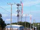
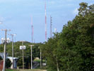
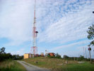
Poor Mountain
Coordinates: 37°11′51" N, 80°09′10" W  ; Ground Elevation AMSL: 3763 ft (1147 m)
Poor Mountain is the location of several broadcasting antennas for radio and television stations in Roanoke Valley. In the antenna farm are the broadcasting antennas for radio stations WVTF 89.1 FM, W220BD 91.9 FM, WXLK 92.3 FM, WSLC 94.9 FM, WSLQ 99.1 FM, WBZS 102.5 FM and digital television stations WDBJ-TV (CBS Ch. 7), WSLS-TV (NBC Ch. 10), WBRA-TV (PBS Ch. 15), WFXR-TV (Fox/CW Ch. 27), WPXR-TV (Ion Ch. 38). Other telecommunication antennas and towers for local, county, state and national public service, are also located on Poor Mountain, including NOAA Weather Radio WXL60 162.475 MHz.
More info: Wikipedia 


