Radio stations in Spokane, Washington — World Radio Map (original) (raw)
- World Radio Map • North America • United States • Washington • Spokane
    Click on the radio station name to listen online Click on the radio station name to listen online |
||
|---|---|---|
| FM,MHz | Station | Transmitter |
| 88.1 |  KYRS Thin Air Comm. Radio KYRS Thin Air Comm. Radio |
Huckleberry Mountain |
| 88.3 |  KWIS Coeur d'Alene Tribe KWIS Coeur d'Alene Tribe |
Coeur d'Alene, ID, Plummer |
| 88.7 |  KAGU KAGU |
Krell Hill - Tower Mountain |
| 89.1 |  K206CQ WayFM K206CQ WayFM |
Krell Hill - Tower Mountain |
| 89.5 |  KEWU Jazz FM KEWU Jazz FM |
Krell Hill - Tower Mountain |
| 89.9 |  KYMS Today's Christian Country KYMS Today's Christian Country |
Sandpoint, ID, Little Blacktail Mountain |
| 90.3 |  KPBZ PRX Remix KPBZ PRX Remix |
Lookout Mountain |
| 90.7 |  K214AR Public Radio K214AR Public Radio |
Sacred Heart Medical Building |
| 91.1 |  KPBX Public Radio KPBX Public Radio KSFC Public Radio KSFC Public Radio PRX Remix PRX Remix |
Mica Peak |
| 91.7 |  KRFA NWPR NPR & Classical KRFA NWPR NPR & Classical |
Moscow, ID, Paradise Ridge |
| 91.9 |  KSFC Public Radio KSFC Public Radio KPBX Public Radio KPBX Public Radio PRX Remix PRX Remix |
Lookout Mountain |
| 92.3 |  K222BG Thin Air Comm. Radio K222BG Thin Air Comm. Radio |
Beacon Hill |
| 92.9 |  KZZU KZZU |
Krell Hill - Tower Mountain |
| 93.7 |  KDRK The Mountain KDRK The Mountain |
Mica Peak |
| 94.1 |  K231CU The Bear K231CU The Bear |
Krell Hill - Tower Mountain |
| 94.5 |  KHTQ Rock 94½ KHTQ Rock 94½ |
Post Falls, ID, Blossom Mountain |
| 95.3 |  KPND Progressive Radio KPND Progressive Radio Studio B Studio B |
Sandpoint, ID, Mount Hoodoo |
| 95.7 |  K239CL Ke Buena K239CL Ke Buena |
Krell Hill - Tower Mountain |
| 96.1 |  KFOO Alt 96.1 KFOO Alt 96.1 |
Mica Peak |
| 96.9 |  KEZE Hot 96.9 KEZE Hot 96.9 |
Antoine Peak |
| 97.3 |  KKRS Christian Radio KKRS Christian Radio |
Davenport, Magnusen Butte |
| 97.7 |  K249FF American Christian Netw. K249FF American Christian Netw. |
Beacon Hill |
| 98.1 |  KISC Kiss 98.1 KISC Kiss 98.1 Kix 99.3 Kix 99.3 |
Krell Hill - Tower Mountain |
| 98.5 |  KLGW K-Love KLGW K-Love |
Grand Coulee, Jack Woods Butte |
| 98.9 |  KKZX Classic Rock KKZX Classic Rock |
Krell Hill - Tower Mountain |
| 99.3 |  K257FX Kix 99.3 K257FX Kix 99.3 |
Krell Hill - Tower Mountain |
| 99.9 |  KXLY The Big Coyote Country KXLY The Big Coyote Country |
Mount Spokane |
| 100.7 |  K264CH News Now 920 K264CH News Now 920 |
Krell Hill - Tower Mountain |
| 101.1 |  KEYF Key 101 KEYF Key 101 |
Krell Hill - Tower Mountain |
| 101.5 |  K268DL Hooptown 101.5 K268DL Hooptown 101.5 |
Krell Hill - Tower Mountain |
| 101.9 |  KTSL Air 1 KTSL Air 1 |
McDowell Hill |
| 102.3 |  KICR K102 Country KICR K102 Country |
Post Falls, ID, Blossom Mountain |
| 103.1 |  KCDA KCDA |
Krell Hill - Tower Mountain |
| 103.5 |  K278CY The Game K278CY The Game |
Krell Hill - Tower Mountain |
| 103.9 |  KBBD Bob FM KBBD Bob FM |
Krell Hill - Tower Mountain |
| 104.3 |  KHTR New Country KHTR New Country Hits 104.7 Hits 104.7 Big New Rock Big New Rock |
Moscow, ID, West Twin Summit |
| 104.5 |  KZIU Joy 104.5 KZIU Joy 104.5 |
N Indian Bluff Rd + Newport |
| 104.9 |  KEEH Shine 104.9 KEEH Shine 104.9 LifeTalk Radio LifeTalk Radio |
Krell Hill - Tower Mountain |
| 105.3 |  K287BV ESPN Spokane K287BV ESPN Spokane |
Krell Hill - Tower Mountain |
| 105.7 |  KZBD Now 105.7 KZBD Now 105.7 |
Krell Hill - Tower Mountain |
| 106.1 |  K291CO Sacred Heart Radio K291CO Sacred Heart Radio EWTN Catholic Radio EWTN Catholic Radio |
Moran Prairie |
| 106.5 |  KSPO American Christian Netw. KSPO American Christian Netw. |
Beacon Hill |
| 107.1 |  KPKL Kool 107.1 KPKL Kool 107.1 |
Deer Park |
| 107.9 |  KMBI Moody Radio KMBI Moody Radio |
Mica Peak |
| WX,MHz | Station | Transmitter |
| 162.400 |  WXL86 NOAA Weather Radio WXL86 NOAA Weather Radio |
Mount Spokane |
| AM,kHz | Station | Transmitter |
| 530 |  WPNZ308 Hwy Advisory Radio WPNZ308 Hwy Advisory Radio |
I-90 |
| 540 |  CBK CBC Radio One CBK CBC Radio One |
Canada, Watrous, SK |
| 590 |  KQNT News Talk KQNT News Talk |
Spokane Valley, Chester |
| 630 |  KTRW The Fabulous KTRW The Fabulous |
Moran Prairie |
| 670 |  KBOI News Talk KBOI News Talk |
Boise, ID, Kuna |
| 700 |  KXLX ESPN Spokane KXLX ESPN Spokane |
Moran Prairie |
| 750 |  KERR Classic Country KERR Classic Country |
Polson, MT, N Reservoir Rd |
| 790 |  KJRB The Bear KJRB The Bear |
Spangle, 1505 E Stutler Rd |
| 810 |  KTBI American Christian Netw. KTBI American Christian Netw. |
Ephrata |
| 840 |  KMAX The Max KMAX The Max |
Colfax |
| 920 |  KXLY News Now 920 KXLY News Now 920 |
Moran Prairie |
| 970 |  KTTO Sacred Heart Radio KTTO Sacred Heart Radio EWTN Catholic Radio EWTN Catholic Radio |
Moran Prairie |
| 1000 |  KNWN Northwest Newsradio KNWN Northwest Newsradio |
Seattle, WA, Vashon Island |
| 1050 |  KFIO American Christian Netw. KFIO American Christian Netw. |
Moran Prairie |
| 1080 |  KVNI Classic Hits KVNI Classic Hits |
Coeur d'Alene, ID |
| 1150 |  KQQQ News Talk KQQQ News Talk |
Pullman |
| 1190 |  KEX NewsRadio KEX NewsRadio |
Portland, OR, Clackamas |
| 1230 |  KSBN Money Talk KSBN Money Talk |
Delaney Building |
| 1250 |  KWSU NWPR NPR News KWSU NWPR NPR News |
Pullman |
| 1280 |  KZFS Hooptown 101.5 KZFS Hooptown 101.5 |
Moran Prairie |
| 1330 |  KYOZ Ke Buena KYOZ Ke Buena |
Moran Prairie |
| 1510 |  KGA The Game KGA The Game |
Spangle, 1505 E Stutler Rd |
| 1610 |  WPHF829 GEG Airport Radio WPHF829 GEG Airport Radio |
Spokane International Airport |
Time
Weather
Krell Hill - Tower Mountain
Coordinates: 47°35'34" N, 117°17'52" W  ; Ground Elevation AMSL: 3645 ft (1111 m)
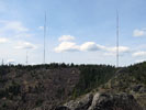
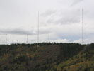
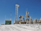
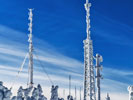
Krell Hill, also known as Tower Mountain, is a peak at the southern end of the Selkirk Mountains in Spokane County, Washington. It rises abruptly to the south east of the relatively flat Moran Prairie neighborhood of Spokane's South Hill. Tower Mountain, while not the official name, is commonly used because there are many tall television and radio towers along the ridge atop the mountain. There are six tall broadcasting towers on the hill:
• 905 ft (276 m) tall KHQ-TV (NBC Ch. 6) tower,
• 823 ft (250.9 m) tall KAYU-TV (Fox Ch. 28) tower,
• 940 ft (286.5 m) tall KREM-TV (CBS Ch. 2) tower,
• 600 ft (182.3 m) KSPS-TV (PBS Ch. 7) tower,
• 408 ft (124.5 m) and 352.3 ft (107.4 m) iHeart Radio towers.
Mount Spokane
Coordinates: 47°55'16" N, 117°06'53" W  ; Ground Elevation AMSL: 5883 ft (1793 m)
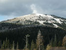
Mount Spokane is a mountain located northeast of Spokane, Washington. Its summit is the highest point in Spokane County, and it is one of the tallest peaks in the Inland Northwest. Mount Spokane is surrounded by Mount Spokane State Park. KXLY-TV (ABC Ch. 4) is the only station in the Spokane market to broadcast from Mount Spokane, to the northeast of the city.
