CLIR'21. Proceedings of the Corpus Limitum Imperii Romani International Conference held in Pécs on May 15th, 2021 (original) (raw)

Proceedings of the Corpus limitum Imperii Romani International Online Conference held in Pécs on May 15 th ,2021{ }^{\text {th }}, 2021
Zsolt Visy (ed.)
CLIR 21
Proceedings of the Corpus Limitum Imperii Romani
International Online Conference held in Pécs, 15th 15^{\text {th }} May 2021
CLIR 21
Proceedings of the Corpus Limitum Imperii Romani
International Online Conference held in Pécs, 15th 15^{\text {th }} May 2021
Editor
Zsolt Visy
Technical editor
Gergő István Farkas
Cover design
Gergő István Farkas
Press
Kontraszt Plusz Ltd.
ISBN 978-615-01-3359-1
© CLIR Research Center
© Authors
Pécs 2021

The organizers and supporters of the CLIR International Online Conference, from left to right Prof. Dr. László LÉNÁRD DSc head of the Pécs Regional Committee of the Hungarian Academy of Sciences, Prof. Dr. Zsolt VISY DSc FSA professor emeritus of the University of Pécs and Prof. Dr. Attila J. Miseta DSc rector of the University of Pécs. Photo taken in the Assembly Room of the Centre of the Pécs Regional Committee of HAS.
FOREWORD
The research of the frontiers of the Roman Empire goes back to centuries, but the importance of its research on international level and broad collaboration emerged in the fifties of the 20th 20^{\text {th }} century. The initiator of this process was Professor Eric Birley who organized the first International Limes Congress in 1949. The long row of these conferences has brought together the scholars of many nations, and now it is evident that the only possible and effective way to gain more precise results about the military history of Rome and the immense organisation of its frontier defence can be achieved only through international cooperation in the fields of ancient history and archaeology. This activity has got a strong impetus from new research methods like aerial archaeology, geophysics, GPS and LIDAR technology, but first of all by the computer technology and internet in the last decades of the 20th 20^{\text {th }} century.
It is then the time to apply all old and new methods in an international system to provide a common platform to support the international research, and to facilitate the access to the enormous quantity of different data. This device is an international scientific database - the CLIR database - that comprises all possible features and data of the Roman Frontiers. Following the first steps have been made since the seventies of the previous century the idea got its form in the Corpus limitum imperii Romani program that has been adopted by the International Union of Academies in 2011 as the 79th −79^{\text {th }}- now 80th 80^{\text {th }} - international scientific research program of IUA for the Danube provinces.
I owe to express my gratitude towards the International Union of Academies, the Pécs Regional Committee of the Hungarian Academy of Sciences, and the University of Pécs for their strong and permanent support to create and activate the CLIR program. My special thank is due to Professor Miklós Maróth who has been supporting the program since the beginnings. This conference could not have been organized without the financial support of UAI and Professor Jean-Luc de Paepe, the Pécs Regional Committee of HAS as hosting institute, and the University of Pécs that ensures the research possibilities to the CLIR International Academic Research Centre. Let me express my gratitude to all these institutions and their representants!
Pécs, September 2021
Zsolt Visy
Table of contents
Foreword … 5
ZSOLTVISY
The development of the CLIR research program … 9
GERGÕ ISTVÁN FARKAS
The CLIR database at https://clir.hu … 23
MIRJANA SANADER
The CLIR program in Croatia … 35
JOSEP GUITART I DURAN - MARTA PREVOSTI
TIR-FOR centenary program of UAI. A present state of things (https://uai.iua.org/en/projects/6/tabula-imperii- romani-tir; https://tir-for.iec.cat) … 43
RICHARD J. A. TALBERT
Barrington Atlas of the Greek and Roman World. The potential advantages of CLIR: creating links with the digital resource https://pleiades.stoa.org and https://uai-iua.org/en/projects … 53
6 FRANCIS TASSAUX
The Illyr Atlas at https://illyratlas.humanum.fr/fr/atlas … 57
Conference poster … 69
GERGŐ ISTVÁN FARKAS
- RÉKA NEMÉNYI - MÁTÉ SZABÓ (eds.)
The Danube Limes in Hungary. Archaeological research conducted in 2015-2020, Pécs, 2020. Table of contents … 72
GERGŐ ISTVÁN FARKAS
- RÉKA NEMÉNYI - MÁTÉ SZABÓ (eds.)
VISY75. Artificem commendat opus. Studia in honorem Zsolt
Visy, Pécs, 2019. Table of contents … 75
The 80th program of UAI: Corpus limitum imperii Romani ZSOLT VISY
The 80th program of UAI Corpus limitum imperii Romani
I think that this conference is a milestone in the history of the CLIR program and maybe also in the development of the international research of the frontiers of the Roman Empire. As all similar enterprises, also CLIR has its history. Allow me to go back to the beginnings!
As a young archaeologist I have joined to the team of the Intercisa (that time Dunaújváros) Museum in 1967 to participate in the excavations running in the territory of the Roman cemetery of Intercisa. The reasons for these investigations were the steady growth of Dunaújváros above Roman Intercisa, and the need to reinforce the edge of the high loess plateau above the Danube. During more than 15 years I excavated thousands of graves, remains of the military vicus round the fortification and important structures of the auxiliary fort. The huge archaeological material, the need for its systematisation compelled me and other scholars working on similar projects in Aquincum and other sites to establish a common platform. It became clear for me as I started to work on military history, on the distribution of troops stationed in the province and in the Empire, at first with publication and evaluation of military diplomas. It was evident for us that the development of the limes of Pannonia can be explained only through a common, harmonised work. Of course, there had been made significant research in the epigraphy and in the wide range of archaeology on international level, and since 1949 as professor Eric Birley established the series of the International Limes Congresses, there was a regular platform for changing views and present new research results in every 3-4 year.
At first, I made attempts to systematise the auxiliary troops recorded on military diplomas and other inscriptions, but I could realize soon that a more sophisticated system would be needed. In these years only the different types of the punch card systems were known and used in Hungary, and I became familiar with them. By
the end of 1973 I have developed a complex system for the Roman archaeological material, by applying the A/5\mathrm{A} / 5 edge punched cards showing two rows of notching. The system of notching, how to input 10 different features in 8 holes, ordered in two rows, was as follows: For 1,2,4,71,2,4,7 you had to cut through two holes, for the other 6 numbers always two, but only the outer ones. It was able to comprise features of all types of settlements, buildings, and different other built structures and those of the wide range of archaeological material, including inscriptions (Figs. 1-2).
Figure 1. The main chapters of the punched card system for Roman structures, finds and inscriptions, 1973 (Image by Zsolt Visy).
- ARCHAEOLOGICAL SITE
- TYPE OF THE SITE
- DATA RELATING TO MILITARY SITES
- DATA RELATING CIVILIAN SITES
- WORKSHOPS
- BUILDING ELEMENTS
- TOOLS
- ARTICLES FOR PERSONAL USE
- WEARING
- CERAMICS
- GRAVE AND CEMETERY
- INSCRIPTION AND COIN
- RELIGION AND ARTS
- TROOPS
- DESCCRPTION OF THE SITE
- BIBLIOGRAPHY
Figure 2. The classification of the military units with the example of the cohors I Hemesenorum, 1973 (Image by Zsolt Visy).
- LEGIONS
- AUXILIARY TROOPS
- cohors I milliaria Hemesenorumcivium Romanorum Antoniniana sagittariurum equitata
- ALA / COHORS
- NUMBER
- MILLIARIA
- NAME
- OTHER NAME
- CVIUM ROMANORUM
- EQUITATA
- SAGITTARIA
- NUMERI
- OTHER TROOPS
- COHORTES PREATORIANAE
- COHORTES URBANAE
- VIGILES
- SINGULARES
- FLEET
- LATE ROMAN TROOPS
Figure 3 represents the original Limes database system, prepared by me in 1974. It was successfully applied in taking the inventory at the Intercisa Museum. The structure of the present CLIR database follows this system: - archaeological site ⋅\cdot type of the site ⋅\cdot data relating to military sites ⋅\cdot data relating civilian sites ⋅\cdot workshops ⋅\cdot building

Figure 3. The system of the Limes Database in 1974 (Image by Zsolt Visy).
elements ・ tools ・ articles for personal use ⋅\cdot wearing ⋅\cdot ceramics ⋅\cdot grave and cemetery ⋅\cdot inscription and coin ・ religion and arts ⋅\cdot troops ⋅\cdot description of the site ∙\bullet bibliography Structure of the volumes ⋅\cdot history of research ⋅\cdot topography ⋅\cdot maps, measurements, plans, photographs - the limes objects with full documentation (text - figures) - the finds according types with documentation (text - figures) - selected epigraphic and numismatic material ⋅\cdot building history ⋅\cdot history of troops ⋅\cdot historic summary ⋅\cdot bibliography.
I benefitted from it in my research on the bases for emperor statues or on the rural settlements in Pannonia inferior. In the nineties one could start with the computers in the Hungarian archaeology, and there were several attempts to modernize and computerize the existing Limes Database. It could be made step-by-step with limited success because the financing of the hardware and software, as well as of experts on informatics was a hard task.
At this moment arose the idea to create an UAI program for the international research of the Roman Frontiers. The CLIR program was supported by the Pécs Committee of Hungarian Academy of Sciences, and the University of Pécs 1{ }^{1}. Let me cite some sentences from the proposal: "Military history and the frontier defence of the Empire are almost synonymous. Together with the history of the army they form the backbone of historical research on the Roman Empire. Works by Latin and Greek authors, tens of thousands of inscriptions and a rapidly increasing amount of archaeological data provide a solid base to investigate and describe the history of the Limes Romanus.
- 1 I owe my gratitude for these institutions, and for his initiation and kind support to professor Miklós Maróth, the and the Presidency of the Union Académique Internationale. ↩︎
Taking into account all the scientific work done and considering the broad international interest on a synchronized and common effort and the systematic evaluation of all investigations of the Roman frontiers in the future, it should be a high priority to create a common platform to prepare a scientific catalogue of the limes Romanus. The best way to do so is to establish a corpus under the umbrella of the UAI, the Corpus Limitum Imperii Romani from Augustus to the end of the Western Roman Empire. From the point of view of the limes Romanus not only the exact frontier line should be included -with its changes over time - but also the frontier provinces with all inner fortifications, military sites and installations. Roman military sites beyond the frontiers also belong to the subject.
CLIR is planned as a catalogue and a comprehensive study of the military sites of the Roman frontiers. A great number of monographs and series have been published - the masterpiece remains Der obergermanisch-raetische Limes (ORL) - but in the past as in the present, a systematic work, prepared and written according to a common structure about the whole limes Romanus is still missing. CLIR should fill this gap. The main target of the project is to enhance international research of the Limes Romanus and to publish its elements on a common and coordinated base. To achieve these goals the followings are to be considered and executed:
- to prepare a list of the limes sites
- the built limes structures: wall, palisade, ditch;
- temporary/permanently used forts and fortifications;
- fortlets, towers and other small military sites
- military roads
- to create an international database for proper organization of the material
- to publish a series of monographs on national and international levels
- on each Roman frontier section according to ancient or modern borders;
- on the military network of the frontier provinces;
- on the military sites.
The Presidency of the Union Académique International supported the program, and the Corpus limitum imperii Romani has been adopted as the 79th 79^{\text {th }} international research program of the Union Académique International, the first program proposed by Hungary since 1919, its foundation in Paris. Some years later the numbering was slightly changed. Since CLIR is the 80th 80^{\text {th }} scientific program of UAI.
The first conference on the CLIR program was held in 2011 in Pécs, under participation of scholars from many countries, and also later conferences gave floor for this program in Hungary and abroad. Research on the ripa Pannonica is an on-going program of the Hungarian Academy of Sciences, the universities, the National Museum and other museums, the scientific team at the University of Pécs. In the course of this work many new military sites and structures have been identified.

Ad hoc Committee, Wednesday 26th 26^{\text {th }} May 2010, 7.00 pm
Corpus Limitis Imperii Romani
The Commission considers that the project “Corpus Limitis Imperii Romani” (CLIR) as interesting and can serve as a model for the study of “Limes” not only in Europe but also in the Middle East and Africa.
The Commission proposes to proceed as follows:
a) limit the goal of the project to the sector of “limes” of the middle basin of the Danube (Pannonia, Dacia);
b) realize the goal of the project by creating a database on the topography of the sites of the bordering area of the Roman Empire and by the publication of archaeological and epigraphic data concerning the Roman military installations in the bordering area;
c) organize a meeting of researchers of the concerned countries (Hungary, Slovakia, Czech Republic, Austria, Poland, Bulgaria, Romania) to implement the project and the work plan. The representatives of the Tabula Imperii Romani (TIR) and the Römisch-Germanisches Kommission (RGK) must participate in this meeting that will be sponsored by the UA);
d) present the results of discussions and the work plan at the Brussels session in May 2011, to give this project the patronage of the UA.
Figure 4. The proposal of the UAI ad hoc Committee on the CLIR program.
UNION
ACADEMIQUE
INTERNATIONALE
Sciences humaines et sociales
Association internationale
non gouvernementale sans but lucratif
feudale en 1919
Monsieur le professeur Visy Zsoft, Egyetemi tanir, PTE Régionet Tamszik, H - 7624 Pécs, Rôkus a. 2. Hungary
Bruxelles, le 30 août 2011
Monsieur le Professeur,
J’ai l’honneur de vous faire savoir que, lors de la 85e 85^{\text {e }} Session de l’Union Académique Internationale qui s’est tenue à Bruxelles du 9 au 13 mai 2011, le projet Corpus Limitis Imperii Romani (CLIR) s’est vu accorder le patronage de l’UAI (voir le rapport ci-joint).
Cette décision de l’Assemblée Générale a été prise à l’unanimité des délégués votants. Votre entreprise est enregistrée sous le numéro 79.
Je vous prie de croire, Monsieur le Docteur, à l’expression de mes sentiments les plus distingués.
Figure 5. The decision of the Assemblée Générale of UAI on the CLIR program in 2011.
Figure 6a. Program of the first CLIR conference held in Pécs, 2011.
Figure 6b. Participants of the first CLIR conference held in Pécs, 2011. Photograph taken in front of the seat of the Pécs Regional Committee of the Hungarian Academy of Sciences.
Figure 6b. Participants of the first CLIR conference held in Pécs, 2011. Photograph
taken in front of the seat of the Pécs Regional Committee of the Hungarian Academy of Sciences.
In the years 2017-2018 the international CLIR Database has been made ready, extended also to incorporate the required information on the World Heritage nomination of the Danube Limes. However, the CLIR database needs further work in order to answer any requirement. Further meetings were held on CLIR also later:
- XXII Limes Congress Ruse, 06.09.2012
- Arch. Institute Cluj-Napoca, 10.11.2012
- Bratislava Group Meeting - Belgrade, 18.04.2013
- Arch. Conference Budapest, 11.05.2015
The list of the limes sites is to be prepared by the participating members/member institutes. In this regard it is of great value that the World Heritage nomination of the Limes Romanus under preparation in all European countries that have shorter or longer sectors of it. The elaboration of the Hungarian World Heritage nomination on the Pannonian limes was supported by two Programs in the years 2005-2011, supported
CLIR meeting at the 21st International Limes Congress Newcastle, 21.09.2009
Present: D. Breeze, S. Sommer, A. Schwarz, S. Jilek, J. Rajtár, P. Dyczek, L. Vagalinski, A. Morillo, M. Redde, VZs.
The Limes of the Roman Empire
- Systematic research monographs about the limes of the Roman Empire from Augustus to Augustulus on the basis of archaeological, historical, epigraphic, numismatic and other sources.
- Material culture (finds, findings) with evaluation, written in similar structure discussed and determined before. It should not incorporate the publication of all finds in detail.
Structure
- Material
- Military road network
- Fortifications
- Adjacent civil settlements, cemeteries
- Conclusions
- The military history of the provinces - according to the present or Roman border lines
- The military history of the Roman Empire from Augustus to Augustulus.
Figure 7. Program of the CLIR Meeting in Newcastle, 2009.
- Report on the last UNESCO Committee Meeting in Brasilia; issues relating to FRE-WHS (serial nominations en-danger list)
- Discussion of the joint declaration “Running and Expanding the World Heritage Site ‘Frontiers of the Roman Empire’” in respect of the role of the Bratislava Group
- Discussion of draft Statement of Outstanding Universal Value
- Discussion of the terminology of future Tentative List Entries and nomination documents
- Short reports on individual countries
- Danube Area Strategy: Danube Limes WHS becomes a cultural flagship project
- Presentation of the CLIR project
Figure 8. Program of the Bratislava Group Meeting in Bratislava, 2010
by the European Union 2{ }^{2}. The systematization of the limes sites have been made in Austria, Slovakia, Hungary, and are running in Croatia, Serbia, Bulgaria and Romania. The last four countries apply the administrative version of the CLIR database in their common WH nomination. New archaeological investigations (aerial reconnaissance, geophysics, any kind of field work, including excavation) are and have been planned and executed in order to gain more detailed data for the different types of the limes sites.
- 2 Culture 2000, 2005-2008: Breeze/Jilek 2008; Dyzcek/Jilek/Lemke 2011; Breeze/Jilek/Thiel/Visy, 2011, 35-98; Visy/SzabóPriskin/Lóki 2011. ↩︎
A lot of field survey and more excavations were made in Hungary, like in the marching camps in the region of Brigetio, in Intercisa and in a watch tower in Kisapostag, and excavations in the auxiliary forts of Nyergesújfalu and Kölked. 3{ }^{3} Similar activities are running also in the countries of the Danube provinces.
To my initiative in 1999 it has been created the Frontiers of the Roman empire united, single World Heritage Site for the Roman Limes running through three continents in 2004. The development of the FRE World Heritage Site is as follows:
- 1987: The inscription of Hadrian’s Wall in the United Kingdom in the List
- 1999: Zs. Visy initiated to create a single World Heritage Site encompassing all the frontiers of the Roman Empire in Europe, the Near East, and North Africa. Following the property had been renamed ‘Frontiers of the Roman Empire’ in 2005
- 2005: The inscription of the Upper German-Raetian Limes in Germany
- 2008: The inscription of the Antonine Wall in the United Kingdom
- 2011: The first nomination dossier of the ripa Pannonica in Hungary
- 2018: Submission of the nomination of FRE DLWest by Germany, Austria, Slovakia and Hungary
- 2021: DLWest by Germany, Austria, and Slovakia inscribed in the List
An important step could be made in 2019 with the establishing of the CLIR International Research Centre based on a contract signed by the Prime Minister’s Office, the University of Pécs and the Pécs Committee of the Hungarian Academy of Sciences, with financial support of the Hungarian State for two years. At present the CLIR Research Centre is supported by the University of Pécs and the Pécs Committee of the Hungarian Academy of Sciences.
In the last decade, several solid results could be achieved. Apart form the enhancing and beginning of the uploading it with relevant data some Hungarian scholars have been worked on different projects related to the program. Several papers have been published on Pannonian archaeological and epigraphical material in the CLIR program, and two monographs are under work in a general scheme as follows:
- history of research
- topography
- maps, measurements, plans, photographs
- the limes objects with full documentation (text - figures)
- the finds with full documentation (text - figures)
- selected epigraphic and numismatic material
- building history
- history of troops
- historic summary
- bibliography.
- 3 Farkas - Neményi - Szabó 2020. ↩︎
Two Pannonian volumes are under work:
- Intercisa - Altinum: Lussonium and its region - Ferenc Fazekas - Zs. Visy - F. Horváth - D. Gabler
- Ad Flexum - Brigetio: Arrabona - Ad Mures (OTKA - Hungarian National Scientific Research Fund) - Szilvia Bíró - Dénes Gabler
Intensive work has been started on the find catalogues and on their evaluation in Hungary 4{ }^{4} and in Romania. Dr. Coriolan Opreanu, director of the Institute of Archaeology and Art History of the Academia Română in Cluj-Napoca has published two monographs in its CLIR program 5{ }^{5}. The other countries have started the work, but thanks to Professor Mirjana Sanader Croatia could make relevant activity in the description of the research and the excavations, the evaluation of the finds, the elaboration of the chronology, and in cataloguing the different finds with evaluation.
A strong cooperation is to be developed with other UAI-programs, especially with TIR-FOR Tabula Imperii Romani-Forma orbis Romani, with the Barrington Atlas of the Greek and Roman World, with the Illyr Atlas, with the collections of the Greek and Latin inscriptions and with those of the archaeological finds that do not make it necessary to incorporate inscriptions and mobile archaeological finds into CLIR in detail only in general together with their evaluation.
For a better cooperation and for the more sophisticated work on the CLIR program I think it would be of great benefit for us to create a scientific board, comprising a leading scholar from every participating country: Austria, Czech Republic, Slovakia, Slovenia, Croatia, Serbia, Bulgaria and Romania. Let me thank the elected board members that for their willingness and readiness to support the work of the CLIR program in their countries:
Austria
Bulgaria
Croatia
Czech Republic
Romania
Serbia
Slovakia
Prof. Dr. Andreas Schwarcz
Dr. Lyudmil Vagalinski
Prof. Dr. Mirjana Sanader
Dr. Balázs Komoróczy
Dr. Coriolan Opreanu
Dr. Şnezana Golubović
Dr. Jan Rajtár
- 4 Visy 2011; Visy 2013a, 253-262; Visy, 2013b, 335-336; Visy 2012 [2013], 221-228, 323-329; Visy, 2015, 923-928; Visy 2017, 539-547; Visy 2020a, 401-408; Visy 2020b, 211-238.
5 Opreanu - LĂZĂRESCu 2015; Opreanu - LĂZĂRESCu 2016. ↩︎
BIBLIOGRAPHY
The Frontiers of the Roman Empire. The Danube Limes. World Heritage Nomination - Austria, Germany, Hungary, Slovakia. Volume I-III and Annexes. Budapest 2018.
Breeze - Jilek 2008 = Breeze, D. J. - Jilek, S. (eds.), Frontiers of the Roman Empire. The European Dimensions of a World Heritage Site. Edinburgh.
Breeze et al. 2011 = Breeze, D. J. - Jilek, S. - Thiel, A. - Visy, Zs.: A Római Birodalom határai. Frontiers of the Roman Empire - Pannonia. Pécs, 35-98.
Dyzcek - Jilek - Lemke 2011 = Dyzcek, P. - Jilek, S. - Lemke, M. (eds.), In the Foorsteps of the Romans. Guidelines to nominate new Danube Limes sections in other Danube countries. Warsaw.
Farkas - Neményi - Szabó 2020 = Farkas, I. G. - Neményi, R. - Szabó, M. (eds.), The Danube Limes in Hungary Archaeological Research Conducted in 20152020 Pécs: CLIR Research Center.
Fazekas - Szabó 2012 = Fazekas, F. - Szabó, A.: Bronzedények Lussoniumból. Bronzegefässe aus Lussonium. [Bronze vessels from Lussonium.] In: Bíró, Sz. -Vámos, P. (eds.), FIRKÁK II. Fiatal római koros kutatók II. konferenciakötete: Fiatal Római Koros Régészek IV. Konferenciája. Győr: Győr-Moson-Sopron Megyei Múzeumok Igazgatósága, 413-429.
Fazekas 2013a = Fazekas, F.: Bronzene militärische Ausrüstungsgegenstände aus dem römischen Kastell von Lussonium (Paks-Dunakömlőd). Specimina nova dissertationum ex Institutio Historiae Antiquae et Archaeologiae Universitatis Quinqueecclesiensis 21-22 (2013), 57-73.
Fazekas 2013b = Fazekas, F.: Bibliographica Lussoniensia: [XIX. Jahrhundert 2012]. Specimina nova dissertationum ex Institutio Historiae Antiquae et Archaeologiae Universitatis Quinqueecclesiensis 21-22 (2013), 337-342.
Fazekas 2014 = Fazekas, F.: The late Roman period and the period of transition in the migration period in Lussonium and its region. PhD dissertation. Manuscript.
Fazekas 2015 = Fazekas, F.: Előmunkálatok Paks új történeti bibliográfiájához: I. Római kor. [Preliminary report for the new historical bibliography for Paks town: Vol. I. Roman age] Paksi Múzeumi Füzetek 7:1 (2014-2015), 274-306.
Fazekas 2018 = Fazekas, F.: Neue römische militaria aus Lussonium. Specimina nova univ. Pécs XXIV (2018), 165-214.
Opreanu - Lăzărescu 2015 = Opreanu, C. H. - Lăzărescu, V.-A.: A Roman Frontier Marketplace at Porolissum in the Light of Numismatic Evidence. Contribution to the Knowledge of the Roman Limes Economy. CLIR series Dacia Porolissensis (I): Porolissum Monographs 1. Cluj-Napoca - Zalău.
Opreanu - Lăzărescu 2016 = Opreanu, C. H. - Lăzărescu, V.-A.: (eds.), Landscape archaeology on the northern frontier of the Roman Empire at Porolissvm. An interdisciplinary approach. CLIR serries Dacia Porolissensis (I): Porolissum Monographs 2. Cluj-Napoca.
Ployer - Polak - Schmidt 2019 = Ployer, R. - Polak, M. - Schmidt, R.: The Frontiers of the Roman Empire. A Thematic Study and Proposed World Heritage Nomination Strategy. Wien: Phoibos Verlag
Visy 2011 = Visy, Zs. (ed.), A rómaiak a Dunánál - A ripa Pannonica Magyarországon mint világörökségi helyszín. Romans on the Danube - the Ripa Pannonica in Hungary as a World Heritage Site. Pécs.
Visy et al. 2011 = Visy, Zs. - Szabó, M. - Priskin, A. - Lóki, R. (eds.), A Danube limes program régészeti kutatása 2008-2011 között. Jelentés a Danube Limes UNESCO World Heritage Site pályázat keretében a PTE BTK Régészet Tanszékének kutatócsoportja által végzett kutatásokról. Danube limes project archaeological research between 2008-2011. Report on the research carried out by the research team of the Department of Archaeology, University of Pécs within the framework of the Danube Limes UNESCO World Heritage Site project. Pécs: University of Pécs, Department of Archaeology.
Visy 2013a = Visy, Zs.: Zum pannonischen Limes auf dem Weg zum Weltkulturerbe. Specimina nova XXI-XXII (2013), 253-262.
Visy 2013b = Visy, Zs.: Corpus limitis imperii Romani. Specimina nova XXI-XXII (2013), 335-336.
Visy 2013c = Visy, Zs.: A new military diploma from Pannonia Inferior. In: Fodor, P. (ed.), More modoque. Festschrift für Maróth Miklós zum siebzigsten Geburtstag. Budapest, 187-191.
Visy 2013d = Visy, Zs.: Der römische Limes und die Donau. The Roman Limes and the Danube. Der Mensch im Mittelpunkt. Zeitschrift des Institutes für den Donauraum und Mitteleuropa 52/2, 2012, 221-228, 323-329.
Visy 2015a = Visy, Zs.: The Program Corpus limitis imperii Romani. Proceedings of the 22nd 22^{\text {nd }} International. Congress of the Roman Frontier Studies, Ruse, Bulgaria, September 2012. Sofia, 923-928.
Visy 2015b = Visy, Zs.: Dacia … diuturno bello Decibali viris fuerat exhausta. András Alföldi and the continuity of Dacia. In: Santangelo, F. - Richardson, J. (eds.), The life and work of Andreas Alfoeldi. HABES 56. Stuttgart: Franz Steiner Verlag, 269-291.
Visy 2014 = Visy, Zs.: Some notes on the Eastern corner of the province Dacia. In: Cociş, S. (ed.), Archäologische Beiträge - Gedenkschrift zum hundertsten Geburtstag von Kurt Horedt. Cluj-Napoca: Mega, 65-68.
Visy 2016a = Visy, Zs.: Bálint Kuzsinszky und Dakien. In: Dobos, A. (ed.), Archaeologia Transylvanica. Studia in honorem Stephani Bajusz. Cluj-Napoca - Targu Mures - Budapest, 411-416.
Visy 2016b = Visy, Zs.: Die spätesten Inschriften von Intercisa. In: Ardevan, R. (ed.), Papers of the 4th 4^{\text {th }} Romanian-Hungarian epigraphic round table. Mensa rotunda epigraphiae Dacicae Pannonicaeque. Cluj-Napoca: Mega, 105-124.
Visy 2016c = Visy, Zs.: Der spätrömische Limes von Valeria und die spätrömischen Villensiedlungen, mit besonderer Berücksichtigung der Villa von Babarc. In: Schwarcz, A. - Soustai, P. - Tcholakova, A. (eds.), Der Donaulimes in der Spätantike und im Frühmittelalter. Wien, 161-170.
Visy 2017a = Visy, Zs.: Noch einmal über die Feldzüge von Augustus in dem Karpatenbecken. Acta Ant. Hung. LV 2015 [2017], 155-166.
Visy 2017b = Visy, Zs.: Some notes on the development of the military road network of the Roman Empire. In: Hodgson, N. - Bidwell, P. - Schachtmann, J. (eds.), Roman Frontier Studies 2009: Proceedings of the XXta \mathrm{XX}^{\text {ta }} International Congress of Roman Frontier Studies (Limes Congress) held at Newcastle upon Tyne in August 2009. Archaeopress Roman Archaeology 25. Oxford, 69-78.
Visy 2017c = Visy, Zs.: Zur Hypothese der mehrstufigen Einverleibung Pannoniens. Hungarian Polis Studies 24, Budapest - Debrecen 2017, 157-166.
Visy 2017d = Visy, Zs.: A római limes magyarországi topográfiája a CLIR program és a világörökségi nevezés tükrében. The topography of the Roman limes in Hungary as represented in the CLIR program and in the World Heritage nomination. In: Benkő, E. - Bondár, M. - Kolláth, Á. (eds.), Archaeological topography of Hungary. Past, present and future. Budapest, 539-547.
Visy 2017e = Visy, Zs: Inlăceni/Énlaka During The Roman Period. Ephemeris Napocensis 27 (2017), 229-248.
Visy 2018 = Visy, Zs.: Some considerations on the late Roman inner fortifications of Pannonia. In: Sommer, C. S. - Matešić, S. (eds.), Limes XXIII. Akten des 23. Limeskongresses in Ingolstadt 2015. Mainz, 447-453.
Visy 2020a = Visy, Zs.: The ripa Pannonica in Historic Sources and Old Maps. H. Bender octogenario. Berichte der Bayerischen Bodendenkmalpflege 61 (2020), 401−408401-408.
Visy 2020b = Visy, Zs.: New research conducted in Intercisa castellum and watchtower INT 5. In: Farkas - Neményi - Szabó 2020, 211-238.
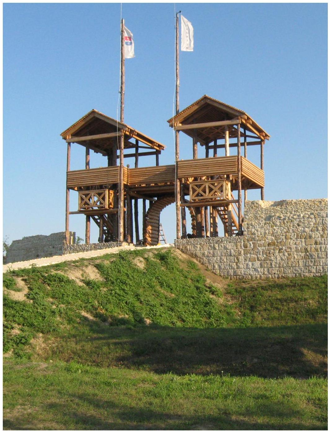
The reconstructed northern gate of the Roman auxiliary fort Lussonium at Paks-Dunakömlőd (HU) (Photo by Zsolt Visy).
02 The CLIR database at https://clir.hu GERGÖ ISTVÁN FARKAS
The CLIR database at https://clir.hu
The following article is focused on presenting in detail the online database and tool (in English) behind the monumental academic project “Corpus Limitum Imperii Romani”, centered around the research of Roman frontier sites primarily in Central Europe, but with a perspective to encompass further regions and provinces, 1{ }^{1} and ultimately, to provide an elaborate compendium of the entire Roman Empire. 2{ }^{2}
At the time of writing this article, the monuments of the Danubian limes in Germany, Austria and Slovakia, were recently granted UNESCO World Heritage Site status, with nomination procedures in Serbia, Romania and Bulgaria well under way and numerous developments are scheduled in the upcoming years.
1. INTRODUCTION
The subject of the CLIR academic research programme, the mighty complex known as the “Frontiers of the Roman Empire” encompasses a wide range of sites, most of them inherently different from each other in terms of complexity, function, chronology and a plethora of other features. These sites are located across three continents, spanning numerous diverse cultural and geographical regions with their own unique histories, climates and characteristics, much of which have amplified since Roman times. It is a
- 1 Ployer - Polak - SchMidT 2019.
2 Such a project is no small feat, and the author(s) would hereby thank all, who contributed to this extensive research agenda. Fellow scholars, academics and experts of various fields have parttaken in this journey from the following institutions: the University of Pécs, the Aerial Archaeological Archives in Pécs, the Janus Pannonius Museum in Pécs, the Hungarian Academy of Sciences in Budapest and its Regional Committee in Pécs as well as its Hungarian Limes Association in Budapest, the Péter Pázmány Catholic University in Piliscsaba, the Eötvös Loránd University in Budapest, the Prime Minister’s Office in Budapest, the Castle Headquarters Heritage Management Nonprofit Ltd. in Budapest, the Lechner Research Center in Budapest and various international institutions and organizations. ↩︎
vast system indeed, and well nigh incomprehensible by the human mind in its entirety. For this reason, the creation of a digital (and later on) online database has been a major milestone in the CLIR project since its humble beginning in the 1970s by Prof. Zsolt Visy, a devout man of science, who dedicated respectable share of his spirit to uncovering much of this mightly inheritance and providing international recognition to these ancient monuments. A series of databases have been created, in parallel to rapid advances in information technologies, their history has been discussed elsewhere and shall not be cited here anew. 3{ }^{3}
The CLIR scientific database available at https://clir.hu is the latest iteration of these database series (Figure 1). It was created by the CLIR Research Center based at the University of Pécs. 4{ }^{4} It is an object-oriented database developed with recent international guidelines in mind (e.g. ARIADNEplus), 5{ }^{5} grounded on a decoupled Drupal 8.x architecture, complemented with both community and custom features, including a Mapbox based GIS module visualizing various components and their relations. The development of the CLIR scientific database took twenty months, the planning was started in November 2018 and concluded in July 2019, and development began August 2019 and concluded in June 2020.
The result is an online tool available in English, that stores detailed structured data on ancient monuments and sites related to the Roman frontiers, in a user-friendly manner
Figure 1. The loading page of the CLIR scientific database at https://clir.hu with query tools in right-side popup. The selected terms “Bridgehead” and “Late Roman fortifications” are children of the term “Military”, referring to Site type. Upon executing the query, the database will return every bridgehead and every Late Roman fortification on the map view.
- 3 FARkAS 2019, 100-107.
4 Prof. Dr. Zsolt Visy DSc FSA was the Chief Scientific Officer of the organization, Gergő Farkas PhD was director, Máté Szabó PhD and Réka Neményi were research associates. At the time of writing this article (August 2021), the status of the research center is under reconsideration.
5 KIEITER 2019. ↩︎
with relations visualized on maps, in-site navigation within datasheets. The CLIR scientific database also enables complex in-depth queries, providing a powerful tool for future research.
2. THE STRUCTURE OF THE DATABASE
As already highlighted above, the frontier system, which is the subject of the database is a highly complex structure. It is comprised of a multitute of sites (numbering in the hundreds in each province), which are inherently different in nature: in Roman times, the military was not as separate a branch of the state as nowadays, but an integral part of contemporary society. Soldiers served 15-25 years (depending on combat arms) and most were drafted between ages 18-25, thus spend most of their adult lives in the army. For this reason, throughout most of the Antiquity, soldiers were openly allowed or at least technically not disallowed from establishing families, who trailed the army and lived in settlements (canabae or vici) near forts. These settlements had a wide range of establishments and services leaning heavily on the pay soldiers received (stipendium), thus although not military installations per se, they were heavily influenced by military presence and especially on the frontiers, they cannot be dealt separately from the limes. After discharge, most soldiers settled in these frontier towns, some of which grew to be great cities and provincial seats, such as Carnuntum Vindobona and Aquincum, the successors of the two latter are present-day capitols as well.
During service, soldiers operated a plethora of workshops (fabricae), which produced military-related arms and armour, but also construction materials, 6{ }^{6} household items, tools, furniture, vessels and vehicles etc. They constructed and maintained roads, bridges, waystations and various other installations which were not solely used by the army alone. These are but a few examples on the wide range of sites and installations, that are strictly speaking not military sites, but are subjects of the CLIR scientific database for reasons of integrity. Sites, that are clearly military by nature, were no less varied in terms of complexity. Imagine the difference between a single watchtower, consisting of a simple wooden platform encircled by a ditch and a rampart and an entire legionary fort, with its numerous towers and defensive works, administrative buildings, barracks and stables, officers’ quarters, workshops, mess halls, latrinae and occasionally entire annexes and settlements bordering it, with shrines, cemeteries etc. Modern research bias, stemming from inadequate or obsolete methodology, unclear focus and priorities, the occasional unprofessional conduct and natural adversities, such as fluvial erosion, changing riverbeds, intensive agriculture, mining or treasure hunting alongside various other activities and events add another layer of complexity and uncertainty to this already intricate system of Roman frontiers. For these very reasons, the CLIR scientific database needed to be flexible, to allow for recording and reviewing data from entities of such different magnitude and structural complexity. The
- 6 Tiles produced in military workshops were also (re)used in civil edifices: FARAS 2020, 255-256; HAIAS 2019, 162-194. ↩︎
system we came up with encompasses data recorded in preexisting databases, and it was our express aim, to render the CLIR scientific database connectible to other online collections. The new database is centered around three major node types: Sites (S), Site components (SC) and Component parts (CP), with Finds (F) still in development (Figure 2). Sites encompass well-defined complexes of archaeological monuments, that form an integral structure, such as a town, or a fort or a watchtower. Edifices or buildings, that can also be outlined rather unanimously in most cases, were recorded as Site components. Component parts represent a more flexible group of entities, ranging from very components of previous Site components (e.g. a room within a building) to a broad range of archaeological features (e.g. ditches, post-holes, walls).
Figure 2. The three major node types of the CLIR scientific database: Sites (S), Site components (SC) and Component parts (CP). The object-oriented database structure allows different sets of attributes (Types, Features) for each node type (image by Gergó Farkas).
The relations between these three node types is limited one-way: S>SC>CP\mathrm{S}>\mathrm{SC}>\mathrm{CP}, meaning that Sites can only be the children of other Sites, but can be parents to all node types, Site components can only be the children of Sites or other Site components and can be parents to Component parts or other Site components, and Component parts can be the children of all node types, but can only be parent to another Component part. This clear cut rule is paired with the substantial possibility, that the number of such parentchild relations within the hierarchy of database elements is virtually unlimited. This is perhaps best explained through a set of two examples. On one hand, take a watchtower (S-1), which consists of a ditch (CP-1), a rampart (CP-2) and a wooden two-storey tower (SC-1), which in turn consists of a room (CP-3), within which four postholes were recorded (CP-4 and CP-5), which were probably used to support the top level, which probably consisted of another room (CP-8), although no direct archaeological evidence of it remained. The relation between the postholes and the hypothetical second floor room is emphasized by grouping these nodes together as a Component group (CG-1).(Figure 3)
The immense possibilites within this structure are perhaps even more perceptible when observing a larger site. Take for example a city, such as Aquincum (S-2)

Figure 3. The schema of a Roman watchtower and its components. See text for legend (image by Gergó Farkas).
Figure 4. The partial scheme of a Roman settlement and select components. See text for legend and Figure 5 for comparison (scheme by Gergó Farkas, base images CCO).
Figure 5. The partial visualization of a Roman settlement and select components. See text for legend and Figure 5 for comparison (scheme by Gergó Farkas, base images CCO).
(Figures 4-5). Every building within the city can be recorded individually, such as a perisytle home (SC-1), which has numerous rooms, including a kitchen (CP-1), which has many pieces of furniture, including an owen (CP-2), which in turn consists of multiple parts, such as a fire pit (CP-3), which can also be broken down into separate archaeological features (CP-4). Such a complexity is not a necessity, and the database can function perfectly, without recording all sites in such excruciating detail, yet the possibility exists nonetheless, and we believe it would be beneficial for future researchers, to have our rich archaeological heritage thoroughly documented in this manner.
Figure 6. The site of Kölked, Várdomb, Altinum Late Roman fortification and its components visualized on map. See the live data at https://clir.hu/node/70037 (image by Gergő Farkas).
These three node types and their relations are also visualized on maps as separate layers of polygons or polylines, with centroids marked with icons and children displayed above their parents. Different node types are colour-coded: Sites are yellow, Site components are blue and Component parts are green. Nodes are visualized through a Mapbox module. Polygons and polylines can be uploaded as WGS84 projected .kml files, which are automatically converted to geoJSON and stylized in a uniform manner.
The database offers several means for highlighting relations between entities unrelated in the hierarchy of parent-child connections. Individual sites, that are related to each other, such as a legionary fortress and the canabae surrounding it, can be grouped together as Site complexes. Site components and component parts can be grouped together as Component groups, which can mark out different layers or divisions within sites, such as a district in a city, or a hypothetical construction subphase within a fort or a wing within a building complex. Individual nodes can also be connected, both for scientific or administrative reasons, e.g. flagging a possible duplication for site admins. These major nodes store the bulk of scientific data. Apart from its internal hierarchy,
each of the Site, Site component and Component part nodes has a datasheet of its own (Table 1). The database also uses other auxiliary node types for administrative purposes, such as Personnel, Institutions, Research activities and Bibliography. These nodes form a separate interrelated system, with the goal to provide easily accessible information on who are the key researchers of a given site, which institutions practice scientific authority and where are records, finds and documentation stored.
3. RECORDED DATA
Visualizing connections and relations between sites and their components is an important feature of the CLIR scientific database, but not merely for itself, but placing scientific analysis in perspective. The datasheets for the three major node types were created with the intent of providing an all-inclusive platform for recording in-depth scientific data in a structured manner. Data are focused around identification and links to other collections (linked-data and open-data), geolocation and map visualization and archaeological data, including research history, textual descriptions and literature, and links to people and institutions involved in research. For a detailed list of data, see Table 1 and visit the database at https://clir.hu.
Table 1. Data groups and types recorded in the CLIR scientific database.
| Nr. | Data (Data type in database) |
|---|---|
| 1 | Identification Name (Text), Name variants (Multiple text fields), Ancient toponyms (Text), Official IDs and links (Multiple text fields and URLs). |
| 2 | Administrative localization present day administrative districts down to settlements (Multiple choice country specific dropdowns from expandable taxonomies), Settlement part / locality (Text). |
| 3 | Geodata Centroids (WGS84 Lat, Long), Exact data (Y/N), Shape (.kml polygon), Line (.kml polyline). |
| 4 | Archaeological data Site type (Multiple choice autocomplete dropdown from “Site type” taxonomy), Features (Multiple choice autocomplete dropdown from “Feature type” taxonomy), Textual dating (Text), Numeric dating (from dates to dates with uncertainty factor), Description (HTML long text). |
| Nr. | Data (Data type in database) |
|---|---|
| 5 | Metric data Measurement type (single choice dropdown from “Metric data measurement type” taxonomy), Measurement data (Integral), Description (Text) |
| 6 | Research activities (recorded as individual nodes with the following data) Title (Text including Site ID, Name, Year and Method), Research method (Multiple choice autocomplete dropdown from “Research method” taxonomy, Start date (Date), End date (Date), Research question (HTML Text), Description (HTML Text), Responsile researcher (Person node type), Participants (Person node type), Responsible institution (Institution node type), Documentation (URL), Related publication (Zotero key). |
| 7 | Participants Personnel (Person node type), Responsible institution (Institution node type). |
| 8 | Bibliography Related publication (Zotero key). |
| 9 | Attachments Images (Images), Documents (Files / Media), Icon (Icon). |
| 10 | Connections Related nodes (Multiple Site, Site component or Component part nodes). |
4. TYPES AND FEATURES
The Roman limes has been vast frontier complex, with thousands of sites still present on three continents and numerous present-day countries. The sheer quantity of data available on these sites necessitates recording them a structured manner. But even so, the inherent complexity of the original installations coupled with Modern research bias warrants furnishing records with an additional feature for enabling in-depth queries, to make the CLIR database a useful tool, rather than just a mere depository of data.
Free text search is available on site, yet the large number of nodes (records) and the differences between different types of elements (as opposed to a classic relational database, which comprise the overwhelming majority of archaeological databases and collections) renders this method of query slow and tedious.
To overcome this obstacle and enable precise and complex queries, the typology of different sites and components and all their characteristics have been compiled in two sets hierarchal structures (taxonomy term trees), one named “Types” and the other named “Features”. Each of the three major node types (Sites, Site components and Component parts) has a “Types” and a “Features” taxonomy of its own, thus a total of six major taxonomies are present in the database (not counting further minor taxonomies, on e.g. research methods, dimensions, measurements etc.). All these taxonomies are expandable, editable and virtually unlimited, they can consist of an indefinite number of levels and elements. At the moment, approximately 300 types and 500 features are recorded in the database.
But how do they work? Each Site can be attributed a “Type” from the taxonomy or more “Types” if their identification is unclear. E.g. a Roman centenarium can be assigned the type “Centenarium (S)”, which in the taxonomy is recorded in the following parentchild relation: MILITARY (S) >> Fortlet (S) >> Centenarium (S). It is thus recorded as a military site, and a fortlet, which is a centenarium. If one queries for fortlets, this centenarium would be listed (or mapped) alongside all fortlets. If one queries for centenaria, only those fortlets would be returned, which were recorded as centenaria. A similar typology has been established for all types of sites, from funerary ones such as cemeteries, to industrial sites such as workshops or even quarries, to civic sites such as settlements or villas. The terms in the taxonomy are free to reorder or expand. All levels in every taxonomy contain a term for unclear or unknown features.
Figure 7. Select features of a Roman watchtower for demonstrating the potential and complexity of the CLIR taxonomy term tree. Terms in white apply to the watchtower, terms in grey indicate other options (the taxonomy term tree contains multiple hundred terms per node type)(image by Gergó Farkas).
However, only a minor fraction of relevant information stems from establishing the typology of a site and assigning it a “Type”. The majority of information is stored as “Features”, which hold information sufficient for proposing relevant research questions. For example, the layout of a site, especially one with an unclear purpose, is an important feature, which can be recorded as the following “Feature”: LAYOUT (S) >> Regular (S) >> Quadratic (S). Every feature of a site can be assigned a “Feature”. But more importantly, not just sites, but their components can be assigned “Features”. E.g. a building can have “Features” describing its layout, function, the building materials and construction techiques used for erecting it, various architectural features (the presence or absence of apses, colonnades, multiple stories, subterranean features, heating, decorations like wall paintings and mosaics etc.).
The queries based on these “Types” and “Features” coupled with the hierarchal parentchild relations between nodes enable constructing highly specialized searches and comparisons, augmenting future research greatly. For example, one could query for mosaic-decorated rooms within rectangular buildings with stone or timber foundations and heated rooms which had a role in administration. [Type=“Room (CP)” AND Feature=“Mosaic (CP)” AND Feature=“Stone foundation (SC)” OR Feature="Timber foundation (SC) AND Feature=“Administrative function (S)”.]
5. FUTURE PLANS
The CLIR International Academic Research Programme has been an ongoing academic quest for more, than four decades. It has yielded vast tomes of knowlegde on the subject of Roman frontiers and has been a pioneer of digital humanities. The colleagues working on this project have been amongst the first in Hungary to have been acquainted with aerial archaeology, database development, 3D documentation, HRTI and surface reconstruction.
In 2021, as a result of several generations of experts in archaeology, ancient history, heritage protection and heritage management, the Danube Limes has been granted internation recognition as a UNESCO World Heritage Site within the aegis of the “Frontiers of the Roman Empire” transnational heritage. We, who have participated in this project strive to continue our work and make the most of our present circumstances and hopefully, the CLIR scientific database will grow to be a useful addition to the international community.
LINKS AND ONLINE CONTENT
The CLIR database: https://clir.hu
The CLIR programme on the UAI website:
http://www.uai-iua.org/en/projects/88/corpus-limitis-imperii-romani
Blog site of the CLIR Research Center: https://www.clir-research.hu/
A description of the CLIR programme (in Hungarian):
https://integralvision.hu/hu/munkak/clir
LITERATURE
Farkas 2019 = Farkas, I. G.: (Notes from the trial of) the CLIR database. In: Farkas, I. G. - Neményi, R. - Szabó, M. (eds.), VISY75 Artificem commendat opus. Studia in honorem Zsolt Visy. Pécs: CLIR Research Center, 159-165.
Farkas 2020 = Farkas, I. G.: New Roman Stamped Tiles from Altinum (Kölked). In: Farkas, I. G. - Neményi, R. - Szabó, M. (eds.), The Danube Limes in Hungary: Archaeological Research Conducted in 2015-2020. Pécs: CLIR Research Center, 255-271. doi: 10.15170/CLIR.2020.12.
Farkas 2021 = Farkas, I. G.: Building Empires - New Research on CBM and Stamped Tiles on Roman Frontiers. Hungarian Archaeology Issue 10, vol. 4 (2021), in press == Birodalomépítés - A római határvidék bélyeges tégláin és CBM anyagán végzett új kutatások. Magyar Régészet 10. évf. 4. szám (2021), in press.
Havas 2019 = Havas, Z.: The Brick Architecture of the Governor’s Palace in Aquincum. PhD dissertation. Budapest: Eötvös Loránd University.
Kreiter 2019 = Kreiter, A.: ARIADNEplus General Assembly Confirms Good Progress Being Made. Hungarian Archaeology 2019 Winter Issue. url: http:// www.hungarianarchaeology.hu/?page\_id=8019.
Ployer - Polak - Schmidt 2019 = R. Ployer - M. Polak - R. Schmidt, Frontiers of the Roman Empire - A Thematic Study and Proposed World Heritage Nomination Strategy. Vienna: Phoibos Verlag.
Visy 2013 = Visy, Zs.: Corpus Limitis Imperii Romani (CLIR). Specimina nova, pars prima 21−22,335−33621-22,335-336.
Visy 2015 = Visy, Zs.: Corpus Limitis Imperii Romani (CLIR). In: Vagalinski, L. Sharankov, N. (eds.), Limes XXII: Roman Frontier Studies. Proceedings of the 22nd 22^{\text {nd }} International Congress of Roman Frontier Studies. Ruse, Bulgaria, September 2012. Bulletin of the National Institute of Archaeology 52. Sofia: Bulgarian Academy of Sciences, National Institute of Archaeology with Museum, 923-929.
The Corpus Limitum Imperii Romani (CLIR) program in Croatia MIRJANA SANADER
The Corpus Limitum Imperii Romani (CLIR) program in Croatia
The researchers at the Department of archaeology of the University of Zagreb are pleased to be collaborating since the very beginning on the scientific program Corpus Limitum Imperii Romani (CLIR) of the International Academic Centre in Pécs under the direction of Professor Visy. The goal of this paper is to give a concise report of our recent work dealing with the problems of the development of Roman borders. What used to be parts of the Roman provinces Pannonia, Dalmatia, and the eastern part of the 10th 10^{\text {th }} Italian region are now the territory of Croatia. The Danubian limes, one of the most famous defensive systems of its kind, also extends partly through Croatian territory. Aside from this, in the province of Dalmatia, in the hinterland of the coast between the Roman cities of Iader and Salona, or more precisely, in between fortresses Burnum and Tilurium, which was the area first conquered by the Romans in the province, the existence of an earlier line of defense, the so-called Delmataean
Figure 1. Map of Croatia with the Roman provinces of Pannonia and Dalmatia and 10th 10^{\text {th }} Italian region (taken from: SAnader 2007, 70, Fig. 61).
limes is assumed. The fact is also that the Roman military facilities are, for now, known only in Dalmatia, which is the object of our presentation.
In the beginning, in the early years of our collaboration on the Corpus Limitum Imperii Romani, we reported on the results of the archaeological excavations of the legionary fortress Tilurium (SanaDER 2003; Śimić-Kanaet 2010; SanaDER et al. 2014; SanaDER et al. 2017; Sanader et al. 2021). Now we have gone a step further, which is why we should remind ourselves that Romans, as has been determined, raised two legionary fortresses and a few auxiliary forts in the province of Dalmatia.
The legionary fortress Burnum was located in the hinterland of the Roman town of Iader, on the left bank of the River Krka (Titius flumen). The legionary fortress Tilurium was located in the hinterland of Salona, the capital of Dalmatia, on the right
Figure 2. Map of the area of the so-called Delmataean limes in Dalmatia (taken from: ZANiŃćvIC 2015, 456).
Figure 3. Aerial view of Burnum with the River Krka.
bank of the River Cetina (Hippus flumen). Forts Promona, Magnum and Andetrium were situated between Burnum and Tilurium, but they are at the moment known only from ancient sources, itineraries, and epigraphic monuments.
Experts have long considered that the positions of Burnum and Tilurium and the forts between them formed a well-thought-out and intentionally built defensive line. Scholars generally accept the hypothesis that a sort of border, which they called the Delmataean limes, indeed existed (ŠAŠEl 1974, 194-199; Wilkes 1977, 245-246; ŠAŠEl 1992, 397-403; Sanader 2002, 713-718; PerišA 2008, 507-517). All these military installations are in the hinterland of the coast, along the Roman state road which connected Aquileia, Salona and Dyrrachium.
However, as has already been mentioned, while the existence and positions of the two legionary fortresses are unquestionable, the forts are known solely from secondary sources, which is why their exact positions are yet to be determined. They remained unknown until today because they have never been archaeologically verified.
Based primarily on the ancient literary sources, it is known that the territory of the eastern Adriatic was the site of two great military conflicts between Rome and the indigenous people, namely Octavian’s Illyrian War (35-33 BCE) and DelmataeanPannonian rebellion (6-9 CE). Although hypotheses of military border line construction
Figure 4. Aerial view of Tilurium with the River Cetina
Figure 5. Detail of the Tabula Peutingeriana VI (taken from: https://www.tabulapeutingeriana.de).
were proposed and were mostly based on the idea of defending the conquered territory, experts did not agree about the reason or the date for such activity. Scholars have made their conclusions through the study of ancient literary sources, epigraphic evidence, and random finds, mostly numismatic and ceramic, which are dated before the Delmataean-Pannonian rebellion, predominantly from the time of the late Republic, but also the early Principate (Wilkes 1969; Alföldy 1987; Matijević 2009; Miletić 2010; Glawš 2015). Due to the need to finally determine what was happening in the area between Burnum and Tilurium, in 2018 we started to work on a scientific research project that should answer several of the open questions. 1{ }^{1} For the successful implementation of reconstructing the defense system at that presumed border zone, it was first necessary to determine the positions that can be considered to be military sites and to formulate the structural indicators (roads, fortresses, forts, watchtowers, ditches, palisades). The goal of the project was the archaeological confirmation of the aforementioned defensive line and its dating.
Our research started by analyzing the old and new archaeological finds as well as the research results obtained by applying contemporary archaeological methods. The combination of all these approaches significantly contributed to bringing us closer to solving these complex issues. For example, ancient itineraries recorded the sites Promona, Magnum and Andetrium as forts along the Iader - Salona road route. However, only by applying alternative archaeological research methods can we hope to find the exact positions of these forts. It is also likely possible, as shown by recent experiences with the same archaeological methods, to discover that other historical installations exist there, but were not recorded to this day.
A major problem for this approach was the extensive area that was to be investigated. It is located between the rivers Krka and Cetina, which makes it exceptionally long and narrow. To be exact, it is 71.5 km of airline distance long and about 20 km wide, from the Adriatic coast to its hinterland. To be able to analyze such a vast territory, test areas were selected - namely, the surroundings of the fortresses Burnum and Tilurium. The areas that were considered as the possible sites of the forts Promona, Magnum and Andetrium were analyzed as well. The areas were chosen in accordance with the study of ancient literary sources and epigraphic monuments as well as analysis of past random finds. To identify possible Roman military forts or other kinds of structures in the research area, various non-destructive research methods were used. We analyzed and interpreted aerial and satellite photographs, historical and modern maps, and LiDAR scans.
The data obtained by LiDAR scanning has been processed at the Ludwig Boltzmann Institute for Archaeological Prospection and Virtual Archaeology in Vienna and gave us unexpected results showing possible archaeological sites where their existence was
- 1 Project website: https://adriarom.ffzg.unizg.hr/. ↩︎

Figure 6. Areas selected for LiDAR scanning (Archive of the project AdriaRom).
Figure 7. LiDAR-based visualization of one of the possible Roman military fortifications (Archive of the project AdriaRom, P7L1).
never even assumed. Namely, completely unknown structures that seem like Roman military fortifications (Tončinić 2021). Following these findings, a systematic field survey was conducted in and around these sites in February 2020, which resulted in the selection of locations where geophysical surveys have been conducted in 2021. In addition to all these non-destructive archaeological methods, which confirmed the existence of historical structures, we consider archaeological excavations to be necessary as well. Only archaeological excavations can ensure the exact dating of recorded structures. Small finds (ceramics, coins, glass finds, metal objects, bone objects, gems), which are commonly unearthed during excavations, are essential for the dating of the layers and the structures. Without the analysis of small finds which are professionally documented during the archaeological excavations, it is not entirely possible to chronologically place the structures which were recorded with non-destructive techniques.
To summarize, our research into the reconstruction of the very first defense line in the hinterland of the eastern Adriatic coast by using a contemporary and established methodological approach, is not yet completed. However, our goal in obtaining more extensive data to answer the questions that are beyond the scope of literary and epigraphical sources was successful. Our hypothesis that such an approach could fill the gaps in current knowledge related to the border line of fortresses and forts that stretched from rivers Krka to Cetina proved well placed. We believe that it could offer a better understanding of the role of this border in the protection of not only Roman conquered territory but also Roman newcomers on the Adriatic coast and their economic interest.
The results we obtained from the study of the Adriatic hinterland clearly indicate that some of the claims of ancient historians should be verified. Written sources claim that changes took place in the conquered region, but the truth in the narrative can only be confirmed by archaeology, and only if archaeology is in possession of relevant material evidence. Work on this project has also shown that the utilization of more archaeological methods could be crucial to the success of such research.
BIBLIOGRAPHY
Alföldy 1987 = Alföldy, G.: Die Auxiliartruppen in der Provinz Dalmatien. In: Speidel, M. (ed.), Römische Heeresgeschichte: Beiträge 1962 -1985. Mavors Roman Army Researches III. Amsterdam, 239-297.
Glavaš 2005 = Glavaš, I.: Vojno značenje cesta u rimskoj provinciji Dalmaciji za principata. PhD thesis. Zadar.
Matijević 2009 = Matijević, I.: Cohors VIII Voluntariorum civium Romanorum i neki njezini pripadnici u službi namjesnika provincije Dalmacije. Tusculum 2/1. Solin, 45−5845-58.
Miletić 2010 = Miletić, Ž.: Burnum - vojničko središte provincije Dalmacije. In: Radman-Livaja, I. (ed.), Nalazi rimske vojne opreme u Hrvatskoj. Zagreb, 113−176113-176.
Periša 2008 = Periša, D.: Je li delmatsko područje presjekao rimski limes? Archaeologia Adriatica 2/2. Zadar, 507-517.
Sanader 2002 = Sanader, M.: Tilurium, Burnum and Bigeste. A New Contribution to the Dating of the Delmataen Limes. In: Freeman et al. (eds.), Limes XVIII = Proceedings of the XVIII th { }^{\text {th }} International Congress of Roman Frontier Studies Held in Amman, Jordan (September 2000). BAR International Series 1084 (II). Oxford, 713-718.
Sanader 2003 = Sanader, M.: Tilurium I. Istraživanja = Forschungen 1997-2001. Dissertationes et Monographiae 4. Zagreb.
Sanader 2007 = Sanader, M. (ed.): Kroatien in der Antike. Mainz am Rhein.
Sanader et al. 2014 = Sanader, M. - Tončinić, D. - Buljević, Z. - Ivčević, S. Šeparović, T.: Tilurium III. Istraživanja 2002. - 2006. godine. Dissertationes et Monographiae 6. Zagreb.
Sanader et al. 2017 = Sanader, M. - Tončinić, D. - Šimić-Kanaet, Z. - Ivčević, S. Buljević, Z. - Šeparović, T. - Miloglav, I.: Tilurium IV. Arheološka istraživanja 2007-2010 godine. Dissertationes et Monographiae 8. Zagreb.
Sanader et al. 2021 = Sanader, M. - Tončinić, D. - Šimić-Kanaet, Z. - Buljević, Z. - Ivčević S.: Tilurium V. Arheološka istraživanja 2010-2018 godine, Dissertationes et Monographiae 10, Zagreb.
ŠAŠEL 1974 = Šašel, J.: Die Limes-Entwicklung in Illyricum. In: Pippidi, D. M. (ed.), D’etudes Sur Les Frontieres Romaines: Actes Du IX e{ }^{e} Congres International, Mamaia, 6-13 Septembre 1972. Bucuresti - Köln, 194-199.
ŠAŠEL 1992 = Šašel, J.: Die Limes-Entwicklung in Illyricum. Opera Selecta. Ljubljana, 397-403.
Šimić-Kanaet 2010=2010= Šimić-Kanaet, Z., Tilurium II. Keramika 1997-2006. Dissertationes et Monographiae 5. Zagreb.
TONČINIĆ 2021 = Tončinić, D.: Izvješće o rezultatima arheološkog terenskog pregleda na dijelu delmatskog limesa između rijeka Krke i Cetine. Zagreb.
Wilkes 1969 = Wilkes, J. J.: Dalmatia. Cambridge.
Wilkes 1977 = Wilkes, J. J.: Augustan Limes in Illyricum?. In: Haupt, D. - Horn, H. G. (eds.), Studien zu den Militärgrenzen Roms, II: Vorträge des 10. Internationalen Limeskongresses in der Germania Inferior. Beihefte der Bonner Jahrbücher 38. Köln, 245-246.
Zaninović 2015 = Zaninović, M.: Ilirski ratovi. Zagreb.
TIR-FOR, a century-old programme by the UAI currently renewed online JOSEP GUITART I DURAN - MARTA PREVOSTI
JOSEP GUITART I DURAN - MARTA PREVOSTI
TIR-FOR, a century-old programme by the UAI currently renewed online
Firstly, we would like to thank those responsible for the UAL project, Corpus Limitum Imperii Romani (CLIR), and its director Zsolt VISY, for their invitation to take part in the online conference. It’s true that one of the challenges facing the International Union of Academies in the coming years is how to ensure collaboration between the various UAI projects but, in this respect, the use of new technologies can help a great deal. The collaboration is promising between two projects as close as the CLIR and TIR-FOR, both focusing on Roman antiquity, based on a geographically structured database and using digital cartography. The TIR-FOR International Commission is therefore ready to set up this collaboration in the immediate future.
THE BACKGROUND
The TIR-FOR project, supervised by the International TIR-FOR Commission, results from the methodological and conceptual unification of the Tabula Imperii Romani (TIR) and Forma Orbis Romani (FOR); two major projects during the 20th century for the cartographic topography of Roman antiquity (Gardiner 1973; Migliorati 2014). They’ve been set up as an extensive collaboration between scientists from different countries, a partnership which, today, the International Commission aims to maintain and enhance by taking full advantage of new technologies (Guitart et al. 2018).
DIGITISING THE PROJECT
At present, the project’s main aim is to share an online map and gazetteer of the Roman Empire. A huge online digital application is being created, cataloguing and mapping all the data available on sites, toponyms and landforms in the Roman Empire based on precise, reliable and first-hand archaeological information provided by specialists from each region we’re working on. The Commission’s goal is to globalise and systematise all this information via an online portal shared by all the teams involved in the project.
Technologically, the current basis of the project is the combination of an SQL Server database, a geoportal or map viewer and a public website with a powerful search tool 1{ }^{1}. One fundamental objective is to link this application with other maps and databases of the Roman world to enrich their capacity and help build up an extensive network of information and analysis related to the Roman world.
Given the recent emergence of a large number of other projects on Roman topography that are highly specialised in various subjects, the TIR-FOR project could seem to have become less relevant. However, our proposal will help to rejuvenate this project. It’s an innovative proposal, possible due to the structure created by TIR-FOR within the UAI and thanks to the huge amount of information generated by it.
TIR
The TIR project focused on summary maps with record sheets and reviews of all the Roman toponyms appearing in the classical sources and the archaeological research carried out in countries formerly occupied by the Roman Empire. It was designed to create maps to a scale of 1:1,000,0001: 1,000,000. The objective of the TIR project was therefore to create a scientific map with a gazetteer summarising the Roman world.
FOR
The FOR project, on the other hand, was designed to produce more detailed maps. It was set up as a large-scale collaboration between countries in order to create detailed cartography of the Roman world with maps to a scale of 1:25,0001: 25,000 or 1:50,0001: 50,000, accompanied by site catalogues (gazetteers) on all the features appearing on the maps themselves, as well as scientific analysis with conclusions regarding the corresponding territories 2{ }^{2}. The ultimate goal of the FOR project was to produce an exhaustive collection of all the evidence available from sources, epigraphy and archaeology that can be included on a map. The online FOR will therefore have great research potential as it’s based on information from either excavations or direct surveys and reports in the archives.
TIR-FOR
The current online project is actually an enlargement of the TIR project by means of the FOR project, producing even more detailed mapping. It’s like zooming in on some specific regions. Both objectives have been maintained, namely to produce a general map and also a detailed map. Consequently, when a general map (or TIR map) is being created for an area, we enter only the most significant and well-known archaeological sites and the toponyms. When a detailed map (FOR map) is being created for an area, however, all the toponyms and also all the sites and finds known must be entered (including small, doubtful and/or relatively unknown sites and finds). Consequently,
- 1 https://tir-for.iec.cat/
2 The first FOR volume published in Catalonia was that of Josep de C. Serra Ràfols (1928). (Prevosti 2013) ↩︎

Figure 1. The TIR map and the sites currently published on the public website.
Figure 2. TIR-FOR application database tables.
the FOR can provide a detailed view of specific zones on the TIR map, as an extension to and more detailed version of the TIR for those regions that have been studied thoroughly and are particularly rich in terms of their archaeological documentation.
TIR-FOR, THE ONLINE APPLICATION
We’ve created a complex geodatabase to digitise the TIR-FOR Project data and disseminate it online. This online PostgreSQL relational database allows us to spatially process the project’s archaeological data. The application is equipped with a map viewer, a public website, an administrator website and a powerful advanced search facility.
The system has been created following strict security protocols with an independent multi-user environment. Each country has its own workspace within the database system in order to enter, edit and search information. In the management application, each team can only see and manage its own data whereas, on the public website, you can see all the information from all the countries, although only in the case of information that has been classified as public.
UNIFIED CRITERIA
The current project is driven by a new unified methodology. The database is used as an integrated system to store the data generated by each country’s archaeological team and is the result of considerable systematic work regarding all the concepts concerned. Extensive work has been carried out to define and systemise the types of site, chronological periods, citation of ancient sources and administrative categories (Fig. 3). Unified criteria enable data to be compared, as well as producing chronologicaltypological maps of the whole Empire or extensive parts of it.
Figure 3. The TIR-FOR application has a drop-down list of typologies and elements as well as a dictionary of typologies and elements with definitions of the different concepts, criteria to identify them and TIR criteria to include them in the database to appear on the map.
SEARCHES
Significantly, one of the main objectives established for the TIR-FOR online project was to create a powerful search and filtering system for data and archaeological sites. This is essential in order to provide society and researchers with a truly useful platform on the archaeological reality of the Roman era. The application is equipped with a “Search” tab and an “Advanced search” tab. On entering “Advanced search”, a multiple-choice menu is available to carry out more powerful and complex searches, providing a detailed system in which users can combine all the fields from the database sheet to create personalised filters (Fig. 4).
Each search produces a map with the results, as well as a list of the sites resulting from the search, which can be downloaded in a csv file suitable for exporting data to GIS programs, containing records with archaeological and geographical information selected from each site. The unification of criteria regarding the different types of site

Figure 4. Map resulting from the search for Catalonia, city, villa, roads and rivers.
Figure 5. Searches can be made throughout the empire, such as the search for villa with aqueduct.
and the elements they might contain, as well as the use of the same chronological periods, means that highly consistent maps can be created of the whole Roman Empire.
PILOT TEST OF THE APPLICATION
This software is now operational and in the testing and fine-tuning phase. In parallel to the construction phase, it was agreed that three of the teams from the International Commission (the team from the Italian Union, the team from the Romanian Academy and the team from the Institut d’Estudis Catalans) would begin to use the application as a TIR pilot test, digitising the data from their respective territories that had been previously published in paper format, as well as updating the information at the same time 3{ }^{3}. The outcome of this pilot test can now be consulted freely online on the project’s website and its results can be seen today, as well as appreciating its future potential for managing and analysing documentary and archaeological data from Roman times. https://tir-for.iec.cat/
- 3 For the FOR, a first pilot test is being done based on the Ager Tarraconensis Project (Guitart et al. 2003; Prevosti and Guitart 2010; id. 2011, Prevosti et al. 2013; Jârrega and Prevosti 2014). ↩︎
Figure 6. The TIR map of Catalonia.
Figure 7. Diagram of the function of gazetteers as connectors of Linked Open Data projects
RESEARCH TOOL
Once a region’s information has been collected and entered in the database, we have information about all the Roman sites under unified criteria, providing us with a good quality tool to manage scientific data. This will become a key instrument for historians and archaeologists to consult and carry out advanced searches, providing basic information about sites which is often difficult to obtain outside a researcher’s own country of work. This tool will therefore help to advance many aspects of archaeological research, for instance comparisons between regions, cross-border issues and specific types of site.
LOD
A large number of historical gazetteers and international databases currently include archaeological heritage information on different historical, epigraphic, numismatic and archaeological subjects. The TIR-FOR application can be networked with these using linked open data protocols. Our aim is for the different archaeological sites to be linked with online applications such as DARE, Pelagios, GAP, ORBIS, Epigraphische Datenbank Heidelberg and others. The value of this application lies in the fact that it’s a tool created on a geographical basis that produces a map, so that all data that meet certain criteria can be found, without exception.
We hope this tool will become an essential resource for anyone interested in the Roman world and specifically in archaeological sites, since it combines open access, the backing offered by TIR-FOR and the scientific quality of its data. Combining our archaeological knowledge and historical heritage in an innovative, direct, entertaining and appealing way will also engage the public at large. As a heritage dissemination and management tool, it can be used for teaching, museums, demos, tourism, outreach and entertainment. Another consequence of this unification will be to promote a sense of a common Mediterranean origin based on classical culture.
We wouldn’t like to end this brief presentation without mentioning one of the aims of the project on which the International Commission has placed considerable emphasis at its most recent meetings: the TIR-FOR online map and gazetteer have great potential for research. Obviously, such research needs to be carried out within each of the teams that make up the Commission and in cooperation between them, but this collaboration can also be opened up to all researchers working on related topics or subjects. Along these lines, in 2020 we organised the “1st TIR-FOR Symposium. From territory studies to digital cartography”, dedicated on this occasion to the relevant aspects of research into the Roman world that are potentially related to TIR-FOR. The Symposium welcomed all researchers interested in these topics and benefitted from a considerable number of contributions. The Symposium in 2020 had to be held online but the aim is to organise regular symposiums, as far as possible every two years, each of them on a specific topic and, if possible, attended in person or combining on and offline. The proceedings from the first Symposium are currently in preparation, a publication which should become available on 2021.
BIBLIOGRAPHY
Bibliography on the subject: https://tir-for.iec.cat/publications/
Gardiner 1973 = Gardiner, R. A.: The International Map of the Roman Empire. The Geographical Journal, 139, 107-111.
Gardiner et al. 2003 = Gardiner, R. A. - Guitart, J. - Palet, J. M. - Prevosti, M. (eds.), Territoris antics a la Mediterrània i a la Cossetània oriental. Barcelona.
Guitart et al. 2018 = Guitart, J. - Prevosti, M. - Soto, P. de - Romaní, N. - Cortés, A. - Padrós, N.: El projecte internacional Tabula Imperii Romani - Forma Orbis Romani (TIR-FOR). Tribuna d’Arqueologia 2015-2016. Barcelona, 332-347.
Járrega - Prevosti 2014 = Járrega, R. - Prevosti, M., (eds.), Ager Tarraconensis 4. Els Antígons, una vil$\cdot$la senyorial del Camp de Tarragona / Els Antígons, a High Status Villa in the Camp de Tarragona. Tarragona.
Migliorati 2014 = Migliorati, L.: Proyecto Tabula Imperii Romani. In: Álvarez, J. M. - Nogales, T. - Rodà, I. (eds.), XVIII CIAC: Centro y periferia en el mundo clásico/Centre and periphery in the Ancient World, Proyectos internacionales de investigación/International research projects. Vol. II. Mérida, 1955-1962.
Prevosti 2013 = Prevosti, M.: Forma Conventus Tarraconensis I: Baetulo-Blanda. La primera carta arqueològica de la Península Ibérica, Butlletí de la Societat Catalana d’Estudis Històrics XXIV, 67-84.
Prevosti - Guitart 2011a = Prevosti, M. - Guitart, J. (eds.), Ager Tarraconensis 1. Aspectes històrics i marc natural / Historical aspects and natural setting. Tarragona.
Prevosti - Guitart 2011b = Prevosti, M. - Guitart, J. (eds.), Ager Tarraconensis 2. El poblament / The population. Tarragona.
Prevosti et al. 2013 = Prevosti, M. - López Vilar, J. - Guitart, J. (eds.), Ager Tarraconensis 5. Paisatge, poblament, cultura material i història. Actes del Simposi internacional / Landscape, Settlement, Material Culture and History. Proceedings of the International Symposium. Tarragona.
Serra Ràfols 1928 = Serra Ràfols, J. de C.: Forma Conventus Tarraconensis. I: Baetulo-Blanda. Barcelona.
5.2
TIR-FOR, a century-old programme by the UAI
The Potential for Linking CLIR and the Barrington Atlas RICHARD J. A. TALBERT
The Potential for Linking CLIR and the Barrington Atlas
My warm thanks go to the organizers for their invitation to contribute briefly by addressing the following question: What connection might be created between the Corpus Limitum Imperii Romani project as it develops further, and the well-known Barrington Atlas of the Greek and Roman World which I edited?1
The short answer must be, I think: “None directly”. Why? Because the Atlas is the outcome of a completed project which attained its goal, one determined in the predigital era at the end of the 1980s - namely, to offer ninety-nine expertly compiled maps of the entire classical world across Europe, North Africa and Asia (almost all at 1:500,0001: 500,000 or 1:1,000,0001: 1,000,000 scale), bound together in a large printed volume. For most of the immense area covered, maps of this caliber focused on the classical period had never been made before. Even so, all the maps are fixed images that it is no longer practical to revise and reissue in the same form. 2{ }^{2}
Instead, for the past twenty years and into the future, mapping can and should be done digitally, with digital technology now making it practical to develop georeferenced images, as well as versatile databases, that build on the foundation laid by Barrington. I especially want to draw to your attention the open-source, online gazetteer and database Pleiades.stoa.org. It was created, with Barrington’s data as its starting-point, in order to provide an expanding forum where anyone with new findings relevant to the geography of the Greek and Roman world may freely share them for the benefit of all those interested worldwide. Barrington remains fundamental, therefore, as a resource for reference.
- 1 Taubert 2000, with Map-by-Map Directory accessible gratis at: assets.press.princeton.edu/B ATLAS/ B ATLAS.PDF
2 However, since 2013 Princeton University Press has also offered them - reduced in size and unrevised - as an App for iPad. ↩︎
Pleiades continues to grow, and to serve as a very visible, accessible tool, one that is heavily used. As such, it can publicize and reinforce the work of the many projects in the ancient field to which it relates. As you would agree, in today’s interconnected intellectual and technological environment it is no longer necessary, let alone beneficial, for projects to advance in isolation. To be sure, every project seeks to fulfill a specific, distinct goal; but nowadays both the design and its implementation ought also to maintain constant concern for what contribution will be made as a result to the larger, international research sphere. 3{ }^{3} Needless to say, connectivity of this kind should matter to the Corpus Limitum Imperii Romani, all the more so in view of the very expansive geographical scope it envisages. 4{ }^{4}
For gaining some insight into the context and goals which molded my plans for Barrington, and also to appreciate the constant struggles to achieve them - with the major funding required - over about twelve years, permit me to point you to my 2019 book Challenges of Mapping the Classical World, published by Routledge. 5{ }^{5} It is only right to add a warning that in many respects the account given here is a disheartening one; but I would claim that it is also realistic, and to this extent instructive.
My own experience, in line with that of many others, has shown that ambitious mapping projects are particularly hard to accomplish. A notable case in our field unfortunately is the Tabula Imperii Romani. 6{ }^{6} Not least so that recurrence of the various setbacks suffered by TIR since as far back as the 1930s may be avoided, I urge that the goal and design of any comparable project be formulated clearly, thought through with care, and limited to what is feasible within no more than a few years. Moreover, for implementing the project there must be firm leadership which maintains focus on achieving the goal, without becoming diverted or preoccupied with aspects of marginal importance. If a project has to be lengthy, I consider it all the more important that there be a pause for review every couple of years, specifically to gauge progress and to assess frankly the value of the work done to that point. Of course, funding must also be maintained, a need which only compounds the unavoidable strains.
With this mix of encouragement and caution, I salute the vision and the ambition of CLIRC L I R, as well as the expertise of its leaders, and I wish its next stages every success. Ideally, these will expand its visibility and its international engagement.
- 3 Note Talbert 2019b, which articulates such concern with reference to work in progress on Roman milestones.
4 Difficulties over scope have likewise affected the Frontiers of the Roman Empire project outlined in Ployer - Polak - Schмют 2019.
5 Note especially 1-5, 113-165, and 169-187 with color plates appended.
6 Up to 2000, see Talbert 2019a, 77-86, 97-99; Talbert 2000, xix. ↩︎
BIBLIOGRAPHY
Ployer - Polak - Schmidt 2019 = Ployer, R. - Polak, M. - Schmidt, R.: The Frontiers of the Roman Empire: A Thematic Study and Proposed World Heritage Nomination Strategy. Vienna.
Talbert 2019a = Talbert, R. J. A.: Challenges of Mapping the Classical World. London. Talbert 2019b = Talbert, R. J. A.: Roads in the Roman world: Strategy for the way forward. In: Kolb, A. (ed.), Roman Roads: New Evidence - New Perspectives. Berlin - Boston, 22-34.
Talbert 2000 = Talbert, R. J. A. (ed.) Barrington Atlas of the Greek and Roman World and Map-by-Map Directory. Princeton - Oxford.
IllyrAtlas, atlas numérique de l’Illyricum FRANCIS TASSAUX
IllyrAtlas, atlas numérique de l’Illyricum
Dans la dynamique d’AdriAtlas, atlas numérique créé dans les années 2008-2012 et fondé sur une base de données liée à un géoatlas, nous avons décidé d’étendre notre champ d’études jusqu’au Danube : ainsi, IllyrAtlas est né en 2018, après des rencontres avec Ausonius et les chercheurs de Slovénie (Institut d’Archéologie), Croatie (Musée archéologique de Zagreb) et Serbie (Institut des Études balkaniques) dans le cadre des échanges bilatéraux de Proteus, Cogito et Pavle Savić.
L’outil informatique et l’objectif principal, qui est de rendre compte de manière actualisée de nos connaissances, restent les mêmes. En revanche, l’aire géographique initiale (autour de l’Adriatique) s’élargit à l’Illyricum, espace entre le Danube et le monde grec et hellénophone, tel que le décrit Strabon (7.5.3). Dans un premier temps, le projet couvre la Dalmatie, la Pannonie et la Mésie supérieure, en prenant comme repère les limites des provinces du Haut-Empire romain. De même, l’arc chronologique, défini par rapport à l’histoire romaine, court dorénavant du II e{ }^{\mathrm{e}} s. a.C. au VIe\mathrm{VI}^{\mathrm{e}} s. p.C.
IllyrAtlas vise à recenser tous les sites antiques, d’abord ceux mentionnés par les sources de l’Antiquité et du haut Moyen Age ainsi que les villes capitales de civitates, puis tous les sites archéologiquement importants : agglomérations secondaires, sites militaires, villas et fermes, mines et carrières, temples et sanctuaires, basiliques paléochrétiennes. Enfin, il est prévu un troisième niveau de sites pour les zones ou microrégions qui ont été l’objet d’études systématiques.
Au-delà de la présentation de cet atlas en ligne, je souhaite aborder la question du vocabulaire utilisé par les chercheurs de pays différents dans la caractérisation des sites.
UN WEBSIG GÉNÉRALISTE SUR L’ILLYRICUM
A côté des portails thématiques comme CLIR ou Atlas Patrimonium Caesaris, IllyrAtlas est un SIG généraliste au même titre que la TIR-FOR et que les grands Atlas en ligne, DARMC et DARE, et traite une grande variété de sites (dans un menu déroulant : Champ de bataille, Découverte isolée, Edifice de culte, Grotte, Gué, Habitat groupé, Habitat isolé, Lieu de culte, Milliaire, Pont, Site de production, Site fortifié, Site funéraire, Site portuaire, Site routier, Toponyme à localisation incertaine, Vestige de route, Ville).
IllyrAtlas est conçu comme une base de données PostgreSQL trilingue (anglais, français, italien) reliée à un geoatlas et à une base bibliographique collaborative Zotero. Dans la base de données, chaque site fait l’objet d’une notice constituée d’une fichemère de 12 rubriques et de fiches-filles par époque.
Les rubriques de la fiche-mère sont:
| Fiche d’identité | Identity card | Carta d’identità |
|---|---|---|
| Chronologie | Chronology | Cronologia |
| Description | Description | Descrizione |
| Histoire des recherches | Historiography | Storia delle ricerche |
| Sources littéraires | Literary sources | Fonti letterarie |
| Sources épigraphiques | Epigraphical sources | Fonti epigrafiche |
| Autres sources | Other sources | Altre fonti |
| Bibliographie | Bibliography | Bibliografia |
| Images | Images | Immagini |
| Site web | Web sites | Siti Web |
| Protection-Conservation | Protection-Conservation | Tutela conservazione |
| Valorisation | Valorisation | Valorisazzione |
Au sein de la rubrique “État civil”, l’item “Type de site” (dont nous venons de voir la liste) est précédé par un autre item “Définition antique”, consacré aux seuls termes latins et grecs utilisés dans les sources pour caractériser le site en question, en sachant que le même site peut recevoir plusieurs termes selon les époques et selon le type de source. Noms antiques et termes modernes aident ainsi à mieux cerner les caractères d’un site.
Précisons par ailleurs que la rubrique “Sources épigraphiques” ne se limite pas aux seules inscriptions qui mentionnent le toponyme antique, mais prend en compte toutes les inscriptions qui ont été trouvées sur le site ou à proximité. Au-delà des inscriptions lapidaires, il est suggéré, autant que faire ce peu, de signaler différents éléments de l’inscriptum inscriptum, avec en priorité les timbres sur amphores et sur tuiles et briques, ainsi que les timbres sur verre. En revanche, le signalement des timbres sur céramique sigillée à titre individuel n’a pas été retenu, compte tenu de leur grand

Figure 1. IllyrAtlas: vue d’ensemble au 30 août 2021.
nombre. Cependant, il peut être intéressant de signaler l’existence d’un corpus ou d’une étude portant sur le site en entier ou sur une fouille ou bien encore quand il s’agit d’hapax. Par ailleurs, la rubrique “Chronologie” présente dans un menu déroulant des diverses phases de l’arc considéré (du II e{ }^{\mathrm{e}} s. a.C. au VIe\mathrm{VI}^{\mathrm{e}} s. p.C.) ; ces phases induisent la création des fiches-filles.
Définies donc par une phase chronologique, la fiche-fille comporte les mêmes rubriques que la fiche-mère; son originalité est d’offrir en plus la rubrique “Analyse des sources écrites et archéologiques” comprenant 10 thèmes avec leurs propres mots-clés, dans le but de permettre une recherche détaillée:
| Géographie | Geography | Geografia |
|---|---|---|
| Fortifications | Fortifications | Fortificazioni |
| Architecture et urbanisme | Architecture and urban planning | Architettura e urbanismo |
| Aménagement du territoire | Planning and civil engineering | Territorio e infrastrutture et génie civil |
| Économie | Economy | Economia |
| Production artistique | Artistic production | Produzione artistica |
| Société | Society | Società |
| Religions polythéistes | Polytheistic religions | Religioni politeiste |
| Christianisme et judaïsme | Christianity and judaism | Cristianesimo et giudaismo |
| Nécropoles et rites funéraires | Necropolis and funeral rites | Nécropoli e riti funerari |
| Trésors et dépôts | Treasures and deposits | Tesori e depositi |
UN ATLAS ET UNE ENCYCLOPÉDIE, À LA FOIS SUPPORT DE CONSULTATION ET INSTRUMENT DE RECHERCHE
Le cœur de la base de données est la rubrique “Description” qui peut se limiter à quelques lignes mais constituer aussi, selon le choix du rédacteur, un véritable article d’encyclopédie de plusieurs pages. Pour les sites majeurs, il est possible de développer certains points au sein de la rubrique “Description” proposée dans chaque fiche-fille. Le but est d’apporter un maximum d’outils et de données pour permettre au lecteur de s’informer, d’aller plus loin et de se forger une opinion ; de lui permettre aussi de connaître les éléments sur lesquels reposent telle description, telle affirmation.
Le geoatlas est conçu dans le même esprit : il est généraliste, mais le websig comporte un certain nombre d’outils et de rubriques afin que le chercheur puisse établir ses propres cartes thématiques dans l’espace et dans le temps (fig. 1 et 2). En outre, grâce à la rubrique “Site web”, la base renvoie également aux autres websig qu’ils soient généralistes ou thématiques comme CLIR et Patrimonium.
Enfin, l’Atlas avec ses deux dernières rubriques prend en compte les aspects sociétaux : la protection et sa mise en valeur.
La présentation d’llyrAtlas dans la présente conférence organisée par le Pr Visy est l’occasion, par ailleurs, d’attirer l’attention sur l’organisation des territoires mais aussi sur le choix des mots et l’importance du vocabulaire pour caractériser des phénomènes anciens.
LA RECHERCHE D’UN VOCABULAIRE ADAPTÉ
Dans la perspective d’études de dynamique territoriale, il est intéressant de revenir sur la séparation entre le vocabulaire fourni par les sources anciennes et celui que nous utilisons actuellement, au sein de la rubrique “État civil”, dans les deux items successifs, “Définition antique” et “Type de sites”.
La première liste est hétéroclite, mêlant des termes juridiques qui définissent un statut politico-administratif à des noms de bâtiments ou groupes de bâtiments à fonction particulière:
Aquae, Caupona, Castellum, Castra, Castrum, Civitas, Civitas (peregrina), Colonia, Conciliabulum, Fons, Forum, Horreum, Insula, Kome, Mansio, mons, Municipium, Mutatio, Oppidum, Pagus, Phrourion, Polis, Praesidium, Praetorium, Stabulum, Statio, Taberna, Templum, Turris, Via, Vicus, Urbs.
Tous ces noms proviennent de sources écrites dans lesquels ils apparaissent soit liés à un site, soit contenus dans l’expression même du toponyme. Ajoutons-y les vignettes de la Tabula Peutingeriana qui évoquent une station thermale - aquae - ou bien celles de la Notitia dignitatum qui définissent une ville à statut de civitas à l’époque tardive,

Figure 2. IllyrAtlas: zoom sur la bande Viminacium - Naissus en Mésie supérieure, à la fin du Haut-Empire.
autant d’indices du statut (dans un petit nombre de cas privilégiés) ou de la fonction majeure d’un site, à une époque donnée. L’intérêt de cette liste de mots latins (ou grecs) est d’abord d’éclairer le chercheur sur la nature, la fonction majeure ou simplement l’origine d’un site.
La seconde liste (item “Type de sites”) propose ensuite de caractériser la ou les définitions majeures d’un site à travers le vocabulaire moderne.
Le principe est de ne pas chercher à faire coïncider à tout prix un nom moderne avec un terme antique, comme par exemple vicus, traduit par village dans la légende de la carte de la TIR K 34, alors qu’il s’agit d’une catégorie juridico-administrative précise. Tous les villages ne sont pas des vici, tous les vici attestés par les sources écrites ne sont pas que des villages mais peuvent être aussi de gros bourgs, voire même des villes. Nous renvoyons ici à la remarque de F. Favory à propos des Gaules: "Je ne veux pas interdire l’usage de vocables latins, je demande qu’on respecte leur charge sémantique et leur
contexte d’origine et qu’on ne substitue pas l’affirmation à l’hypothèse. Autrement dit, je recommande, dans l’approche des campagnes gallo-romaines, de réserver le mot de vicus aux vici avérés, comme on réserve la qualité de forum aux fora avérés, de colonia aux coloniae avérées, etc. De ce point de vue, le vicus n’a pas à être doté d’un capital d’ubiquité qu’on interdirait aux autres vocables juridico-politiques" (FAVory 2012, 42). C’est pourquoi nous ne suivrons pas des chercheurs comme R. Brulet qui proposent de faire de vicus un terme générique (Brulet 2017, 329) selon l’usage italien (les vici sont passés en effet dans la langue italienne, comme les ville).
Partant de ce principe, voyons les principaux types de sites tels qu’on cherche à les définir dans la terminologie moderne.
LES SITES MILITAIRES
Dans l’atlas, ils sont abordés de manière très générale en se référant à la terminologie de I. Von Schnurbein (von Schnurbein 2006, 68) : au-delà des termes latins avérés, ils sont caractérisés dans notre fiche-mère de l’état civil/type de site par l’expression "site militaire " et, dans les fiches-filles, sous le thème “Fortifications”, par les motsclés “camp, military camp, campo militare”, “enceinte, perimeter walls, cinta”, “fort/ forteresse, fort/fortress, forte/fortezza”, “fossé, ditch, fosso”, “porte, gate, porta”, “tour, tower, torre”. Ces termes concernent aussi bien la période préromaine et le HautEmpire, que l’Antiquité tardive et la période paléobyzantine, ces dernières marquées par la multiplication des sites d’habitats fortifiés, sans que l’on sache, alors, s’ils sont pourvus ou non d’une garnison militaire.
Ils nous amènent aussi à nous interroger sur leur rapport avec l’habitat : tout camp, quel que soit sa taille, constitue en même temps un habitat groupé ; en règle générale, sa création entraine spontanément l’apparition d’une agglomération civile, les canabae, qui, éventuellement plus tard, pouvait recevoir un statut juridique propre, révélé par l’épigraphie.
LES SITES ROUTIERS
Il est parfois proposé de mettre sur le même plan les termes mansio, mutatio et statio et de les traduire indifféremment par “station routière” ; mais, tout comme pour le vicus, nous proposons d’attribuer le terme latin à tel site seulement s’il est attesté par une source antique.
Pour sortir de “l’imbroglio entre la terminologie latine et les realia archéologiques” (Colleoni 2016, 4), il faut rappeler d’abord le sens de chacun des trois termes.
La mansio, dans les Itinéraires routiers, désigne à la fois une étape journalière entre deux agglomérations routières et ces agglomérations elles-mêmes ; ce terme a aussi sa définition juridique dans le Code Théodosien : "la mansio apparaît donc comme étant d’abord une agglomération [—]. Ce peut être le lieu d’habitat d’une petite communauté
civique, ayant même son territoire propre. La fonction de la mansio ne se limite pas au service de transport" (Crogiez Pétrequin 2009, 103-104 ; cf ; aussi Crogiez Pétrequin 2014, 307-309). La mutatio, qui, parmi les Itinéraires routiers, n’apparaît que dans l’Itinerarium Burdigalense, désigne l’établissement où le Pèlerin a changé de chevaux, que ce relais se trouve au sein d’une agglomération ou en situation isolée en bord de route. Ainsi Pagus Iovis, connu comme mansio par la Tabula Peutingeriana, est mentionnée par le Pèlerin comme une mutatio parce qu’il n’a fait qu’y changer de chevaux avant de continuer sa route et s’arrêter le soir à Idimum, qu’il désigne alors comme mansio (Tassaux 2018).
Quant au terme statio, il se rapporte généralement à une station de beneficiarii consularis ou à une station de douane (France - Nelys-Clémens 2014a; France -Nelys-Clémens 2014b, 117-246). Mais dans le Code Théodosien, la statio désigne “un édifice du cursus publicus […] C’est bien un terme technique, contrairement à celui de mansio” (Crogiez-Pétrequin 2014a, 317). Ainsi, en l’absence de sources écrites, nous utiliserons le mot-clé neutre de “Site routier”.
L’HABITAT ISOLÉ.
Il englobe les villas, les fermes et les établissements ruraux indéterminés. La villa est ici un terme générique passé dans les différentes langues pour désigner, en ce qui concerne l’époque romaine, le centre d’un domaine rural avec partie résidentielle, dotée d’un certain confort, voire d’un certain luxe, et une partie à vocation économique. Dans un premier temps, seules les villas dont on possède au moins le plan ou une partie du plan sont recensées dans notre atlas.
L’HABITAT GROUPÉ (FIG. 3)
Une attention particulière a été accordée à l’habitat groupé, un concept valable à n’importe quelle époque. Nous voudrions nous arrêter sur ce qu’il recouvre à l’époque romaine et sur la difficulté qu’ont les chercheurs à s’accorder sur une terminologie plus précise quand il s’agit de caractériser une hiérarchie de l’habitat. L’expression small town, popularisée en Grande-Bretagne à partir des années 70 (Todd 1970 ; RodWELL Rawley 1975) et employée encore aujourd’hui (BARET 2020) n’est guère satisfaisante, car d’emblée, elle exclut toutes les communautés villageoises ; en outre, certains villes, par leur superficie et leur parure monumentale, peuvent dépasser largement des capitales de cités.
Les termes généralement employés en anglais ou en italien, tel que minor settlement / insediamento minore (par exemple Faoro 2018, 188 ; Horvat 2020), correspondent en français à agglomération secondaire (définie par Mangin 1986, employé parmi d’autres par De Ligt - Bintcliff 2020). Cette expression a l’avantage de souligner la hiérarchie au sein du territoire d’une civitas, en distinguant bien la caput civitatis de toutes les agglomérations qui en dépendent, quel que soit leur statut juridique, vicus, mansio ou autre, et quel que soit leurs(s) fonction(s) et leur morphologie. En
somme, dans chaque ager civitatis, on observe un réseau d’habitats, représenté par une agglomération principale et des agglomérations secondaires, tout comme on y observe un réseau routier principal et secondaire, les deux types de réseaux structurant le territoire.
Les agglomérations secondaires / minor settlements peuvent s’appliquer aussi bien à des villages de paysans, à des bourgs à fonction productrice et/ou commerciale majeure et à de véritables villes à fonction secondaires et tertiaires multiples, si l’on veut bien utiliser ici le vocabulaire diachronique de la géographie humaine applicable à toutes les époques. Cela concerne donc autant le village de Virovitica (JelinčIć VučKović 2015), que la station thermale d’Aquae Iasae (Kušan ŠpaJ 2014), la petite ville de Praetorium Latobicorum (BAVEC 2020) ou bien encore le bourg routier de Timacum Minus (Petrović 2019, 115-119).
Figure 3. Habitat groupé et structuration du territoire de Naissus à la fin du Haut-Empire - sources: IllyrAtlas complétés par les cartes de Mócsy 1974 (hors texte), de la TIR K 34, des IMS IV, 18 et 28, de Berisha & Goddard 2019, fig. 1, p. 2 - (DAO Yolande Marion).
Ces questions de vocabulaire, compliquées par l’héritage des différentes écoles historiques et archéologiques avec leurs approches différentes, appellent à une nécessaire harmonisation des thesaurus pour une période donnée et sur la longue durée. L’exemple de l’ouvrage collectif pluridisciplinaire sur Les mots de la ville, où la terminologie est analysée à la fois selon les langues (allemand, anglais, arabe, espagnol, français, italien, portugais et russe) et selon les époques, est particulièrement éclairant à cet égard (Topalov et al. 2010).
CONCLUSION
Au-delà, notre connaissance de l’habitat et d’une manière générale de l’occupation du sol et du dynamisme territorial reste dépendant du caractère sporadique et hétéroclite de nos informations sur chaque site, avec une inconnue majeure, l’habitat rural
groupé / les villages / les agglomérations de paysans. Cependant, la multiplication des recherches archéologiques, qu’elles soient préventives ou programmées, et l’apport des nouveaux outils comme ceux de la télédétection permettent d’envisager de grands progrès sur ces thèmes dans les années à venir.
Tout ceci va de pair avec le développement des atlas, bases de données, corpus en ligne et websig, généralistes ou thématiques, dont l’un des intérêts majeurs est de faire connaître ces progrès pour enrichir la réflexion et la recherche. C’est l’avantage de ces nouveaux outils de divulgation en open access, en liaison justement avec les bases de données bibliographiques comme Zotero, permettant de faire face à la masse croissante des publications. Dans cette évolution actuelle, on soulignera l’utilité de la présente rencontre de Pécs, tout comme celle organisée en 2020 par la TIR-FOR à Barcelone en 2020 (Guitart Duran - Prevosti s. a. à paraître), qui nous amène à chercher un langage commun et des passerelles et échanges entre les différents projets.
BIBLIOGRAPHIE
Baret 2020=2020= Baret, F.: The Roman Small Town in the Massif central (civitates of the Arverni, Vellavii, Gabali, Ruteni, Cadurci and Lemovices. Methodology and Main Results. In: De Ligt, L. - Bintcliff, J. (eds.), Introduction in Regional Urban Systems in the Roman World. Mnemosyne Supplements History and archaeology of classical antiquity 431. Leiden - Boston, 103-127.
Bavec 2020 = Bavec, U.: Praetorium Latobicorum - Trebnje. In: Horvat, J. - Lazar, I. - Gaspari, A. (eds.), Manjša rimska naselja na slovenskem prostoru / Minor Roman settlements in Slovenia, 403-420. Opera Instituti archaeologici Sloveniae 40. Ljubljana, 363-386.
Berisha - Goddard 2019 = Berisha, M. - Goddard, C.: Ulpiana (Dardanie), La datation de la fortification de l’église septentrionale. In: Chroniques des activités archéologiques de l’Ecole française de Rome 2019. https://journals.openedition. org/cefr/2746
Brulet 2017 = Brulet, R.: Les agglomérations: le débat terminologique et le concept. In : Santoro, S. (ed.), Emptor et mercator. Spazi e rappresentazioni del commercio romano, EdiPuglia. Bari, 315-336.
Colleoni 2016=2016= Colleoni, F.: Stations routières en Gaule romaine: architecture, équipements et fonctions, Gallia 73.1. Paris.
Crogiez-Pétrequin 2009=2009= Crogiez-Pétrequin, S.: Le terme mansio dans le Code Théodosien. Une approche de définition. In: Crogiez-Pétrequin, S. - Jaillette, P. - Huck, O. (eds.), Le Code Théodosien. Diversité des approches et nouvelles perspectives, Collection EFR 412. Rome, 89-104.
Crogiez-Pétrequin 2014 = Crogiez-Pétrequin, S.: La statio, les stationarii et le cursus publicus dans le Code Justinien. In: France, J. - Nelis-Clément, J. (eds.), La statio. Archéologie d’un lieu de pouvoir dans l’empire romain, Scripta Antiqua 66. Bordeaux: Ausonius Éditions, 307-318.
De Ligt - Bintcliff 2020 = De Ligt, L. - Bintcliff, J.: Introduction in Regional Urban Systems in the Roman World, Mnemosyne Supplements History and archaeology of classical antiquity 431 .Leiden - Boston.
Faoro 2018 = Faoro, D. (ed.), L 'amministrazione dell’Italia romana dal I secolo a.C. al III secolo. d.C. Fondamenti. Firenze: Le Monnier Università.
Favory 2012 = Favory, F.?: La dure condition des agglomérations secondaires. Les Nouvelles de l’archéologie 127 (2012), 40-43.
France - Nelis-Clément 2014 = France, J. - Nelis-Clément, J.: Les stationes, lieux de contrôle et de représentation du pouvoir. In: France, J. - Nelis-Clément, J. (ed.), La statio. Archéologie d’un lieu de pouvoir dans l’empire romain, Scripta Antiqua 66. Bordeaux: Ausonius Éditions, 117-246.
Guitart Duran - Prevosti s. a. = Guitart Duran, J. - Prevosti, M.: 1 st { }^{\text {st }} TIR-FOR symposium, From territory studies to digital cartography, Barcelona, 26-27 th { }^{\text {th }} October 2020. A paraître.
Horvat - Lazar - Gasparı 2020 = Horvat, J. - Lazar, I. - Gaspari, A.: Manjša rimska naselja na slovenskem prostoru / Minor Roman settlements in Slovenia, Opera Instituti archaeologici Sloveniae 40, Ljubljana. 2020.
JelinčIć VučKović 2015 = Jelinčić Vučković, K., Rimsko selo u provinciji Gornjoj Panoniji: Virovitica Kiškorija Jug. Roman Village in The Province of Upper Pannonia: Virovitica Kiškorija South, Monographiae Instituti archaeologici 7. Zagreb: Institut za arheologiju.
Kušan ŠpalJ 2014 = Kušan Špalj, D. Aquae Iasae, Najnovejše rimske nadjdbe na območju Varaždinskih Toplice. Recent discoveries of Roman remains in the region of Varaždinske Toplice. Ljubljana.
Mangin - JACQUet - Jacob 1986 = Mangin, M. - Jacquet, B. - Jacob, J.-P.: Les agglomérations secondaires en Franche-Comté romaine, Besançon.
Mócsy 1974 = Mócsy, A.: Pannonia and Upper Moesia: History of the Middle Danube Provinces of the Roman Empire. London.
Petrović 2019 = Petrović, V. P.: Les voies et agglomérations romaines au cœur des Balkans. Le cas de la Serbie. Scripta antiqua 120. Bordeaux: Ausonius Éditions.
Rodwell - Rowley 1975 = Rodwell, R.T. - Rowley, T.: The ‘Small Towns’ of Roman Britain: Papers presented to a conference. British Archaeological Reports British Series Nr. 15. Oxford.
Tassaux 2018 = Tassaux, F., En route pour Jérusalem avec l’Anonyme de Bordeaux. Tibiscum 8 (2018), 91-110.
Todd 1970 = Todd, M.: The Small Towns of Roman Britain. Britannia 1 (1970), 114−130114-130.
Topalov - Coudroy de Lille 2010 = Topalov, C. - Coudroy de Lille, L.: Depaule, J.P. et Marin, B, dir. L’aventure des mots de la ville à travers le temps, les langues, les sociétés. Paris.
von SChNURBEIN 2006 = von Schnurbein, S.: Formes, taille, terminologie, configuration générale. In: Reddé, M. - Brulet, R. - Fellmann, R. - Haalebos?, J. K. - von Schnurbein, S. (eds.), Les fortifications militaires, dAf 100. Bordeaux, 68-72.
ABRÉVIATIONS ET WEBOGRAPHIE
Adriatlas: Atlas numérique de l’Adriatique antique
http://adriaticummare.org/fr/bdd
DARE: Digital Atlas of the Roman Empire
https://dh.gu.se/dare/
DARMC: Digital Atlas of the Roman and Medieval Civilization
https://darmc.harvard.edu/
IllyrAtlas: Atlas numérique de l’Illyricum
http://illyratlas.huma-num.fr/fr/
IMS: Inscriptions de la Mésie supérieure
IMS IV: Naissus - Remesiana - Horreum Margi (Petar Petrović éd.), Beograd, 1979.
Patrimonium : Atlas Patrimonium Caesaris
https://patrimonium.huma-num.fr/atlas/
TIR: Tabula Imperii Romani
TIR L 34: Soproni, S. éd., Aquincum-Sarmizegetusa-Sirmium, Amsterdam. 1968.
TIR K 34: Šašel, J. éd., Naissus. Dyrrachion. Scupi. Serdica. Thessalonike, Ljubljana. 1976.
TIR-FOR : Tabula Imperii Romani- Forma Orbis Romani
https://tir-for.iec.cat/the-map

Participants of the 17th 17^{\text {th }} Limes Congress in 1997 at Porolissum (RO) at the reconstructed gate of the Roman auxiliary fort (Photo by Zsolt Visy).
Union Académique Internationale 80th scientific research program Corpus Limitum Imperii Romani (CLIR)
online conference
14 May 2021 (Friday) 10-12 AM CET
PROGRAM
Opening and greetings
10.00 - 10.10 Prof. Miklós Maróth academic
10.10 - 10.20 Prof. László Lénárd academic
Report on work done in previous years
10.20 - 10.35 Prof. Zsolt Visy Dsc (University of Pécs / Hungarian Academy of Sciences), The development of the CLIR research program
10.35 - 10.50 Gergő István Farkas PhD (Völgység Museum / CLIR Research Center), The CLIR database at https://clir.hu
10.50 - 11.05 Máté Szabó PhD (Aerial Archaeological Archives in Pécs), Topography of the CLIR research program
11.05 - 11.20 Prof. Mirjana Sanader (University of Zagreb), The CLIR program in Croatia
11.20−11.3011.20-11.30 Break
Cooperation and collaboration with UAI research programmes
11.30 - 11.45 Prof. Josep Guitart I Duran (University of Barcelona) - Prof. Marta Prevosti (Catalan Institute of Classical Archaeology), TIR-FOR centenary program of UAI. A present state of things (http://www.uai-iua.org/en/projects/6/tabula-imperii-romani-tir; https://www.tir-for.iec.cat; https://www.tir-for.iec.cat)
11.45 - 12.00 Prof. Richard J. A. Talbert (Ancient World Mapping Center at the University of North Carolina ), Barrington Atlas of the Greek and Roman World. The potential advantages of CLIR: creating links with the digital resource https://pleiades.stoa.org/; http://www.uai-iua.org/en/projects/54/atlas-of-the-greek-and-roman-world
12.00 - 12.15 Prof. Francis Tassaux (University of Bordeaux), The Illyr Atlas http://illyratlas.humanum.fr/fr/atlas
Election of the Board members of the program Corpus
Official programme of the Corpus Limitum Imperii Romani (CLIR) online international conference held on 14th May 2021 (Friday), 12-12 AM CET. Hosted live at the seat of the Pécs Regional Committee of the Hungarian Academy of Sciences.
Meeting of the Bratislava Group at Ilok (HR) in 2003 during the XIX th { }^{\text {th }} Limes Congress.
The valetudinarium of the legionary fortress at Novae / Shishtov (BG) (Photo by Zsolt Visy).

The gate of the auxiliary fort at Traismauer (AT) (Photo by Zsolt Visy).
Pontes - Pylons of the bridge spanning the Danube near DrobetaTurnu Severin (RO) and Kladovo (RS) (Photo by Zsolt Visy).
DL 2020 - Out now
The latest volume published by CLIR Research Center presents the most recent findings on the Hungarian section of the Danube Limes. Seventeen authors have collaborated in the making of this title. See table of contents on the following pages.
Farkas, I. G. - Neményi, R. - Szabó, M. (eds.), The Danube Limes in Hungary. Archaeological Research conducted in 2015-2020 (Pécs: CLIR Research Center, 2020), Kontraszt Plusz Ltd., 576 pp., ISBN 978-963-429-597-6 (print), ISBN 978-963-429-598-3 (digital), DOI: 10.15170/CLIR. 2020.
DL 2020 - Table of contents
MÁTÉ STIBRÁNYI - LÁSZLÓ NAGY
Ditches along the road. Archaeological geophysical surveys along the
Pannonian Limes between 2015-2017. pp. 11-36.
DOI: 10.15170/CLIR. 2020.01
JÁNOS ATTILA TÓTH
Underwater and “islandological” data and observations related to the Ripa Pannonica. pp. 37-44.
DOI: 10.15170/CLIR. 2020.02
ISTVÁN A. VIDA
Thoughts on the numismatic history of the Pannonian limes.
pp. 45-75.
DOI: 10.15170/CLIR. 2020.03
MÁTÉ SZABÓ - BOGLÁRKA FÁBIÁN
- FANNI FODOR
Research on the Roman temporary camps near Brigetio (Komárom-Szôny). Results of the excavations conducted on the BRI V, VI(-VII), X-XI, XIIIXIV, XIX, XXII-XXIII, XXX and XXXII archaeological sites.
pp. 75−11075-110.
DOI: 10.15170/CLIR. 2020.04
CSANÁD KISS
Research on Roman temporary camps around Brigetio
pp. 111-124.
DOI: 10.15170/CLIR. 2020.05
LÁSZLÓ SCHILLING
- ZSÓFIA FRANCISKA SÖRÖS
- DÁVID JABLONKAI - KRISTÓF NOVÁK
Crumerum (Nyergesújfalu) im Licht der neueren Forschungen.
pp. 125-185.
DOI: 10.15170/CLIR. 2020.06
ANITA KOCSIS
GPR survey in the Late Roman fort of
Tokod.
pp. 185-198.
DOI: 10.15170/CLIR. 2020.07
PÉTER GRÓF
Roman watchtower Visegrád-
Szentgyörgypuszta 1. Preliminary
excavation report.
pp. 11-36.
DOI: 10.15170/CLIR. 2020.08
ZSOLT VISY
New reserach conducted in the castellum of Intercisa (Dunaújváros) and watchtower INT-5 pp. 209-236.
DOI: 10.15170/CLIR.2020.09
RÓBERT LÓKI
Altinum (Kölked). Ground-Penetrating
Radar survey 2017-2020.
pp. 237-252.
DOI: 10.15170/CLIR.2020.10
GERGŐ ISTVÁN FARKAS
New Roman stamped tiles from Altinum (Kölked).
pp. 253-269.
DOI: 10.15170/CLIR.2020.11
VISY75 - Out now
The latest volume published by CLIR Research Center presents the most recent findings on the Hungarian section of the Danube Limes. Seventeen authors have collaborated in the making of this title. See table of contents on the following pages.
Farkas, I. G. - Neményi, R. - Szabó, M. (eds.), The Danube Limes in Hungary. Archaeological Research conducted in 2015-2020 (Pécs: CLIR Research Center, 2020), Press: Kontraszt Plusz Ltd., 576 pp., ISBN 978-963-429-597-6 (print), ISBN 978-963-429-598-3 (digital), DOI: 10.15170/CLIR. 2020.
VISY75 - Table of contents
NÁNDOR AGÓCS - ERNŐ SZABÓ
Notes on the collegial stonemasonry workshops from Aquincum pp. 36-51.
MIHAI BÄRBULESCU
The legionary fortress from Potaissa (Turda). 45 years of archaeological research.
pp. 52-69.
DAVID J. BREEZE - REBECCA H. JONES
The creation of a map: depicting the Roman Empire pp. 70-77.
ALFREDO BUONOPANE
Due mensurae per liquidi da roma nelle collezioni del Museo Archeologico al Teatro Romano di Verona pp. 78-85.
SORIN COCIŞ - COSMIN ONOFREI Cohors I Brittonum on a tile stamp found at Sutoru (Sălaj county) pp. 86-93.
KLARA DE DECKER
Import Bronzegefässe als Beigaben in den Gräberfeldern von Intercisa pp. 94-113.
PIOTR DYCZEK
Discovering the history of the VIII Augusta legion in Novae pp. 114-127.
WERNER ECK
- ANDREAS PANGERL
Neue Diplome für die Truppen
in den Donauprovinzen pp. 128-145.
BOGLÁRKA FÁBIÁN
Seated Hercules statue from the collection of the Hungarian National Museum pp. 146-157.
GERGŐ ISTVÁN FARKAS
(Notes from the trial of) the CLIR database pp. 158-165.
MÁRIA FEKETE
Einige wichtige Veränderungen in der zukünftigen Pannonien. Region am Ende des 7. Jahrhunderts v. Chr. G. pp. 166-181.
FANNI FODOR
Another sarcophagus from the western cemetery of the Aquincum military town pp. 182-193.
MANFRED HAINZMANN
Schwesterliche Grabfürsorge in Noricum pp. 194-207.
ORSOLYA HEINRICH-TAMÁSKA
- MÁTÉ SZABÓ
Late Antique fortifications in Pannonia: a landscape archaeological approach pp. 208-231.
HANS PETER JESCHKE
The linear historic cultural landscape zone of the “Frontiers of the Roman Empire” and a cultural landscape maintenance system (‘KulturlandschaftsPflegewerk’)
pp. 232-259.
LOLA KÁLÓCZI
Secrets of the ancient cemetery pp. 260-273.
MAGDOLNA KISS - SZILVIA HORVÁTH
Pannonischer Bäderführer - römische
Badekultur und Heilbäder in Pannonien pp. 274-290.
HARALD KOSCHIK
Der Anfang in Bayern - Grenzenlos pp. 290-299.
PÉTER KOVÁCS
Some notes on the beginning of the epigraphic research in Hungary in the 15th 15^{\text {th }} and 16th 16^{\text {th }} centuries pp. 300-323.
RÓBERT MÜLLER
Gibt es noch eine Keszthely-kultur? pp. 324-337.
RÉKA NEMÉNYI - ILDIKÓ TALABÉR
Early Christian jewellery in Pannonia pp. 338-369.
EDUARD NEMETH
Pannonia and Trajan’s Dacian wars pp. 370-379.
ADRIAN OLIVIER
The role and significance of archaeology in the integrated Europe of the 21st 21^{\text {st }} century pp. 380-395.
CORIOLAN HORATIU OPREANU - VLAD-ANDREI LÂZÂRESCU
The basilica of the forum at Municipium Septimium Porolissense (Dacia). An overview pp. 396-411.
SZILAMÉR-PÉTER PÁNCZÉL
- CSONGOR LUKÁCSI
Evidence concerning the use and production of composite bows in Câlugăreni/Mikháza pp. 412-427.
RENÉ PLOYER
„Oppidorum et limitum conditor tempestivus"
pp. 428-445.
JÁN RAJTÁR
Die römischen Feldlager in Iža pp. 446-457.
JOSEF SCHWING
War auch das östliche Pannonien
des 9 Jahrhunderts karolingisch? pp. 458-469.
KATALIN SIDÓ
- SZILAMÉR-PÉTER PÁNCZÉL
A fireplace from the wooden principia of Câlugăreni / Mikháza pp. 470-479.
C SEBASTIAN SOMMER
Leaving traces - Spuren hinterlassen pp. 480-493.
ÁDÁM SZABÓ
Special ceremonial square in Aquincum pp. 494-509.
CSABA SZABÓ
Gods and cities: Roman religionin urban context in the 2nd −3rd 2^{\text {nd }}-3^{\text {rd }} centuries ADA D.
A methodological overview pp. 510-533.
ANTAL SZABÓ
Angaben zu den Totenbetten des
römischen Gräberfeldes von Lussonium
pp. 534-545.
ANDREA VADAY
Angaben zur Rekonstruktion
der Leichenbetten
pp. 546-557.
LYUDMIL F.VAGALINSKI
Late Roman civic basilica
in Heraclea Sintica
pp. 558-567.
PREFACE
The research of the frontiers of the Roman Empire goes back to centuries, but the importance of its research on international level and broad collaboration emerged in the fifties of the 20th 20^{\text {th }} century. The initiator of this process was Professor Eric Birley who organized the first International Limes Congress in 1949. The long row of these conferences has brought together the scholars of many nations, and now it is evident that the only possible and effective way to gain more precise results about the military history of Rome and
the immense organisation of its frontier defence can be achieved only through international cooperation in the fields of ancient history and archaeology. This activity has got a strong impetus from new research methods like aerial archaeology, geophysics, GPS and LIDAR technology, but first of all by the computer technology and internet in the last decades of the 20th 20^{\text {th }} century.