Cape Verde: Brava Island (original) (raw)
Brava – The Island of Flowers
Size:
64 km² (the smallest inhabited island)
Capital of the island:
Vila Nova Sintra (approx. 2,000 inhabitants)
Highest elevation:
Monte Fontainhas, 976 m
With its beauty, tranquillity and seclusion, Brava is the smallest inhabited island in Cape Verde. Despite the fact that the island of flowers, as Brava is also called, is one of the most scenic islands of Cape Verde, it has only been on the itinerary of a few visitors so far. With its almost circular shape and a diameter of 10 km, the island captivates visitors with its fascinating mountain landscapes, steep rocky coasts, green nature, flower displays and idyllic villages. As a result of Mount Fontainhas (976 m) and its location in the lee of Fogo, clouds form over Brava all year round, which provide a plant-friendly climate through dew.
You can reach Brava two or three times a week by ferry from Fogo (the small island airport is closed). As the ferry schedule can change at short notice, you should plan enough time and buffer for a visit to the small island.

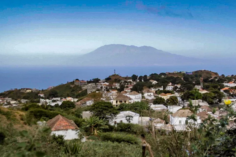
A view over Vila Nova Sintra, Brava on Fogo
With its approximately 2,000 inhabitants, Nova Sintra is the tranquil capital of the island, where it is pleasantly cool due to its location at an altitude of about 500 m. It is one of the most beautiful towns on the island. It belongs to the most beautiful places of the archipelago with its well-kept sobrados (two-storey houses), cobblestone streets and a splendour of hibiscus and bougainvillea bushes as well as purple jacaranda trees, where one immediately feels at home. The central square, Praça Eugénio Tavares, invites you to linger longer, for example by visiting the Esplanada Sodadi. You can see the Church of the Nazarenes and the colonial Igreja São João Baptista, near which there is a lookout point offering views as far as the coast. On the eastern entrance to Vila Nova Sintra, the stone replica of Columbus’ ship Santa Maria stands guard. There is a St. John’s Day celebration around the monument on 24 June, the biggest festival in Brava. To get the best view of the island’s capital, visit the Miradouro (lookout) de Nova Sintra, a few kilometres out on a road to the southeast.

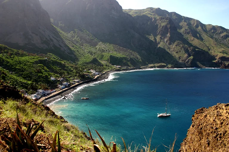
A view of Fajã de Agua, Brava
The island’s second largest village with 600 inhabitants is Furnas with its harbour. But it offers little and is only a transit point for tourists. However, Fajã de Água, situated in a very beautiful bay, is quite different. The shore road is lined with coconut palms, and rising mountains in the background complete the idyllic picture. There are also some beautiful villages in the mountains of the island’s interior. We should mention, for example, the picturesque Cova Joana with its soberrados and hibiscus hedges. The village of Nossa Senhora do Monte is situated on a ridge. From the neighbouring village of Mato, you can see the Alto de Fontainhas, Brava’s highest mountain at 976m. Even further south, in a barren landscape, is the rather isolated village of Cachaço. When the weather is clear, you can see as far as Fogo from here.
Brava is easy to explore by car, but even better on foot. The hike to Fajã de Água is almost a “must”. It is very steep and leads in serpentines from Nova Sintra down to the sea, past oases with palm and mango trees.
The hike to Fontainhas is also a good way to get a good impression of the island’s interior. At Brava’s highest peak, it is easy to reach and the path is not demanding. With good weather, there are great views of the island and the neighbouring island of Fogo once you have reached your destination.