Cape Verde: Fogo Island (original) (raw)
Fogo – The volcanic Island
Size:
476 km² (the fourth largest island)
Population:
Approx. 37,000
Capital of the island:
São Filipe (approx. 10,000 inhabitants)
Highest elevation:
Pico do Fogo, 2,829 m
Fogo is the name of fire. And this name reveals what the island in the south of the archipelago with its 40,000 inhabitants is: a volcano. Being the highest peak in Cape Verde, the volcanic mountain Pico de Fogo with its 2,829 metres dominates the landscape of the island. Also interesting are the cooled lava rivers, which were formed during the volcanic eruptions of the last centuries, and the pretty island capital São Filipe. Fogo is without a doubt one of the most beautiful islands in the archipelago.

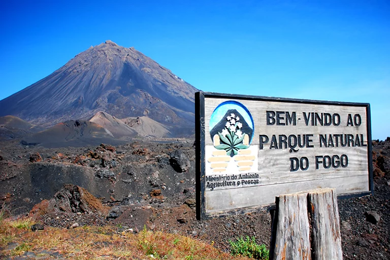
Pico de Fogo Volcano, Fogo Island
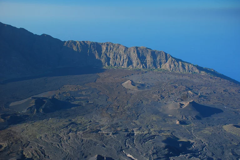
It is best to do it from the collapse crater called Chã das Caldeiras, at an altitude of about 1,600 metres. It involves a good 1,000 metres of altitude, and the climb takes about 3-4 hours. Because of the partly steep and fine scree (volcanic ash) sections, a guide is mandatory and good shoes are absolutely necessary. The collapsed crater with a diameter of 8 km is enormous. That area is still volcanically active. The last eruption took place in November 2014.
Chã das Caldeiras

Chã das Caldeiras, Island of Fogo
There is a small, friendly mountain village in the Caldeira with a particularly warm-hearted population. The people live from winegrowing, agriculture and, in the meantime, more and more from tourism. Staying overnight in this area is very special because of the remoteness, as well as the view of the magnificent Pico and the atmosphere in the midst of the black lava masses. Besides, the area is one of the few places that are not yet connected to the public electricity grid. Speaking of winegrowing: Chã das Caldeiras is the only place in Cape Verde where it exists. A tasting at the wine cooperative or at Ramiro’s is not to be missed!
São Filipe

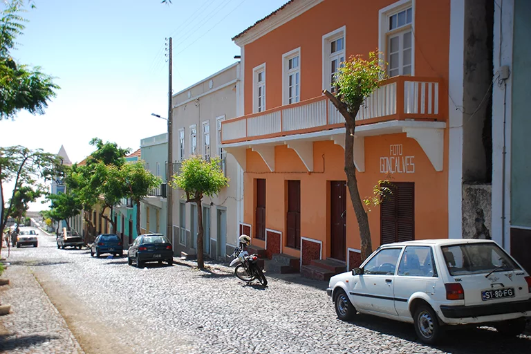
Island Capital São Filipe, Island of Fogo
Located in the southwest of Fogo, the island’s capital São Filipe is one of the most beautiful places in the country. Situated along a black lava beach on a 100m-high cliff, it is one of the most beautiful places in the country. With its quiet and well-kept squares, Portuguese colonial architecture and views of the smallest island of Brava, the old town is impressive. Particularly worth mentioning are the Sobrados, old mansions, of which there are still quite a large number. It is also worth seeing the local market (Mercado Municipal), where fruit, vegetables, fish and meat are sold. In the museum “Casa da Memório” you can learn more about the city’s history. A stairway leads to the black sand beach.
The island’s airport is also located in São Filipe. There is a daily domestic flight from Praia that takes only 20 minutes.
The north of the island

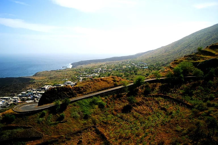
Road to Mosteiros, Island of Fogo
Further places worth mentioning are Mosteiros and Cova Figueira. Mosteiros, which used to have the island’s second airport, can be found in the north of the island. The village lies sleepily at the foot of a steep cliff directly on the Atlantic and exudes a morbid charm. There are unfortunately only a few tourists who stray to Mosteiros, although there is also some accommodation here. In the east of Fogo, Cova Figueira is worth mentioning, the third largest village on the island. This is where many Cape Verdeans living in the USA and returned emigrants have built their houses, which stand out colourfully.
An island tour on Fogo runs along the ring road. On the east coast, you get a good impression of the lava flows from various volcanic eruptions that happened a long time ago. Various craters and ash mountains are also worth mentioning. From Mosteiros, the tour later continues along the west coast to São Filipe. The natural sea pools of Salinas invite you to take a dip in the Atlantic, provided the Atlantic is calm.
Much of Fogo is dry and vegetation-poor, but in the north-east of the island, the trade wind clouds accumulate, so that it is green here and fruit as well as vegetables can be grown easily. On the north-eastern slope between Chã das Caldeira and Mosteiros there are coffee plantations and one of the largest contiguous forest areas in Cape Verde.
Hiking is especially good in the Chã das Caldeiras: Besides the already mentioned ascent of Pico do Fogo, the path to the small Pico, which was formed during the volcanic eruption in 1995, is popular. The climb up to Bordeira, the crater wall, is also worthwhile. The hike through the green north of the island from the Caldeira down to Mosteiros or vice versa is also interesting.