Geograph:: Line of Elan Valley Aqueduct © Ian Capper (original) (raw)
taken 16 years ago, near to Pipe Aston, County of Herefordshire, England
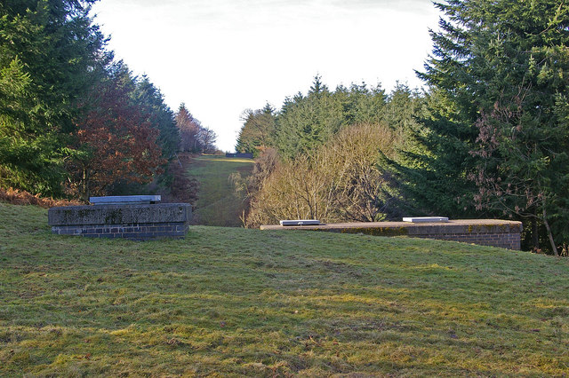
Line of Elan Valley Aqueduct
These covers and the similar one in the distance, along with the unplanted grassy break, mark the line of the aqueduct through Bringewood.
A 73 mile/117km aqueduct built between 1896 and 1904 connecting the Elan Valley Reservoirs near Rhayader with Frankley Reservoir on the outskirts of Birmingham. The engineer was James Mansergh. It operates by gravity, with a net fall of around 170 feet/50m, giving an average gradient over the length of 1 in 2300. The flow speed is 2mph/3 kph. Rivers and valleys are crossed by bridged aqueducts, using inverted siphons to lose and regain height for the larger drops, with a siphon house at either end and wash-out valves to allow sediment to be removed. Most of the aqueduct was built using the cut and cover method, but there are 15 bored tunnels totalling almost 13 miles/21 km, the longest, Dolau Tunnel, being over 4 miles long (almost 7 km). Initially there were two pipes, each of 42 inch diameter, with two more (of 60 inch diameter) added between 1919 and 1961. Between 2015 and 2019, three new bored sections were built at Nantmel, Bleddfa and Knighton to provide a diversion for their respective sections which had become worn out.
For photos Link.
TIP: Click the map for more Large scale mapping
Grid Square
SO4573, 125 images (more nearby 🔍)
Photographer
Date Taken
Friday, 20 February, 2009 (more nearby)
Submitted
Thursday, 5 March, 2009
Subject Location
OSGB36:  [SO 458 738](/gridref/SO 458 738/links) [100m precision]
WGS84: 52:21.6044N 2:47.7931W
Camera Location
OSGB36: [SO 458 738](/gridref/SO 458 738/links)
View Direction
West-southwest (about 247 degrees)

Image classification(about): Geograph
This page has been viewed about 941 times