Great Lakes Circle Tour™: Project Archive - Great Lakes Commission (original) (raw)
 The 6,500-mile Great Lakes Circle Tour™ is a scenic, international road system connecting the five Great Lakes and the St. Lawrence River. The Circle Tour signage system was established in the late 1980s as a cooperative, regional effort between the Great Lakes Commission and the eight U.S. states and two Canadian provinces that comprise the Great Lakes-St.Lawrence system. The Circle Tour established new routes and connected them to previously designated highways on “North America’s Fresh Coast.”
- **Media: North Coast Chronicles Podcast: **“Whatever Happened with the Great Lakes Circle Tour?” featuring GLC Deputy Director Tom Crane — click here for a direct link to play the podcast (2023)
- News and photos: Lt. Gov. Quinn bikes Circle Tour to boost Great Lakes tourism (2005)
- Great Lakes Circle Tour™ GLC Briefing Paper (1989)
- GLC Resolution on the Great Lakes Circle Tour™ (1989)
Background
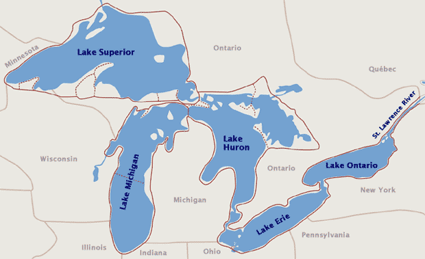
Great Lakes Circle Tour route (view individual lake maps below)
At its Annual Meeting in November 1988, the Great Lakes Commission approved a Great Lakes Circle Tour™ project. The circle tour idea had originated with the Commission’s Tourism and Outdoor Recreation Task Force. This group of state and provincial representatives acknowledged the interstate and U.S. – Canada competitive environment on tourism and sought a cooperative regional project where all jurisdictions could work together. The Circle Tour offers an opportunity to showcase the Great Lakes resource where promotion can be both collaborative and localized. All eight Great Lakes States tourism/travel office directors endorsed the idea.
The Commission formed a Great Lakes Circle Tour™ Task Force and charged it with developing appropriate polices. With the Lake Superior and Lake Michigan Circle Tours already in existence, the Task Force focused on route designation for Lakes Huron and Erie and systemwide signage. The New York Seaway Trail was also established by this time and the Task Force recommended its inclusion in the Circle Tour system. The Seaway Trail is recognized by many as the “gold standard” for its success and promotional efforts. The Task Force recognized that replicating New York’s experience across the Great Lakes Basin may be difficult, especially in the short term. It was agreed that local jurisdictions should have primary promotion responsibilities to be aided by the states and provinces where practical, such as designating routes on official highway maps and referencing it on web sites.
The Task Force produced a full-color “lure piece” brochure and distributed 50,000 copies to the states and Ontario and Quebec. New logos were established for the overall system and Lakes Erie and Huron. A conference was organized in Toledo to present the initiative to the region and gather promotion ideas. Other issues were addressed including signage size which varies with type of roadway and route location – state/provincial trunkline closest the Great Lakes shoreline or connecting waterway. On August 23, 1990 the Great Lake Circle Tour as well as the U.S. portion of the Lake Erie Circle Tour were dedicated at Sandusky, Ohio with the Ohio Governor and the Commission Chairman presiding.
During the decade following dedication, the Great Lakes Commission has organized separate Circle Tours workshops for Lakes Superior, Michigan and Erie where local promotion was the focus. Ohio’s portion of Lake Erie has embraced this idea with county convention and visitors bureaus collaborating on promotion programs and materials including their “Lake Erie Escapades” initiative. The Commission staff has used various forums to describe the Circle Tour and worked with authors as they prepared books on the topic. In one instance, staff worked with the Lake Michigan Carferry Service, Inc. to designate the the cross-Lake Michigan auto ferry as an official spur route for the Lake Michigan Circle Tour.
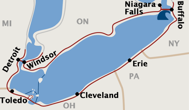
Lake Erie Map
Lake Huron Map

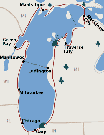
Lake Michigan Map
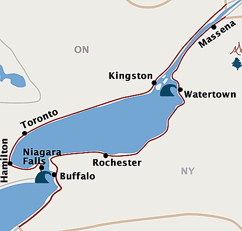
Lake Ontario Map
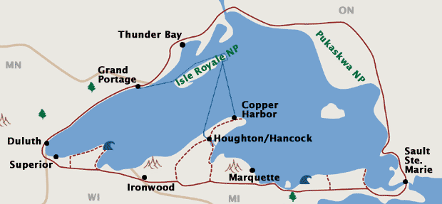
Lake Superior Map
