Hochalpenkopf (Cima dei Colli Alti) Peak Hike, Dolomites (original) (raw)
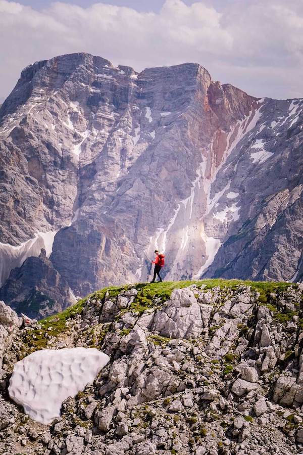
Most people who venture to Lago di Braies (Pragser Wildsee) snap a few photos, walk around the lake, and leave. That’s how the great majority of visitors will experience the most popular lake in the Italian Dolomites. However, there’s a far better way to experience it, if you’re willing to put in the effort.
We recommend hiking from Lago di Braies to the summit of Hochalpenkopf/Cima dei Colli Alti via Grünwaldtal/Val di Foresta valley and the Malga Uces de Fojedora/Hochalmhütten mountain pasture huts.
This is a long circuit hike (16.9 km total) perfect for anyone seeking a full-day adventure in the Prags Dolomites. This trail ventures into some of the most secluded areas of Fanes-Sennes-Prags Nature Park.
The trail presents very minimal technical difficulty. However, it’s very long. We were wiped out by the end of it.
We recommend starting as early as possible to avoid getting baked in the valley as we did. On a sunny day, the bleached dolomite rock in the valley reflects the sunlight like snow and you’ll roast like a pig on a spit. Sorry for the visual. My point is: start early! My second point is: bring sun protection (CAT 3 polarized sunglasses, sun hat, sun lotion).
Recommended CAT 3 Sunglasses: Julbo Fury Sunglasses
Recommended REACTIVE CAT 0-3 Sunglasses: Julbo Fury Sunglasses (photochromic lens) – this lens will adjust automatically to the light environment (shifting from CAT 0 to CAT 3). That means if you’re hiking along a shady trail, it’ll adjust to CAT 2, so you have better visibility. This functionality makes it more expensive.
Note: most trail signs in the Braies/Prags Dolomites are in Ladin and German. So, follow signs to Hochalpenkopf, as you won’t see any signs directing you to Cima dei Colli Alti.
- Hochalpenkopf Circuit Hike Map
- How to Get to Lago di Braies/Pragser Wildsee
- Hochalpenkopf Trail Description
- Where to Stay near Lago di Braies
- More Alta Pusteria Travel and Hiking Guides
- Dolomites Trip Planning Essentials
- Trailhead: Lago di Braies/Pragser Wildsee
- Distance: 16.9 km circuit
- Time Needed: 6:30 hours
- Elevation Gain/Loss: 1202 meters
- Difficulty: Moderately-difficult because of length
- Minimum Elevation: 1493 meters
- Maximum Elevation: 2540 meters
- Route: Lago di Braies/Pragser Wildsee – Grünwaldalm – Hochalmhütten – Slapadures Joch – Flatschkofel Scharte – Hochalpenkopf – Pragser Furkel – Lago di Braies/Pragser Wildsee
- When to Hike: June – October
- Where to Stay in Braies Valley: Garni Bergblick (budget), Berggasthaus Agritur Moserhof (midrange), or Farmhouse Hanslerhof (midrange)
- Where to Stay in Val Pusteria: Hotel Christof (luxury), or Silentium Dolomites Chalet Since 1600 (luxury)
- Recommended Trail Map: Tabacco 031 Dolomiti di Braies
Hochalpenkopf Circuit Hike Map
How to Get to Lago di Braies/Pragser Wildsee

We’ve written an in-depth guide about visiting Lago di Braies, which includes a lot of helpful information on parking and access restrictions during the high season (July 10 – September 10).
Hochalpenkopf Trail Description
Lago di Braies/Pragser Wildsee to Malga Foresta/Grünwaldalm (50 minutes)

Trail 1/19
Our hike begins by following the trail that circuits Lago di Braies (Seeweg/trail 19/Alta Via 1), counter-clockwise. If you’re facing the lake, head right and walk around the stately Hotel Lago di Braies. The lake path directly in front of the hotel is private (hotel guests only).
Soon, you’ll be on the “Seeweg” lake trail. Follow this path all the way to the opposite end of the lake (20 minutes).
When you reach the other end, follow signs to Malga Foresta/Grünwaldalm (trail 19, signed 30 minutes). This trail branches off to the right (west).
Cross the bridge and follow the wide gravel road to the Malga Foresta/Grünwaldalm alpine pasture hut (20 minutes).
Malga foresta is a managed hut, serving food and drinks throughout the day. It occupies a very scenic location, encircled by mountains. If you’re not in the mood for a big excursion today, you can grab lunch here, and head back to Lago di Braies, completing the circuit trail around the lake.
Malga Foresta/Grünwaldalm to Uces de Fojedora/Hochalmhütten (1:45 hours)
Trail 19
Continue walking along trail 19 (a gravel road) through the Val Foresta valley. This part of the hike is flat and easy, but it gets really hot, as there’s minimal shade.
After walking 2.8 km (about 40 minutes), you’ll come to a clearing with a private, rustic wooden hut: Alte Kaser, 1757 m. At the signed intersection, continue straight on trail 19, crossing the meadow.
From here, you’ll dip into a patch of forest, and then start the 360-meter ascent to Baita/Ütia Fojadöra.
This narrow hiking trail snakes its way uphill, steeply at first, and follows the Rü Fosch/Finsterbach stream for a time.
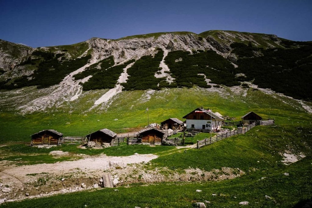
Eventually, you’ll clear the tree line and enter the high alpine pasture area of Fojedora. A dozen huts are clustered together in the basin below. This storybook scene is enchanting. In this solitary location, time stands still.
Baita/Ütia Fojadöra is a managed hut as well.
Uces de Fojedora/Hochalmhütten to Ju dles Slapadures/Slapadures Joch (20 minutes)
There’s a gravel road that continues uphill and left (west). Follow this road for about 10 minutes. When you reach an intersection, turn right onto trail 32. The trail isn’t well-defined at first, as the painted waymarks are fading.
You’ll hike up a grassy slope until reaching a signed intersection at Ju dles Slapadures/Slapadures Joch.
Ju dles Slapadures/Slapadures Joch to Forcella Valacia/Flatschkofel Scharte (30 minutes)
Trail 6
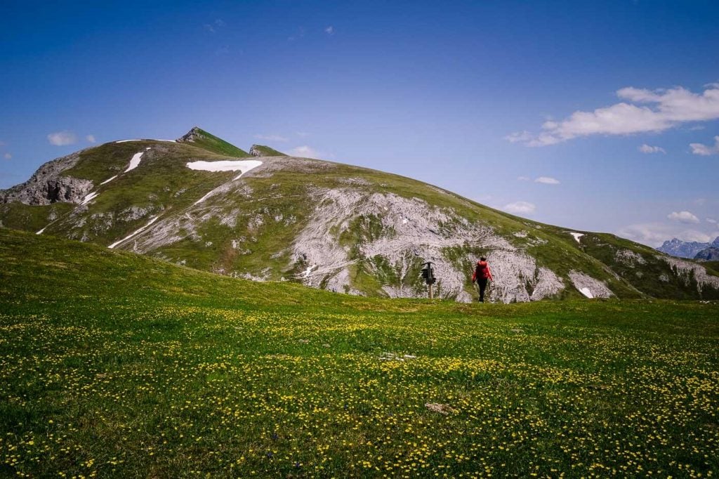
From Ju dles Slapadures/Slapadures Joch, follow trail 6 northeast in the direction of Hochalpenkopf (signed 2:10 hours).
Trail 6 yields more wonderful vantages of the Fojedora huts below, backed by the impressive Grosse Zinne/Cima Grande, Seekofel/Croda del Becco, Kleiner Seekofel/Piccola Croda del Becco, and Cima de Riciogogn.
The path ultimately descends to the Forcella Valacia/Flatschkofel Scharte mountain pass. As you approach the pass, you’ll see the Niedertal valley and the peaks of the Rieserferner Group mountain range in the distance.
Forcella Valacia/Flatschkofel Scharte to Hochalpenkopf (1:40 hours)
Trail 61
At the mountain pass, trail 6 continues north to Olang/Valdaora.
Take trail 61 east.
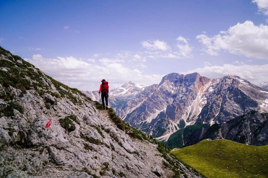
After making a counter-ascent, trail 61 traverses the vast high alpine pasture of Fojedora/La Munt defora/Hoch Alm.
This is the most satisfying and visually engrossing part of the hike. You’re crossing green meadows on an undulating high alpine path (with very little grade difference), whilst soaking in the views of the Prags/Braies mountains.
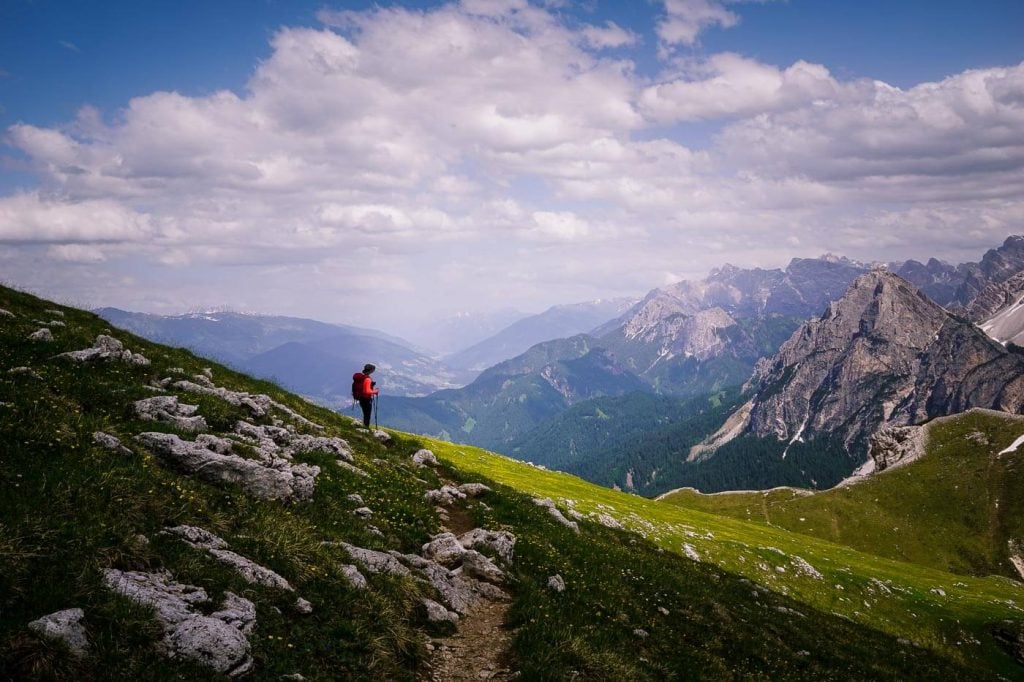
Trail 61 – View of Upper Puster Valley
When you reach the 61/61A trail intersection, head left and uphill on trail 61A to the summit of Hochalpenkopf (signed 40 minutes). It’s only a 190-meter ascent to the peak and takes less time than the sign suggests.

Trail 61A – View of Seekofel / Croda del Becco
At the summit, you’ll see Lago di Braies, Puster Valley and Olanger Stausee, and countless peaks.
Hochalpenkopf to Lago di Braies/Pragser Wildsee (1:30 hours)
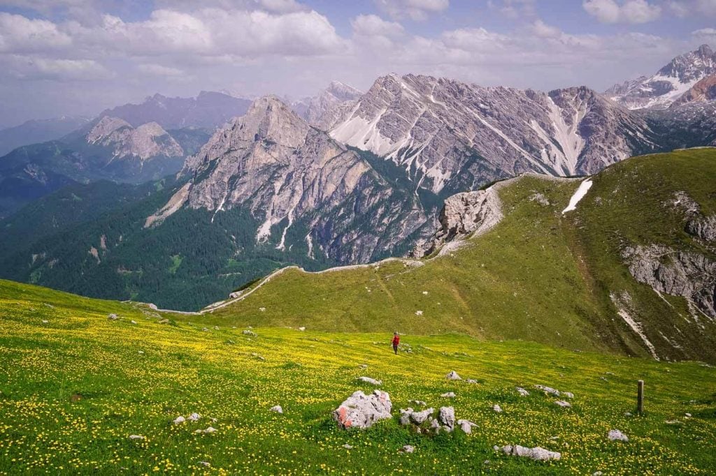
Trail 61 – Hiking to Pragser Furkel
Descend along the same trail back to the intersection and continue east to Pragser Furkel. Here, sheep graze during the pasture season. Keep a respectful distance and stay on the marked trail.
Herrstein and Rosskopf dominate the view. You can also make out Haunold, Dreischusterspitze, and Dürrenstein.
You’ll descend across a loamy track towards the stone wall (which fortifies the pasture) to Pragser Furkel. Hop over a stone wall and start the descent.
Tight switchbacks twist and turn along a loose rocky path, lined with dwarf pine. Hiking poles are essential. We love our Black Diamond Trail Trekking Poles.
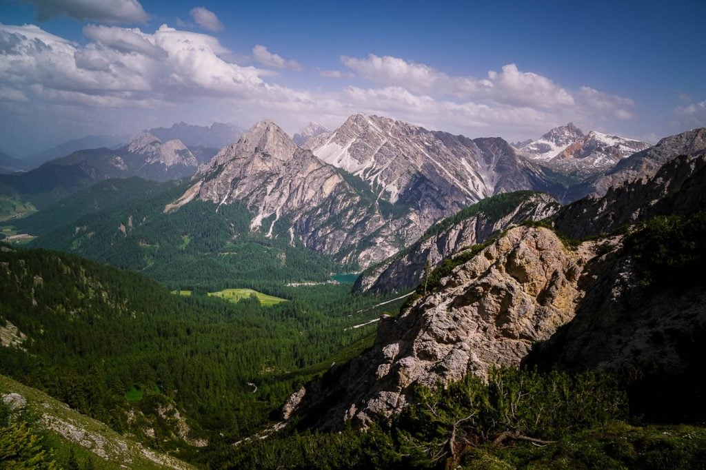
Trail 61 – Descent to Lago di Braies
After about 30 minutes, you’ll arrive at Käser Alm (not managed). From here, it’s a 50 minute descent to Lago di Braies/Pragser Wildsee. You’ll cross the pasture, follow trail 61 at first, and descend through a thick forest.
The trail is full of rubble, branches, and debris. Luckily, after 10 minutes, you’ll join a forest road.
We hiked along this forest road until following the path (Trail 20) around the Riedl farm/pasture and eventually back down to the lake.
Where to Stay near Lago di Braies
Valle di Braies / Pragser Tal Valley
Valle di Braies valley is the best base for exploring everything that the northern Prags/Braies Dolomites has to offer. The top attractions are Prato Piazza and Lago di Braies.
But with more time, you can venture off-the-beaten-path to the Ütia Fojadora mountain pasture, Grünwaldtal valley and Hochalpensee lake, Hochalpenkopf peak, Croda del Becco/Seekofel summit, Herrstein peak, Grosser Rosskopf peak, and the Gaisl high trail (Prato Piazza to Malga Rossalm).
Budget | Garni Bergblick is a darling guesthouse in Braies/Prags Valley, located a mere 5.6 km (8-min drive) from Lago di Braies, 6.2 km (9 min drive) from Ponticello, and 11.3 km (18 min drive) from Prato Piazza. Set in an idyllic meadow surrounded by trees, Garni Bergblick is the perfect base for exploring the Braies/Prags Dolomites. Breakfast is included in the rate.
Budget-Midrange | Berggasthaus Agritur Moserhof is a traditional and cozy farm stay, perched high above Braies/Prags Valley. Breakfast and dinner are included in the rate. From Moserhof, it’s a 5-minute drive down to the valley and a 11-minute drive to Lago di Braies.
Midrange | Farmhouse Hanslerhof is a mountain guesthouse and farm overlooking Braies/Prags Valley and surrounded by meadows. Guests love the charming stone pine rooms, homemade breakfasts (included the room rate), and quiet location. From Hanslerhof, it’s an 8 minute drive to Lago di Braies.
Midrange | Hotel Erika is a 3-star hotel situated at the entrance of Valle di Braies. Guests have access to a lovely 400m² wellness area containing a Finnish Sauna (90 °C), steam bath (42-45° C), bio sauna (60 °C), infrared lounge, jacuzzi, and relaxation rooms. Rooms are clean and comfortably furnished in a Tyrolean-alpine style. A rich and varied breakfast buffet and a 5-course dinner are included in the room rate (half board). From Hotel Erika, it’s a 10-minute drive to Lago di Braies and a 20-minute drive to Prato Piazza.
Look for an accommodation in Braies Valley.
Monguelfo, Val Pusteria
Monguelfo (Welsberg in German) is a village in Val Pusteria, only 3-minutes away from the entrance of Braies Valley.
Luxury | Hotel Christof is a new and stylish hotel in the village of Monguelfo/Welsberg in Val Pusteria. Stay here for the striking fresh-faced architecture, modern 600 m² wellness area, and excellent cuisine (you can book breakfast-only or half board). This modern hotel is a splash of cheerful color and laid-back fun on the South Tyrolean hospitality scene. From the hotel, it’s a 13-minute drive to Lago di Braies.
Luxury | Silentium Dolomites Chalet Since 1600 is tucked away on the edge of a forest, 2-km from the town center of Monguelfo/Welsberg. It’s a 15-minute drive from Silentium Chalet to Lago di Braies. Guests love the kind hospitality, picturesque location, and excellent breakfasts (included) and dinners (optional).
Look for an accommodation in Monguelfo.
More Alta Pusteria Travel and Hiking Guides
Sesto/Sexten Dolomites:
- Tre Cime di Lavaredo Loop Trail
- Rifugio Auronzo Toll Road
- Sentiero Bonacossa North Trail
- Cadini di Misurina Viewpoint
- Torre dei Scarperi Circuit Hike
- Val Fiscalina
Braies/Prags Dolomites:

GET YOUR FREE EBOOK
Signup for our newsletter to get our guide to “Secret Hiking Destinations in Europe.”
Dolomites Trip Planning Essentials
Use our Dolomites Travel Guide to plan an unforgettable trip to Northern Italy.
When to Hike in the Dolomites
The best time to hike in the Dolomites is between mid-June and mid-September. If the weather is stable, the hiking season can extend until late October.
How to Get to the Dolomites
Read How to Get to the Dolomites to find out how to travel to the Dolomites from the closest airports, train stations, and bus terminals.
If you’re traveling without a car, also check out How to Visit the Dolomites Without a Car.
Car Rental
The easiest way to travel between hiking destinations in the Italian Dolomites is with your own car. Check out our itineraries for trip inspiration:
We recommend using the Discovercars.com car rental reservation platform to search for and book car rentals. This easy-to-use booking platform compares car rental deals from 500+ trusted providers, so that you can choose the best option for your trip.
Tip: If you can only drive automatic transmission cars, as opposed to manual transmission cars (stick shift), book your car rental as early as possible.
Best Places to Stay
Figuring out where to stay in the Dolomites is probably the biggest hurdle to planning a trip to the Dolomites. We’ve created three guides to help you decide where to stay:
- Where to Stay in the Dolomites in Summer: best villages and towns in South Tyrol, Trentino and Belluno
- Best Hotels in the Dolomites: best boutique and luxury hotels in the Dolomites
- Dolomites Accommodation Guide: farm stays, mountain huts, wellness hotels, aparthotels
- Best Val Gardena Hotels: best accommodations in Ortisei, Santa Cristina, and Selva
We suggest choosing 2-4 bases for your Dolomites trip and spending 2-4 nights in each base.
- Base 1: Val Gardena
- Base 2: Val di Funes
- Base 3: Alta Badia
- Base 4: Cortina d’Ampezzo
- Base 5: Alta Pusteria
- Base 6: San Martino di Castrozza
What to See & Do
During your trip to the Dolomites, you can go via ferrata climbing, culinary hiking, hut to hut hiking, cycling, paragliding, and so much more. We’ve highlighted our favorite experiences in Best Things to Do in the Dolomites.
Wherever you decide to stay, you’ll be surrounded by glorious mountain scenery and incredible natural landmarks.
In Best Places to Visit in the Dolomites, we’ve outlined the most iconic attractions as well as lesser-known destinations across the Dolomites, including Alpe di Siusi, Lago di Braies, Tre Cime di Lavaredo, Lago di Sorapis, Lago Federa, Cadini di Misurina, Seceda, Baita Segantini, and the Adolf Munkel Trail to Geiserlalm.
Dolomites Packing List
Hiking Gear
- Day Pack: Osprey Tempest 30 Women’s Backpack / Osprey Talon 33 Men’s Backpack
- Grade B/C high-cut hiking boots: Meindl Schuhe Island Lady (Kati’s Boots), Women’s Hanwag Tatra II GTX (Sabrina’s Boots), Men’s Hanwag Tatra II GTX (men’s equivalent)
- CAT 4 Sunglasses: Julbo Shield Mountain Sunglasses
- Hiking Poles:Black Diamond Trail Trekking Poles
- Reusable Water Bottle: Ion Leakproof 32 oz Water Bottle
Outdoor Photography Gear
- Camera Body: Sony Alpha a6400
- Mid-range Zoom Lens: Tamron 17-70mm 2.8 Di III-A VC RXD
- Wide angle Zoom Lens: Sony – E 10-18mm F4 OSS Wide-angle Zoom Lens
- Backpack Camera Clip: Peak Design Camera Clip
Dolomites Hiking Guides
Hiking in the Dolomites is our passion. Year after year, we love discovering new trails and expanding our knowledge of the area. For day hiking, check out Best Day Hikes in the Dolomites. For trekking, take a look at our guide to Hut to Hut Hiking in the Dolomites and Alta Via 1.
For region-specific hiking trails, check out:
- Best Hikes in Val Gardena
- Best Hikes in Cortina d’Ampezzo
- Best Hikes in Alta Badia
- Sexten Dolomites Hiking Guide
Recommended Hiking Guidebook: Cicerone Guide: Shorter Walks in the Dolomites
This post may contain affiliate links.