Hundskopf Hike + Felix-Kuen-Steig Via Ferrata, Innsbruck (original) (raw)
Hundskopf (2243 m) is a peak in the Karwendel Mountains, near Hall in Tirol and Innsbruck, in Tyrol, Austria.
It’s the easternmost rocky summit in the Gleirsch-Halltal Chain.
The hike to Hundskopf starts at Hinterhornalm (1522 m), accessible by car only via a toll road.
To reach the Hundskopf summit, you have two options. You can either ascend the Felix-Kuen-Steig (Grade A/B), a short and easy via ferrata (Klettersteig in German). Or, you can ascend the eastern ridge to the summit, which is an airy, partially-secured path.
Ideally, hikers ascend the Felix-Kuen-Steig and then descend the eastern ridge in one circuit. However, the via ferrata is optional.
Though the via ferrata itself is short and easy, the hike is quite strenuous. It’s a tough 2-hour ascent to reach the base of the Felix-Kuen-Steig.
At the end of the tour, we recommend detouring to Walderalm mountain pasture for delicious Tyrolean Knödel (dumplings).
- Hundskopf Hiking Map
- Special Equipment
- Where to Start the Hundskopf Hike
- Hinterhornalm – Hundskopf – Walderalm Trail Description
- Where to Stay near Hundskopf
- Discover More of Tyrol and Beyond

- Trailhead: Hinterhornalm Car Park, Gnadenwald | Google Maps
- Distance: 6.9 km lollipop-circuit
- Time Needed: 4 hours
- Elevation Gain/Loss: 764 meters
- Hike Difficulty:Difficult
- Via Ferrata Difficulty: Easy – Grade A/B
- Minimum Elevation: 1476 meters
- Maximum Elevation: 2240 meters
- Where to Stay in Hall in Tirol: kontor Boutiquehotel (luxury), or Parkhotel Hall in Tirol (luxury)
- Where to Stay in Innsbruck: Motel One Innsbruck (budget-midrange), NALA individuellhotel (midrange), Altstadthotel Weisses Kreuz (luxury), or Weisses Rössl (luxury)
- Austria Travel Itineraries: 2-Week Austria Road Trip and 7-Day Austria Road Trip
Hundskopf Hiking Map
Special Equipment

We recommend bringing a via ferrata kit. Depending on your level of experience, you may not need it. However, I always say, “it’s better to be safe than dead.”
A via ferrata kit consists of a climbing helmet, climbing harness, and a via ferrata lanyard with carabiners. Climbing gloves like Black Diamond half finger gloves are also very useful.
Climbing Helmet
- Women’s Climbing Helmet: Black Diamond women’s climbing helmet
- Men’s Climbing Helmet: Black Diamond men’s climbing helmet
Climbing Harness
- Women’s Climbing Harness: Petzl CORAX LT Women’s Harness
- Women’s Climbing Harness: Black Diamond Women’s Momentum Harness
- Men’s Climbing Harness: PETZL Corax Climbing Harness
- Men’s Climbing Harness: Black Diamond Men’s Momentum Rock Climbing Harness
Lanyard
- Unisex Lanyard with Carabiners: PETZL Scorpio Vertigo via ferrata Lanyard
- Unisex Lanyard with Carabiners: Salewa Ergo Core, Unisex Adult
- What we use and love: CAMP Kinetic Gyro Rewind Pro
Where to Start the Hundskopf Hike
Hinterhornalm

Hinterhornalm is located at the top of the Hinterhornalm toll road in Gnadenwald, Tyrol.
To drive up to Hinterhornalm, you must pay a 5 EUR toll. Payment is accepted in cash only: EUR Coins and 5, 10, 20 EUR bills.
The toll road entrance is “unmanned” and marked with various signs that read:
Mautstrasse gebührenpflichtig: toll road chargeable
Ticket beim Kassenautomat lösen: Buy a ticket at the ticket machine
Kassenautomat. Bei nichtbeachtung erfolgt Besitzstörungsklage: automatic pay station. Failure to comply will result in a lawsuit against trespassers
After purchasing your ticket, drive the winding mountain road up to the Hinterhornalm car park.
Display the ticket on your windshield.
Hinterhornalm – Hundskopf – Walderalm Trail Description
Approach | Hinterhornalm – Felix-Kuen-Steig (2 hours)

From the Hinterhornalm car park, follow the hiking trail that leads north in the direction of “Klettersteig Hundskopf.” Don’t follow the gravel road leading to Walderalm.
The path crosses a grassy slope to a line of spruce.
With views of the Inntal and Hinterhornalm, the trail ascends the forest.

Increasingly steeper and more rugged, the path twists up a belt of dwarf pine. After crossing a scree slope, the trail zigzags up the rocky mountainside.
Scramble up the crags, following the red-painted waymarks to the east flank of the mountain. You will see Walderalm below.
After about an hour from the start, the trail crests the eastern spine of the Gleirsch-Halltal Chain, a wide, dwarf-pine-carpeted slope.
Views open up to the Hinterautal-Vomper-Kette, the Karwendel chain that flanks the other side of the Vomper Loch valley.

The path continues west across the slope and then along a balcony, overlooking the Inntal, to the base of a fixed cable. Scramble up the short secured section.
Continue the steep, craggy ascent to another short secured section.

Soon, you’ll reach the ridge. A large cairn marks the start of the Hundskopf summit circuit trail.
This is the best place to gear up (helmet, harness, lanyard). Note: you’ll return to this exact spot, after descending along the eastern ridge.
Head right first.

Follow the fixed cable along the northern ledge.
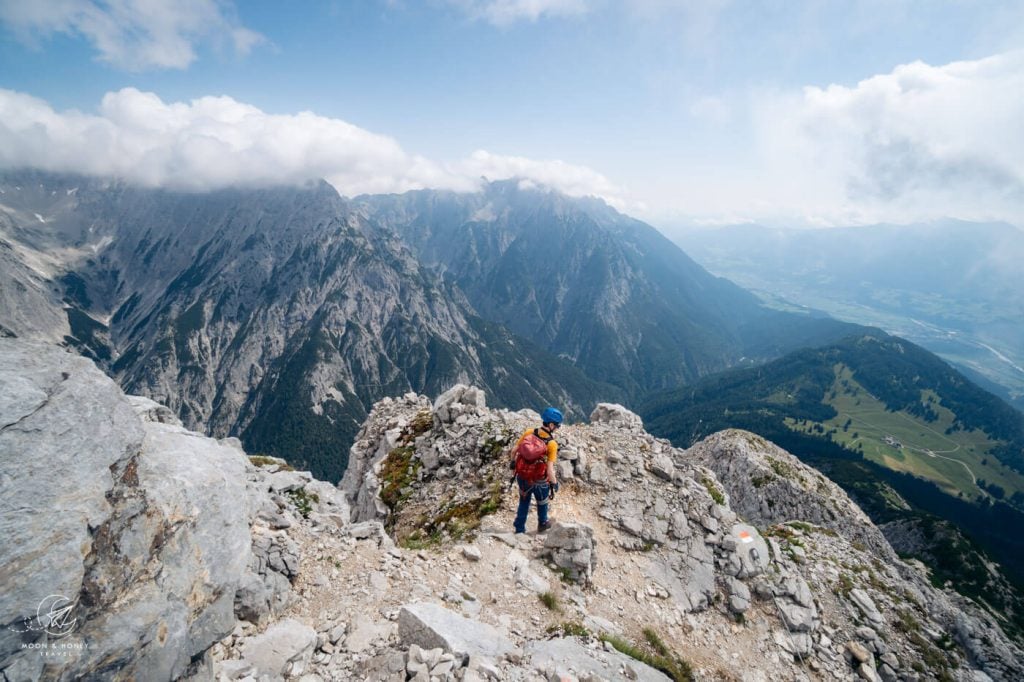
This airy, partially-secured trail crosses the northern flank of Hundskopf to reach a wide saddle.

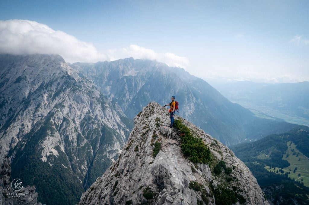
You can see the summit of the thumb-shaped Hundskopf directly ahead.
The saddle marks the beginning of the Felix-Kuen-Steig via ferrata (Grade A/B).
Via Ferrata | Felix-Kuen-Steig to Hundskopf (15 minutes)

From the saddle, make a sharp left and climb up the northwestern flank of Hundskopf, using the various aids: rungs and cables.
There are two vertical steps to tackle.

It takes no more than 15 minutes to scramble up to the Hundskopf summit.

Descent | Hundskopf Peak – Walderalm – Hinterhornalm (2 hours)

From the cross-bearing summit, the trail continues along the eastern ridge.

This narrow, ridge-hugging path is the highlight of the tour, as it affords sweeping views of the Inntal Valley and the Karwendel Mountains.
The exposed sections of the ridge are secured.
Drop down the last vertiginous crag, using the fixed aids, to complete the circuit.

From the cairn, descend along the familiar path.
We thought the descend was more difficult, given then gradient and terrain. We highly recommend using hiking poles like these Unisex Black Diamond Hiking Poles.

After completing about 70% of the descent, you’ll arrive at a junction. Unfortunately, the junction isn’t well signed. There’s only a “Klettersteig” sign here.
But, if you cross the meadow in an easterly direction, the path to Walderalm is very obvious and well-marked.
Follow the forest trail to the mountain pastures of Walderalm. There are several cattle barns and an Almhütte, which serves warm and cold meals during the day.

Walderalm is open Tuesdays-Sundays from 10 am until 6 pm. The kitchen closes at 5 pm.
They’re famous for their Kaspressknödel (cheese dumplings), which they serve in soups, salads, and alongside sauerkraut.

Bring cash.
From Walderalm, follow the gravel road for 20 minutes back to Hinterhornalm.
Where to Stay near Hundskopf

The closest accommodation to the trailhead is Alpenhotel Speckbacher Hof in Gnadenwald. This traditional hotel has an on-site restaurant and wellness area. Reviews are mixed.
You can also check out Gasthof Ebner (budget-midrange) and Landgasthof Bogner in Absam, the settlement north of Hall in Tirol, only 10 km away from Hinterhornalm.
Hall in Tirol
Hall in Tirol is a town in the Inn Valley, just east of Innsbruck. Its historic center has been beautifully restored, making it a delight to explore on foot. Hall rose to prominence in the 13th century, because of the salt industry.
It was actually the most important commercial center in North Tirol. This is a great base for exploring the Karwendel Mountains and Innsbruck’s surroundings.
Top-Choice Luxury | Hotel Kontor is a boutique hotel in Hall in Tirol with airy, minimalist rooms featuring hardwood floors, billowy linen, and tea and coffee makers. Breakfast is included. On-site parking is available.
Luxury | Parkhotel Hall in Tirol is a modern, dog-friendly hotel with soundproof rooms, an on-site restaurant, and a 580 m2 spa area, walking distance to the historic Altstadt (Old Town). Parking is available (extra charge). A rich breakfast is included.
Look for accommodation in Hall in Tirol.
Innsbruck
Budget-Midrange | Motel One Innsbruck is located near the Innsbruck Train Station, a mere 10-minute walk into the Innenstadt (Inner City of Innsbruck). This modern 3-star hotel offers snug rooms with views overlooking the city and mountains. Don’t miss the top floor bar. Perks: luggage storage and 24/7 reception. Breakfast and underground parking are both available for an extra charge.
Midrange | NALA individuellhotel is a quirky hotel with uniquely-designed rooms, a sun terrace, fitness room, breakfast (extra fee), and nearby parking (extra fee).
Midrange-Luxury | Faktorei is a boutique hotel housed in a 15th century town house with 12 sun-drenched minimalist rooms, a garden, terrace, and bar. Private garage parking is available, but must be reserved in advance (extra fee). Breakfast is served in the hotel’s adjacent café (extra fee).
Top Choice – Luxury | Altstadthotel Weisses Kreuz is a contemporary hotel with an atmospheric bar in Innsbruck’s pedestrian zone. Stay here for the delicious breakfast, stylish design, professional staff, and location. No on-site parking.
Top Choice – Luxury | Set in a historic building in the center of Innsbruck, the exceptional Weisses Rössl is a boutique hotel with a 600-year-old Tyrolean restaurant. Expect a delicious breakfast. Paid public parking is located nearby.
More Innsbruck Accommodations: Montagu Hostel (budget), Hotel Innsbruck (luxury), or Hotel Zach (luxury)
Look for accommodation in Innsbruck.
Discover More of Tyrol and Beyond
Innsbruck:
Karwendel Mountains:
Lake Achensee:
- Lake Achensee
- Lamsenjochhütte – Hahnkampl Circuit Trail
- Seekarspitze – Seebergspitze Ridge Trail
- Bärenkopf Peak
- Hochiss Peak Hike
Via Ferratas in the Alps:
- Alpspitze (Grade A/B) in Garmisch-Partenkirchen, Bavaria, Germany
- Via Ferrata Oskar Schuster (Grade B/C) in the Sassolungo Group, Dolomites
- Via Ferrata Sass Rigais (Grade B/C) in the Puez-Odle Group, Val Gardena, Dolomites
- Gran Cir (Grade A) in the Cir Group, Alta Badia, South Tyrol, Italy
- Mount Triglav (Grade A/B) in Julian Alps, Slovenia – 2 days needed

GET YOUR FREE EBOOK
Signup for our newsletter to get our guide to “Secret Hiking Destinations in Europe.”

This post may contain affiliate links.