Climbing, Hiking & Mountaineering : SummitPost (original) (raw)
Geographical Structure
Overview
High group of Mountains where carst phaenomena are most expressed. These limestone mountains are like Swiss cheese - heaven for speleologists. Some deepest caves in Europe were discovered in this group. Several of them have vertical drops of more than 1000 meters. being the first barrier on SW this group has the highest quantities of rain and snow in Julian Alps. In past, winters with 7 meters of snow on Kanin were not rare. By: Vid Pogachnik
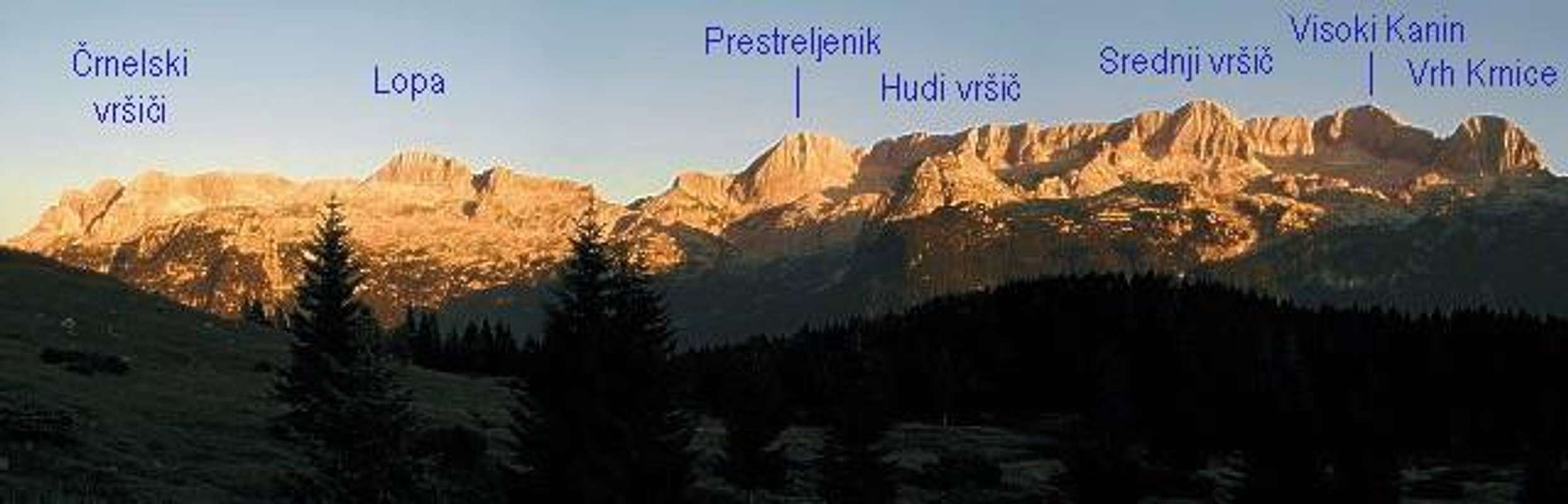
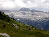
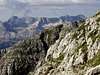
The Kanin group seen from north, from the pass Sella Nevea.
Main ridge
In the main ridge of Kanin group are located the main and the highest summits in the group. That ridge starts on the border crossing between Slovenia and Italia called Predel pass (around 1100m) and goes first on the Jerebica (2125m) then over some unimportant mountains falls on the pass Cez Brezic (1699m) and then rises up on the Mala Cernelska spica (2273m) and Velika Cernelska spica (2332m). From those two summits goes in the SE direction another ridge that comes over Vrh Ribeznov (2024m) on the powerful mountain Rombon (2208m). The main ridge goes from Velika Cernelska spica in the west direction over Hudi vrsic (2344m), Grdi Vrsic (2327m) on Lopa (2406m). From Lopa the ridge descend on the important pass Prevala (2067m). From the pass Preval the ridge rises up steeeply on the Prestreljnik (2499m). From Prestreljnik the main ridge continue in the west direction over Hudi Vrsic (2478m), Srednji Vrsic (2543m) on the highest mountain in the Kanin group Visoki Kanin (2587m).
Now from the Visoki Kanin go two ridges. One ridge goes on the Italian side on Vrh Krnice (2443m) and Zrd (2324m) and then steeply fall in the valley. The second ridge is the border ridge between Slovenia and Italia and goes in the south direction over some unimportant mountains and comes on Vrh laske planje (2448m). Then the ridge slowly falls down over Velika Baba (2148m) and Skutnik (1721m) to the valley of Soca.
On the both side of the main ridge of Kanin group are two big plateaus. One plateau is on the Italian side (north side) and the second plateau is on the Slovenian side (south side). On both plateaus are many mountains and ridges. It would be thoughtless if I named all mountains.
Mountains on other ridges
Here are named mountain that they are not located in the nearness of the main ridge of Kanin group but they are on some other ridges but they belong to Kanin group.
These mountains are Matajur (1643m), Stol (1673m), Gran Monte (1636m), Monte Chiampon (1709m), Muzci/Musi (1869m), Lopic / Monte Plauris (1958m) and many other.
More photos 1
More photos 2
Important summits
Visoki Kanin, (2587m).
Prestreljnik, (2499m).
Vrh laske planje, (2448m).
Lopa, (2406m).
Velika Cernelska spica, (2332m).
Rombon, (2208m).
Jerebica, (2125m).
Lopic / Monte Plauris, (1958m).
Muzci/Monte Musi, (1859m).
Stol, (1673m).
Matajur, (1643m).
There are many more mountains. I named only the most popular. For more mountains check the pages of the single mountain.
Other Places To See
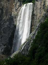
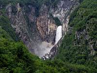
- Slap Boka/Waterfall Boka
Boka waterfall is the highest waterfall in the Upper Soča valley and the most magnificent, the strongest Slovenian waterfall. It falls 106 meters. It can be seen at its best from the bridge on the road Zaga-Bovec. But it is approachable over two marked paths. But be careful on the paths because they are secured!
There are many other beautiful waterfalls. But the most popular are the pools and the gorges on the many beautiful rivers. I will name some of them: Soca river, Moznica river, Učja river …
The link to the map of the Waterfalls in Triglavski Narodni park. You just click on the waterfall and you will get information about it. - Prestreljnikovo okno/Window of Prestreljnik
The window is located in the west ridge of the mountain Prestreljnik and it can be approachable over the steep scree and after climbing on some rocks.
Nadiza/Natisone River
By: Vid Pogachnik
Nadiza river is sunny, warm and still very clear. Its sources are below Stol and Gran Monte, then it flows as a beautiful creek towards south. Near Logje it turns eastwards and seemingly flows towards Soca river, but just below Kobarid it suddenly decides to turn southwards again carves a deep gorge between Mija and Matajur and finally gets out of Julian Alps at Cedad/Cividale.
While today's main road follows the river from Kobarid to Cedad/Cividale, in past also paths along its upper flow towards west were much used. Today still a romantic witness of those times stands - the 'Napoleon bridge' below Logje village.
Here are some attractions of this beautiful river and its valley:
Landarska jama / La grotta di san Giovanni d'Antro. High above the river, near Ponteacco there's a cave with a nice church, arranged for tourist visit. It was built by early Christians and later modified by Langobard people. The cave behind the church was already used by stone age men.
Napoleonov most / Il ponte di Napoleone. The bridge has its name by Napoleon Bonaparte, whose army was supposed to cross it. But it was built far before - in times of ancient Romans. Its romantic arc reminds us on old paths, leading from Kobarid towards west.
Nadiza/Natisone ponds. Near Kred village and further towards west the river has some nice places, which are used for summer swimming.
The upper canyon. West of Logje village the river enters a nice canyon, which can be passed, if water is not very high. All around are nice, picturesque places for swimming.
Valleys
Trenta is by many most beautiful and most romantic valley of Julian Alps. It is certainly one of longest (around 22km), placed in the heart of Julian Alps, dividing them into western and eastern part. Its mouth or end is near the small town of Bovec where it enters Bovec basin. Through it runs the most beautiful Slovenian river, crystal clear Soca! It has amazing light blue – light green color and is very popular for rafting. Along the river there are few villages and hamlets. Largest and most beautiful are Soca and Trenta villages. Trenta is very deep valley. Some of the peaks rise 2000m above it. Trenta begins bellow beautiful Bavski Grintavec (2347m) peak. Its 5km long upper part, squeezed between Jalovec group and Trentski Pelc ridge is called Zadnja Trenta. This is wildest and most beautiful part of the valley. At the end of Zadnja Trenta, where valley begins to make 180 degree turn around Trentski pelc group is source of Soca river. It appears on the surface 100 meters above valley floor, coming out of deep hole filled with crystal clear blue water, surrounded by smooth and dark cliffs. A kilometer lower, at bridge over Soca and Limarica rivers, Vrsic pass road begins to ascend. Few hundred meters up the road is famous monument to Julius Kugy which as ever looking at Jalovec. This is one of most beautiful panoramas in Julian Alps!
Val Resia/Dolina Rezije
Moznica is the small valley below the north face of Rombon and below the south slopes and face of Jrebica. It is very beautiful and you can walk there on the macadam road and then higher over some hunting routes to the pass Cez Brezice (1699m).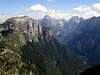
Getting There
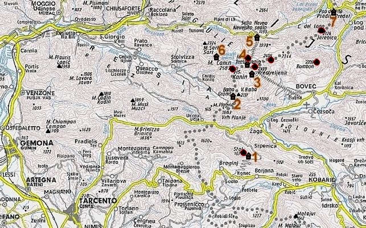
Numbers refer to Kanin group huts: (1) Koca na Stolu, (2) Bivouac C.A.I. Manzano, (3) Dom Petra Skalarja na Kaninu, (4) Rif. C. Gilberti, (5) Rif. Divisione Julia-Nevea, (6) Bivouac Marussich, (7) Dom na Predelu.
By car/bus Soca valley and Bovec can be reached over Vrsic pass (from Sava valley) or from south, from Gorica/Gorizia.
Valleys Rezija/Resia and Reklanica/Raccolana can be reached from Val Canale (Tagliamento river) by deterring from the highway Udine-Tarvisio. Nevejski preval/Sella Nevea (Pass) can also be reached from NE, from Trbiz/Tarvisio.
For more information about coming on starting points you can read on the main pages of the mountains and on the nice overview page of Julian Alps.
Maps: Tabacco: Alpi Giulie Occidentali Tarvisiano. No: 019, 1:25000 (very good!). Julijske Alpe - Zahodnii del (Western part). Planinska zveza Slovenije. 1:50000. Turisticna karta – Bovec z okolico, 1:25000.
Triglav National Parc
By Velebit
TNP is Slovenian largest national park, which is covering almost entire Julian Alps that belong to Slovenia. First ideas to protect this beautiful area came from Dr. Belar. He proposed, in 1908, 7 Triglav Lakes Valley to be protected. Because of land ownership problems it could not be realized. Finally, in 1924, on the area of 14 hectares, Alpine Nature Park was established in the valley, with time limit of 20 years. After WW 2 came the idea of true National Park. 7 Triglav Lakes Valley, together with Triglav, were declared Triglav National Park in 1961, on the area of 20 square km. But the true objectives of NP could not be obtained so finally in 1981, after years of preparation, true TNP was established. It was significantly enlarged to 838 square km with inner (542km square) and outer circle of protection. Park was named after Triglav, nation’s highest peak and symbol, which is almost in the middle of the park. As Julian Alps are mostly made of limestone, park area is exceptionally rich in various karst phenomena, including a special type of the mountain karst. It includes numerous valleys and peaks. All of Slovenian glacial lakes, except Bled Lake, are inside the park. Park is very rich with flora, which is mostly alpine but due to vicinity of Mediterranean climate there are some endemic species. Lowest point of the Park is only 180m.
Nice climbing routes
Jerebica
- Sivi ideal (Grey Ideal). UIAA V+, A1. 500m.
- Alijeva smer (Ali's route). UIAA VI+/VI-. 400m,.
- Tumova smer (Tumova route) UIAA IV-V/III.
- Huljeva smer (Hulj's route). VI/V. 400m.
For more climbing routes check the main pages of the mountains.
Mountain huts and bivouacs
Mountain huts and bivouacs:
(1) Koca na Stolu, 1668m,
(2) Bivouac C.A.I. Manzano,
(3) Dom Petra Skalarja na Kaninu, 2260m,
(4) Rif. C. Gilberti, 1850m,
(5) Rif. Divisione Julia - Nevea, 1142m,
(6) Bivouac Marussich, 2050m,
(7) Dom na Predelu, 1154m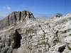
Camping
Camping inside the Triglav National Park is forbidden. Beside the mountain huts there are plenty of hotels and private apartments in the towns and villages, which surround the area. Here are few links where you can find info on accommodations closer and further away:
Bovec
Kranjska Gora
Bled
Existing SummitPost Pages
Visoki Kanin, Prestreljnik, Lopa, Jerebica, Bela pec, Zrd,
Mountain and Weather Conditions
Mountain conditions in Julian Alps are well known, thanks to Kredarica (2515m) hut and meteo station, which is bellow the Triglav.
You can observe current conditions and forecast for Kredarica on the Wunderground meteo site. Here is direct link to Wunderground - Kredarica page.
Some weather informatin can also be found here.