This LA neighborhood is choked by smog. The solution: a network of sensors on offices, homes and bags (original) (raw)
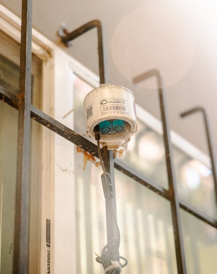
Jose Luis Salas looks up at the ladder. “Are you ready?” he asks Shance Taylor, an environmental project manager who’s holding a white container, about the size of a shoebox, covered with wires and numbers.
Taylor nods and climbs up to reach the side of Salas’s tidy house in Pacoima, a neighborhood in Los Angeles’s north-east San Fernando valley. The curious box in their hands is known as Aeroqual sensor – part of a community air-quality monitoring program run by Pacoima Beautiful, a local environmental group.
Taylor, wearing a green Pacoima Beautiful shirt, turns on the sensors and ensures they’re connecting to Salas’s wireless internet. Then they zip tie the box to the white siding of the house, their hands deftly weaving through the metal grating.
The box is one of six stashed around the city – on business rooftops, playgrounds and around houses like Salas’s – quietly sucking up the air and making precise measurements of pollutants such as PM2.5 and ozone. It’s all part of a community-driven effort to understand the effect of pollution in real time, in one of Los Angeles’ most environmentally challenged neighborhoods.
Pacoima is one of the most densely populated communities in Los Angeles county, made up of a multicultural, working-class community. Photograph: Thalia Juarez/The Guardian
Los Angeles is rated one of the country’s worst cities for air pollution, but even here, Pacoima stands out.
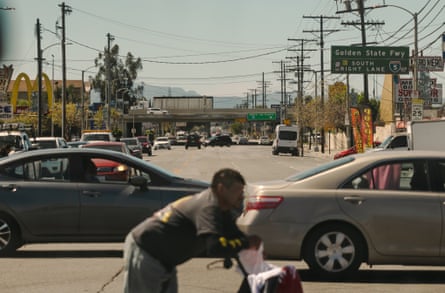
With a multicultural, working-class community of more than 81,000 people squeezed into seven sq miles, it’s one of the most densely populated areas in Los Angeles county. The neighborhood is a peninsula of highways – hemmed in by Interstate 5, Highway 118 and Interstate 210. It’s also home to a small regional airport, heavy industry such as auto-dismantlers, landfills and factories, and has a rail line that cuts through the middle.
Salas has lived in this area for 26 years, and has felt the air turn stale. “There are certain days when there is no fog and no breeze, yet you can see smoke in the streets,” he said. Sometimes when he exercises outdoors, he struggles to breathe.
According to the California Environmental Protection Agency, Pacoima is one of California’s most environmentally burdened communities because of its proximity to freeways and heavy industry that pump out pollution. The air in Pacoima can often be much worse than in neighborhoods just miles away. Nearly 9% of residents have asthma.
“They are impacted by every possible thing in Los Angeles,” said Paloma Giottonini, an urban planning professor at California State University, Northridge, who brings students to study and work with Pacoima Beautiful. “They’re surrounded by freeways. They’re surrounded by factories, landfills, power generation, so all the pollution is there.”
Through air sensors, Pacoima residents are able to track the air quality in their neighborhood through a project with Pacoima Beautiful. Photograph: Thalia Juarez/The Guardian
That’s why sensors such as the one that hangs at Salas’s house are so critical.
Environmentally burdened communities typically lack information about what they’re breathing, but Pacoima is bucking the trend with hyperlocal monitoring. Gathering data on their own air and disseminating that information is part of a larger project the citizens of Pacoima hope will secure a better climate future. Through air sensors, cool pavement and other climate-forward projects, they are pushing back against a hotter and more smoggy city.
Having this hyperlocaldata is critical because the closest monitor used for regulatory purposes is miles away – and doesn’t reflect conditions on the ground. The hope, said Giottonini, is to use data to guide better management in the future. Pacoima Beautiful is advocating for more Air Quality Index (AQI) sensors for the entire north-east San Fernando valley, since the closest official regulatory sensor is miles away.
“They can come to the city saying: ‘Look at our levels. Our levels are much higher than everywhere else. Do something about it.’” explained Giottonini. “Data in the hands of the community is really powerful.”
Sucking up the data
On an unseasonably hot March day, sweat trickled down my back as Taylor drove Pacoima Beautiful’s white truck around the city, showing me the organization’s climate projects. As we drove streets lined with neat houses, I could see what Salas was talking about: dozens of cargo trucks rolled through the narrow lanes, belching out dark clouds of smoke on their way to distribution centers and construction sites.

Pacoima is bordered by three highways and is home to a small regional airport.
When Giottonini’s students studied the trucks in 2023, they tallied more than 200 trucks in the first two and a half hours of the day. Over the course of a day, Pacoima sees more than 500 trucks, with more than 100,000 cars passing on each freeway. That brings a myriad of health impact implications, Taylor said. “They increase the risk of asthma, respiratory disease and heart issues. Our residents tend to be older, or young people – the most vulnerable.”
Pacoima Beautiful has its roots in trying to improve the environment. The organization was founded in 1996 by five mothers who were concerned about the trash and toxic smells from industrial factories their children faced while walking to school. They knew that collective action was the only way to fight back. Now, it has expanded past trash to address a swathe of environmental problems – including the climate crisis.
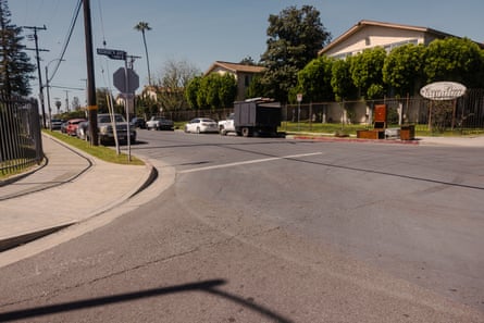
We drove to an area of asphalt that looks different, more blue than black. Taylor explained that the city had covered more than 700,000 sq ft of roads, school playgrounds and parking lots with reflective, light-colored, and often blueish epoxy coating. It aims to lower the temperatures on the streets. A 2020 study published in the journal Environmental Research Letters found that the use of such coatings in two Los Angeles neighborhoods decreased pavement temperatures up to 10F. We also stopped by a sidewalk garden where residents have planted free edible fruits and vegetables on a site once plagued by illegal dumping.
The difference in color between cool asphalt and typical asphalt is seen in Pacoima, California. Photograph: Thalia Juarez/The Guardian
One of the group’s biggest projects right now is air quality monitoring – an effort that began in 2019, and includes several types of sensors that attack the problem in different ways. There’s the ones at Salas’s house – the Aeroqual – there’s also commercially available PurpleAir monitors and small Airbeam monitors that can be clipped on to a backpack or waistband to get mobile results.
In 2025, Pacoima Beautiful received six Aeroqual stations, from the state agency South Coast Air Quality Management District (AQMD), which measured a handful of pollutants – PM2.5, PM10, ozone and nitrogen dioxide – as well as temperature and humidity. They carefully studied where to install them, and put them up. The results are sent to a dashboard where they can be monitored. The results show that the air quality in Pacoima is routinely worse than in other nearby neighborhoods.
Chart of the difference in AQI between a Pacoima and Reseda air monitor
The new sensors build on earlier efforts: in 2019 the group installed PurpleAir monitors on community buildings and on residents’ houses. And from 2020 to 2025,Pacoima Beautiful ran a six-week program every summer called Air Ambassadors, where citizens clipped on palm-sized white AirBeam monitors and walked around, sucking up air and mapping their personal air pollution levels in real-time. The devices take a snapshot of air quality every few minutes and log it with the location.
Amanda Ortega, a Los Angeles USD teacher, participated in the program in summer 2025 and noticed the differences in the neighborhoods she walked through – and it made her worry for her students’ health.
“I would walk paths where my students would walk, just to see where there was the worst air quality,” she said. The highest levels of pollution, she found, were in lower-income neighborhoods. Many of her students have asthma, and she thought of the ways their environment affected their lungs. There was one spot in particular – off San Fernando Road near the freeway – where the readings stopped her in her tracks. “I thought: Whoa. This is bad.’”
The future of air quality sensors
Low-cost sensors are already changing the way people manage their own health risks – especially in the face of climate crisis-linked disasters such as wildfires and heatwaves. Hyperlocal monitoring is reshaping who can access data, who can act and when.
When wildfires swept across Sonoma county in 2020, researchers wanted to know the risks to farmworkers, who faced huge pressures to keep picking grapes despite the smoke. They looked at air quality data from a single AirNow monitor – US Environmental Protection Agency’s official air quality reporting system – and 359 monitors from PurpleAir to see what the air quality was like at different times of the day and over the course of the fires.
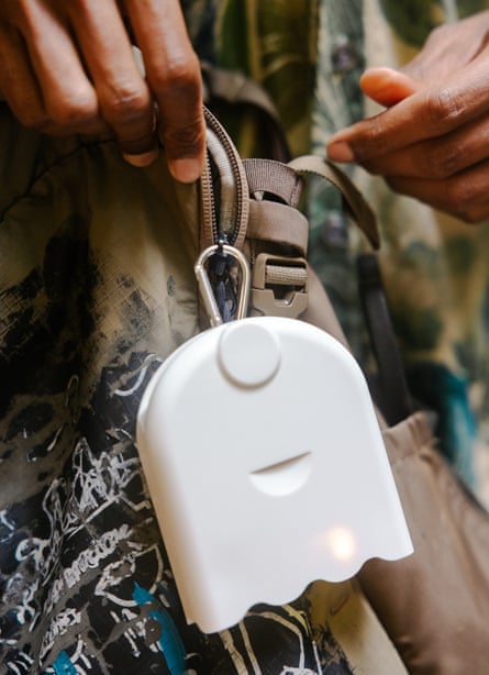
Shance Taylor demonstrating how AirBeam monitors work in Pacoima, California. Photograph: Thalia Juarez/The Guardian
Michael Mendez, a University of California, Irvine professor who led the research, said there was misinformation at the time that it was safer to work in the fields at night – but the PurpleAir showed that night-time air quality was sometimes worse than daytime. The sensors allowed both farmworkers and residents to make educated decisions, he said. Two large wineries, E&J Gallo Winery and Eco Terrano Vineyards, have since guaranteed their employees and contractors hazard pay whenever air quality from wildfire smoke is deemed unhealthy for the general population.
Mendez grew up in Pacoima and saw the injustices in the natural environment as well as the poor air quality in that part of the valley. “I had a lot of friends and relatives that had respiratory diseases and asthma,” he said. “The town is a bowl that traps in hazardous pollutants.”
His research also opened his eyes to the challenges of air monitoring on a larger level. “Even the state of California, which is often seen as an air quality leader, has an antiquated AirNow system,” he said. “The AirNow sensors we have are only focused on the precursors of smog and, most importantly, PM2.5 – but they don’t look at heavy metals or volatile organic compounds”, pollutants that become common after fires.
In Washington state’s Methow valley, monitoring the air can be critical – the valley’s steep geography traps pollution near the bottom, and it suffers from nearby seasonal wildfires. Like the residents in Pacoima, Liz Walker sees the utility of air quality sensors in the community. Walker, who runs a consulting business on air quality and is also a professor at the University of Washington, helped her region create a PurpleAir sensor network. It became one of the largest rural PurpleAir sensor networks in the country, with 35 sensors across the Methow and Okanogan valleys, spanning approximately 180 miles.
In her community, people check the air quality like the weather – a constant reminder that the skies could turn hazardous at any point. “Sensors are incredible for making previously invisible places visible,” she said. “You have an actual record of the air quality numbers that matches up with a health standard established by a federal agency.”
In a climate-changing world, air pollution will get worse. The Los Angeles basin made huge strides in improving its air, but as temperatures creep up, the heat can trap polluted air in place. Los Angeles is predicted to experience an average of 22 extreme heat days annually by 2050, up from six extreme heat days each year between 1980 and 2000.
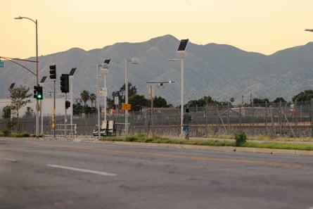
A small aircraft lands at Whiteman airport, home to over 600 aircraft, in the nearby residential neighborhood on 20 March 2026. Photograph: Thalia Juarez/The Guardian
For Salas, the data his sensor puts out is part of understanding where he lives. He volunteered to take part in the air monitoring after a university study found his house lies in one of Pacoima’s most affected areas – just half a mile from Whiteman airport, home to over 600 aircraft which spew out jet fuel exhaust on residents. But when he looks at the numbers coming from the sensors, he’s even more concerned about the freeways. “The data I’ve seen from these monitors shows there is more pollution near the freeway areas because of the heavy trucks that transport heavy materials and use diesel,” he said. “Those freeways are right inside the city of Pacoima.”
As Taylor finished attaching the white sensor box to Salas’s house, Salas grinned. “There,” he said. “It’s good. It’s done.” A week after the box was installed, the numbers showed the air quality was moderate. The amount of microscopic airborne particles – known as PM2.5 – was higher at his house than at the reference stations in nearby Reseda or North Hollywood.
“My hopes are to leave a better world for the people who come after us,” Salas said. “I’m not just talking about our children, but our grandchildren. I hope they are left with a better world, with a better natural environment and a cleaner environment.”
- This article was produced as a project for USC Annenberg’s Center for Health Journalism and Center for Climate Journalism and Communication 2025 Health and Climate Change Reporting Fellowship.
- The Guardian receives support for visual climate coverage from the Outrider Foundation. The Guardian’s coverage is editorially independent.