Nernier (original) (raw)
commune in Haute-Savoie, France
| Language | Label | Description | Also known as |
|---|---|---|---|
| English | Nernier | commune in Haute-Savoie, France |
Statements
0 references
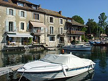
Maisons du port nernier.jpg
600 × 450; 350 KB
0 references
Nernier (French)
1 reference
https://www.insee.fr/fr/information/3363419
6 January 2019
1 reference
imported from Wikimedia project
located in the administrative territorial entity
1 reference
imported from Wikimedia project
0 references
arrondissement of Thonon-les-Bains
0 references
2 references
imported from Wikimedia project
imported from Wikimedia project
0 references
located in statistical territorial entity
0 references
22 March 2015
1 reference
22 September 2017
https://www.insee.fr/fr/information/2560698
46°21'56"N, 6°18'13"E
1 reference
répertoire géographique des communes
26 October 2015
office held by head of government
0 references
476
2013
1 reference
imported from Wikimedia project
409
2015
1 reference
The National Institute of Statistics and Economic Studies
Recensement de la population 2015 (French)
27 December 2017
389
1 January 2016
1 reference
380
1 January 2017
determination method or standard
1 reference
376
1 January 2018
determination method or standard
1 reference
378
1 January 2019
determination method or standard
1 reference
398
1 January 2020
determination method or standard
1 reference
411
1 January 2021
determination method or standard
1 reference
177
2017
determination method or standard
1 reference
The National Institute of Statistics and Economic Studies
203
2017
determination method or standard
1 reference
The National Institute of Statistics and Economic Studies
372 metre
1 reference
répertoire géographique des communes
2015
RGC_2015.txt
425 metre
1 reference
répertoire géographique des communes
2015
RGC_2015.txt
0 references
0 references
1.82 square kilometre
1 reference
répertoire géographique des communes
26 October 2015
74140
1 reference
dataset of postal codes in France
1 October 2018
+33-4-50-72-82-26
1 reference
24 September 2023
1 reference
24 September 2023
1 reference
24 September 2023
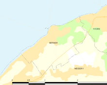
Map commune FR insee code 74199.png
756 × 605; 19 KB
0 references
Blason ville fr Nernier.svg
600 × 660; 16 KB
1 reference
imported from Wikimedia project
Nernier
0 references
0 references
category for the view of the item
0 references
0 references
Identifiers
Bibliothèque nationale de France ID
1 reference
26 August 2015
0 references
0 references
1 reference
28 October 2013
French public service directory ID
auvergne-rhone-alpes/haute-savoie/mairie-74199-01
0 references
1 reference
1 reference
imported from Wikimedia project
0 references
0 references
Sitelinks
Wikipedia(32 entries)
- astwiki Nernier
- cawiki Nernier
- cebwiki Nernier
- cewiki НегӀнье
- dewiki Nernier
- diqwiki Nernier
- elwiki Νερνιέ
- enwiki Nernier
- eowiki Nernier
- eswiki Nernier
- euwiki Nernier
- frpwiki Nèrniér
- frwiki Nernier
- huwiki Nernier
- itwiki Nernier
- lawiki Nernia
- lmowiki Nernier
- mswiki Nernier
- nlwiki Nernier
- ocwiki Nernier
- plwiki Nernier
- ptwiki Nernier
- rowiki Nernier
- skwiki Nernier
- svwiki Nernier
- ukwiki Нерньє
- uzwiki Nernier
- vecwiki Nernier
- viwiki Nernier
- warwiki Nernier
- zh_min_nanwiki Nernier
- zhwiki 内尔涅


