Barbados Maps & Facts (original) (raw)
Barbados, the easternmost island in the Caribbean Sea, is relatively flat and less mountainous, in comparison to its more-mountainous island neighbours to the west. It has an area of 439 sq. km (169 sq mi).
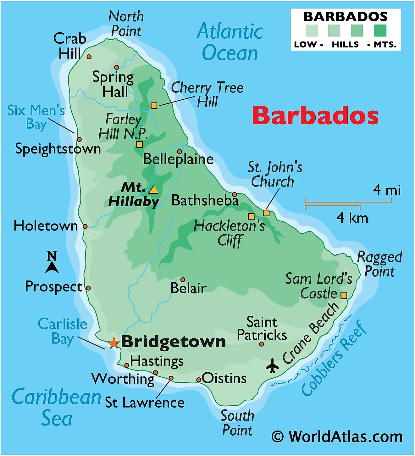
As observed on the physical map of Barbados above, the island is roughly triangular in shape. In the western half, the land rises gently from coastal lowlands into the rolling hills.
Beyond those hills in the central highland region stands the island’s highest point – Mount Hillaby, at an elevation on 1,120ft (340m) above sea level (as marked on the map by a yellow upright triangle).
In the eastern third of Barbados, the landscape rises sharply into low hills that shadow the coastline. In the southern part of the island, the highlands decline steeply to the St. George’s Valley, where the land rises to form Christ Church Ridge between the sea and the valley. Barbados is drained by a few small rivers and all rise in the hilly areas of the central and north. Rainfall also irrigates Barbados through a series of small streams. Offshore, much of the country is circled by coral reefs.
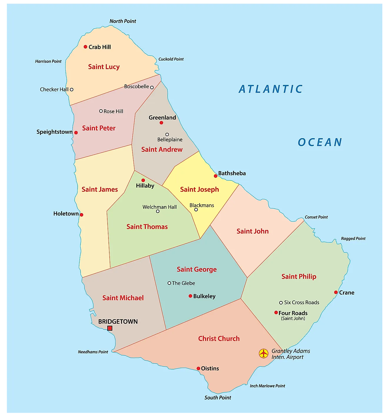
Parishes of Barbados Map
Barbados is divided into 11 parishes and 1 city. In alphabetical order, the parishes are: Christ Church, Saint Andrew, Saint George, Saint James, Saint John, Saint Joseph, Saint Lucy, Saint Michael, Saint Peter, Saint Philip, and Saint Thomas. Bridgetown is a city in Barbados.
Located in the south western part of the island country, along the Carlisle Bay is, Bridgetown - the capital and the largest city of Barbados. It is the chief administrative and financial center of the country. Bridgetown is an important sea port in the Caribbean region.
Where is Barbados?
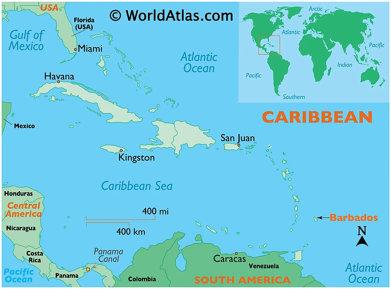
Barbados is an island country located in the south eastern Caribbean region of North America. It is positioned both in the Northern and western hemispheres of the Earth. Barbados lies to the east of St. Lucia, St. Vincent and the Grenadines; to the southeast of Martinique; to the northeast of Trinidad and Tobago. Barbados is surrounded by the Atlantic Ocean.
Regional Maps: Map of North America
Outline Map of Barbados
Key Facts
| Legal Name | Barbados |
|---|---|
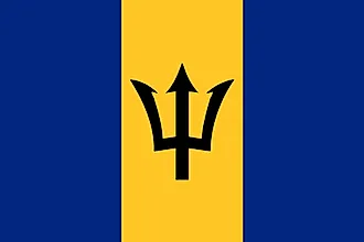
| Flag |  |
| Capital City | Bridgetown |
| 13 06 N, 59 37 W | |
| Total Area | 430.00 km2 |
| Land Area | 430.00 km2 |
| Water Area | N/A |
| Population | 287,025 |
| Currency | Barbadian dollars (BBD) |
| GDP | $5.21 Billion |
| GDP Per Capita | $18,148.24 |
This page was last updated on February 25, 2021


