Colombia Maps & Facts (original) (raw)
Covering a respectable area of 1,141,748 sq. km, Colombia is located in the northwestern part of South America with a coastline along both the Pacific Ocean and the Caribbean Sea. Colombia shares five separate land borders with the nations Brazil, Ecuador, Peru, Venezuela, and Panama. Colombia's most densely populated areas can be found along the northern coast as well as in the mountain ranges in the center of the county. Eastern Columbia is mostly made up of thick rainforests and tropical plains.
The Colombian Andes dominate the landscape in the western part of the country. The Colombian Andes is further divided into three branches: The Cordillera Central (Central Range), Cordillera Oriental (Eastern Range), and Cordillera Occidental (Western Range). Located in the Sierra Nevada de Santa Marta mountain range in the extreme northern part of the country is, the Pico Cristobal Colon - the highest peak in Colombia, which rises to an elevation of 18,950ft. It is closely followed by the Pico Simon Bolivar, at an elevation of 18,497ft.
The savannas lie to the east of the Andes mountain ranges. Although this region is sparsely populated, this part of Colombia is home to vast agricultural estates and plantations that are responsible for growing and harvesting much of the nation's food. Other natural resources can be found here too such as oil and natural gas.
The Amazon rainforest is situated in the far south-eastern part of the country. As one would imagine, this part of Colombia is not often visited and does not have much in the way of permanent settlements aside from a few small and isolated villages. The weather here is incredibly hot and humid and suffers from a lack of infrastructure. Its remoteness does have its benefits of course. This region has largely been untouched by man and is home to some of the most amazing wildlife anywhere in the world.
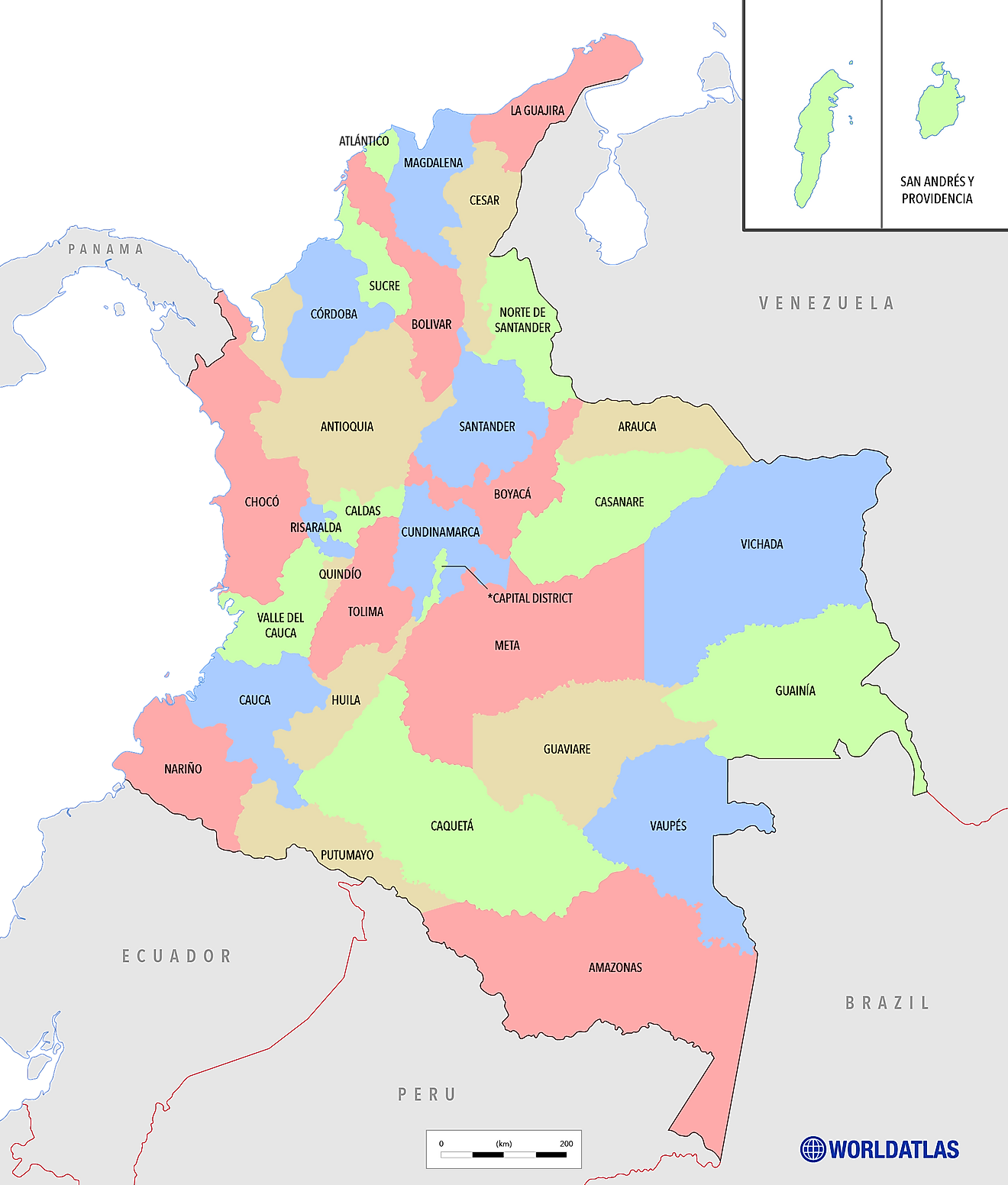
Administrative Map of Colombia
Colombia (officially, Republic of Colombia) is divided into 32 departments (departamentos, singular - departamento) and 1 capital district (distrito capital). In alphabetical order, these departments are: Amazonas, Antioquia, Arauca, Atlantico, Bolivar, Boyaca, Caldas, Caqueta, Casanare, Cauca, Cesar, Choco, Cordoba, Cundinamarca, Guainia, Guaviare, Huila, La Guajira, Magdalena, Meta, Narino, Norte de Santander, Putumayo, Quindio, Risaralda, Archipielago de San Andres, Providencia y Santa Catalina (colloquially San Andres y Providencia), Santander, Sucre, Tolima, Valle del Cauca, Vaupes, and Vichada. Bogota is the capital district.
These departments are subdivided into a total of 1,122 municipalities. The municipalities are further subdivided into comunas in the urban area and into corregimientos in the rural areas.
Covering an area of 1,141,748 sq. km, Colombia is one of the world’s most linguistically and ethnically diverse countries. Situated in the central part of the country and placed on a high plateau in the northern Andes Mountains is Bogotá – the capital and the largest city of Colombia. It serves as the administrative, political, economic, and industrial center of Colombia. Located at 8,530ft (2,600m) above sea level, Bogotá is one of the highest capitals in the world.
Where is Colombia?
Colombia (officially, Republic of Colombia) is a country located in the northwestern part of South America. It is geographically positioned in the Northern and Western hemispheres of the Earth. The Equator passes through the southern edge of the country; therefore, Colombia also partially lies in the Southern hemisphere. Colombia is bordered by Panama to the northwest; by Ecuador and Peru to the south; by Venezuela to the east, and by Brazil to the southeast. It is also bounded by the Caribbean Sea in the north and by the Pacific Ocean in the west. Colombia shares its maritime borders with Costa Rica, Nicaragua, Honduras, Jamaica, Haiti, and the Dominican Republic.
Colombia Bordering Countries:Ecuador, Peru, Brazil, Panama, Venezuela.
Regional Maps: Map of South America
Outline Map of Colombia
Key Facts
| Legal Name | Republic of Colombia |
|---|---|
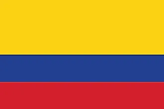
| Flag |  |
| Capital City | Bogota |
| 4 36 N, 74 05 W | |
| Total Area | 1,138,910.00 km2 |
| Land Area | 1,038,700.00 km2 |
| Water Area | 100,210.00 km2 |
| Population | 50,339,443 |
| Major Cities | Bogotá (11,507,960) Medellín (4,102,308) Cali (2,863,730) Barranquilla (2,349,400) Bucaramanga (1,381,498) Cartagena (1,087,599) Cúcuta (963,045) Ibagué (600,087) Pereira (583,602) Valledupar (572,619) |
| Currency | Colombian pesos (COP) |
| GDP | $323.80 Billion |
| GDP Per Capita | $6,432.39 |
This page was last updated on December 18, 2023


