El Salvador Maps & Facts (original) (raw)
El Salvador, the smallest and most densely populated country in Central America, shares its borders with Guatemala to the northwest, Honduras to the north and east, and the Pacific Ocean to the south. It encompasses a total area of approximately 21,041 square kilometers (8,124 square miles).
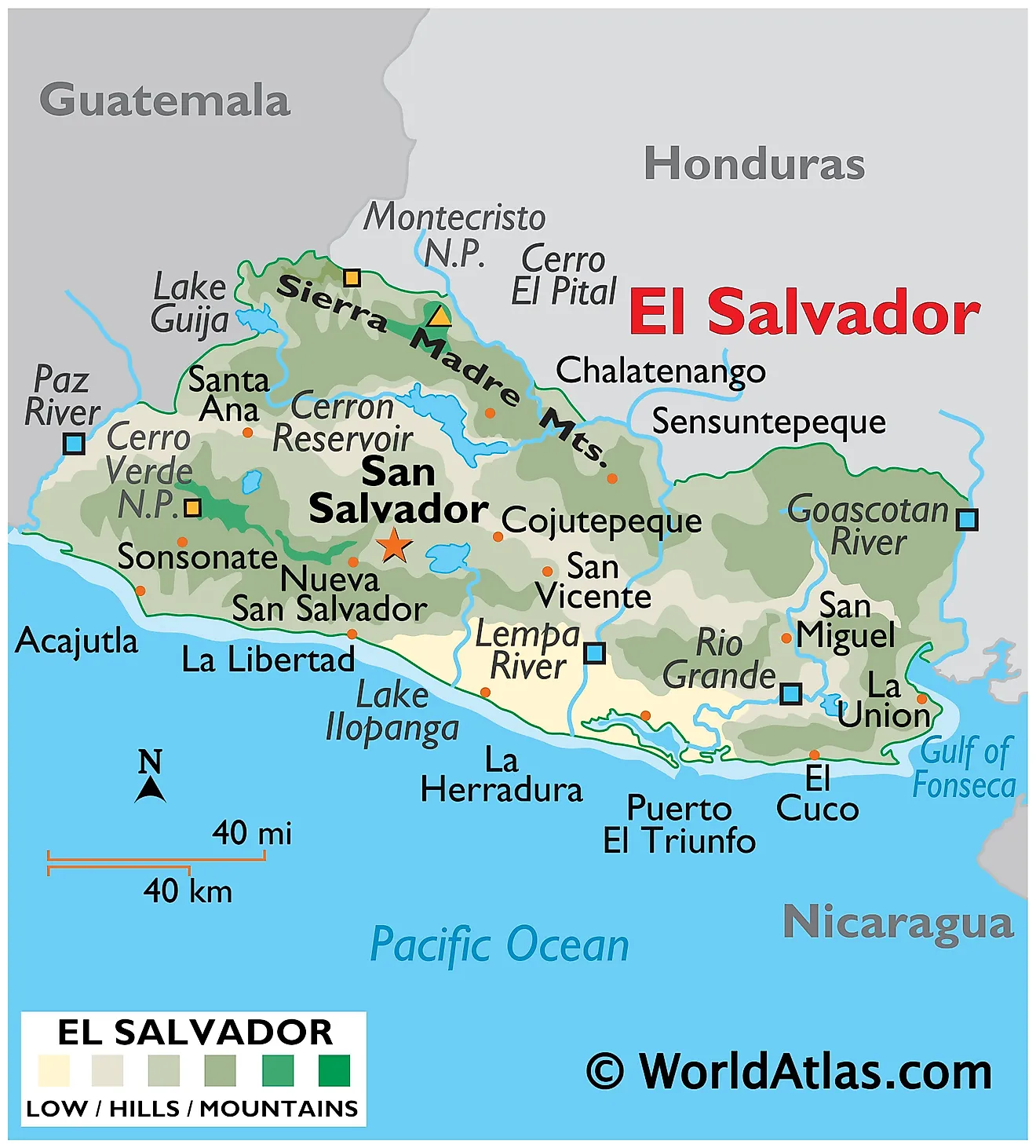
Central Region: The Central Region of El Salvador is characterized by a mix of mountains, valleys, and a volcanic plateau. This area includes the nation's capital, San Salvador, which lies within a valley near the San Salvador Volcano. The region is dominated by the volcanic chain, part of the larger Sierra Madre mountains, which includes several volcanoes such as San Salvador, Ilopango, and San Vicente. The highest point in the country, Cerro El Pital, stands at 2,730 meters (8,957 feet) and is located on the border with Honduras in the northern part of this region.
Eastern Region: The Eastern Region is marked by the Lempa River, which is the longest in El Salvador and a key geographic feature. Originating in Guatemala, the river traverses the country from north to south, eventually emptying into the Pacific Ocean. This region is less mountainous compared to the central area but features several volcanic peaks, such as Conchagua near the Gulf of Fonseca. The landscape here is characterized by wide plains and rolling hills, with the coastal plains being wider compared to the central and western parts of the country.
Western Region: In contrast, the Western Region of El Salvador is predominantly mountainous, forming part of the Sierra Madre range. This area is noted for its high volcanic activity, with prominent volcanoes like Santa Ana, which is the highest volcano in the country at 2,381 meters (7,812 feet), and Izalco, known as the "Lighthouse of the Pacific" for its frequent eruptions in the past. The region is also home to the Coatepeque Caldera, a large volcanic crater lake, which is one of the country's significant natural features.
Coastal Region: El Salvador's Coastal Region along the Pacific Ocean is characterized by sandy beaches and tidal wetlands. The coastline stretches over 307 kilometers (191 miles), featuring important estuaries and mangrove forests. This region is relatively flat compared to the mountainous interior, with occasional coastal cliffs. The Salvadoran coastline is crucial for the local fishing industry and is a popular destination for surfers due to its consistent waves.
Rivers: While El Salvador does not have a large number of major rivers, the Lempa River's role is significant in the geography of the country. It provides vital water resources for agriculture and hydroelectric power. The river's basin covers a substantial portion of the country and extends into Guatemala and Honduras.
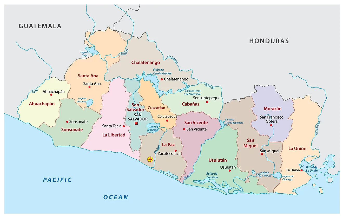
Political Map of El Salvador
El Salvador (officially, the Republic of El Salvador) is divided into 14 departments (departamentos, sing. departamento). In alphabetical order, the departments are: Ahuachapan, Cabanas, Chalatenango, Cuscatlan, La Libertad, La Paz, La Union, Morazan, San Miguel, San Salvador, San Vicente, Santa Ana, Sonsonate and Usulutan. These departments are further subdivided into 262 municipalities (municipios).
Covering a total area of 21,041 sq. km, El Salvador is the smallest country in Central America. It is also the most densely populated Central American nation. Located in the Valley of the Hammocks, on the Ace Chaute River is, San Salvador – the capital, the largest and the most populous city of El Salvador. It is also the administrative, cultural, educational, economic and financial hub of the country.
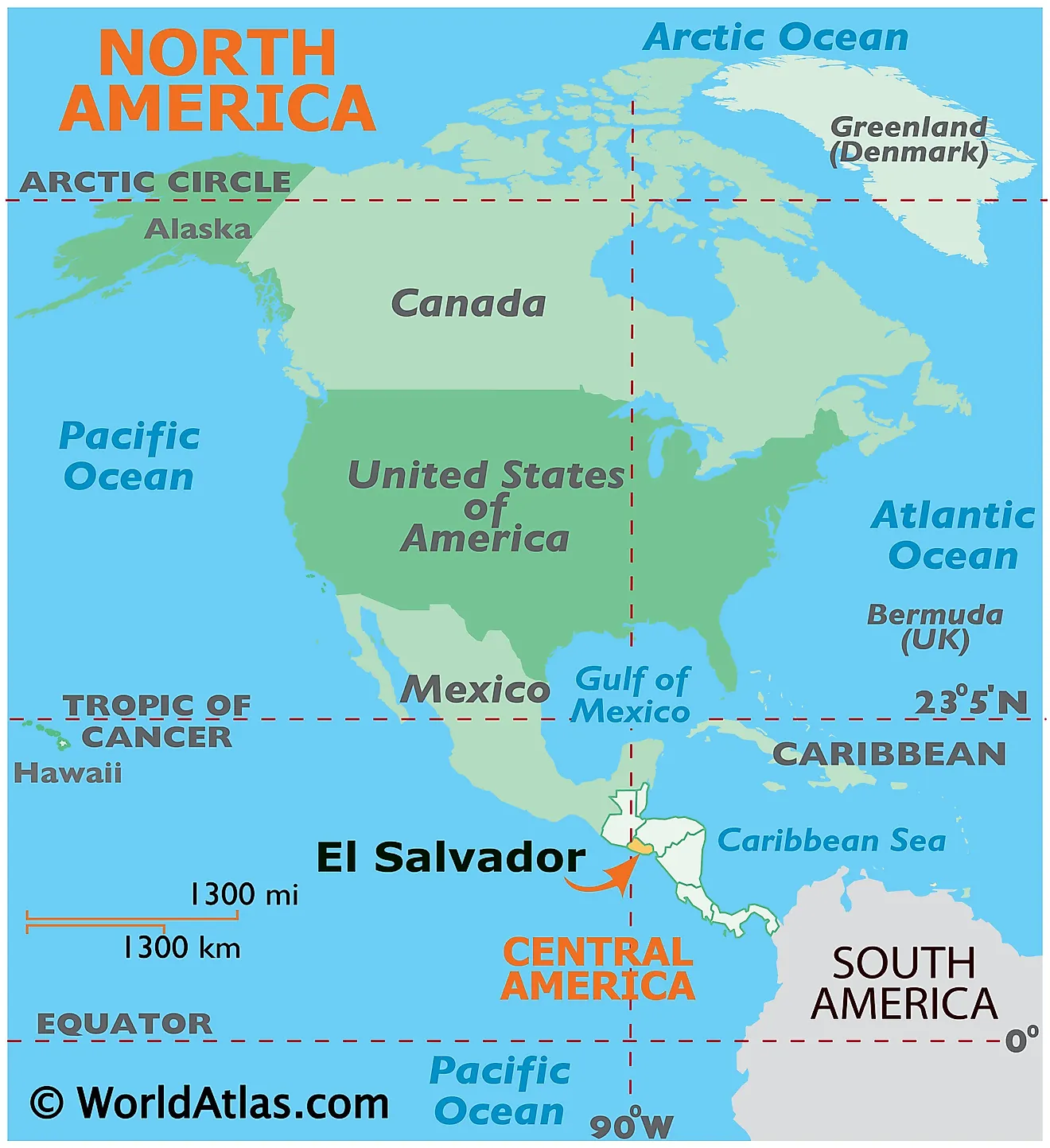
Where is El Salvador?
El Salvador is a small mountainous Central American nation. It is positioned in the Northern and Western hemispheres of the Earth. It is bordered by Honduras to the northeast; Guatemala to the northwest and by the Pacific Ocean to the south. Since El Salvador mostly occupies the western side of the isthmus; it is the only Central American nation without a coast on the Caribbean.
El Salvador Bordering Countries:Guatemala, Honduras.
Regional Maps: Map of North America
Outline Map of El Salvador
Key Facts
| Legal Name | Republic of El Salvador |
|---|---|
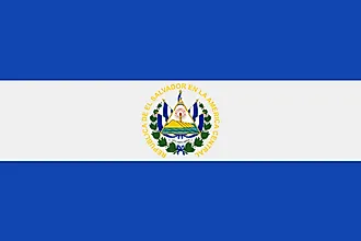
| Flag |  |
| Capital City | San Salvador |
| 13 42 N, 89 12 W | |
| Total Area | 21,041.00 km2 |
| Land Area | 20,721.00 km2 |
| Water Area | 320.00 km2 |
| Population | 6,453,553 |
| Largest City | San Salvador (1,116,052) |
| Currency | US Dollar (USD) |
| GDP | $27.02 Billion |
| GDP Per Capita | $4,187.25 |
This page was last updated on December 19, 2023


