Lesotho Maps & Facts (original) (raw)
Lesotho is an enclave as it is surrounded by South Africa in Southern Africa. The country has an area of 30,000 sq. km.
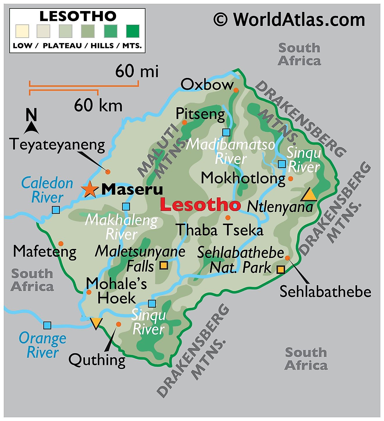
Lesotho is also unique in other ways. It is the only independent state in the world that lies entirely above 1,400 m in elevation. In fact, 80% of the country lies above 1,800 m. Its lowest point (marked on the map by an inverted yellow triangle) of 1,400 m is thus the highest (lowest point) in the world.
Thabana Ntlenyana is the highest point of Lesotho at 3,482 m (marked on the map by an upright yellow triangle)
As for geographic regions in Lesotho, the only real lowlands are in the southwest along the Caledon River. The balance of Lesotho is a series of foothills and plateaus fronting mountains, central, east and north.Significant rivers include the Calendon, Makhaleng, Malibamatso, Matsoku and Orange (or Senqu). The Orange River at about 2,100 km in length is one of the longest rivers in Africa. It rises in the Lesotho Highlands as the Sinqu River. In South Africa it flows west, passing the southern edge of the Kalahari Desert and winds through the Namib Desert before draining into the Atlantic Ocean.
Districts of Lesotho Map
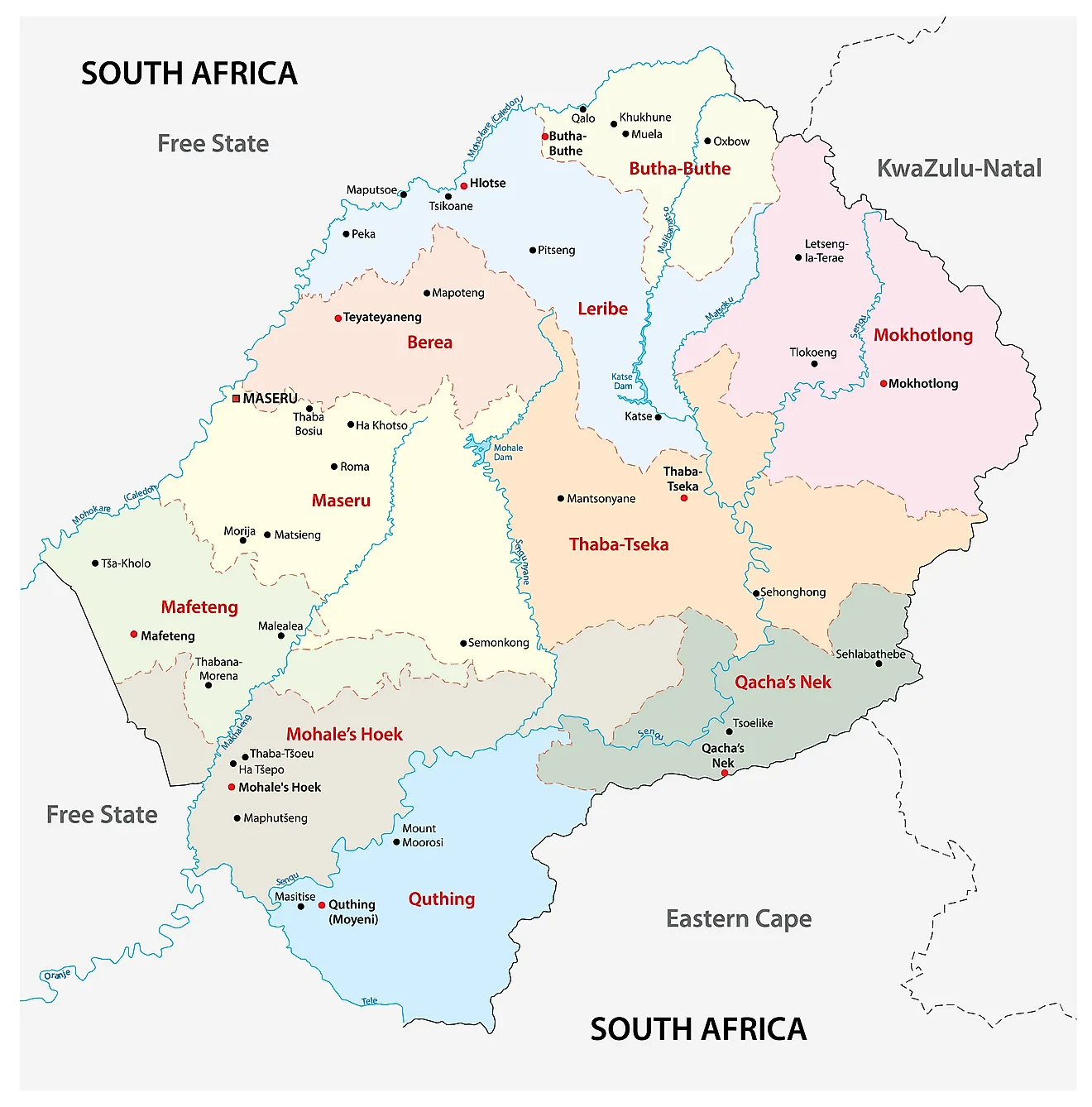
Lesotho has 10 districts, each with a capital called camptown. The districts are subdivided into 80 constituencies and 129 local community councils.
In alphabetical order, the districts are as follows: Berea, Butha-Buthe, Leribe, Mafeteng, Maseru, Mohale's Hoek, Mokhotlong, Qacha's Nek, Quthing, Thaba-Tseka
With an area of 4,279 sq. km, Maseru is the largest district and the most populous one as well. The capital of the district is also called Maseru and is the national capital as well.
Where is Lesotho?
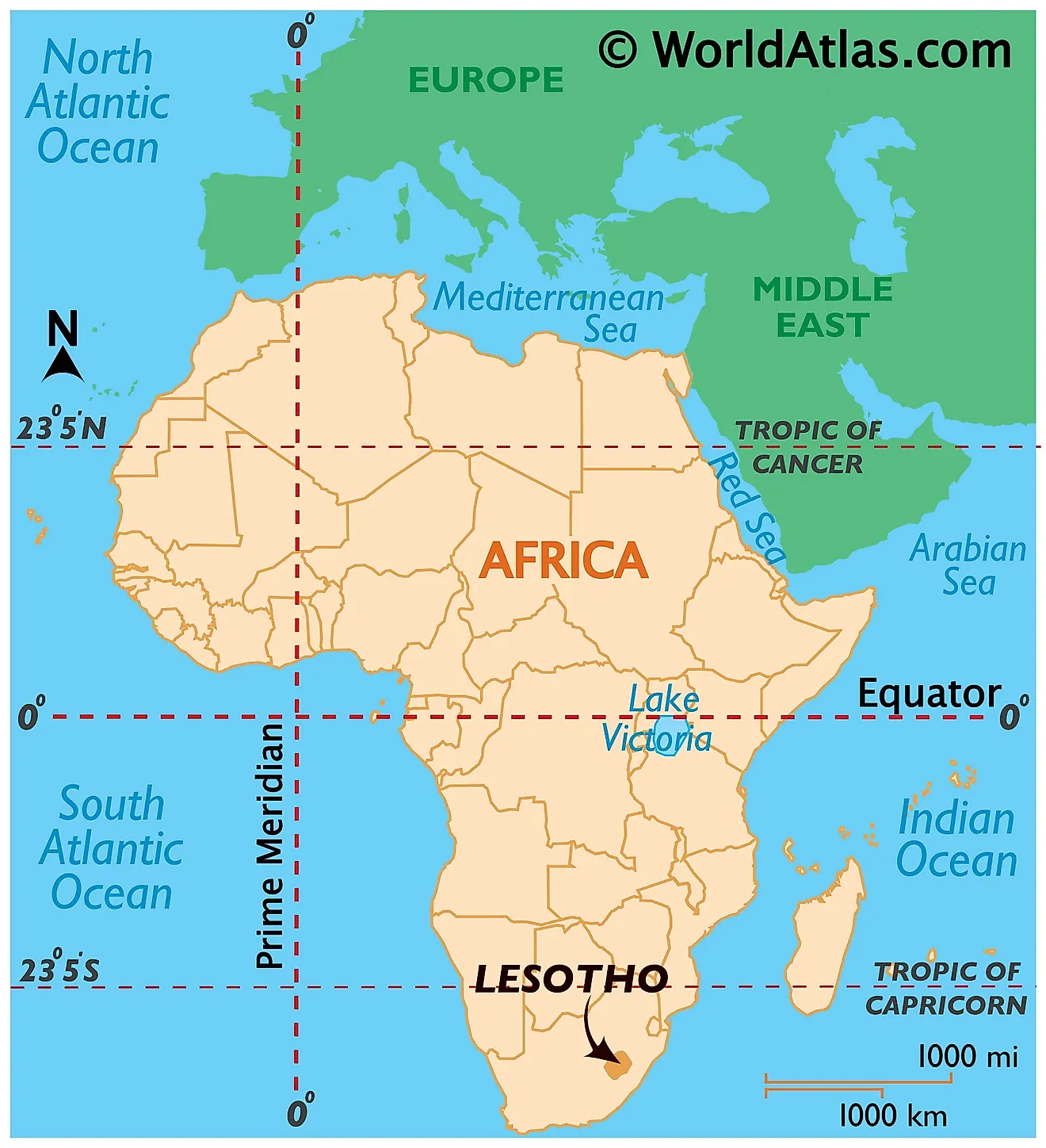
Lesotho or the Kingdom of Lesotho is a Southern African country. It is an enclaved nation that is located with the territory of South Africa. It is in the Southern and Eastern Hemispheres of the Earth.
Lesotho Bordering Countries:South Africa.
Regional Maps: Map of Africa
Outline Map of Lesotho
Key Facts
| Legal Name | Kingdom of Lesotho |
|---|---|
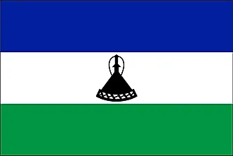
| Flag |  |
| Capital City | Maseru |
| 29 19 S, 27 29 E | |
| Total Area | 30,355.00 km2 |
| Land Area | 30,355.00 km2 |
| Water Area | N/A |
| Population | 2,125,268 |
| Currency | Maloti (LSL) |
| GDP | $2.46 Billion |
| GDP Per Capita | $1,157.54 |
This page was last updated on February 24, 2021


