Moldova Maps & Facts (original) (raw)
Moldova is a small Eastern European country with an area of 33,846 km2(13,068 sq mi) including the disputed territory of Transnistria. Excluding it, Moldova occupies an area of 29,683 km2(11,461 sq mi).
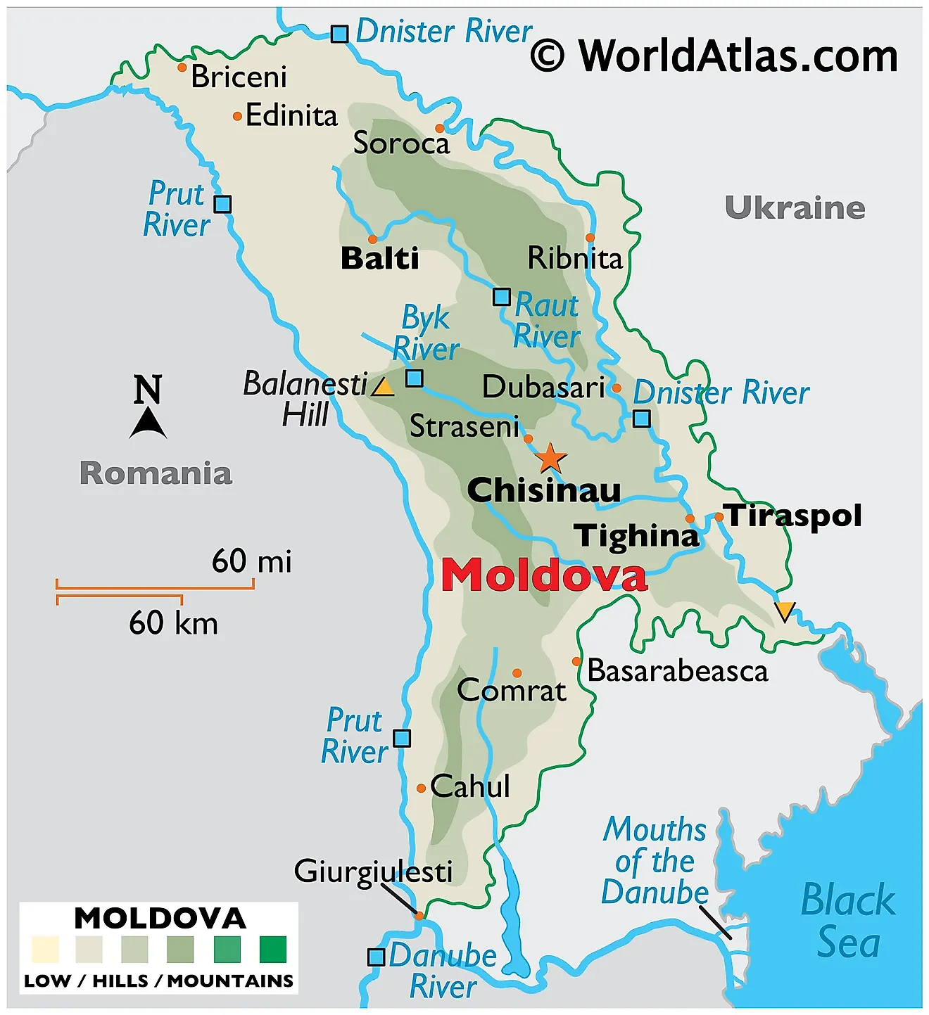
As observed on the physical map of Moldova, the country has a hilly terrain with a subtle slope south toward the Black Sea. Its topography is relatively rugged. However, elevations never reach beyond 430 m (1,411 ft) - which is the country's highest point, Balanesti Hill and marked on the map by a yellow upright triangle.
These hilly regions are part of the Moldavian Plateau, a part of the Carpathian Mountains. Accounting for much of the terrain along that plateau are steep forested slopes interlaced by valleys and ravines.
To the north, Moldova's terrain features the Bălți steppe region, a level plain with an average elevation of 500 to 650 ft (150 to 200 m). The region also has uplands.
As observed on the map above, Moldova has a well-developed network of streams and rivers draining the land to the Black Sea. While the Dniester river forms only a small part of Moldova's border with Ukraine. At 2 m, the Dniester River has the country's lowest point. The Prut completely makes up the entire western border with Romania.Other important rivers of note include the Nistru and Byk.
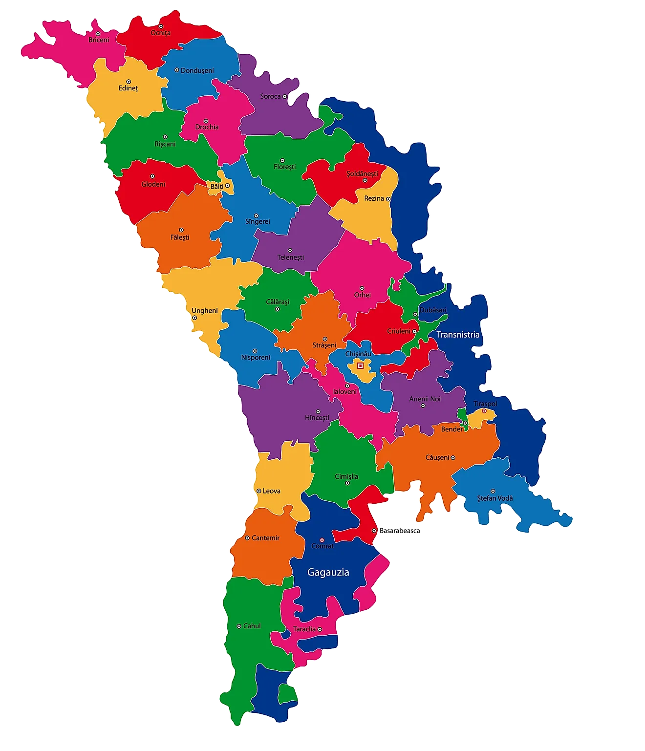
Raions or Districts of Moldova Map
Moldova (officially, the Republic of Moldova) is divided into 32 raions or districts (raioane, sing. raion), 3 municipalities (municipii, singular - municipiul), 1 autonomous territorial unit (unitatea teritoriala autonoma) and 1 territorial unit (unitatea teritoriala). In alphabetical order, the raions are: Anenii Noi, Basarabeasca, Briceni, Cahul, Cantemir, Calarasi, Causeni, Cimislia, Criuleni, Donduseni, Drochia, Dubasari, Edinet, Falesti, Floresti, Glodeni, Hincesti, Ialoveni, Leova, Nisporeni, Ocnita, Orhei, Rezina, Riscani, Singerei, Soldanesti, Soroca, Stefan Voda, Straseni, Taraclia, Telenesti, and Ungheni. The municipalities are: Balti, Bender, and Chisinau. Gagauzia is an autonomous territorial unit and Stinga Nistrului (Transnistria) is a territorial unit.
[The final status of Transnistria is disputed as the central government does not control that territory].
Located in the central part of the country, is Chisinau – the Capital and the largest city of Moldova. It is also the chief industrial and economic center of the country. Chisinau is the largest transportation hub and the most economically prosperous locality in Moldova.
Where is Moldova?
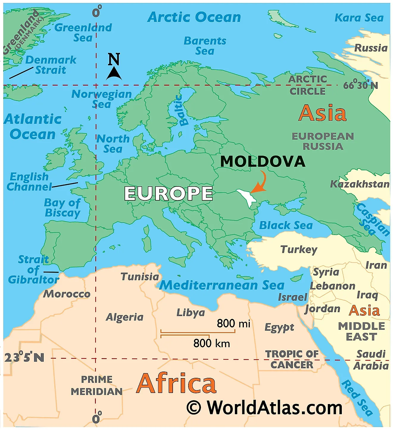
Moldova is a landlocked Eastern European country. It is positioned in the Northern and Eastern hemispheres of the Earth. Moldova is situated in the east of the Carpathian Mountains between the Prut and Dniester Rivers. Moldova is bordered by 2 nations: by Ukraine in the north, east and south and by Romania in the west.
Moldova Bordering Countries:Ukraine, Romania.
Regional Maps: Map of Europe
Outline Map of Moldova
Key Facts
| Legal Name | Republic of Moldova |
|---|---|
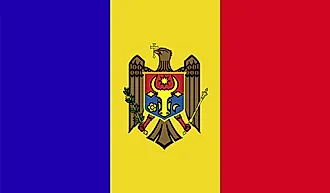
| Flag |  |
| Capital City | Chisinau in Romanian (Kishinev in Russian) |
| 47 00 N, 28 51 E | |
| Total Area | 33,851.00 km2 |
| Land Area | 32,891.00 km2 |
| Water Area | 960.00 km2 |
| Population | 2,657,637 |
| Largest City | ChiÅinÄu (487,707) |
| Currency | Moldovan lei (MDL) |
| GDP | $11.96 Billion |
| GDP Per Capita | $4,498.52 |
This page was last updated on February 24, 2021


