The United Arab Emirates Maps & Facts (original) (raw)
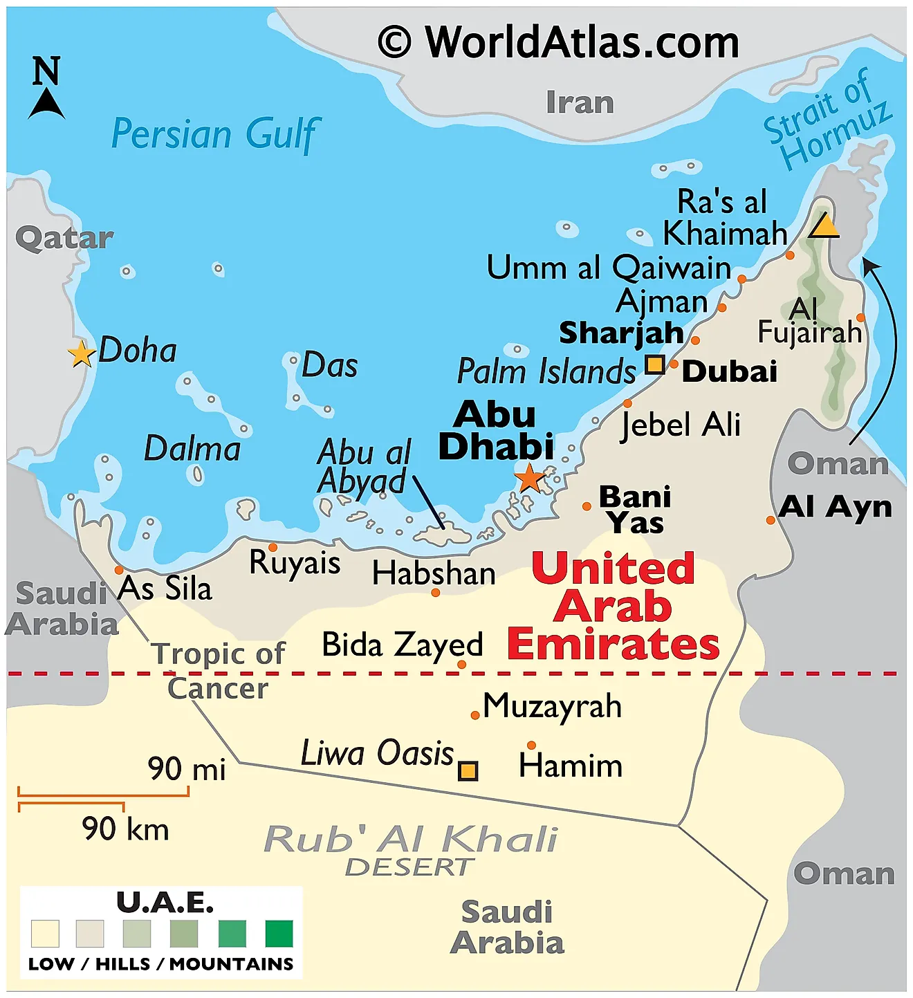
The United Arab Emirates (UAE) lies in the eastern part of the Arabian Peninsula, covering an area of about 83,600 km2 (approximately 32,300 mi2). It shares its borders with Saudi Arabia to the west and south, Oman to the east and southeast, and maritime boundaries with Iran across the Persian Gulf (also known as the Arabian Gulf) to the north.
Geographical Regions: The UAE is divided into two main regions of terrain, and politically, into seven emirates. The larger part consists of a desert hinterland that incorporates two main expanses of rolling sand dunes, the Rub' al Khali (The Empty Quarter) to the south, and an area of gravel plains and dunes to the north of the Hajar Mountains. These areas are largely uninhabited due to their arid and harsh environment, and reach as far as the barren coast.
The Hajar Mountains, stretching ultimately to Oman from the northern emirate of Ras Al Khaimah after reaching the easternmost point in Al Fujairah, provide the second main geographical feature. These mountains, which form the highest range in the eastern Arabian Peninsula, split the UAE into coastal and interior regions. The mountains host a variety of plant and animal life, supported by more abundant rainfall and cooler temperatures than the surrounding desert plains.
The Coast: The UAE possesses flat, barren, coastal plains. Along the western coast, it meets the Arabian Gulf, with an extensive coastline of more than 650 km, characterized by many inlets, or 'khors,' and islands. Abu Dhabi's coastal area is dominated by tidal channels or sabkhas and numerous islands such as Saadiyat Island, Yas Island, and Sir Bani Yas Island.The country has also created a considerable number of man-made islands, especially in the emirate of Dubai. The most renowned among these are the Palm Jumeirah, Palm Jebel Ali, and the World Islands, created for residential, leisure, and tourism purposes.
The eastern coastline, along the Gulf of Oman in the Fujairah emirate, is more rugged and mountainous, marked by a string of small bays and inlets. This coast has fewer islands, the most significant of which is Snoopy Island, a popular site for divers and snorkelers.
Contrary to the dry nature of its landscapes, the UAE has few permanent bodies of water. It hosts no notable rivers, and freshwater bodies are mainly limited to artificial reservoirs and a few oases, such as Al Ain Oasis, which is fed by underground wells.
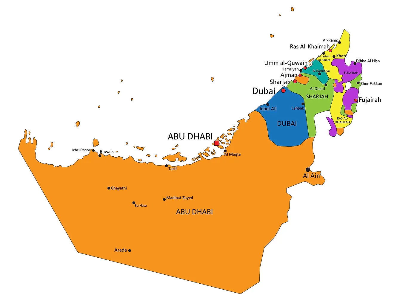
Emirates Map of The United Arab Emirates
The United Arab Emirates (UAE), a federation located in the eastern part of the Arabian Peninsula, comprises seven distinct emirates. Each emirate maintains considerable autonomy, while also participating in federal structures.
Abu Dhabi, the largest of the seven emirates, spans 67,340 km2 (26,000 mi2), accounting for about 87% of the total land area of the UAE. It houses the capital city of the same name, and it hosts the seat of the UAE's federal government.
Dubai, known as the economic hub of the UAE, follows Abu Dhabi in size. Located on the Arabian Gulf's southern shore, it also includes the famous city of Dubai, one of the world's most important financial and business centers.
Sharjah, adjacent to Dubai, possesses a significant coastline on both the Arabian Gulf and the Gulf of Oman. It also encompasses some important enclaves like Khor Fakkan, Kalba, and Dibba Al-Hisn.
Ajman, the smallest emirate, nestles in the center of the UAE's western coast. Despite its size, it operates a significant port and provides a free trade zone that attracts businesses from various sectors.
Umm Al Quwain, located just north of Ajman, constitutes one of the less populated emirates. It contains a significant natural reserve, Al Seneyah Island, along its coast.
Ras Al Khaimah, occupying the northernmost part of the UAE, borders Oman's exclave of Musandam. It includes an important seaport and some of the UAE's most fertile agricultural land.
Fujairah, uniquely situated on the UAE's eastern coast along the Gulf of Oman, possesses the UAE's only access to the Indian Ocean. It features a significant shipping port, the Port of Fujairah.
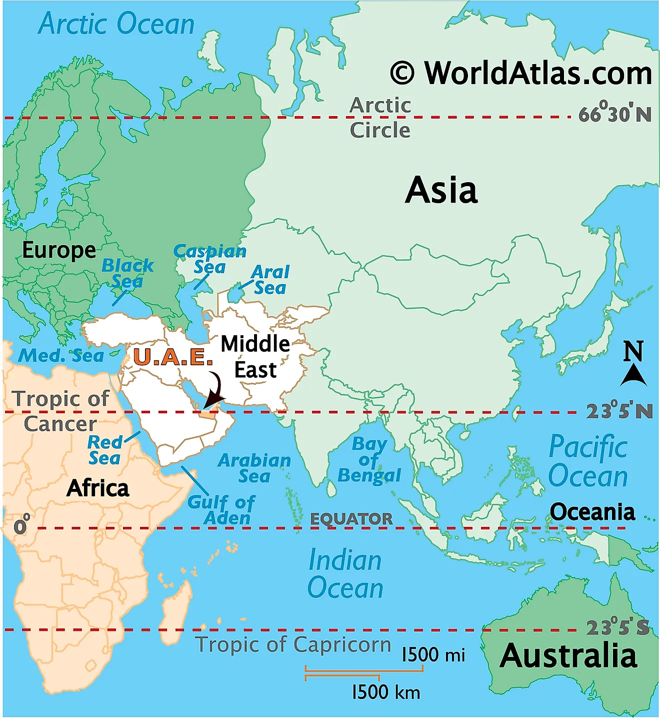
Where is The United Arab Emirates?
United Arab Emirates is a Middle East country that is located on the north east edge of the Arabian Peninsula, bordering the Gulf of Oman and the Persian Gulf. It is situated in the Northern and Eastern Hemispheres of the Earth. It is bordered by Saudi Arabia in the south and west; and by Oman in the east. The country also shares its maritime borders with Iran in the north and Qatar in the west.
United Arab Emirates Bordering Countries:Saudi Arabia, Oman.
Regional Maps: Map of Asia
Outline Map of The United Arab Emirates
Key Facts
| Legal Name | United Arab Emirates |
|---|---|
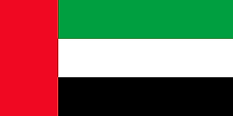
| Flag |  |
| Capital City | Abu Dhabi |
| 24 28 N, 54 22 E | |
| Total Area | 83,600.00 km2 |
| Land Area | 83,600.00 km2 |
| Water Area | N/A |
| Population | 9,770,529 |
| Major Cities | Dubayy (Dubai) (3,007,583) Ash-Shariqah (Sharjah) (1,830,858) Abu Zaby (Abu Dhabi) (1,566,999) Al-Ain (645,203) Ajman (411,397) |
| Currency | Emirati dirhams (AED) |
| GDP | $421.14 Billion |
| GDP Per Capita | $43,103.32 |
This page was last updated on July 13, 2023


