Strait Of Gibraltar (original) (raw)
A strait is defined as a narrow water body bordered by landmasses that connects two larger water bodies. Straits can be formed due to the movement of tectonic plates or by the fracture of an isthmus. The Strait of Gibraltar is a narrow water passage that connects the Atlantic Ocean with the Mediterranean Sea and is also one of the world’s busiest waterways.
Where Is The Strait Of Gibraltar?
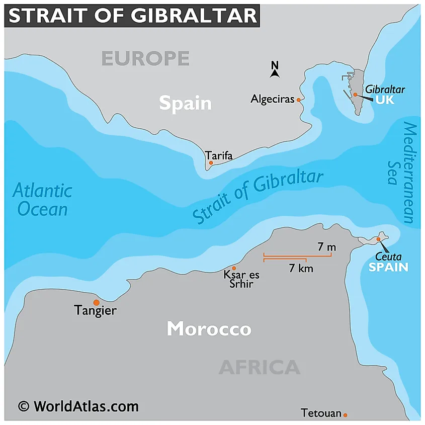
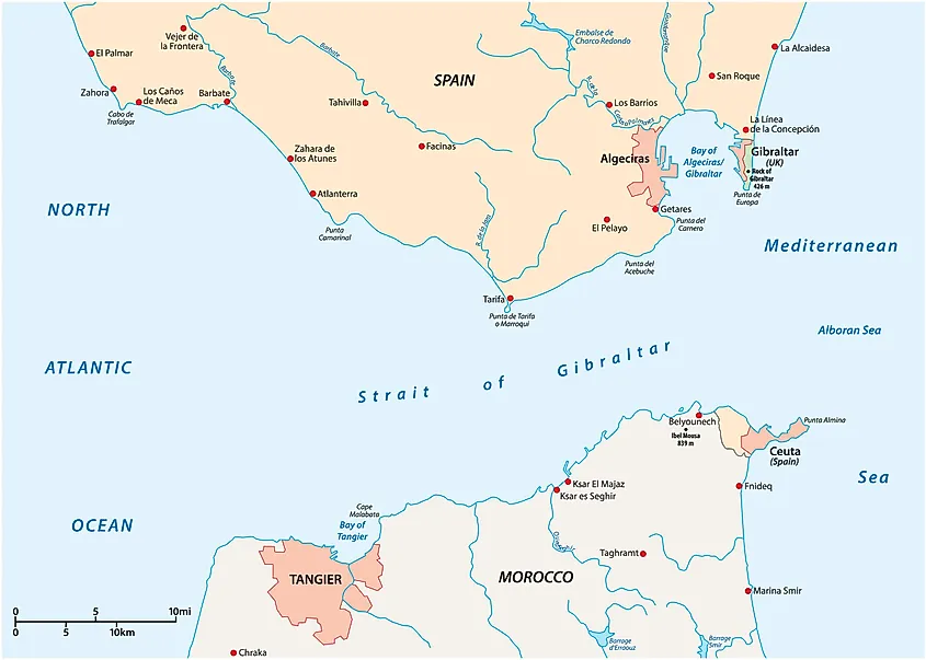
Map of the Strait of Gibraltar.
Also referred to as Estrecho de Gibraltar in Spanish, the Strait of Gibraltar is strategically positioned between the southern part of the European continent and the northwestern part of the continent of Africa. The Strait is bordered by Spain and the British Overseas Territory of Gibraltar in the north; and by the African country of Morocco and the Spanish exclave of Ceuta in the south.
Geography
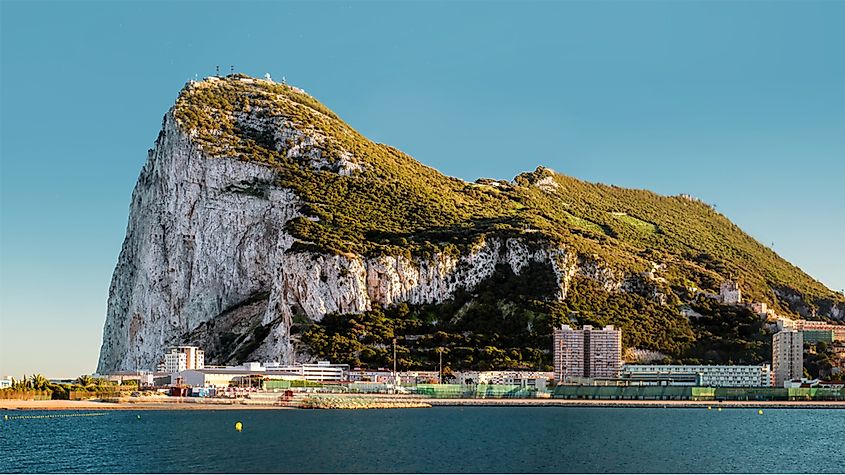
The Rock of Gibraltar in Gibraltar, a British Overseas Territory.
The Strait of Gibraltar is about 58 km long and has a width of about 13 km at its narrowest point between Morocco’s Point Cires and Spain’s Point Marroquí. The western end of the strait located between Spain’s Cape Trafalgar and Morocco’s Cape Spartel has a width of about 43 km. The strait’s eastern end located between the Rock of Gibraltar in the north and Mount Hacho or Jebel Moussa in the south has a width of about 23 km. These two land features in the strait’s eastern extremity are known as the Pillars of Heracles. The Strait of Gibraltar's depth ranges from 300 to 900 m and it forms a significant gap between the high plateau of Spain and the Atlas Mountains of Northern Africa. Geological studies have revealed that the Strait was formed due to the northward movement of the African Plate towards the European Plate.
A significant amount of water is also exchanged through the Strait of Gibraltar. The Atlantic Ocean and the Mediterranean Sea have different salinity levels and therefore the highly saline waters from the Mediterranean Sea flow outward and underneath the currents from the Atlantic Ocean, whereas the less saline Atlantic waters flow inward and on top of the Mediterranean Sea current.
Brief History
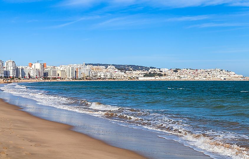
Tangier, a prominent Moroccan city located in Strait of Gibraltar.
Several archaeological studies have revealed that the Neanderthals lived in the Strait area about 125,000 years ago. Evidence of Homo Sapiens living here dates back 40,000 years.
Given the short distance between Europe and Africa here, the Strait of Gibraltar was used by many peoples crossing over throughout history, including the Carthaginians, Romans, Vandals, Moors and Berbers. The Strait of Gibraltar served as a vital navigational route and was therefore used by early navigators to access the Mediterranean Sea from the Atlantic Ocean and vice versa. Over the years, various countries have tried to forcefully acquire control over the strait and the Rock of Gibraltar.
The Strait of Gibraltar acts as a chokepoint for the ships that move into or out of the Mediterranean Sea. However, it also functions as a vital shipping route for the countries of northern Africa, southern Europe, and western Asia. An important port located on the Strait of Gibraltar is the Moroccan port of Tanger-Med, near Tangier.
Wildlife
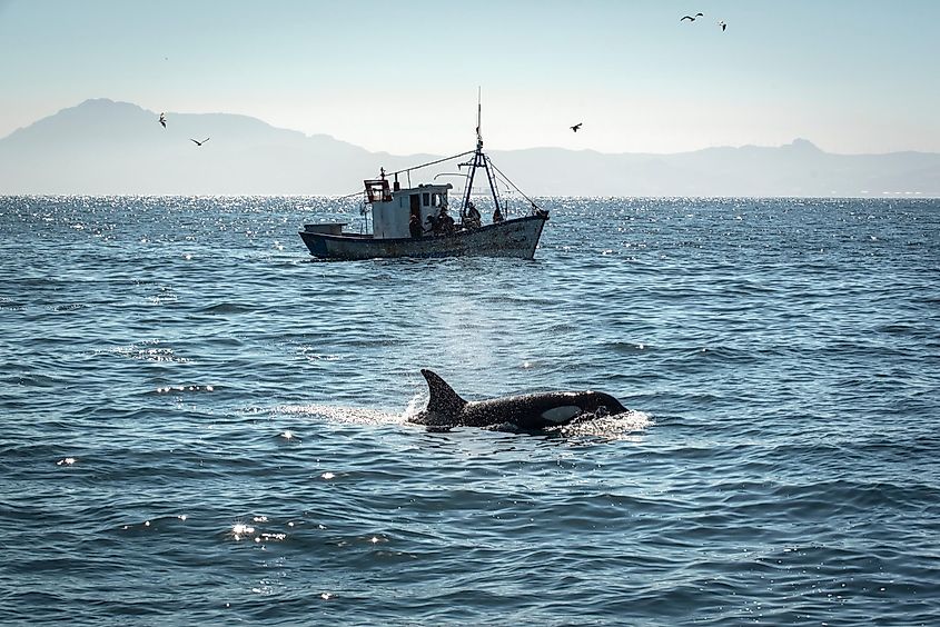
A killer whale in the Strait of Gibraltar.
BirdLife International has recognized the Strait of Gibraltar as an Important Bird Area, as several migratory birds use this strait every year to migrate from the Mediterranean regions to the Atlantic. Some of the notable migratory birds that are found here include the Atlantic puffins, Audouin’s gulls, Balearic shearwaters, lesser black-backed gulls, razorbills, and Scopoli’s shearwaters. About 36 individuals of a killer whale pod also reside in the waters of the Strait.
Map of the Strait of Gibraltar.