Osilo (original) (raw)
From Wikipedia, the free encyclopedia
Comune in Sardinia, Italy
| Osilo Ósile | |
|---|---|
| Comune | |
| Comune di Osilo | |
 |
|
Location of Osilo  |
|
  OsiloLocation of Osilo in SardiniaShow map of Italy OsiloLocation of Osilo in SardiniaShow map of Italy OsiloOsilo (Sardinia)Show map of Sardinia OsiloOsilo (Sardinia)Show map of Sardinia |
|
| Coordinates: 40°44′N 8°40′E / 40.733°N 8.667°E / 40.733; 8.667 | |
| Country | Italy |
| Region | Sardinia |
| Province | Sassari (SS) |
| Frazioni | Santa Vittoria, San Lorenzo |
| Government | |
| • Mayor | Giovanni Manca |
| Area[1] | |
| • Total | 98.3 km2 (38.0 sq mi) |
| Elevation | 672 m (2,205 ft) |
| Population (31 December 2008[2])[3] | |
| • Total | 3,317 |
| • Density | 34/km2 (87/sq mi) |
| Demonym | Osilesi |
| Time zone | UTC+1 (CET) |
| • Summer (DST) | UTC+2 (CEST) |
| Postal code | 07033 |
| Dialing code | 079 |
Osilo (Sardinian: Ósile) is a comune (municipality) in the Province of Sassari in the Italian region Sardinia, located about 170 kilometres (110 mi) north of Cagliari and about 10 kilometres (6 mi) east of Sassari. It is part of the Anglona traditional region. The municipality of Osilo contains the frazioni (subdivisions, mainly villages and hamlets) Santa Vittoria and San Lorenzo.
Osilo borders the following municipalities: Cargeghe, Codrongianos, Muros, Nulvi, Ploaghe, Sassari, Sennori, Tergu.
Economy is mostly based on agriculture and animal husbandry, especially of sheep, which include about 250 dairy companies. It is the production center of the Osilo pecorino cheese. Sights include a castle and several churches.

Church of Immacolata Concezione
Church of Rosario
Historical Centre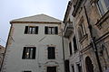
Historical Centre
Railway Station


![]()
Wikimedia Commons has media related to Osilo.
- ^ "Superficie di Comuni Province e Regioni italiane al 9 ottobre 2011". Italian National Institute of Statistics. Retrieved 16 March 2019.
- ^ All demographics and other statistics: Italian statistical institute Istat.
- ^ "Popolazione Residente al 1° Gennaio 2018". Italian National Institute of Statistics. Retrieved 16 March 2019.