MicroSat-100 (original) (raw)

Home - Search - Browse - Alphabetic Index: 0- 1- 2- 3- 4- 5- 6- 7- 8- 9
A- B- C- D- E- F- G- H- I- J- K- L- M- N- O- P- Q- R- S- T- U- V- W- X- Y- Z
MicroSat-100
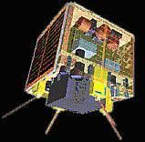
SSTL Midisatellite
Credit: NASA
British microsatellite bus. Enlarged version of the basic Surrey Microsat-70 bus.
AKA: Bilsat;BNSCSat;DMC;Enhanced Microsat SSTL;Nigeriasat. Status: Operational 2002. First Launch: 2002-11-28. Last Launch: 2012-07-22. Number: 8 . Payload: 40 kg (88 lb). Gross mass: 130 kg (280 lb). Diameter: 0.61 m (2.00 ft).
The SSTL-100 enhanced microsatellite platform expanded the range of SSTL's modular microsatellite to missions of 70 to 130 kg total mass, with a typical payload mass of up to 40 kg.
Whilst building extensively on the MicroSat-70 heritage, the enhanced microsatellite provided substantially greater payload power and volume to match emerging customer requirements. It included orbit station-keeping for constellation applications, and an advanced attitude control system using reaction wheels and control moment gyros for agile and precise pointing. A typical configuration (as used on three Disaster Monitoring Constellation satellites) included 2 Gbytes of on-board storage and dual-redundant 8-Mbit/sec S-band downlinks.
The MicroSat-100 structure was based on the same modular principles as the MicroSat-70. The internal module stack was mounted on larger facets providing accommodation for additional avionics, propulsion and payload subsystems. The volume above the stack was available for payloads, and was generally configured as an Earth-facing aperture.
The MicroSat-100 was proven in orbit by the AlSAT-1 mission, and further units were launched in 2003. The MicroSat-100 provided a proven baseline for customization, or an exceedingly cost-effective off-the-shelf solution for LEO remote sensing missions.
Electric System: 0.11 average kW.
More at: MicroSat-100.
Subtopics
| AlSat 1 Earth observation satellite built by SSTL for Algerian Centre National des Techniques Spatiales (CNTS) => Agence Spatiale AlgTrienne (ASAL), Algeria. Launched 2002. Used the Microsat-100 bus. Launched 2002. |
|---|
| Deimos 1 Earth Observation satellite built by SSTL for Deimos, Spain. Launched 2009. Used the Microsat-100 bus. |
|---|
| UK-DMC 2 Earth Observation satellite built by SSTL for British National Space Centre, UK. Launched 2009. Used the Microsat-100 bus. |
|---|
| AlSat 1B Earth observation satellite built by SSTL for Agence Spatiale AlgTrienne (ASAL), Algeria. Launched 2016. Used the SSTL-100 bus. |
|---|
Family: Communications, Earth, Sun synchronous orbit, Surveillance, Technology, Technology satellite. Country: UK. Launch Vehicles: R-7, R-14, Kosmos 3, Kosmos 11K65M, Dnepr, Atlas V, Soyuz-FG, Atlas V 401. Launch Sites: Cape Canaveral, Plesetsk, Baikonur LC31, Cape Canaveral LC41, Plesetsk LC132/1, Baikonur LC109, Taiyuan LC2. Agency: CNES, Surrey, DGA. Bibliography: 2, 552, 554.
Photo Gallery
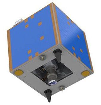 |
ALSAT-1Credit: Manufacturer Image |
|---|
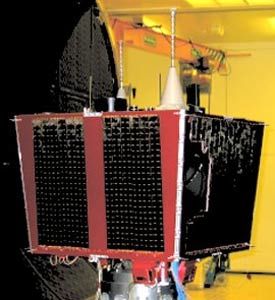 |
Bilsat 1 (BiltenSat)Credit: Manufacturer Image |
|---|
 |
Deimos 1Credit: Manufacturer Image |
|---|
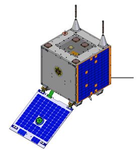 |
ExactView-1Credit: Manufacturer Image |
|---|
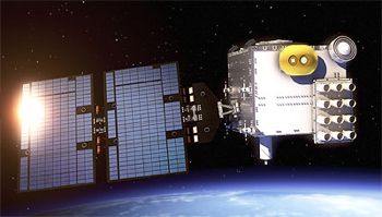 |
FORMOSAT 7 / COSMIC-Credit: Manufacturer Image |
|---|
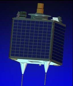 |
NigeriaSat 1Credit: Manufacturer Image |
|---|
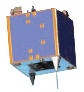 |
Nigeriasat XCredit: Manufacturer Image |
|---|
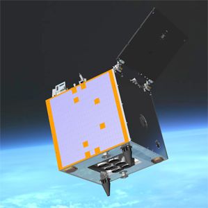 |
UK-DMC 2Credit: Manufacturer Image |
|---|
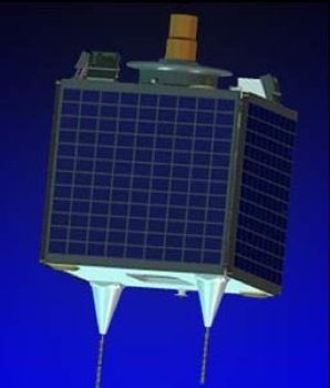 |
UK-DMC 1Credit: Manufacturer Image |
|---|
2002 November 28 - . 06:07 GMT - . Launch Site: Plesetsk. Launch Complex: Plesetsk LC132/1. LV Family: R-14. Launch Vehicle: Kosmos 11K65M.
- ALSAT-1 - . Mass: 80 kg (176 lb). Nation: Algeria. Agency: NCST. Manufacturer: Surrey. Program: Alsat. Class: Surveillance. Type: Civilian surveillance satellite. Spacecraft: MicroSat-100. USAF Sat Cat: 27559 . COSPAR: 2002-054A. Apogee: 745 km (462 mi). Perigee: 681 km (423 mi). Inclination: 98.20 deg. Period: 99.00 min.
Delayed from September 12, October 29. ALSAT 1 was an Algerian imaging minisatellite. The 90-kg satellite was the first part of an international Disaster Monitoring System (DMS) for alerting natural/man-made disasters. ALSAT was built by Surrey Satellite for the CNTS (Centre National des Techniques Spatiales) in Algiers. It carriee a 32-m resolution 3-band imager, a 100 mN resistojet thruster for small orbit corrections, and a GPS receiver. The SSTL Microsat-100 class satellite was a 0.60m cube with a 6m gravity gradient boom. As well as gravity gradient stabilization, it used a momentum wheel to improve stability for imaging.
2003 September 27 - . 06:12 GMT - . Launch Site: Plesetsk. Launch Complex: Plesetsk LC132/1. LV Family: R-14. Launch Vehicle: Kosmos 11K65M.
- Bilsat 1 (BiltenSat, Tubitak 1, DMC-Turkey) - . Mass: 100 kg (220 lb). Nation: Turkey. Agency: Tubitak-Bilten. Manufacturer: Surrey. Class: Earth. Type: Disaster monitoring satellite. Spacecraft: MicroSat-100. USAF Sat Cat: 27940 . COSPAR: 2003-042B. Apogee: 695 km (431 mi). Perigee: 677 km (420 mi). Inclination: 98.20 deg. Period: 98.50 min.
Three disaster monitoring DMC satellites (BILSAT-1, NigeriaSat-1 and UK-DMC) were lofted in a single Kosmos launch. They joined the first DMC satellite, AlSAT-1, which was launched into a 686 km sun-synchronous low Earth orbit in November 2002, to provide a worldwide daily imaging capability. The spacecraft were 3-axis stabilised nadir-pointing. The imaging payload was a 32-metre resolution GSD multispectral wide-swath Earth imaging cameras and a12-metre GSD panchromatic camera. The Kosmos rocket delivered the satellites into orbit with a precision about an order of magnitude better than the maximum allowable - placing the satellites into orbit with a semi-major axis accurate to within 700 metres and just 300 metres from that of AlSAT-1. Bilsat 1 was built for TUBITAK-ODTU-BILTEN, the Information Technology and Electronics Research Institute of the Middle East Technical University, Ankara, Turkey - NigeriaSat 1 (DMC-Nigeria) - . Mass: 80 kg (176 lb). Nation: Nigeria. Agency: NSRDA. Manufacturer: Surrey. Class: Earth. Type: Disaster monitoring satellite. Spacecraft: MicroSat-100. USAF Sat Cat: 27942 . COSPAR: 2003-042D. Apogee: 694 km (431 mi). Perigee: 677 km (420 mi). Inclination: 98.20 deg. Period: 98.50 min.
- BNSCSat 1 (DMC-UK) - . Mass: 80 kg (176 lb). Nation: UK. Agency: BNSC. Manufacturer: Surrey. Class: Earth. Type: Disaster monitoring satellite. Spacecraft: MicroSat-100. USAF Sat Cat: 27941 . COSPAR: 2003-042C. Apogee: 694 km (431 mi). Perigee: 677 km (420 mi). Inclination: 98.20 deg. Period: 98.50 min.
2009 July 29 - . 18:46 GMT - . Launch Site: Baikonur. Launch Complex: Baikonur LC109. LV Family: R-36M. Launch Vehicle: Dnepr.
- Deimos 1 - . Mass: 90 kg (198 lb). Nation: Spain. Agency: Makeyev bureau. Manufacturer: Surrey. Class: Earth. Type: Earth resources satellite. Spacecraft: MicroSat-100. USAF Sat Cat: 35681 . COSPAR: 2009-041A. Apogee: 677 km (420 mi). Perigee: 635 km (394 mi). Inclination: 98.10 deg. Period: 97.80 min. Disaster monitoring satellite, surveilling 600 km swaths in 22-meter resolution in three spectral bands. Operated by Deimos Space SL, Madrid, Spain..
- DMC 2 - . Mass: 95 kg (209 lb). Nation: UK. Agency: Makeyev bureau. Manufacturer: Surrey. Class: Earth. Type: Earth resources satellite. Spacecraft: MicroSat-100. USAF Sat Cat: 35683 . COSPAR: 2009-041C. Apogee: 677 km (420 mi). Perigee: 625 km (388 mi). Inclination: 98.10 deg. Period: 97.80 min. DMC International Imaging, Guildford, Surrey, UK..
2011 August 17 - . 07:12 GMT - . Launch Site: Taiyuan. Launch Complex: Taiyuan LC2. LV Family: R-36M. Launch Vehicle: Dnepr.
- Nigeriasat X - . Mass: 86 kg (189 lb). Nation: Nigeria. Agency: NSRDA. Manufacturer: Surrey. Class: Technology. Type: Technology satellite. Spacecraft: MicroSat-100. USAF Sat Cat: 37790 . COSPAR: 2011-044C. Apogee: 699 km (434 mi). Perigee: 656 km (407 mi). Inclination: 98.20 deg. Period: 98.30 min. Technology demonstration satellite built by Surrey Satellite with participation by Nigerian engineers..
2012 July 22 - . 06:41 GMT - . Launch Site: Baikonur. Launch Complex: Baikonur LC31. LV Family: R-7. Launch Vehicle: Soyuz-FG.
- ExactView-1 - . Mass: 100 kg (220 lb). Nation: Canada. Agency: ExactView. Manufacturer: Surrey. Class: Communications. Type: Civilian communications satellite. Spacecraft: MicroSat-100. USAF Sat Cat: 38709 . COSPAR: 2012-039C. Apogee: 822 km (510 mi). Perigee: 805 km (500 mi). Inclination: 98.90 deg. Period: 101.20 min. Carried Automatic Identification System (AIS) for the identification and location of maritime vessels..
Home - Search - Browse - Alphabetic Index: 0- 1- 2- 3- 4- 5- 6- 7- 8- 9
A- B- C- D- E- F- G- H- I- J- K- L- M- N- O- P- Q- R- S- T- U- V- W- X- Y- Z
© 1997-2019 Mark Wade - Contact
© / Conditions for Use