Okean-O (original) (raw)

Home - Search - Browse - Alphabetic Index: 0- 1- 2- 3- 4- 5- 6- 7- 8- 9
A- B- C- D- E- F- G- H- I- J- K- L- M- N- O- P- Q- R- S- T- U- V- W- X- Y- Z
Okean-O

Okean-O
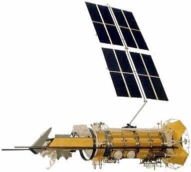
Okean-O2 satellite. The Tselina-2 and -3 SIGINT satellites are believed to use the same vertically-stacked satellite bus and to be similar in appearance.
Credit: Dmitry Pieson
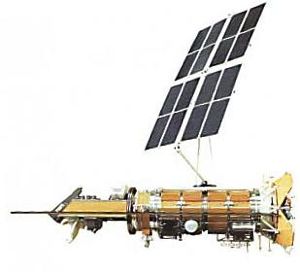
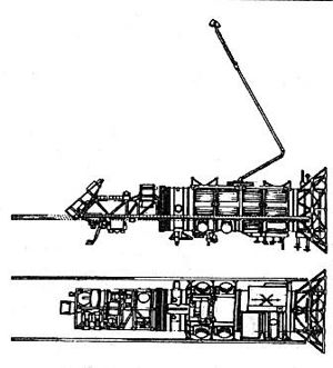
Ukrainian earth resources radar satellite. Ocean Observation satellite built by KB Yuzhnoye for NKAU, RKA, Russia. Launched 1999.
AKA: 17F43;Okean-3;Sich-2. Status: Operational 1999. First Launch: 1999-07-17. Last Launch: 1999-07-17. Number: 1 . Gross mass: 6,360 kg (14,020 lb).
The Okean-O third-generation heavy oceanographic research satellite used a side scanning radar, radiometer, and multispectral scanners to comprehensively study the surface and subsurface energy of the world ocean.
A decree of 5 May 1977 authorized development of three earth resource satellites. The Ministry of Defense was tasked with developing these systems, even though they did not contribute directly to any military mission. Okean-O, which became Okean-3, was based on the Tselina-D bus. The Sich-2 / Okean-O 17F43 oceanographic research satellite weighed 6360 kg. Launched by the Zenit booster, it represented Phase 2 of the third generation of Soviet space systems. With both the satellite and launch vehicle manufacturer located in the Ukraine, it did not fly until long after the break-up of the Soviet Union. Mission was acquisition of operational oceanographic information in the interests of various branches of the national economy of the USSR and international cooperation; continued trials of new types of informational and measurement apparatus and methods of remote sensing of the earth's surface and atmosphere. Proposed scientific instruments were:
- RLSBO-D side-looking radar with a swath width of 700 km and a resolution of 1.5 x 2.- km
- Delta-2 scanning radiometer with a swath width of 900 km and a resolution of 16 x 21 km
- MSU-M 4-band multispectral scanner with a swath width of 1930 km and a resolution of 1.7 km
- MSU-SK 5-band multispectral scanner with a swath width of 600 km and a resolution of 175 x 245 m
- MSU-V 8-band multispectral scanner with a swath width of 180 km and a resolution of 50 m
- MSU-E 3-band multispectral scanner with a swath width of 45 km and a resolution of 30 m
- Video optical spectrometer with a swath width of 740 km and a resolution of 1 km
The Okean-O program was designed:
- to estimate the potential reserves of the energy of tides and the accumulated energy of solar radiation
- to study the World Ocean as a global damper and regulator of heat and moisture content of the atmosphere
- to detect zones of upwelling and higher bioproductivity
- to study subsurface circular eddies and their effect on the formation of destructive cyclones and typhoons
- to ensure the safety of navigation and control of the ice situation in the Arctic and Antarctic
- to study the dynamics of sea currents, and the processes of self-purification of sea water and cleansing of river effluents; and
- to control the intensity of pollution of the oceans with oil and oil product discharged. Okean spacecraft with their electro-optical and radar sensors were designed and manufactured by the Ukrainian Yuzhnoye Scientific Production Association of Dnepropetrovsk.
More at: Okean-O.
Family: Earth, Earth resources radarsat, Sun synchronous orbit. Country: Ukraine. Launch Vehicles: Zenit-2. Projects: Okean. Launch Sites: Baikonur, Baikonur LC45/1. Agency: Yuzhnoye, RAKA. Bibliography: 2, 5, 12909.
Photo Gallery
 |
Okean-OCredit: Yuzhnoye |
|---|
 |
Okean-O |
|---|
 |
Okean-OCredit: Manufacturer Image |
|---|
1999 July 17 - . 06:38 GMT - . Launch Site: Baikonur. Launch Complex: Baikonur LC45/1. LV Family: Zenit. Launch Vehicle: Zenit-2.
- Okean-O - . Payload: Okean-O no. 1. Mass: 4,360 kg (9,610 lb). Nation: Russia. Agency: RAKA. Manufacturer: Yuzhnoye. Program: Okean. Class: Earth. Type: Earth resources satellite. Spacecraft: Okean-O. USAF Sat Cat: 25860 . COSPAR: 1999-039A. Apogee: 649 km (403 mi). Perigee: 648 km (402 mi). Inclination: 97.90 deg. Period: 97.70 min.
First of a new generation of larger Okean oceanographic satellites, carried a side-looking radar (RSL-BO), and a set of visible and infrared scanners and radiometers. It is built by the Ukrainian Yuzhnoye company and is a joint project of the Russian Aviation/Space Agency (RAKA) and the Ukrainian National Space Agency (NKAU).
Home - Search - Browse - Alphabetic Index: 0- 1- 2- 3- 4- 5- 6- 7- 8- 9
A- B- C- D- E- F- G- H- I- J- K- L- M- N- O- P- Q- R- S- T- U- V- W- X- Y- Z
© 1997-2019 Mark Wade - Contact
© / Conditions for Use