Veere (The Netherlands) (original) (raw)

This page is part of © FOTW Flags Of The World website
Zeeland province
Last modified: 2018-12-15 by rob raeside
Keywords: veere |
Links: FOTW homepage |search | disclaimer and copyright | write us | mirrors
 Shipmate Flagchart : http://www.flagchart.net
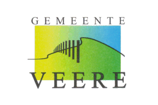
provisional logo-flag
- Veere municipality
- Veere 1676 flag
- Veere old flag
- Veere Coat of Arms Other Veere pages:
- Biggekerke
- Domburg
- Koudekerke
- Mariekerke
- Meliskerke
- Oostkapelle
- Valkenisse
- Westkapelle See also:
- Zeeland
- Zeeland Province - The Municipalities
- The Netherlands
- Alphabetical list of Dutch municipalities
- The Netherlands - Index of all pages
Veere municipality
Number of inhabitants (1 Jan 2003): 22.000; area: 134,96 km²; Settlements: Domburg (seat), Aagtekerke, Biggekerke, Gapinge, Grijpskerke, Koudekerke, Meliskerke, Oostkapelle, Serooskerke, Veere, Vrouwenpolder, Westkapelle, Zoutelande
On 1 Jan 1997 the former municipalities of Veere,Domburg,Mariekerke,Valkenisseand Westkapelle merged to form the new municipality of Veere. No new flag adopted yet - the logo-flag is used provisionally.
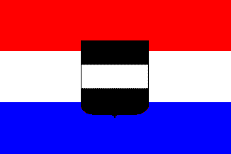
Veere 1676 flag
 Shipmate Flagchart : http://www.flagchart.net
Around 1676
Veere [former Municipality]
 Shipmate Flagchart : http://www.flagchart.net
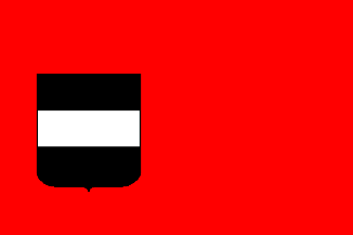
Used until 1997
A red flag with a shield in the centre. The shield is horizontally striped black over white over black.
(Source: Dutch atlas made by Delisle in 1739)
James Dignan, 14 November 1996
Veere Coat of Arms
[![[Veere Coat of Arms]](http://www.crwflags.com/fotw/images/n/nl-ze)
Granted 21 Feb 1975