The Encyclopedia of Arda - Harondor (original) (raw)
The land between the Poros and the Harnen

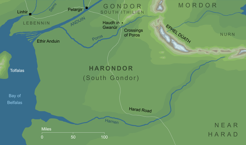
A desert region commonly called South Gondor, that lay beyond the River Poros from Gondor itself, and extended southwards for some two hundred miles, until its southern border was defined by the River Harnen. The Harad Road ran through this land, connecting South Ithilien to the Harad beyond the Harnen.
Throughout the first half of the Third Age, Harondor was under the control of the Kings of Gondor, but that changed at the time of civil war known as the Kin-strife. At that time, Castamir the Usurper took the rightful throne from King Eldacar, but was ultimately overcome and slain. Castamir's sons were besieged at Pelargir for a time, but escaped by sea to settle in Umbar, where they founded a haven for the enemies of Gondor. From that haven far to the south, the forces of the Corsairs began to ravage Harondor, and it became a debatable land between Gondor and Umbar.
The escape of Castamir's sons and the founding of Umbar took place in the year III 1448. Long afterwards, in III 2885, an army out of the Harad not only attacked but occupied Harondor, using it as a staging post for raids into Ithilien. Their campaign was brought to an end by Steward Túrin II, who defeated them at the Crossings of Poros with the aid of Folcred and Fastred of Rohan.
Indexes:
About this entry:
- Updated 17 July 2012
- This entry is complete
For acknowledgements and references, see the Disclaimer & Bibliography page.
Original content © copyright Mark Fisher 2008, 2012. All rights reserved. For conditions of reuse, see the Site FAQ.