East of Helena (original) (raw)
 |
 |
 |
 |
|---|---|---|---|
 |
 |
 |
 |
 |
 |
 |
 |
 |
 |
 |
 |
 |
 |
 |
 |
 |
 |
 |
 |
 |
 |
 |
 |
 |

City of East Helena
In 1888, a large lead smelter was built on the banks of Prickly Pear Creek in the Helena Valley by the Helena and Livingston Lead Smelting Company. In 1898, the American Smelting and Refining Company (ASARCO) purchased the 160 acre site. ASARCO operated the smelter until 2001.
East Helena grew up around that enterprise. For over a century, the smelter processed 70,000 tons of lead bullion a year, and provided a livelihood for thousands of families. It also produced untold tons of toxic contaminants.
In 1984, the Environmental Protection Agency named East Helena as a Superfund cleanup site. ASARCO smelting operations were suspended in 2001.
In November of 2007, the Independent Record presented the ASARCO story.
Click here to access the archived feature.
On August 14, 2009, the ASARCO stacks were felled by dynamite charges, an emotional step in cleaning up the smelter site.
Looking West on Main Street, ca. 1900
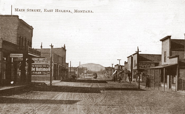
COLLECTION OF KENNON BAIRD
Mount Helena is in the distance, and the streetcar from Helena is on the tracks. Many of the buildings on the left were destroyed by the fire of 1919 (scroll down for the fire story).
Circa 1900 Views of the ASARCO Smelter
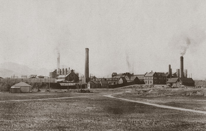
COLLECTION OF KENNON BAIRD • CLICK ON IMAGE FOR A BIG VERSION IN A NEW WINDOW
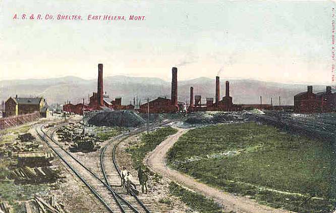
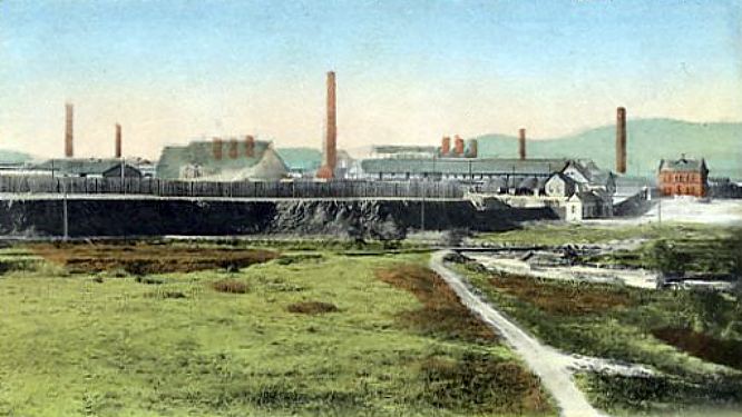
Enameled Souvenir Spoon, ca 1900

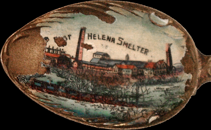
COURTESY OF PAMELA J. ATTARDO, LEWIS & CLARK COUNTY HERITAGE AND TOURISM COUNCIL
ASARCO Smelter at Night, 1920s
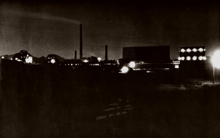
COURTESY OF TOM KILMER • CLICK ON IMAGE FOR A BIG VERSION IN A NEW WINDOW
Smelter Stack Maintenance, 1946
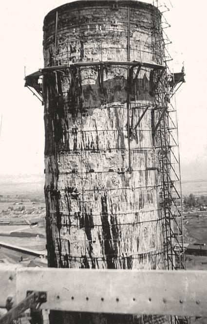
COLLECTION OF WES AND CAROL SYNNESS
Small souvenir lead ingot from the East Helena ASARCO Smelter, date unknown.
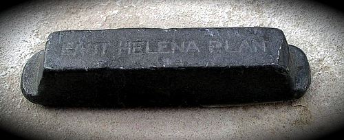
Small souvenir lead ingot from the East Helena ASARCO Smelter, 1960s.
ASARCO Stacks Demolished, August 14 2009
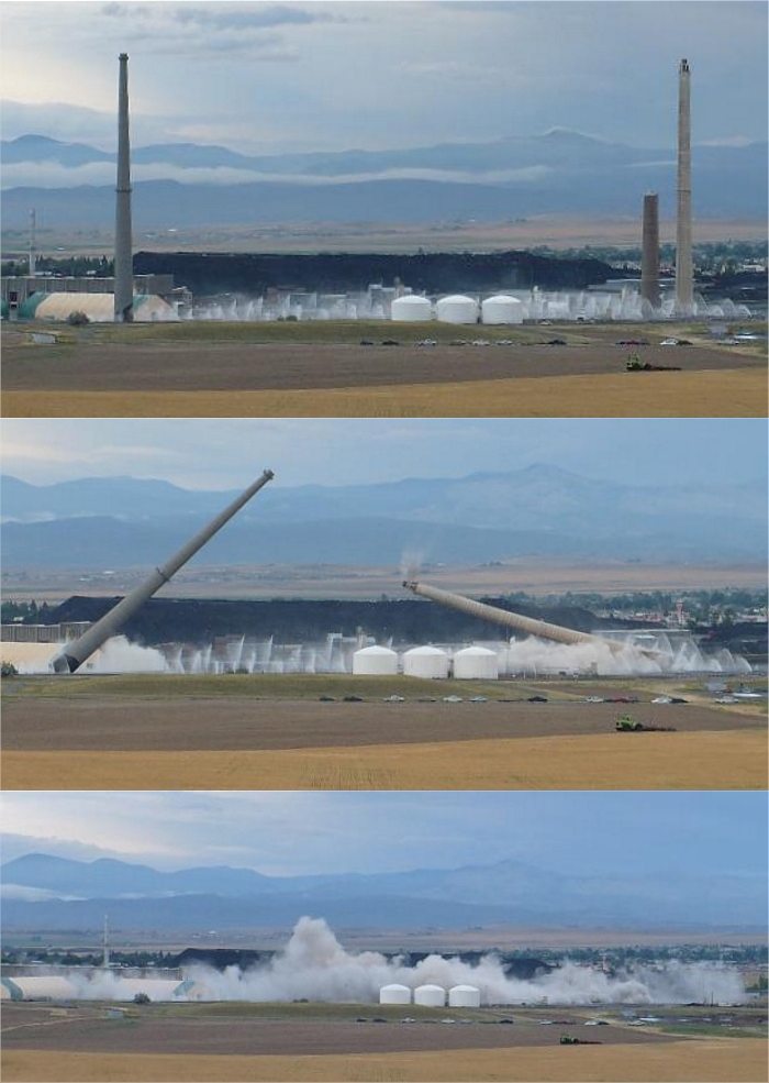
PHOTOS BY PATTI CASEY SCOTT
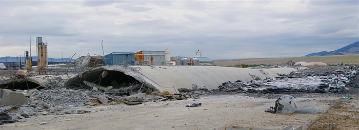
PHOTO BY TERRY BASS • CLICK HERE FOR MORE OF TERRY'S DEMOLITION PHOTOS
Demolition Video
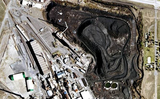
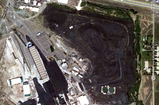
Satellite Views of the Site - ca. 2007 and 2013
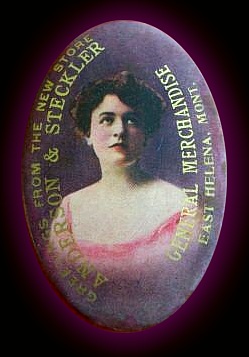
Ca. 1900 advertising pocket mirror from the
Anderson & Steckler General Mercantile , East Helena.
East Helena Fire, August 19 1919
Perhaps started by a carelessly discarded cigarette, the blaze of Aug. 19, 1919 ravaged East Helena's small business district...

Looking East on Main Street in East Helena, 1920s

KENNON BAIRD COLLECTION • CLICK ON IMAGE TO ENLARGE IN A NEW WINDOW
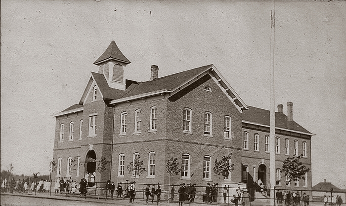
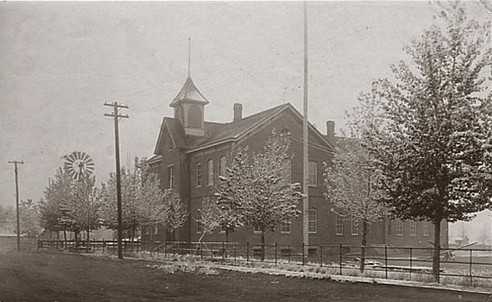
Two Views of the East Helena Public School, Early 1900s
Enameled Souvenir Spoon, ca 1900

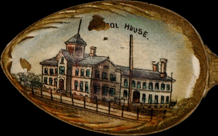
COURTESY OF PAMELA J. ATTARDO, LEWIS & CLARK COUNTY HERITAGE AND TOURISM COUNCIL
Remodeled and Expanded East Helena Public School, 1940s
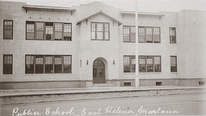

Sts. Cyril & Methodius Catholic Church, circa 1900
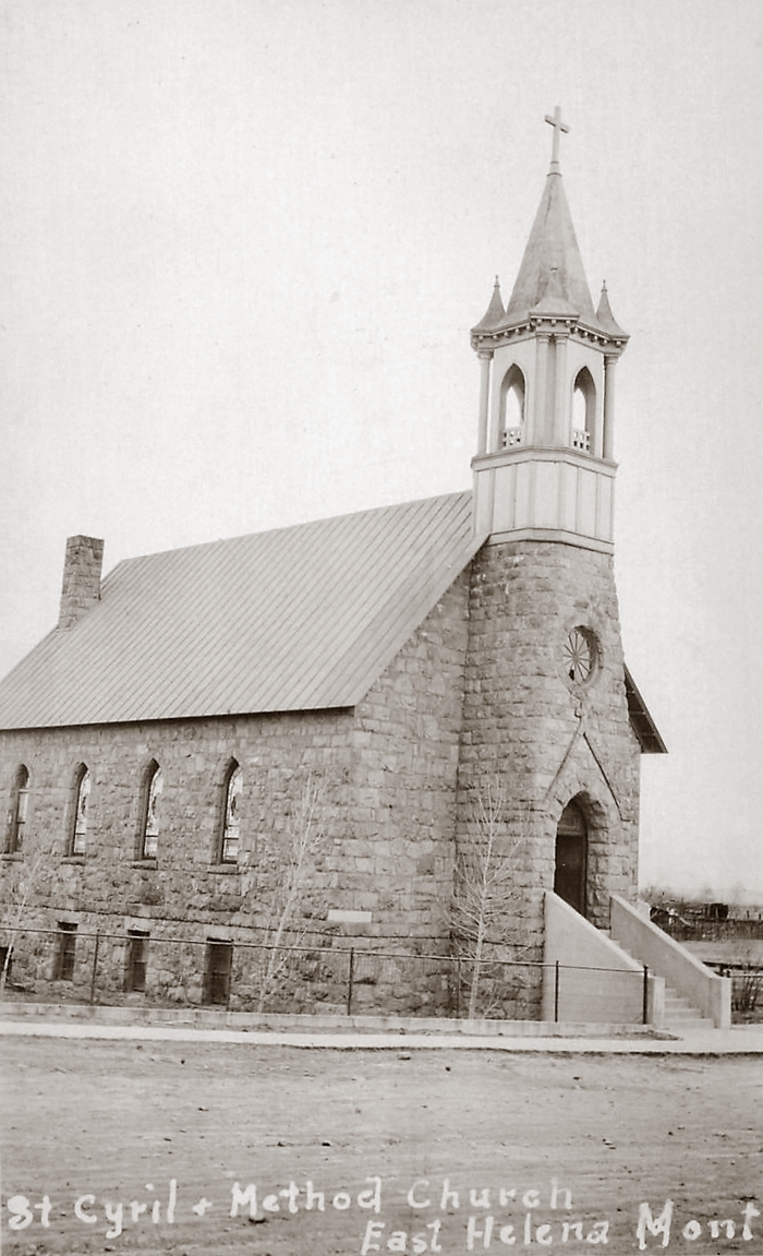
COURTESY OF THE DAVID POOR COLLECTION

The church pictured here served the community of East Helena from 1899 to 1988. A new building, thoughtfully incorporating architectural elements of the old, was dedicated in 1989. For a history of the church and parish, please visit the website of the Sts. Cyril & Methodius Church. The map overlay is from the 1930 Sanborn Insurance map of East Helena. Later modifications were made to the church buildings.
Sts. Cyril & Methodius Catholic Church Interior
May 25, 1945 • Photo by Jorud

COURTESY OF THE KENNON BAIRD COLLECTION
CLICK ON IMAGE TO OPEN A BIG VERSION IN A NEW WINDOW

American Smelting & Refining Co. Employees at the Montana Club, April 17, 1952
Click on any image to open a big version in a new window
Photos by Les Jorud, Collection of Kennon Baird


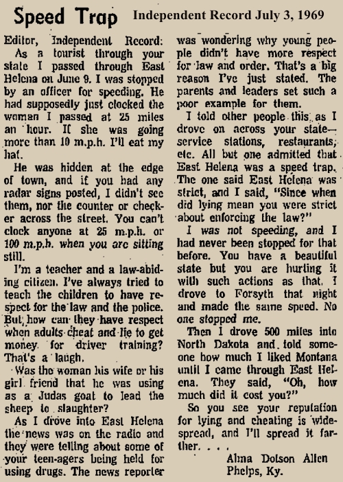
Infamous Speed Trap
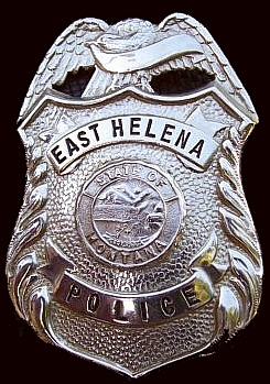
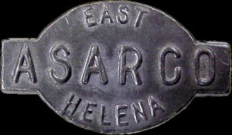
When Highway 287 was the main street of East Helena, the city was notorious as a speed trap. This badge was a familiar sight to many hard-traveling motorists who failed to brake quickly enough from 75 to 25 mph. And even if you were actually going at the posted speed, you might not escape -- especially if you had out-of-state plates...

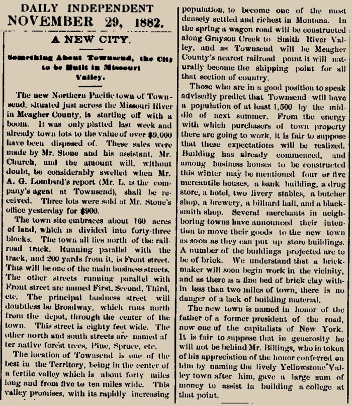
Townsend, Montana
Located about 30 miles southeast of Helena, Townsend was created by the Northern Pacific Railroad In 1882. Townsend was named by railroad officials, in honor of the wife of Charles Barstow Wright (1822-1898), President of the Northern Pacific from 1875 to 1879.
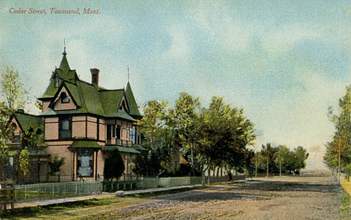
Cedar Street, Townsend, circa 1900
Probably the 200 block of South Cedar
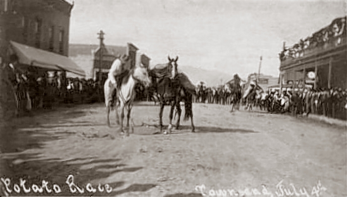
Potato Race, Main St., Townsend Montana, July 4 1914
Main Street, Townsend, Montana 1916
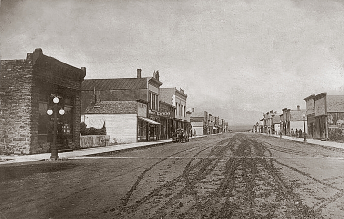
Main Street of Townsend, 1940s

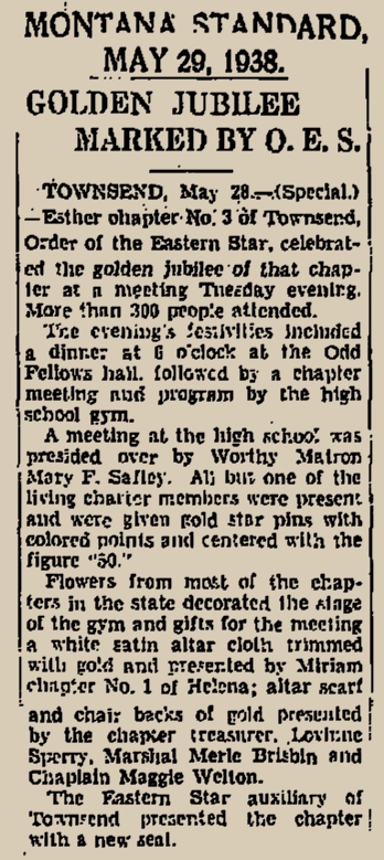
Golden Jubilee, Esther Chapter No. 3., Order of the Eastern Star
May 24, 1938 • Broadwater High School Gymnasium
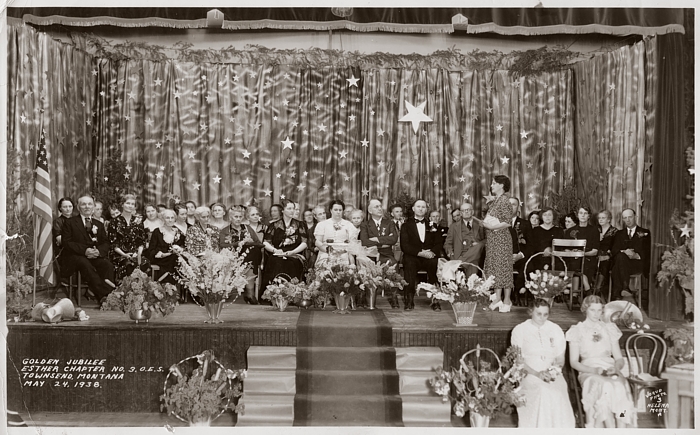
COLLECTION OF KENNON BAIRD • CLICK ON IMAGE TO OPEN A BIG VERSION IN A NEW WINDOW
The woman sitting next to the flag is my great aunt, Viola Myrle Brisbin, née Spear, (1892-1962)
 |
 |
|---|
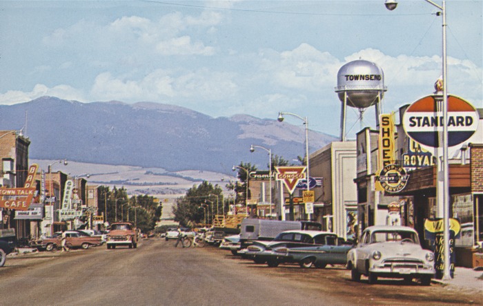
Townsend, Early 1960s
The River Inn Nite Club and Motel
Just north of Townsend • Opened in 1941 -- Moved to Lakeside, 1965

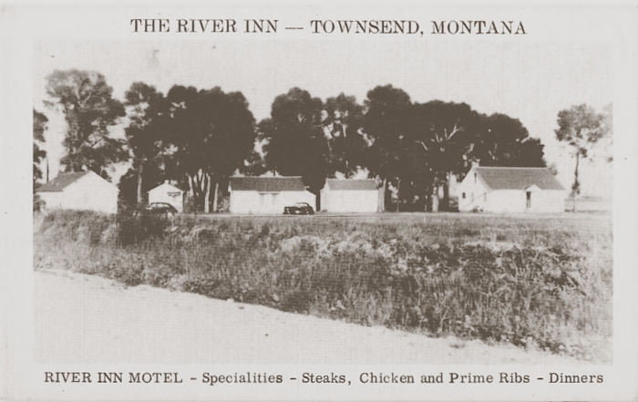
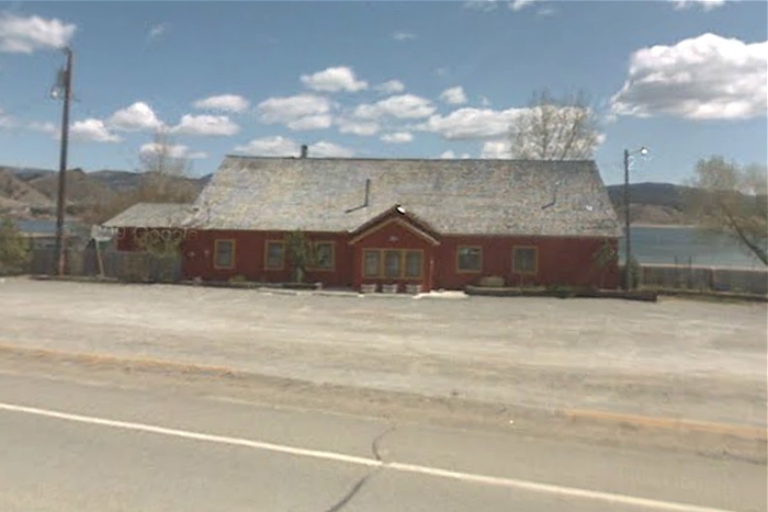
The River Inn was built in 1941 by Lester Goodwin (1897-1986). He later built six motel cottages adjacent to the Inn. Situated near the bank of the Missouri River, the building suffered repeated damage from ice-jams after the construction of the current Canyon Ferry Dam. In 1965, the property was apparently purchased by the Bureau of Reclamation, and the buildings were sold to be moved, The Inn was purchased by one Gary Smith for $1,111, and is now at Lakeside.
The River inn Nite Club is now the Lakeside Bar
1940 Toston Dam
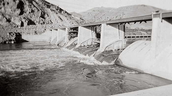
COURTESY OF TOM KILMER
East of Townsend is the Toston Dam on the Missouri River. It was completed in 1940.

 |
 |
 |
 |
|---|---|---|---|
 |
 |
 |
 |
 |
 |
 |
 |
 |
 |
 |
 |
 |
 |
 |
 |
 |
 |
 |
 |
 |
 |
 |
 |
 |