Massachusetts Base and Elevation Maps (original) (raw)


The two maps shown here are digital base and elevation maps of Massachusetts. Higher resolution maps like these and many other digital maps, wall maps, custom radius maps, travel maps, travel guides, map software, and globes and games, for business and the classroom, are available to purchase fromMaps.com - The World's Largest Maps Store!.Enter code "NETSTATE" at checkout for 10% off orders of $50 or more!
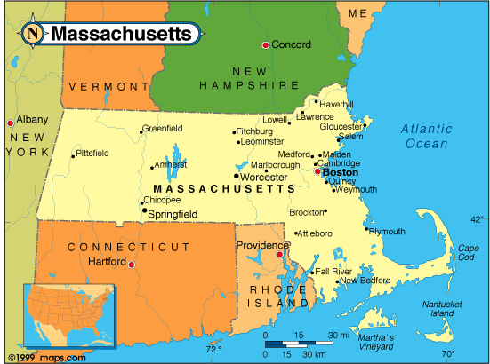 |
This Massachusetts base map highlights the location of the state capitol,Boston, and major cities throughout the state. Portions of Massachusetts' border states,Vermont,New Hampshire,Rhode Island, Connecticut, and New York are included to show the relationship between Massachusetts and its neighbors. A small inset shows Massachusetts among the other 47 Continental United States. |
|---|---|
| Massachusetts base map, Courtesy of Maps.com. |
|
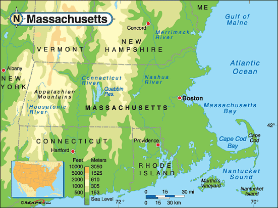 |
This elevation map of Massachusetts illustrates the number of feet or meters the state rises above sea level. As you can see, the eastern third of Massachusetts and the Connecticut River Valley resides at, or less than 500 feet above, sea level.The lowest point in the state is sea level at the Atlantic Ocean. The highest point in Massachusetts is in thenorthwestern part of the state, in Berkshire County, whereMount Greylock rises to 3,486 feet above sea level in a part of the Appalachian Mountains referred to as the Berkshire Hills or simply, the Berkshires.Mount Greylock, inMt. Greylock State Reservation, is about 14 miles north ofPittsfield, Massachusetts. [ Topographic map | Arial photograph ] |
| Massachusetts elevation map, Courtesy of Maps.com. |
Additional information
Massachusetts maps: Additional maps and map links from NETSTATE.COM.
Massachusetts geography: More Massachusetts geography from NETSTATE.COM.
State elevations: State elevations listed by mean elevation, state high point and state low point.
Purchase Massachusetts maps: Maps.com - The World's Largest Maps Store!
- Select map type by clicking on "category" to left on destination page.
- Use code NETSTATE at the checkout for 10% off orders of $50 or more!
- Over 6,000 products to choose from!