Vermont Base and Elevation Maps (original) (raw)


The two maps shown here are digital base and elevation maps of Vermont.
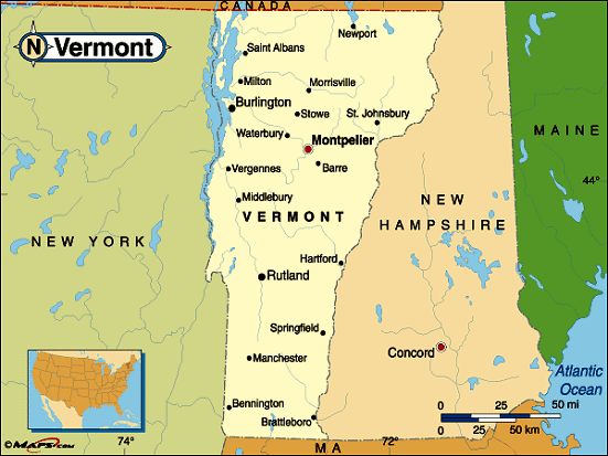 |
This Vermont base map highlights the location of the state capitol,Montpelier, and major cities throughout the state. Portions of Vermont's border states,New Hampshire,Massachusetts, andNew York are included to show the relationship between Vermont and its neighbors. A small inset shows Vermont among the other 47 Continental United States.On the north, Vermont shares an international border with Canada. |
|---|---|
| Vermont base map | |
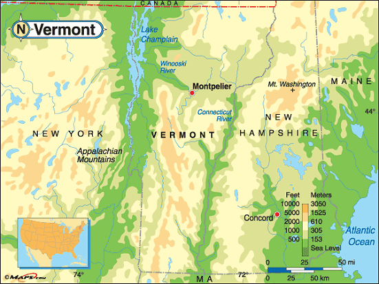 |
This elevation map of Vermont illustrates the number of feet or meters the state rises above sea level. The lowest elevation in Vermont is 95 feet above sea level atLake Champlain. Lower elevations also follow the Connecticut River on the border of New Hampshire.The Green Mountains run through the center of Vermont andit is here that the highest point in the state is found.Mount Mansfield rises 4,393 above sea level in Chittendon County about eight miles northeast ofStowe. It lies within Mt. Mansfield State Forest to the east ofUnderhill State Park. [ Topographic Map ] |
| Vermont elevation map |
Additional information
Vermont maps: Additional maps and map links from NETSTATE.COM.
Vermont geography: More Vermont geography from NETSTATE.COM.