Oregon Base and Elevation Maps (original) (raw)


The two maps shown here are digital base and elevation maps of Oregon. Higher resolution maps like these and many other digital maps, wall maps, custom radius maps, travel maps, travel guides, map software, and globes and games, for business and the classroom, are available to purchase fromMaps.com - The World's Largest Maps Store!.Enter code "NETSTATE" at checkout for 10% off orders of $50 or more!
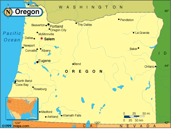 |
This Oregon base map highlights the location of the state capitol,Salem, and major cities throughout the state. Portions of Oregon's border states,Washington,Idaho,Nevada,California are included to show the relationship between Oregon and its neighbors. A small inset shows Oregon among the other 47 Continental United States.Oregon is bordered by the North Pacific Ocean on the west. |
|---|---|
| Oregon base map, Courtesy of Maps.com. |
|
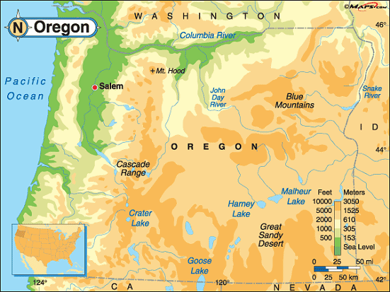 |
This elevation map of Oregon illustrates the number of feet or meters the state rises above sea level. Oregon's lower elevations are in the west where the state's low point, sea level, is at the Pacific Ocean.The highest point in the state isMount Hood, in northern Oregon, Clackamas County, about 50 miles east ofPortland. It's embedded in theMt. Hood Wilderness Area within theMt. Hood National Forest. |
| Oregon elevation map, Courtesy of Maps.com. |
Additional information
Oregon maps: Additional maps and map links from NETSTATE.COM.
Oregon geography: More Oregon geography from NETSTATE.COM.
Purchase Oregon maps: Maps.com - The World's Largest Maps Store!
- Select map type by clicking on "category" to left on destination page.
- Use code NETSTATE at the checkout for 10% off orders of $50 or more!
- Over 6,000 products to choose from!