Washington Base and Elevation Maps (original) (raw)


The two maps shown here are digital base and elevation maps of Washington.
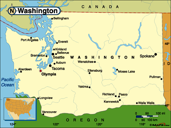 |
This Washington base map highlights the location of the state capitol,Olympia, and major cities throughout the state. Portions of Washington's border states,Idaho andOregon are included to show the relationship between Washington and its neighbors. A small inset shows Washington among the other 47 Continental United States.Washington shares an international border with Canada on the north and is bordered by the North Pacific Ocean on the west. |
|---|---|
| Washington base map | |
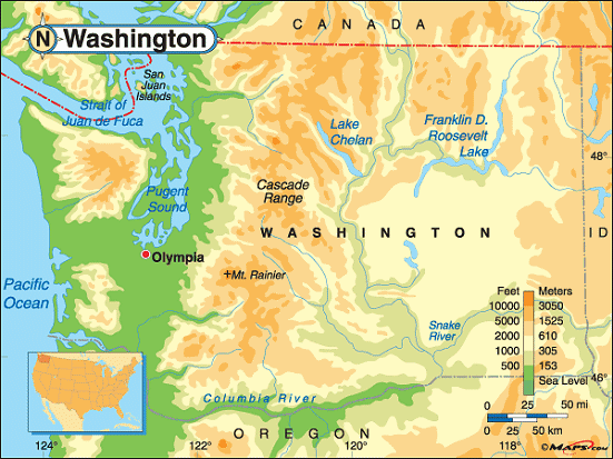 |
This elevation map of Washington illustrates the number of feet or meters the state rises above sea level. Washington's elevation runs from sea level on the Pacific Coast to14,410 feet above sea level in the Cascade Range that runs north-south along the coast in Washington and Oregon.Mount Rainier, originally named Tahoma (Great Snowy Peak), is located in Pierce County, about 54 miles southeast ofSeattle. It's surrounded by theMt. Rainier National Park. [ Topographic Map ] |
| Washington elevation map |
Additional information
Washington maps: Additional maps and map links from NETSTATE.COM.
Washington geography: More Washington geography from NETSTATE.COM.