Atascosa County, Texas. (original) (raw)
28� 53' 24" N, 98� 31' 48" W (28.89, -98.53)
Population: 48,981 (2020)
44,911 (2010) 38,628 (2000) 30,533 (1990)
Total area: 1,221 square miles (3,160 km2)
1,220 square miles (3,200 km2) land
1.9 square miles (4.9 km2) water
| |  |
| ------------------------------------------------------------------------------------------------------------------- |
|
| ------------------------------------------------------------------------------------------------------------------- |
Atascosa County History
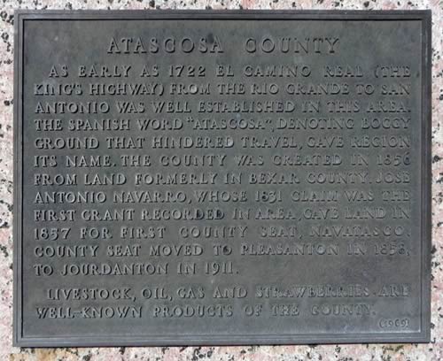
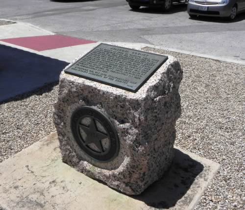
1936 Texas Centennial Marker: Atascosa County Courthouse groundsATASCOSA COUNTY
As early as 1722 El Camino Real (The King's Highway) from the Rio Grande to San Antonio was well established in this area. The Spanish word "Atascosa," denoting boggy ground that hindered travel, gave region its name. The county was created in 1856 from land formerly in Bexar County.
Jose Antonio Navarro, whose 1831 claim was the first grant recorded in area, gave land in 1857 for first county seat, Navatasco. County seat moved to Pleasanton
in 1858, to Jourdanton in 1911. Livestock, oil, gas and strawberries are well-known products of the county.
Atascosa County Town List
Cities, Towns & Ghost Towns: History, attractions, landmarks, architecture, monuments, museums, cemeteries, bridges, parks, vintage & contemporary images, area destinations, forum...County Seat - Jourdanton
Atascosa County Vintage Maps
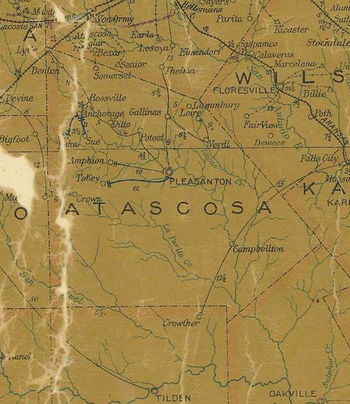
Atascosa County 1907 postal map
From Texas state map #2090
Courtesy Texas General Land Office

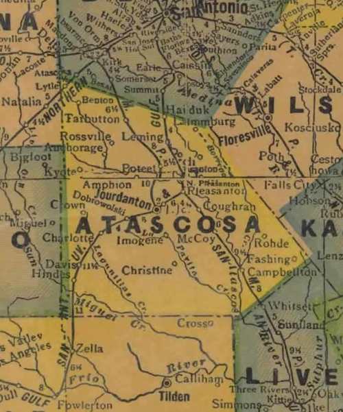
Atascosa County 1920s map
From Texas state map #10749
Courtesy Texas General Land Office
Atascosa County 1940s map
From Texas state map #4335
Courtesy Texas General Land Office
Atascosa County 1936 Texas Centennial marker
Photo courtesy Barclay Gibson, August 2011
Texas Escapes, in its purpose to preserve historic, endangered and vanishing Texas, asks that anyone wishing to share their local history, stories, landmarks and vintage/historic photos, please contact us.