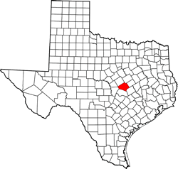
Bell County, Texas. (original) (raw)
Texas | Counties Central Texas North
31� 2' 24" N, 97� 28' 48" W (31.04, -97.48)
Population: 370,647 (2020)
310,235 (2010) 237,974 (2000) 191,088 (1990)
Total area 1,088 square miles (2,820 km2):
1,051 square miles (2,720 km2) land
37 square miles (96 km2) water
| |  |
| ----------------------------------------------------------------------------------------------------------- |
|
| ----------------------------------------------------------------------------------------------------------- |
Bell County History
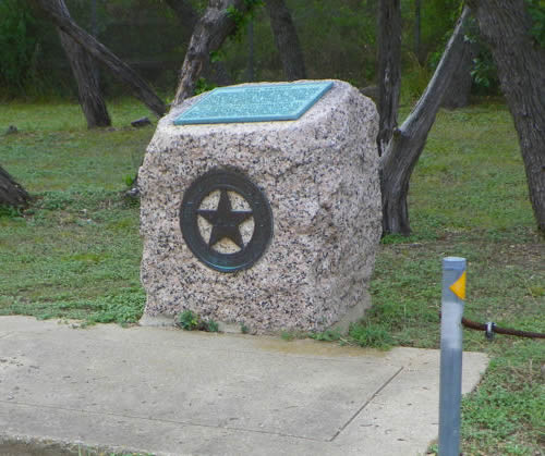
1936 Centennial - Highway Marker:BELL COUNTY
Settlement began on Lampasas River, 1847.
Created Jan. 22, organized Aug. 1, 1850.
Named for Peter Hansbrough Bell (1812-1898), native of Virginia; veteran of Battle of San Jacinto; served in Somervell expedition to stop Mexico's Raids into Texas; officer in Mexican War; Governor of Texas 1849-1853; U.S. Congressman, 1853-1857.
First county seat Nolanville.
Moved Dec. 16, 1851, to Belton.
By 1860 population was 4,799.
Sent 12 troop companies into Civil War. Furnished goods from flour mills, hat factory, tanyard, leather works, blacksmith shops, cabinet shop, beef slaughter pens.
Bell County Town List
Cities, Towns & Ghost Towns: History, attractions, landmarks, architecture, monuments, museums, cemeteries, bridges, parks, vintage & contemporary images, area destinations, forum...County Seat - Belton
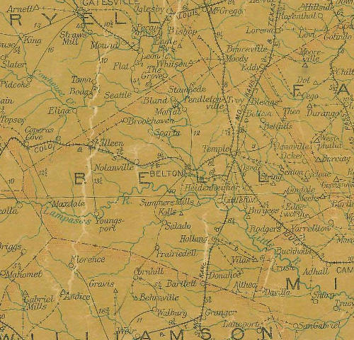
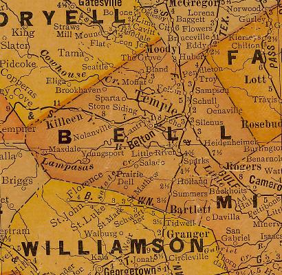
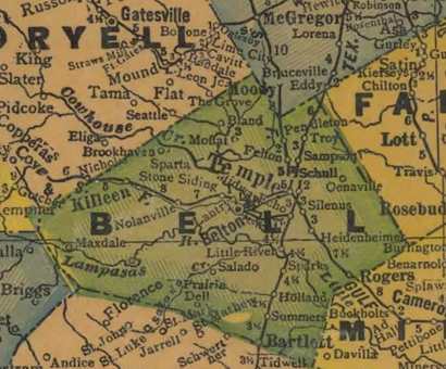
Bell County Vintage Maps
Bell County 1907 postal map
From Texas state map #2090
Courtesy Texas General Land Office
Bell County 1920s map
From Texas state map #10749
Courtesy Texas General Land Office
Bell County 1940s map
From Texas state map #4335
Courtesy Texas General Land Office
Bell County
1936 Texas Centennial Marker
2 miles S of Belton
Roadside park at Lampasas River bridge & IH-35 S feeder road
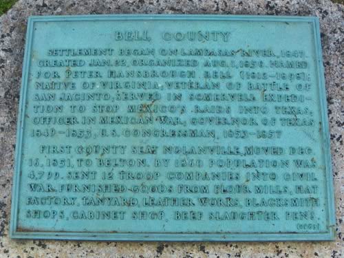
Bell County 1936 Texas Centennial marker
Photo courtesy Barclay Gibson, April 2010