Burnet County Texas. (original) (raw)
Texas | Counties Texas Hill Country
30� 46' 48" N, 98� 10' 48" W (30.78, -98.18)
Population: 49,130 (2020)
42,750 (2010) 34,147 (2000) 22,677 (1990)
Total area:1,021 square miles (2,640 km2)
994 square miles (2,570 km2) land
27 square miles (70 km2) is water
| |  |
| --------------------------------------------------------------------------------------------------------------- |
|
| --------------------------------------------------------------------------------------------------------------- |
Burnet County History
1936 Centennial Marker
(on US 281, 1.7 miles north of Burnet):
Formed from portions of Travis, Williamson and Bell counties.
Created Feb. 5, 1852;
organized August 28, 1852.
Named in honor of David G. Burnet (1788-1870), president of the Provisional Government of the Republic of Texas in 1836.
County seat, Burnet, famous for its granite mountains.
Burnet County Town List
Cities, Towns & Ghost Towns: History, attractions, landmarks, architecture, monuments, museums, cemeteries, bridges, parks, vintage & contemporary images, area destinations, forum...
County Seat - Burnet
Burnet County Vintage Maps
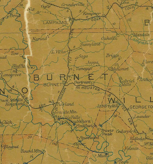
1907 postal map showing Burnet County & Colorado River
From Texas state map #2090
Courtesy Texas General Land Office
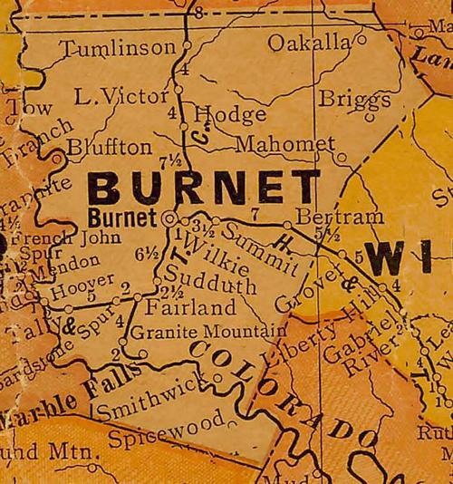
1920s map showing Burnet County & Colorado River
From Texas state map #10749
Courtesy Texas General Land Office
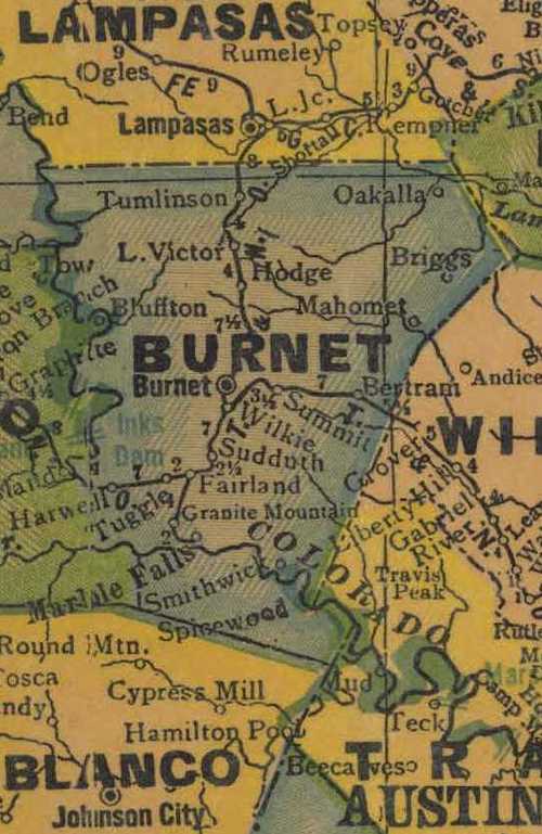
1940s map showing Burnet County & Colorado River
From Texas state map #4335
Courtesy Texas General Land Office
Texas Escapes, in its purpose to preserve historic, endangered and vanishing Texas, asks that anyone wishing to share their local history, stories, landmarks and recent or vintage photos, please contact us.