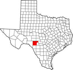
Edwards County Texas. (original) (raw)
Texas | Counties 29� 58' 12" N, 100� 18' 0" W (29.97, -100.3)
Population: 1,911 est. (2016) 2,002 (2010)
Total area: 2,120 square miles (5,500 km2)
2,118 square miles (5,490 km2) land
2.0 square miles (5.2 km2) water
| |  |
| ---------------------------------------------------------------------------------------- |
|
| ---------------------------------------------------------------------------------------- |
Edwards County History
- 1936 Texas Centennial Marker (on US Hwy 377, 2 miles N of Rocksprings):
EDWARDS COUNTY
Formed from Bexar County; created February 1, 1858.
Organized September 10, 1883.
Named in honor of Haden Edwards 1771-1849. Empresario leader of the Fredonian War in 1827.
County seat, Leakey 1883
Rocksprings, since 1890. - Historical Marker (on courthouse square):EDWARDS COUNTY
Atop the Edwards Plateau, extending into the scenic Nueces Valley. Angora goat capital of the world. The economy is based on ranching. Wild game is abundant. Created in 1858 and organized 1883 from old Bexar district. Named for Haden Edwards (1813-1865), an early leader and colonizer in Texas. First county seat was Leakey; present boundaries were created, and county seat was moved on April 13, 1891, to Rocksprings. First courthouse and jail were built that year. After a fire in 1897, the present courthouse was erected; it withstood a destructive tornado that claimed 72 lives in the county in 1927. First officials to serve the county (1891-1893) as it is presently constituted were the following: James M. Hunter, County Judge; W. M. Sanford, County and District Clerk; Ira L. Wheat, Sheriff and Tax Collector; S.A. Hough, County Attorney; W.H. Cowan, County Treasurer County Commissioners: John Eaton, Precinct No. 1; C. H. Kirchner, Precinct No. 2; H. Schweithelm, Precinct No. 3; M. M. Bradford, Precinct No. 4 (1967)
Edwards County Town List
Cities, Towns & Ghost Towns: History, attractions, landmarks, architecture, monuments, museums, cemeteries, bridges, parks, vintage & contemporary images, area destinations, hotels, and forum.County Seat - Rocksprings
Book Hotel Here - Junction Hotels
Edwards County Vintage Maps
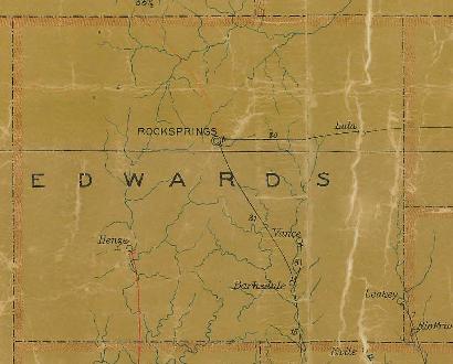
Edwards County 1907 postal map
From Texas state map #2090
Courtesy Texas General Land Office
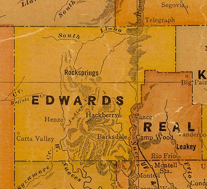
Edwards County 1920s map
From Texas state map #10749
Courtesy Texas General Land Office
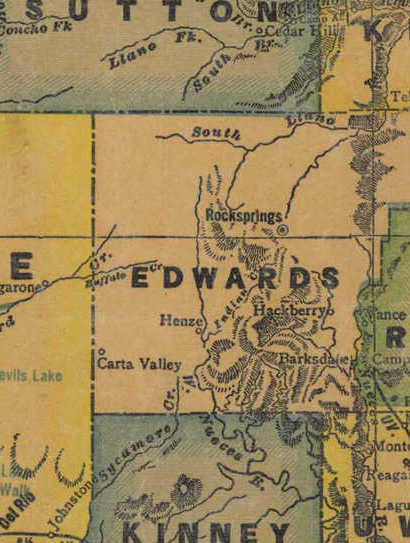
Edwards County 1940s map
From Texas state map #4335
Courtesy Texas General Land Office
Texas Escapes, in its purpose to preserve historic, endangered and vanishing Texas, asks that anyone wishing to share their local history, stories, landmarks and vintage/historic photos, please contact us.