Fayette County, TX history, cities, towns, courthouse, jail, vintage maps, hotels and more. (original) (raw)
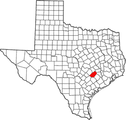
FAYETTE COUNTY, TEXAS
29� 51' 36" N, 96� 55' 48" W (29.86, -96.93)
Population: 24,554 (2010)
Total area: 960 square miles (2,500 km2)
950 square miles (2,500 km2) land
9.8 square miles (25 km2) water
| |  |
| --------------------------------------------------------------------------------------------------------------------------- |
|
| --------------------------------------------------------------------------------------------------------------------------- |
Fayette County History
(from 1936 Texas Centennial Marker)
Formed from Colorado and Bastrop counties.
Created December 14, 1837.
Organized January 1, 1838.
Named in honor of Marquis de LaFayette. 1757-1834. Nobleman and republican friend of Washington and of the United States.
County Seat, La Grange.
Fayette County Town List
Cities, Towns & Ghost Towns: History, attractions, landmarks, architecture, monuments, museums, cemeteries, bridges, parks, vintage & contemporary images, area destinations, hotels, and forum.
County Seat - La Grange
Book Hotel Here - La Grange Hotels
Fayette County Vintage Maps
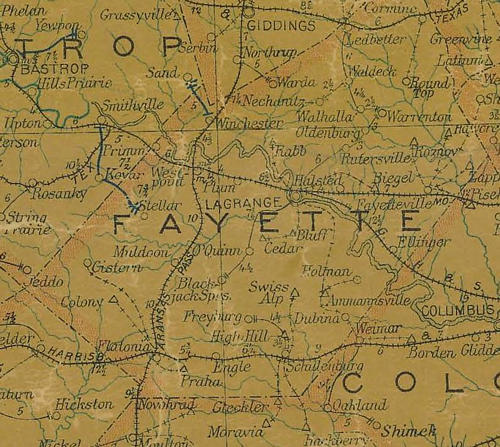
Fayette County 1907 postal map
From Texas state map #2090
Courtesy Texas General Land Office
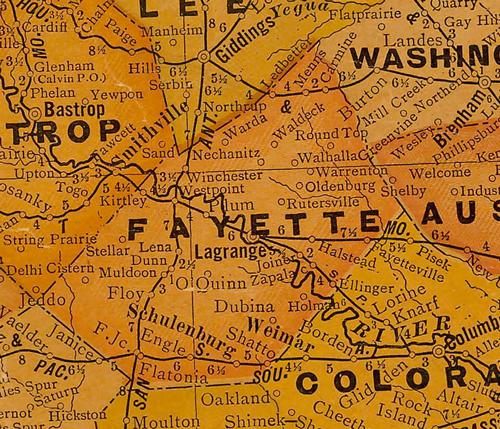
Fayette County 1920s map
From Texas state map #10749
Courtesy Texas General Land Office
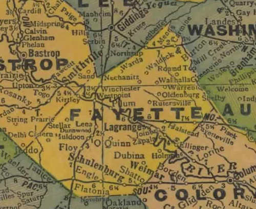
Fayette County 1940s map
From Texas state map #4335
Courtesy Texas General Land Office
Texas Escapes, in its purpose to preserve historic, endangered and vanishing Texas, asks that anyone wishing to share their local history, stories, landmarks and recent or vintage photos, please contact us.