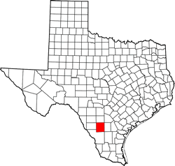
La Salle County, Texas. (original) (raw)
Texas | Counties 28� 20' 24" N, 99� 6' 0" W (28.34, -99.1)
Population: 6,886 (2010)
Total area: 1,494 square miles (3,870 km2)
1,487 sq mi (3,851 km2) land
7.5 square miles (19 km2) water
| |  |
| ---------------------------------------------------------------------------------------------------------------------------- |
|
| ---------------------------------------------------------------------------------------------------------------------------- |
La Salle County History
Historical Marker on courthouse square:
LA SALLE COUNTY
The Presidio Rio Grande Road brought travelers to this area for centuries. In 1852 the U. S. Army built and garrisoned Fort Ewell, for protection. The first permanent settler, William A. Waugh, opened a rancho near the Cibolo Crossing on the Spanish Road in 1856.
On Feb. 1, 1858, the county was created and named for Robert Cavalier, Sieur de La Salle (1643-1687). The first French explorer of Texas.
The county's first post office opened in 1871 at the Guajuco Crossing. County government was organized Nov. 2, 1880, at Crarey's Rancho. Various courthouses existed before 1883, when Cotulla became county seat.
La Salle County Town List
Cities, Towns & Ghost Towns: History, attractions, landmarks, architecture, monuments, museums, cemeteries, bridges, parks, vintage & contemporary images, area destinations, hotels, and forum.County Seat - Cotulla
Area Hotel - Cotulla Hotels | More Hotels
La Salle County Vintage Maps
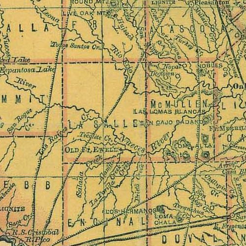
From 1876 Houston & Texas Central R. R. Texas state map #79301 showing La Salle & McMullen County
Courtesy Texas General Land Office
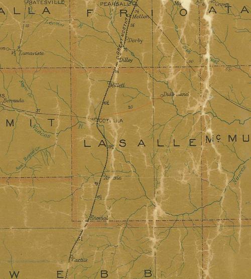
From 1907 Texas state map #2090 showing La Salle County
Courtesy Texas General Land Office
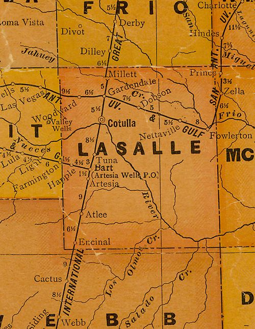
From 1920 Texas state map #10749 showing La Salle County
Courtesy Texas General Land Office
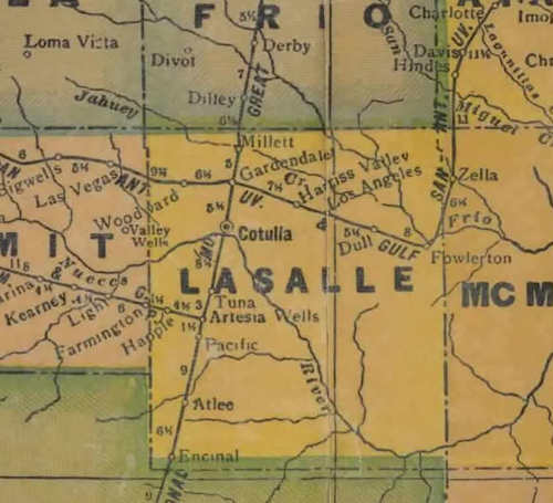
From 1940 Texas state map #4335 showing La Salle County
Courtesy Texas General Land Office
Texas Escapes, in its purpose to preserve historic, endangered and vanishing Texas, asks that anyone wishing to share their local history, stories, landmarks and recent or vintage photos, please contact us.