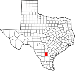
McMullen County Texas. (original) (raw)
Texas | Counties 28� 21' 0" N, 98� 34' 12" W (28.35, -98.57)
Population: 707 (2010)
Total area: 1,157 square miles (3,000 km2)
1,137 square miles (2,940 km2) land
17 square miles (44 km2) water
| |  |
| ------------------------------------------------------------------------------------------------------------------- |
|
| ------------------------------------------------------------------------------------------------------------------- |
McMullen County History
(Historical Marker on courthouse grounds)
McMULLEN COUNTY
Created 1858. Organized 1862. Abandoned because of bandit activities in thicket area during the Civil War. Reorganized 1877, with Tilden as county seat. Named for John McMullen (1785-1853), founded with James McGloin of the Irish Colony at San Patricio; President Pro Tempore of the General Council which governed Texas in 1836, on the eve of the Republic. Of the 254 Texas counties, 42 bear Indian, French or Spanish names. 10 commemorate such colonizers as McMullen and Stephen F. Austin, "Father of Texas". 12 honor Washington and other American patriots. 96 were named for men who fought in the Texas war for independence (15 dying at the Alamo), signed the Declaration of Independence from Mexico, or served as statesmen in the Republic of Texas. 23 have the names of frontiersmen and pioneers. 11 honor American statesmen who worked for the annexation of Texas; 10, leaders in Texas since statehood, including jurists, ministers, educators, historians, statesmen; and 36, men prominent in the Confederacy during the Civil War. Rockwall and 8 others have geographical names. San Jacinto and Val Verde were named for battles; Live Oak and Orange, for trees; and Mason for a fort.
1964
McMullen County Town List
Cities, Towns & Ghost Towns: History, attractions, landmarks, architecture, monuments, museums, cemeteries, bridges, parks, vintage & contemporary images, area destinations, hotels, and forum.County Seat - Tilden
Book Area Hotel - San Antonio Hotels
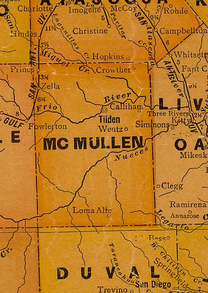
McMullen County Vintage Maps
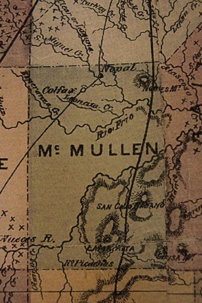
McMullen County 1874 Map
Courtesy Texas General Land Office
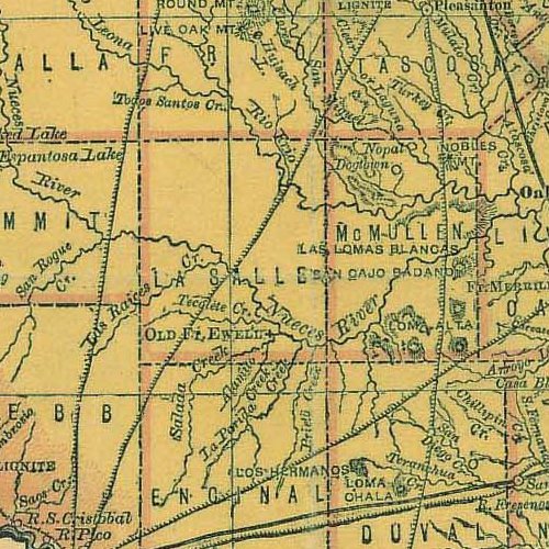
From 1876 Houston & Texas Central R. R. Texas state map #79301 showing La Salle & McMullen County
Courtesy Texas General Land Office
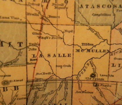
McMullen County 1882 Map
Courtesy Texas General Land Office

From 1907 Texas state map #2090 showing McMullen County
Courtesy Texas General Land Office
From 1920 Texas state map #10749 showing McMullen County
Courtesy Texas General Land Office

From 1940 Texas state map #4335 showing McMullen County
Courtesy Texas General Land Office
Texas Escapes, in its purpose to preserve historic, endangered and vanishing Texas, asks that anyone wishing to share their local history, stories, landmarks and recent or vintage photos, please contact us.