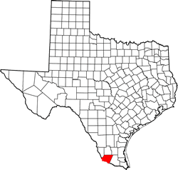
Starr County Texas. (original) (raw)
Texas | Counties 26� 34' 12" N, 98� 43' 48" W (26.57, -98.73)
Population: 64,122 est. (2016) 60,968 (2010)
Total area: 1,229 square miles (3,180 km2)
1,223 square miles (3,170 km2) land
5.9 square miles (15 km2) water
| |  |
| ------------------------------------------------------------------------------------------------------------- |
|
| ------------------------------------------------------------------------------------------------------------- |
Contiguous Counties:
Jim Hogg County (N) Brooks County (NE) Hidalgo County (E) Zapata County (W) Camargo Municipality, Tamaulipas, Mexico (S) Guerrero, Tamaulipas, Mexico (SW) Gustavo D�az Ordaz, Tamaulipas, Tamaulipas, Mexico (S) Mier Municipality, Tamaulipas, Mexico (SW) Miguel Alem�n Municipality, Tamaulipas, Mexico (SW)
Starr County History
1936 Texas Centennial Marker:STARR COUNTY
Formed from Nueces County;
Created February 10, 1848; organized August 7, 1848.
Named for Dr. James Harper Starr 1809-1890; pioneer Texas surgeon and Indian fighter, located at Nacogdoches in 1837; Secretary of the Treasury of the Republic of Texas 1839-1840; Assistant Postmaster General of the Confederacy.
Rio Grande City, the county seat.
Starr County Town List
Cities, Towns & Ghost Towns: History, attractions, landmarks, architecture, monuments, museums, cemeteries, bridges, parks, vintage & contemporary images, area destinations, hotels, and forum.County Seat - Rio Grande City
Book Hotel Here - Rio Grande Hotels
Starr County Vintage Maps
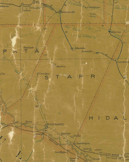
Starr County 1907 postal map
From Texas state map #2090
Courtesy Texas General Land Office
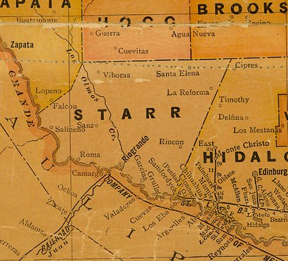
Starr County 1920s map
From Texas state map #10749
Courtesy Texas General Land Office
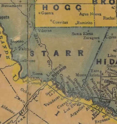
Starr County 1940s map
From Texas state map #4335
Courtesy Texas General Land Office
Texas Escapes, in its purpose to preserve historic, endangered and vanishing Texas, asks that anyone wishing to share their local history, stories, landmarks and vintage/historic photos, please contact us.