Last Remaining International Boundary for The Republic of Texas. (original) (raw)
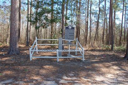
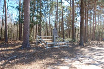
International Boundary Republic of Texas-United States Marker
Photo courtesy Gerald Massey , Feb. 2009
Photographer's Note:
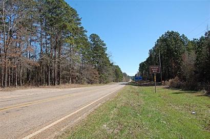
"The marker is located on the Louisiana / Texas state line on Louisiana Highway 765 and Texas FM-31. This is only six miles from Logansport, Louisiana while it is ten miles from Deadwood, Texas.
Only a hundred yards or so from the marker is a sign saying "Galloway." This was the birthplace of Country Musician Jim Reeves. I believe that Galloway would technically be the closest "community" to the marker, although it doesn't appear on the Texas state map while Deadwood and Logansport both appear on their respective maps." -
Gerald Massey, February 2009
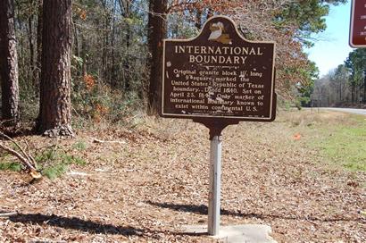
International Boundary Marker Text
International Boundary Marker
Historical Landmark
Photo courtesy Gerald Massey , Feb. 2009
A Unique Historical Landmark by Bob Bowman ("All Things Historical" Column)
Travelers who take the time to wander down Farm Road 31 between Deadwood, Texas, and Logansport, Louisiana, will find a one-of-a-kind historical landmark.
A granite shaft set into the ground on April 23, 1841, marks the only international boundary existing within the continental United States... more
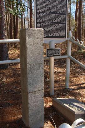
International Boundary Marker
Historical Landmark
Photo courtesy Gerald Massey , Feb. 2009
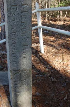
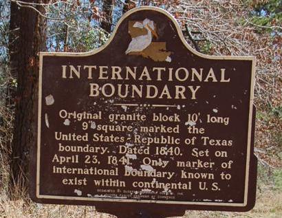
International Boundary Historical Marker
Photo courtesy Gerald Massey , Feb. 2009
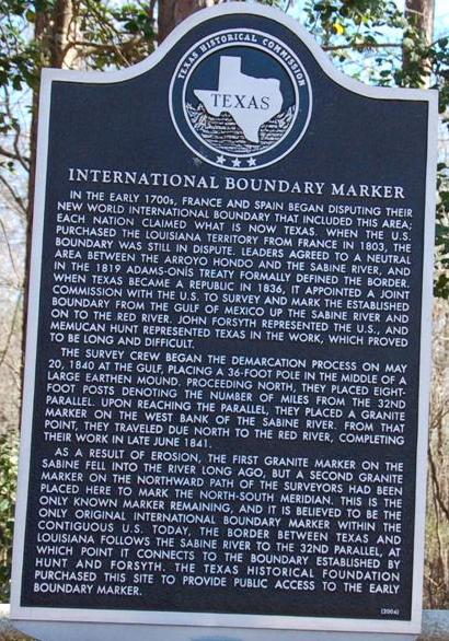
Historical Marker: 8149 FM 31S
International Boundary Marker
In the early 1700s, France and Spain began disputing their New World international boundary that included this area; each nation claimed what is now Texas. When the U.S. purchased the Louisiana Territory from France in 1803, the boundary was still in dispute. Leaders agreed to a neutral area between the Arroyo Hondo and the Sabine River, and the 1819 Adams-On�s Treaty formally defined the border. When Texas became a republic in 1836, it appointed a joint commission with the U.S. to survey and mark the established boundary from the Gulf of Mexico up the Sabine River and on to the Red River. John Forsyth represented the U.S., and Memucan Hunt represented Texas in the work, which proved to be long and difficult.
The survey crew began the demarcation process on May 20, 1840 at the Gulf, placing a 36-foot pole in the middle of a large earthen mound. Proceeding north, they placed eight-foot posts denoting the number of miles from the 32nd parallel. Upon reaching the parallel, they placed a granite marker on the west bank of the Sabine River. From that point, they traveled due north to the Red River, completing their work in late June 1841.
As a result of erosion, the first granite marker on the Sabine fell into the river long ago, but a second granite marker on the northward path of the surveyors had been placed here to mark the north-south meridian. This is the only known marker remaining, and it is believed to be the only original international boundary marker within the contiguous U.S. Today, the border between Texas and Louisiana follows the Sabine River to the 32nd parallel, at which point it connects to the boundary established by Hunt and Forsyth. The Texas Historical Foundation purchased this site to provide public access to the early boundary marker.
2004
[See Birth of a Republic by Jeffery Robenalt ]
International Boundary Republic of Texas-United States Marker
Photo courtesy Gerald Massey , Feb. 2009
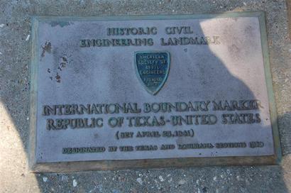
International Boundary Republic of Texas-United States Marker plaque
Photo courtesy Gerald Massey , Feb. 2009
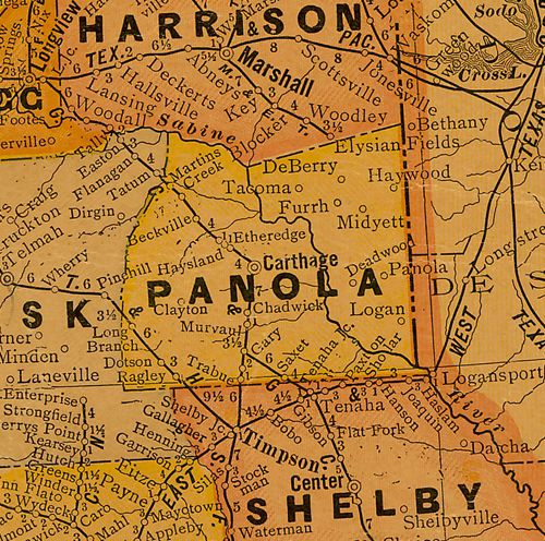
1920s Panola County map showing
Deadwood, TX & Logansport, Louisiana
From Texas state map #10749
Courtesy Texas General Land Office