Guerra, Texas, Jim Hogg county, history, vintage maps. (original) (raw)
History in a Pecan Shell
Located in the southwestern portion of Jim Hogg County, Guerra lies fourteen miles south of Randado and thirty-five miles north of Garceno on Ranch Road 649. Its current population is six, making it the smallest town in Texas. However, it was not always like this.
A. Guerra, whose last name is the Spanish word for "war", first settled the land in the late 1800s. Although the town was named after him, the Mexican inhabitants preferred calling it El Colorado because large numbers of red cattle roamed the area. The post office moved from San Antonio Viejo and opened at Guerra in 1906 with Don Apolonio Gomez acting as the postmaster. By 1914, the town had a hundred citizens and sixteen businesses.
From 1920 to 1967, the number of those living in Guerra remained the same with fifty people. The number increased by 25 the following year. Over two decades later in 1990, the town had only fifteen residents, most of them working at a retail store. The reason for this big change in size remains a mystery. Regardless, Guerra still exists and even remains a part of the Jim Hogg County Independent School District like all the other towns in the region.
Bibliography
Tshaonline.org
Wikipedia.org
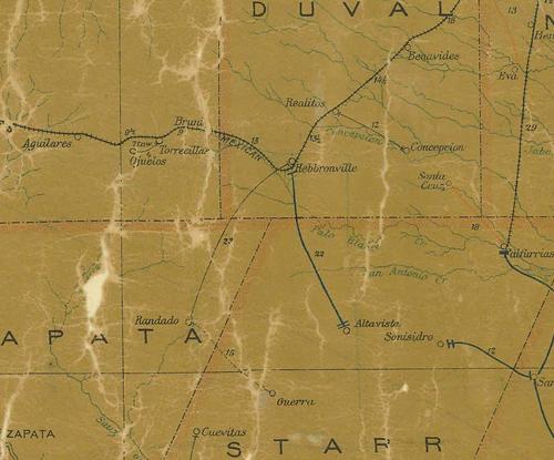
1907 postal map showing Guerra in Starr County
before Jim Hogg County was formed
From Texas state map #2090
Courtesy Texas General Land Office
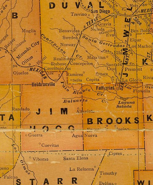
1920s map showing Guerra in Jim Hogg County
From Texas state map #10749
Courtesy Texas General Land Office
Texas Escapes, in its purpose to preserve historic, endangered and vanishing Texas, asks that anyone wishing to share their local history, stories, landmarks and vintage/historic photos, please contact us.