Distance between Namakkal and Panipat, Namakkal to Panipat Distance (original) (raw)
- Political Map of India
- States and Capitals of India
- Districts of India
- Physical Map of India
- India Outline Map
- India River Map
- India Satellite Map
- India Zone Map
- Tier I And Tier II Cities of India
- Per Capita Income of India
- Climate Map of India
- Temperature Map of India
- India Seismic Zone Map
- India Topographic Map
- Mountain Ranges in India
- Soil Map of India
- Vegetation Map of India
- Lakes in India
- Telecom Circles Map
- Hydro Power Plants in India
- Thermal Power Plants in India
- Nuclear Power Plants in India
- Pre Partition Map of India
- Annual Rainfall in India
- Water Resources of India
- Jyotirlinga Shrines in India
- Map of Ruling Parties of India
- India Map in Various Languages
- India Road Map
- India Railway Map
- Airports in India
- National Highways in India
- Railway Zones Map of India
- Konkan Railway
- Delhi Metro
- Air Network in India
- Ports in India
- Tourist Places in India
- Religious Places in India
- Char Dham Yatra
- Beaches in India
- Hill Stations in India
- Hotels in India
| | | | | - | |
 |
 |
|---|
The driving distance from to is:
| Source »» | Namakkal , Tamil Nadu |  |
Destination »» | Panipat , Haryana |
|---|
 |
Driving Direction Map from Namakkal to Panipat |  |
|---|
| Directions to be Taken | Map |
|---|
| | Find Locations from Namakkal | | | ------------------------------ | |
- Namakkal to Abu Road
- Namakkal to Adilabad
- Namakkal to Agartala
- Namakkal to Agra
- Namakkal to Ahmedabad
- Namakkal to Ahmednagar
- Namakkal to Ahwa
- Namakkal to Aizawl
- Namakkal to Ajanta
- Namakkal to Ajmer
- Namakkal to Akbarpur
- Namakkal to Akola
- Namakkal to Alappuzha
- Namakkal to Alibag
- Namakkal to Aligarh
- Namakkal to Alipore
- Namakkal to Alirajpur
- Namakkal to Allahabad
- Namakkal to Alleppey
- Namakkal to Almora
- Namakkal to Along
- Namakkal to Alwar
- Namakkal to Amalapuram
- Namakkal to Ambaji
- Namakkal to Ambala
- Namakkal to Ambasa
- Namakkal to Ambikapur
- Namakkal to Amravati
- Namakkal to Amreli
- Namakkal to Amritsar
- Namakkal to Amroha
- Namakkal to Anand
- Namakkal to Anantapur
- Namakkal to Anantnag
- Namakkal to Angul
- Namakkal to Anini
- Namakkal to Anjaw
- Namakkal to Anugul
- Namakkal to Anuppur
- Namakkal to Ara
- Namakkal to Arambagh
- Namakkal to Araria
- Namakkal to Ariyalur
- Namakkal to Asansol
- Namakkal to Ashoknagar
- Namakkal to Auli
- Namakkal to Auraiya
- Namakkal to Aurangabad
- Namakkal to Ayodhya
- Namakkal to Azamgarh
| | Driving Directions Distance Chart of Cities of India Distance Maps of India National Highways of India Road Map of India India Rail Network Air Network in India Airports in India Seaports in India | | --------------------------------------------------------------------------------------------------------------------------------------------------------------------------------------------------------------------------------------------------------------------------------------------------------------------------------------------------------------------------------------------------------------------------------------------------------------------------------------------------------------------------------------------------------------------------------------------------------------------------------------------------------------------------------------------------------------------------------------------------------------------------------------------------- |
DISTANCE CALCULATOR
LOOKING FOR SHORTER ROUTES
Click on the buttons to select your Cities and press Submit
![]()
![]() ---------------------------------------------------------------------------------------------------------------------------------
---------------------------------------------------------------------------------------------------------------------------------


Advertise with us Let Your Voice be Heard by 1O Million Users in India
| | | | | - | |
| | | | | - | |
FAQs and Answers on Indian History and Geography
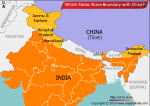
Which States Share Boundary with China?India, in total, shares land borders with 6 sovereign countries. China is one of those. Below are the Indian states which share borders with the country. 1. Jammu and Kashmir This northern state of India is mostly located in the Himalayan mountains. It shares a… Read More...
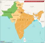
Which States Share Boundaries with Pakistan? There are four states that share a border with Pakistan, namely, Jammu and Kashmir, Punjab, Rajasthan, and Gujarat. The India Pakistan Border is quite intriguing. Since India has installed 1,50,000 flood lights on… Read More...
Which Places in India Still Largely Speak Sanskrit?Sanskrit is considered as Dev Bhasha, the language of Gods. It has a history of around 3500 years. It used to be a primary language of ancient India. Its earliest form Vedic Sanskrit, was prevalent from 1500 500 BCE. However, it is fading… Read More...
BUY MAPS ONLINE
 Delhi City Map INR 1499 view details
 India Detailed Map INR 1499 view details
 Maharashtra Large Map INR 1499 view details
 Mumbai City Map INR 1499 view details
 Digital Map of India INR 999 view details
EU GDPR Update:
MapsofIndia has updated its Terms and Privacy Policy to give Users more transparency into the data this Website collects, how it is processed and the controls Users have on their personal data. Users are requested to review the revised Privacy Policy before using the website services, as any further use of the website will be considered as User's consent to MapsofIndia Privacy Policy and Terms.
We follow editorialcalls.org for border and boundary demarcations
- India Flag
- Geography of India
- History of India
- Economy of India
- Culture of India
- Who is Who
- Languages in India
- National Symbols
- Why India Matters
- Road Map of India
- National Highways
- Indian Railways
- Metro Maps
- Delhi Metro Map
- Air Network in India
- Airports in India
- Ports in India
- Konkan Railway
- Hotels in India
- Tourist Places in India
- Historical Places
- Taj Mahal India
- Religious Places
- Hill Stations in India
- Beaches in India
- Wildlife Sanctuaries
- Monuments of India
- Custom Maps
- GIS Services
- On this Day in History
- Current Events Archive
- India Events
- Map Games
- Ikaai Land
- India Quiz
- I Know My India Game
