Kullu District Map (original) (raw)
| *Map showing National Highway, Major Roads, District Headquarters, Major Towns, Rivers and etc in Kullu District. | Disclaimer |
|---|
Close
Disclaimer: All efforts have been made to make this image accurate. However Mapping Digiworld Pvt Ltd and its directors do not own any responsibility for the correctness or authenticity of the same.
| | Major Districts of Himachal Pradesh | | | -------------------------------------- | |
 |
 |
 |
 |
|---|---|---|---|
| Kangra District Map | Kullu District Map | Mandi District Map | Chamba District Map |
 |
 |
 |
 |
| Shimla District Map | Solan District Map | Una District Map | Bilaspur District Map |
| other districts of Himachal Pradesh >> |
| | Travel Map of Himachal Pradesh | | | --------------------------------- | |
| 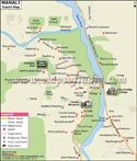 |
| 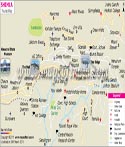 | |
| ------------------------------------------------------------------------------------------------------------------------------------------------------------------- | ---------------------------------------------------------------------------------------------------------------------------------------------------------------------------------------- | |
| Manali Travel Map | Shimla Travel Map | |
| | | | |
| |
| ------------------------------------------------------------------------------------------------------------------------------------------------------------------- | ---------------------------------------------------------------------------------------------------------------------------------------------------------------------------------------- | |
| Manali Travel Map | Shimla Travel Map | |
| | | | |
Kullu a traveler's paradise is a district of Himachal Pradesh. It is situated at an altitude of 1230 m. The total area of Kullu is 5,503 sq. km. It comprises of a total population of 381,571 according to the census of 2001.The places that have been an all time favorite of the tourists from India and abroad are
- Bijli Mahadev Shrine
- Raghunathji Temple
- Vaishno Devi Temple
- Manikaran
| Total /Rural/ Urban | Population | Child Population in the age group 0-6 | Literates | ||||||
|---|---|---|---|---|---|---|---|---|---|
| Persons | Males | Females | Persons | Males | Females | Persons | Males | Females | |
| T | 4,37,474 | 2,24,320 | 2,13,154 | 50,041 | 25,504 | 24,537 | 3,10,487 | 1,76,552 | 1,33,935 |
| R | 3,96,216 | 2,02,418 | 1,93,798 | 46,089 | 23,445 | 22,644 | 2,77,004 | 1,57,984 | 1,19,020 |
| U | 41,258 | 21,902 | 19,356 | 3,952 | 2,059 | 1,893 | 33,483 | 18,568 | 14,915 |
| Facts of Kullu District | |
|---|---|
| State | Himachal Pradesh |
| District | Kullu |
| District HQ | Kullu |
| Population (2011) | 437903 |
| Growth | 14.76% |
| Sex Ratio | 942 |
| Literacy | 79.4 |
| Area (km2) | 5503 |
| Density (/km2) | 79 |
| Tehsils | Kullu, Nirmand, Banjar, Manali |
| Lok Sabha Constituencies | Mandi |
| Assembly Constituencies | Manali, Kullu, Banjar, Anni (SC) |
| Languages | Himachali including Kanashi, Hindi |
| Rivers | Beas |
| Lat-Long | 31.835566,77.474785 |
| Travel Destinations | Manali, Gauri-Shankar Temple, temple of Tripura Sundri Devi, Krishna temple of Murli Dhar, temple of Devi Sarvali, Shiva Temple, temple of Gayatri Devi, Vashishta Muni Temple, Arjun Gufa, Nehru Kund, Solang Valley, Kullu valley, The Hidimba Devi Temple etc. |
| Government Colleges/Universities | Govt. Degree College etc. |
Last Updated on : January 13, 2022