TN county landforms (original) (raw)
TN county landforms
Tennessee Landforms by county
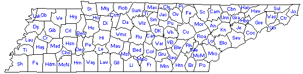
Click on the county on the map or in the list below to see the landforms of that county and a GPS file (county.gpx) to download to your GPS.
Anderson Bedford Benton Bledsoe Blount Bradley Campbell Cannon Carroll Carter Cheatham Chester Claiborne Clay Cocke Coffee Crockett Cumberland Davidson Decatur DeKalb Dickson Dyer Fayette Fentress Franklin Gibson Giles Grainger Greene Grundy Hamblen Hamilton Hancock Hardeman Hardin Hawkins Haywood Henderson Henry Hickman Houston Humphreys Jackson Jefferson Johnson Knox Lake Lauderdale Lawrence Lewis Lincoln Loudon Macon Madison Marion Marshall Maury McMinn McNairy Meigs Monroe Montgomery Moore Morgan Obion Overton Perry Pickett Polk Putnam Rhea Roane Robertson Rutherford Scott Sequatchie Sevier Shelby Smith Stewart Sullivan Sumner Tipton Trousdale Unicoi Union VanBuren Warren Washington Wayne Weakley White Williamson Wilson
USGS physical and cultural features of Tennessee countiesor here
TN county high pointsor other county peaks
TN county maps (pdf's) or Google county map
Wikipedia's county info
Census county info
History of County Formations in Tennessee 1776-1985
Tennessee Division of Geology Bulletin 86 (2009) "Tennessee Topography", topographical data on each county
counties and landform regions
TN USGS 7.5 topo quad maps by county
TN caves per county 2011 also see TN county sinkholes
Tennessee Topography, bulletin #86, David Starnes, 2009, county geography
Tennessee's National Register of Historic placesby county
Tennessee lookout towers by county
Wayhoo's USGS Tennessee county waypoints
Google map with US county overlay
Tennessee landforms home waterfalls arches rocks peaks balds lakes regions county
since 4/26/05 ©Tom Dunigan