Pennsylvania Base and Elevation Maps (original) (raw)


The two maps shown here are digital base and elevation maps of Pennsylvania. Higher resolution maps like these and many other digital maps, wall maps, custom radius maps, travel maps, travel guides, map software, and globes and games, for business and the classroom, are available to purchase fromMaps.com - The World's Largest Maps Store!.Enter code "NETSTATE" at checkout for 10% off orders of $50 or more!
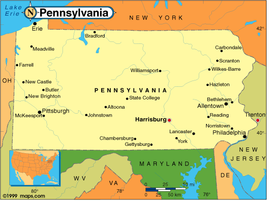 |
This Pennsylvania base map highlights the location of the state capitol,Harrisburg, and major cities throughout the state. Portions of Pennsylvania's border states,New York,New Jersey,Delaware,Maryland,West Virginia, andOhio are included to show the relationship between Pennsylvania and its neighbors. A small inset shows Pennsylvania among the other 47 Continental United States. |
|---|---|
| Pennsylvania base map, Courtesy of Maps.com. |
|
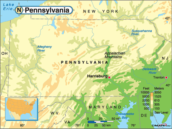 |
This elevation map of Pennsylvania illustrates the number of feet or meters the state rises above sea level. Pennsylvania's lower elevations are in the southeast part of the state and along the Delaware and Susquehanna Rivers. The low point is the Delaware River at sea level.The high point in the state isMount Davis, the peak of a long ridge calledNegro Mountain, and can be found in southern Pennsylvania about four miles north of the Maryland border. Located inForbes State Forest, Somerset County and about five miles northwest ofSalisbury, Mount Davis rises 3,213 feet above sea level. |
| Pennsylvania elevation map, Courtesy of Maps.com. |
Additional information
Pennsylvania maps: Additional maps and map links from NETSTATE.COM.
Pennsylvania geography: More Pennsylvania geography from NETSTATE.COM.
Purchase Pennsylvania maps: Maps.com - The World's Largest Maps Store!
- Select map type by clicking on "category" to left on destination page.
- Use code NETSTATE at the checkout for 10% off orders of $50 or more!
- Over 6,000 products to choose from!