West Virginia Base and Elevation Maps (original) (raw)


The two maps shown here are digital base and elevation maps of West Virginia.
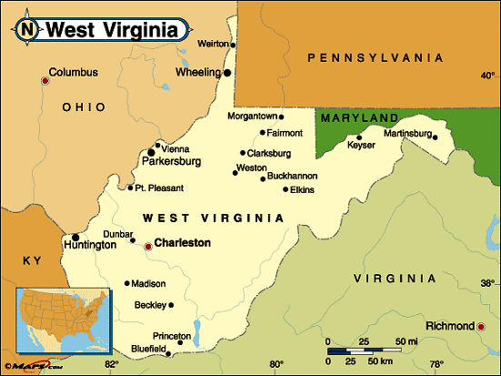 |
This West Virginia base map highlights the location of the state capitol,Charleston, and major cities throughout the state. Portions of West Virginia's border states,Pennsylvania,Maryland,Virginia,Kentucky, andOhio are included to show the relationship between West Virginia and its neighbors. A small inset shows West Virginia among the other 47 Continental United States. |
|---|---|
| West Virginia base map | |
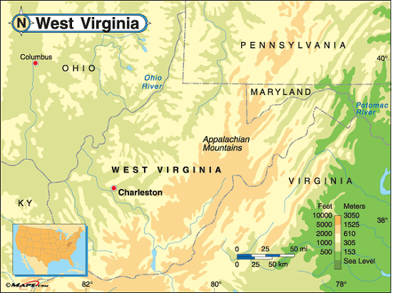 |
This elevation map of West Virginia illustrates the number of feet or meters the state rises above sea level. The landscape of West Virginia is quite rugged, as the Appalachian Mountain system passes from north to south through the state. The lower areas of West Virginia are found along the rivers and streams that wind their courses through the valleys of the Blue Ridge and Allegheny Mountain Ranges. The lowest point in the state is at the Potomac River in Jefferson County; 240 feet above sea level.The highest point in the state isSpruce Knob in Pendleton County. Located in thesoutheastern part of the state, within the Spruce Knob National Recreation Area, within theMonongahela National Forest, and about 130 miles west ofCharleston, Spruce Knob rises 4,863 feet above sea level. It's the tallest mountain in the Allegheny Mountains. [ Topographic map | Arial photograph ] |
| West Virginia elevation map |
Additional information
West Virginia maps: Additional maps and map links from NETSTATE.COM.
West Virginia geography: More West Virginia geography from NETSTATE.COM.