Texas Flood of 1935. (original) (raw)
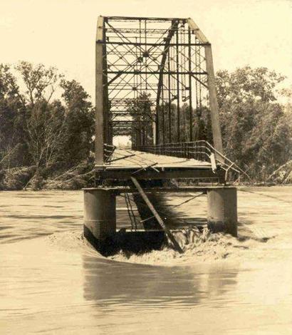
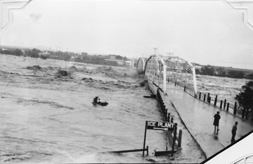
1935 Flood - Colorado River Bridge in Columbus, Texas
Photo courtesy Nesbitt Memorial Library 00160
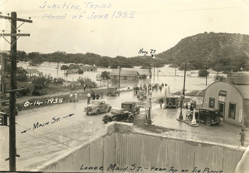
The April showers of 1935 may or may not have brought May flowers. If they had, they would almost certainly have been swept away into the Gulf of Mexico. Central and South Central Texas experienced heavy rains that Spring which greatly affected Austin, San Antonio and lesser cities like Junction, Uvalde and D'Hanis.
Although Texas was hit with record-breaking rainfall in 2007, vastly improved infrastructure prevented the devastation which Central Texas and the Hill Country suffered in the 30s. (See Rob Hafernik's Dam Fun: A July 4th Trip Up the Chain of Highland Lakes.)
The 2007 flooding around Burnet, Marble Falls and Cedar Park brought nearly 20 inches of rain in a 24-hour period which is far more than the 9.21 inches of rain Austin received for the month of May 1935 or the 9.71 inches that June. But when one factors in ground saturation and no run-off channels, the resulting damage of the 1935 rains was far worse.
1935 Flood - Austin, Texas
Photographer: H.M. Stene, a cartographer for TXDoT
1935 Flood - Austin, Texas
Courtesy of Austin History Center, PICA 008484-A
In 1935, while Austin was receiving its deluge, San Antonio was hit even harder with 14.07 inches in May with 8.41 inches the next month. The stores around Alamo Plaza were flooded in late May and tiny D'Hanis, Texas reported a hard-to-believe 20-24 inches of rain in just 2 Hours and 45 Minutes.
View of Cibolo Creek Bridge on Highway 66 North of San Antonio
River near flood stage.
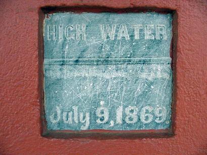
Early to mid-June rains approached 20 inches in many other smaller communities from Uvalde to Austin. The Llano, Colorado and Pedernales Rivers all reached flood stage, affecting the cities of Junction, Llano, and Fredericksburg. On June 14 and 15 the Colorado River was just 1 foot below the record reached in July of 1869.
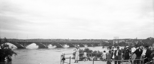
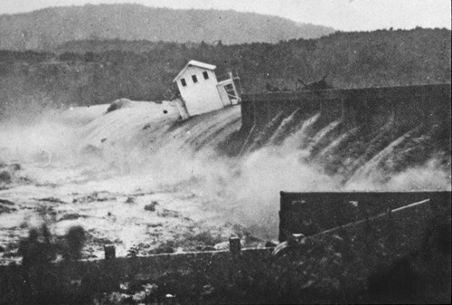
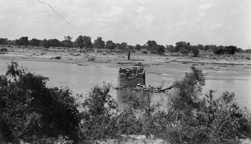
The 1935 flood of the Colorado River in Travis County
Photo courtesy TXDoT
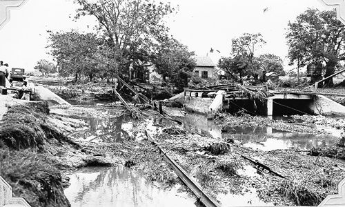
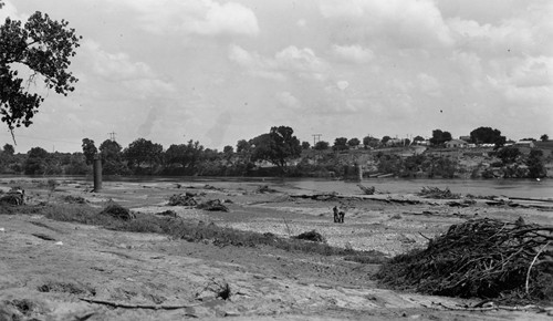
The 1935 flood of the Colorado River in Travis County
Photo courtesy TXDoT
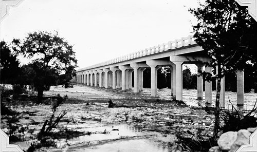
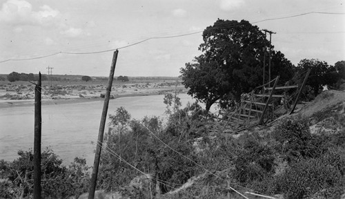
The 1935 flood of the Colorado River in Travis County
Photo courtesy TXDoT
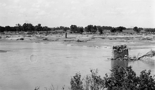
The 1935 flood of the Colorado River in Travis County
Photo courtesy TXDoT
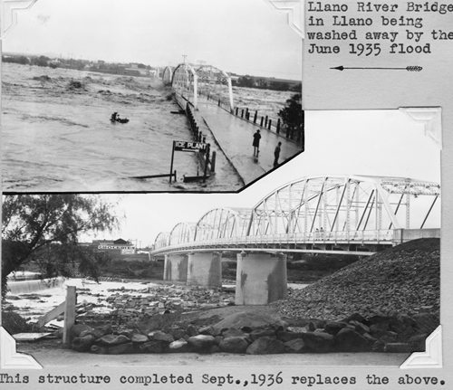
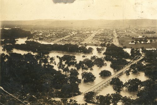
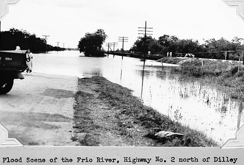
The Llano River crested at its record level ever (at that time). June also brought flooding on the Nueces River and West Nueces River. Flooding extended from north of Brackettville to the Rio Grande (just downstream from Del Rio). Uvalde reported 12.5 inches within a 12 hour period and the total for that day was 17.6 inches.
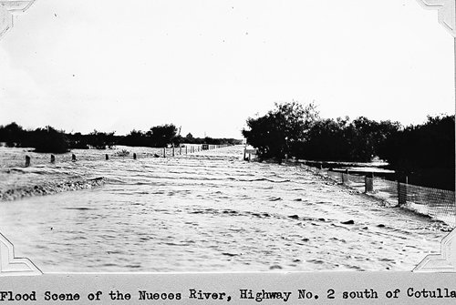
Flood scene of the Nueces River, Highway No. 2 south of Cotulla
DAM FUN: Highland Lakes Dams
Photos and Story by Rob Hafernik
DAMS:
Tom Miller Dam, Mansfield Dam, Max Starke Dam, Wirtz Dam, Inks Dam & Buchanan Dam
LAKES:
Lake Austin, Lake Travis, Lake Marble Falls, Lake LBJ, Inks lake & Lake Buchanan
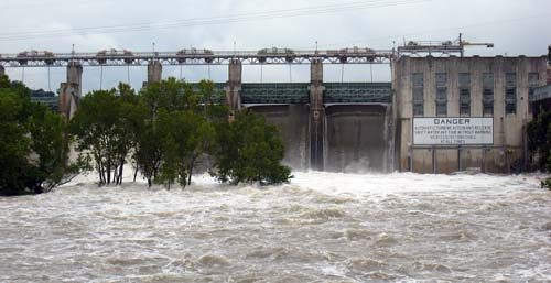
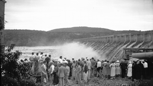
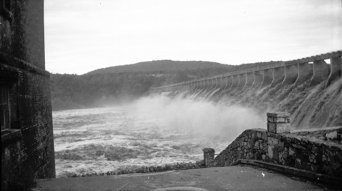
Tom Miller Dam - with three and half floodgates open
See Dam Fun
The Great Flood of 1935
A Narrow Escape
Excerpted from the diary of Maryleene Bolen Christensen
Shared by her daughter, Carolyn Oldfather A recent letter from Carolyn Oldfather included an excerpt from her mother�s diary. It�s a first-hand account of a narrow escape from almost certain destruction from the roiling waters of the (usually placid) Llano River. Ms. Oldfather and her sister are preserving her mother�s work as a family project and we thank her for allowing us to share this account with our readers. What follows is an entry from the Spring of 1935, when the author, Maryleene Bolen Christensen was approaching her 13th birthday: - Editor �When we got to Llano we stayed with Uncle Walt and Mildred... for a little while. I guess Mama and Daddy rented a little cabin by the river. As I remember the place, it must have had one room and a little lean-to where we kids slept.
Marguriete [Maryleene�s sister] and I had so much fun while we lived in Llano � we would play on the spillway below the dam. The spillway was just behind Uncle Walt�s and Mildred�s house.I think Mildred and Uncle Walt were renting [that] great big old house.
While we stayed with them, we could hear the water splashing over the dam and down the spillway at night and we loved the sound. The bridge across the Llano River was one mile across and Marguriete and I had lots of fun running across it.
One day Mama decided to go back home � maybe because it had started to rain � or was it because she was just tired of living that way. Anyway, we went back to San Angelo, and it was a good thing � because the day after we left, the river flooded and washed that big bridge away, and the cabin we�d lived in and all the lovely old trees that had been growing along the river banks for many years. I�m sure many of them were big pecan trees. It was total devastation!�
The 1892 Llano River Bridge in Llano being washed away by the 1935 flood


1940sl map showing Colorado River coursing through Fayette, Colorado and Wharton Counties
Courtesy Texas General Land Office
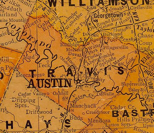
1920s map showing Colorado River coursing through Travis County
Courtesy Texas General Land Office
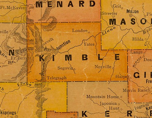
1920s map showing Llano River coursing through Kimble County
Courtesy Texas General Land Office
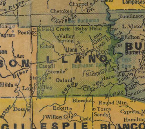
1940s map showing Llano River coursing through Llano County
From Texas state map #4335
Courtesy Texas General Land Office