Jana Horvat | Research Centre of the Slovenian Academy of Sciences and Arts (original) (raw)
Papers by Jana Horvat

In: J. Horvat, S. Groh, K. Strobel, M. Belak (eds.), Roman urban landscape. Towns and minor settlements from Aquileia to the Danube, Opera Instituti Archaeologici Sloveniae 47, 429-446, 2024
Nove raziskave Petovione v nasprotju s starejšimi domnevami kažejo, da je legijski tabor v 1. st.... more Nove raziskave Petovione v nasprotju s starejšimi domnevami kažejo, da je legijski tabor v 1. st. ležal na levem bregu Drave, na območju Vičave in Panorame. Lokacijo dokazuje izkopano obzidje s stolpom (lesena in zidana faza), dodatno pa jo potrjujejo drobne najdbe vojaške opreme in obrisi domnevnih vojaških barak, ki so vidni na georadarskih posnetkih. V drugem delu prispevka na podlagi georadarskih raziskav na Panorami predstavljamo urbanistični razvoj kolonije Petovione v 2. in 3. st. Sledijo kratki pregledi novejših raziskav svetišč, gospodarskih dejavnosti (lončarstvo, steklarstvo, pridobivanje marmorja in trgovina z marmornimi izdelki) ter mestnega teritorija.

Alernator 29, 2023, https://www.alternator.science/sl/daljse/rimljani-na-ptujski-panorami/, 2023
Panorama s sprehajalno potjo, ki poteka v smeri antične ulice in ob liniji obzidja legijskega tab... more Panorama s sprehajalno potjo, ki poteka v smeri antične ulice in ob liniji obzidja legijskega tabora. V ospredju je marmorna kopija nagrobnika iz 3. st. Pogled proti jugovzhodu. Foto: Luka Pukšič, Arhiv ZRC SAZU-Inštitut za arheologijo Na Ptuju, kjer je mogoče najlažje prečkati Dravo, sta se že od davnine križali pomembni magistrali. T. i. jantarjeva pot je vodila iz Italije na sever proti Baltiku, druga je v smeri vzhod-zahod potekala po Dravi oziroma ob njej. Grajski grič, s katerega je mogoče nadzirati reko in poti, je verjetno neprekinjeno poseljen že sedem tisočletij, od zgodnje bakrene dobe naprej. V 1. stoletju pr. n. št. je območje Ptuja ležalo na jugovzhodu Noriškega kraljestva (http://iza.zrcsazu.si/pdf/Sasel_Kos_Situla_36_1997.pdf) , ki je zajemalo Vzhodne Alpe z obrobjem. Rimljani (https://zalozba.zrcsazu.si/sl/publikacije/v-srcu-rimskega-imperija) so kraljestvo leta 15 pr. n. št. brez bojev priključili svoji državi, v panonskih vojnah od leta 12 do leta 8 pr. n. št. pa so zavzeli Ilirik (https://iza2.zrc-sazu.si/sl/publikacije/rimsko-osvajanje-zahodnegabalkana#v) (tako so imenovali prostor med Jadranskim morjem in Donavo). Celotno ozemlje do Donave so postopoma zasedli do sredine 1. stoletja n. št. Ime Poetovio (http://iza.zrc-sazu.si/pdf/Sasel_Kos_Poetovio_2014.pdf) , kot so naselbino na Ptuju imenovali Rimljani, verjetno izvira še iz prazgodovine. Petoviona je dogovorjena slovenjena oblika, Ptuj in nemško Pettau pa sta neposredna naslednika latinskega imena.
![Research paper thumbnail of J. Horvat, RESULTS OF THE EXISTING SITUATION ANALYSIS (ESA) AND THE ANALYSIS OF GOOD PRACTICES (GP) [J.H.];J. Horvat, J. Krajnc, XII - MANAGEMENT PLAN AND PILOT ACTION FOR THE ARCHAEOLOGICAL PARK POETOVIO (PTUJ)](https://attachments.academia-assets.com/113723754/thumbnails/1.jpg) ](
](In: R. Perna (ed.), COMMON SUSTAINABLE GOVERNANCE MODEL FOR ARCHAEOLOGICAL PARKS, 2023
An Archaeological Park is a territorial area where a predominantly archaeological value of the la... more An Archaeological Park is a territorial area where a predominantly archaeological value of the landscape has been identified, integrated with the presence of historical, cultural, and environmental values, an object of a project for an integrated and sustainable development, in close cooperation with the local community.

In: J. Horvat , F. Bernardini, M. Belak (eds.), The Roman conquest beyond Aquileia (II−I centuries BC), Opera Instituti Archaeologici Sloveniae 45, 2023
On the San Rocco hill, remote sensing and field-walking campaigns indicated the existence of a la... more On the San Rocco hill, remote sensing and field-walking campaigns indicated the existence of a large Roman military camp (Camp 1) extending over the whole area, a small camp on the top of the hill (Camp 2), and a large area south of it where orthogonal structures have been identified. To clarify the function and chronology of the remains, three trenches were opened in 2019 and 2021. Part of a terrace construction dated between the end of the 2nd and mid-1st century BC was found in Trench 1. Together with orthogonal crop and shadow marks, it indicates that a large part of the hill was arranged in terraces. The northern rampart of Camp 1 was excavated in Trench 3. The 6.5-m-wide fortification of Phase 1 consisted of four lines of defence combining a low stone wall with a wooden superstructure, protected by a palisade, two lines of wooden obstacles, and a stone escarpment. The structure, dated to the 2nd century BC, was destroyed by a fire and restored by adding an earth bank in Phase 2 (end of the 2nd or beginning of the 1st century BC). Camp 2 on the top of the hill was protected by a low walkway that consisted of an earth rampart reinforced on the inside by a row of stones and on the outside by a stone accumulation (Trench 2). Its construction in Phase 1 is dated into the pre-Caesarean period and the renovation in Phase 2 into the mid-1st century BC. Keywords: San Rocco, northern Istria, Late Republican period, 2nd century BC, 1st century BC, military camp, early Roman military architecture, caliga hobnails

In: Roma e il mondo adriatico, II , 2022
The contribution discusses select cremation cemeteries from Slovenia that lie in the hinterland o... more The contribution discusses select cremation cemeteries from Slovenia that lie in the hinterland of Tergeste. In their cist graves, the proximity to indigenous settlements and continuity of burial, the cemeteries at Socerb,
Rodik and Žirje can be associated with the indigenous inhabitants living here in the 1st and 2nd centuries AD. Of those, the cemetery at Rodik was probably the burial grounds of the tribe of Rundictes, mentioned in an
inscription from the mid-1st century AD. The cemetery at Vipava, to the contrary, includes graves from the 1st and 2nd centuries AD that had constructions of tegulae, contained several urns, with individual urns in some cases holding the remains of more than one deceased, and revealed a rather standardised set of grave goods (jug, cup, coin). This cemetery is seen as the burial grounds of a community that had perhaps moved here from the Venetic area in the early 1st century AD at the latest.

Arheološki vestnik 73, 2022
The cemetery in Marof is associated with the Roman settlement at Ig, a vicus on the territory of ... more The cemetery in Marof is associated with the Roman settlement at Ig, a vicus on the territory of colonia Emona. The archaeological excavations here brought to light 27 cremation and one inhumation burial dating from the second half of the 1st to the late 3rd or 4th century, most of them heavily disturbed or robbed. The form of the grave pits and the goods correlate well with those from other cemeteries in Emona’s countryside. In its south-western part, the cemetery included walled burial enclosures, one of which was excavated and found to hold four cremations. The slightly separated north-eastern part held four groups of burials, likely also forming family burial plots, though unwalled. Three of these groups included a relatively rich burial of a man, from the second half of the 1st or first half of the 2nd century, interred with a knife and a scraper possibly associated with tanning. This division of the cemetery and the differences in the burial manner suggest we could be dealing with two different population groups.Excavations also unearthed several phases of a road passing through the cemetery. Beside this road, a large pit was dug between the late 4th and the 6th century, and a tombstone, as well as several fragments of other monuments thrown into it.Keywords: Slovenia; Ig; Marof; Roman period; cemetery; burial enclosure; burial rite; grave goods; tanning; social groups

Journal of Roman Archaeology, 2021
Recent investigations at Grociana piccola, a site in northeastern Italy consisting of two sub-rec... more Recent investigations at Grociana piccola, a site in northeastern Italy consisting of two sub-rectangular fortifications, offer the rare opportunity to investigate Early Roman military architecture outside the Iberian peninsula. Excavations have revealed an inner rubble masonry rampart dated to the 2nd c. BCE by associated pottery, mainly amphora remains. This date suggests that the fortification was in use during the first Roman conquest and/or later campaigns of the 2nd c. BCE, providing one of the earliest and smallest examples of a military fort. The fort's ramparts were built using the same building technique as much larger 2nd-c. BCE military camps. Another trench uncovered the northeastern corner of the outer rampart and a probable tower or artillery platform which can be connected to a temporary camp built during the mid-1st c. BCE.

In: Visentini P., Cividini T., Schindler Kaudelka E., Ventura P. (a cura di), L’ARCHEOLOGIA DI UN TERRITORIO ATTRAVERSO LA CERAMICA: ABITATI, PRODUZIONI, SCAMBI E COMMERCI NEL FRIULI ROMANO, Atti della Giornata di Studio (Udine 26 ottobre 2020), 2021
From the mid-2nd to the mid-1st century BC the inhabitants of Ocra and Nauportus, settlements of ... more From the mid-2nd to the mid-1st century BC the inhabitants of Ocra and Nauportus, settlements of Roman merchants on the Amber Route, used exclusively Roman pottery such as is also known from contemporary contexts in Friuli. In contrast, the indigenous population of Emona, a contemporary settlement further inland along the Amber Route, predominantly used locally made pottery; the influx of Roman pottery only gradually began increasing in the first half and middle of the 1st century BC. In areas removed from the main route, Roman
pottery is all but absent until the Early Augustan period. The Augustan period brought a drastic increase in the import of goods from Italy and other regions of the Mediterranean, which is linked to an organised supply of goods and immigration from Italy. Specifically, the pottery unearthed in the fort at Obrežje and the settlement at Vičava in Ptuj (Poetovio) mirrors the supply of the army on operations in the 1st century AD. The ceramic contexts of the villas at Školarice and Šentoma, in the territory of Tergeste, and the Fluvio Frigido vicus, in the territory of Aquileia, clearly show that the western sector of Slovenia formed
part of the same trading network as Friuli, whereas the areas of southern Noricum (Celeia) and south-western Pannonia (Poetovio) gravitated towards the Danube basin and northern Gaul. At least from the mid-1st century AD onwards, potters in Emona, Celeia and Poetovio
produced local fineware, plain tableware and oil lamps modelled on imported wares. By the early 2nd century AD, local production prevailed over imported goods.

In: Adriatlas 4. Produzioni artigianali in area adriatica: manufatti, ateliers e attori (III sec. a.C. – V sec. d.C.), 2021
The western part of present-day Slovenia belonged to Regio X of Italy in the Early Imperial Perio... more The western part of present-day Slovenia belonged to Regio X of Italy in the Early Imperial Period and for the most part to the province of Venetia et Histriain the Late Roman period. It is a transitional area, crossed by the prehistoric Amber Route and later the viae publicae Aquileia–Emona–Carnuntum and Emona–Sirmium that connected the northern Adriatic with the central Danube Basin and the northern Balkans.

Periodico di Mineralogia 90, 2021
Quite rare pottery shards showing a paste rich in black sand particles, possibly igneous minera... more Quite rare pottery shards showing a paste rich in black sand particles, possibly igneous minerals, have been discovered in late Republican Roman sites of Trieste area (north-eastern Italy) and south-western Slovenia in the Caput Adriae. Most of them belong to late Greco-Italic and Dressel 1 amphora types, in use from the end of the 3rd and the beginning of 1st centuries BC. Following a methodological procedure based on the analysis of igneous temper, proved to be particularly effective by several scholars, numerous minerals have been extracted from the surface of 16 pottery shards, without causing any visible damage to them. Microprobe analysis has allowed the identification of igneous minerals (olivine, clinopyroxene, feldspar and garnet), most likely originating from the Roman or Campanian magmatic provinces. The chemistry of garnets, indicated in the past as a possible tracer of ancient commerce but no longer used in the last decades to study Italian late Republican pottery, has proved to be a promising tool to distinguish among the two magmatic provinces. According to our study, most of the investigated garnets-bearing samples would originate from Somma-Vesuvius while some of them from Latium.

In: Življenje v Alpah. Življenje v Alpah nekoč in danes - od prve obljudenosti visokogorskega sveta pred več tisoč leti do trajnostnega razvoja turizma danes, 2020
During two decades of field research in mountain areas, field walks and test excavations revealed... more During two decades of field research in mountain areas, field walks and test excavations revealed about 80 archaeological sites, spanning from the 4th millennium BC to the end of the 1st millennium AD. This contribution presents their chronology and typology in relation to altitude. On the basis of radiocarbon dates, the earliest human activity in mountain areas can be dated to the end of the 4th and the first half of the 3rd millennium BC. Population first peaked in the Middle and Late Bronze Age, especially in the early Urnfield period (13th –11th centuries BC). Sites from the Roman (1st–4th centuries AD), Late Antique (5th–6th centuries), and Early Medieval (7th–10th centuries) periods are relatively common. In the Kamnik-Savinja Alps and the Karavanke mountains, the number of sites decreases significantly in the Late Antique period and there is discontinuity between Late Antiquity and the Early Middle Ages. In the Julian Alps, however, there was no significant hiatus between the Late Antique and Early Medieval periods.

In: J. Horvat, I. Lazar, A. Gaspari (eds.), Manjša rimska naselja na slovenskem prostoru / Minor Roman settlements in Slovenia, Opera Instituti Archaeologici Sloveniae 40, 2020
The conclusion of the book takes a comprehensive and comparative look at the minor Roman settleme... more The conclusion of the book takes a comprehensive and comparative look at the minor Roman settlements in Slovenia using uniform criteria. The comparison reveals four main groups that likely represent the most significant types of minor Roman settlements in the area: minor urban settlements, roadside stations, remote settlements and hilltop settlements, the last limited to the region of Notranjska. Most were established in the 1st or 2nd centuries and abandoned in the first half of the 5th century. The settlements of the first two groups were located along the main roads and boasted buildings of quality construction, public buildings and epigraphic monuments revealing a population that included immigrants from Italy and members of the local elite, some of whom were indigenous in origin. The settlements of the third and fourth groups were removed from important roads, their buildings more modest in character and their populations presumably largely autochthonous.

In: J. Horvat, I. Lazar, A. Gaspari (eds.), Manjša rimska naselja na slovenskem prostoru / Minor Roman settlements in Slovenia, Opera Instituti Archaeologici Sloveniae 40, 2020
Nauportus (modern Vrhnika) was located on the route between Italy and the Middle Danube area, nea... more Nauportus (modern Vrhnika) was located on the route between Italy and the Middle Danube area, near the springs of the Ljubljanica river, where the waterway towards the east started. The original settlement of the Celtic tribe of the Taurisci was controlled by the Romans from the end of the 2nd century or the beginning of the 1st century BC onwards. In the mid-1st century BC at the latest, Nauportus had the status of vicus in the territory of Aquileia. The magistri vici were freedmen of Aquileian merchant families. In the Augustan period, a fortified storehouse complex with a port for transit traffic and the supply of the legions in the Middle Danube area stood at Dolge njive on the right bank of the Ljubljanica. The Dolge njive complex was abandoned after the Augustan period, which was also the time when Nauportus lost its principal role in the wider area. The settlement at Breg on the other side of the river and along the road towards Emona kept developing. The strategic significance of the area again becomes apparent in the Late Roman period, when the fort at Gradišče and the tower at Turnovšče were built, perhaps as early as the end of the 3rd century. In the 4th century, a defence wall was built on the hills west of Nauportus as part of the Claustra Alpium Iuliarum defence system. The settlement at Breg was probably abandoned at the same time as most of the lowland settlements, i.e. in the first half of the 5th century.

In: The geography of Slovenia: small but diverse, World Regional Geography Book Series, 2020
A brief overview of the history of Slovenia as told by archaeology runs from prehistory to the Sl... more A brief overview of the history of Slovenia as told by archaeology runs from prehistory to the Slavs, from the earliest human traces some 300,000 years ago, through the momentous discovery of a purported Neanderthal musical instrument in Divje babe I Cave, the Eneolithic pile-dwellers in the Ljubljansko barje that used two-wheeled carts, the hoards and hillforts of the Bronze Age, and the prosperity of the Hallstatt period with a peak in artistic expression in situla art, to the arrival of the Celts, who mark the end of prehistory. In the last decades of the first century BC, the territory of what is now Slovenia was incorporated into the Roman Empire. Newcomers and indigenous inhabitants lived side by side in a number of flourishing towns, used newly constructed roads, and urbanized the countryside. The period of prosperity ended in late Antiquity with the decline of the Roman Empire. In the face of danger, the population either migrated to safer regions outside the borders of what is now Slovenia or retreated to naturally well-protected peaks that were additionally fortified. The early Slavs entered such a world but left little evidence in the archaeological record.

In: Dolenz, H., Strobel, K. (eds.). Chronologie und vergleichende Chronologien zum Ausgang der Römischen Republik und zur Frühen Kaiserzeit, Kärntner Museumsschriften 87, 2019
Italian ware prevails among the pottery from the early Imperial context from Nauportus. The local... more Italian ware prevails among the pottery from the early Imperial context from Nauportus. The local/regional origin is presumed only for some coarse kitchenware items. The chronology of the contexts was confirmed by dedrochronological dating of the wooden barrels.

Les/Wood 68/1, 2019
During archaeological excavations on wet sites in the area of the ancient Roman Nauportus (today’... more During archaeological excavations on wet sites in the area of the ancient Roman Nauportus (today’s Vrhnika,Slovenia) in 2005, preserved parts of various wooden structures were discovered. We collected and investigated almost 500 samples of wood from these. Half of the samples were silver fir (Abies alba) and oak (Quercus sp.). In particular,we focused on the dendrochronological investigation of three barrels made of silver fir wood, which were used to consolidate the walls of the three water wells. First, we constructed and dated a silver fir tree-ring chronology with the help of teleconnection. Afterward, we dated the barrels with the end dates: barrel 1 – end date 10 AD, barrel 2 – end date 3 AD, and barrel 3 – end date 10 AD. All dates represent the terminus post quem, after which the barrels were made and used for wells. The time frame for the construction of wells was complemented by the dates we obtained by analysing archaeological finds on the same site. The barrels from Nauportus were compared with contemporaneous barrels from water wells recently excavated in Emona (today’s Ljubljana, Slovenia). The barrels are among the first successfully dendrochronologically dated wooden remains from the 1st Century AD in Slovenia. They will allow for the better dating of stratigraphic archaeological layers, construction phases and individual archaeological finds in the wider area south of the Alps in the period soon after it was occupied by the Romans.

Archaeological and anthropological sciences 12, 2020
This paper presents the results of an international research aimed at investigating the ancient l... more This paper presents the results of an international research aimed at investigating the ancient landscape of the Mali Kras plateau, a sector of northern Istria (southwestern Slovenia). The remains of two main protohistoric hill forts, Mali Kras and Socerb, and a few minor sites were already reported from this area. A cemetery, associated with Socerb hill fort, was in use between the sixth century BC and the first century AD. Airborne LiDAR remote sensing of Mali Kras plateau has allowed to identify several unknown archaeological features, ranging from approximately square features (30 × 30 m) to larger enclosures with different shapes, very long linear features and stone mounds. The elaboration and digitization of high-definition remote sensing data compared with historical cartography, field surveys, targeted small-scale excavations and thermoluminescence dating have been performed in order to decode the complex archaeological palimpsest. The square structures can be attributed to Middle-Recent Bronze Age on the basis of pottery finds. These structures are located close to natural passages from the plateau to the gulf of Trieste, in areas with low visibility and scarcity of soil, which were traditionally used for grazing activities. The other identified enclosures, some of them sharing a similar chronology, were also probably used for pastoral activities but for other purposes since their shape and size are different. Two main long drystone walls define the southeastern sector of Mali Kras plateau in correspondence of the most accessible entrance to the area. The preliminary data and comparisons with similar structures suggest these walls could correspond to protohistoric linear boundaries built to delimit grazing or agricultural areas under direct control of the nearby settlements. The enclosures identified at Mali Kras plateau, most probably connected to herding activities, and perhaps the long linear walls too, could reflect the development of new husbandry practices in the Middle-Recent Bronze Age in the karst areas of the north Adriatic hinterland, such as observed in the alpine territory.

In: C. S. Fioriello, F. Tassaux (eds.), I paesaggi costieri dell’Adriatico tra Antichità e Altomedioevo, Scripta Antiqua 119, AdriAtlas 2 , 2019

Forschungsberichte der ANISA für das Internet 1, (ANISA FB 1) , 2019

In: M. Auer (ed.), Roman Settlements along the Drava River, Ager Aguntinus 3, 2019
The navigable route along the Ljubljanica and Sava rivers connected the south-eastern Alps with t... more The navigable route along the Ljubljanica and Sava rivers connected the south-eastern Alps with the central Danube basin. Located near the springs of the Ljubljanica was the fortified complex of Nauportus that combined the functions of a river port, storage area and trading post, and was active in the Augustan period. During the Roman military operations in Pannonia, it presumably also served as a storage depot on the supply line. The importance of river transport in the area is mirrored in the finds of Early Roman cargo ships in the Ljubljanica, but also in the sanctuary of the goddess Adsalluta and the river god Savus that stood in the vicinity of the most treacherous rapids in the gorge of the Sava. The sanctuary complex provides evidence for the river traffic between the 1st and 3rd centuries. The forts that sprang up along the Sava and the Ljubljanica in the Late Roman period show that navigation increased in this period and the river routes gained in military importance once more.
In: J. Horvat, S. Groh, K. Strobel, M. Belak (eds.), Roman urban landscape. Towns and minor settlements from Aquileia to the Danube, Opera Instituti Archaeologici Sloveniae 47, 429-446, 2024
Nove raziskave Petovione v nasprotju s starejšimi domnevami kažejo, da je legijski tabor v 1. st.... more Nove raziskave Petovione v nasprotju s starejšimi domnevami kažejo, da je legijski tabor v 1. st. ležal na levem bregu Drave, na območju Vičave in Panorame. Lokacijo dokazuje izkopano obzidje s stolpom (lesena in zidana faza), dodatno pa jo potrjujejo drobne najdbe vojaške opreme in obrisi domnevnih vojaških barak, ki so vidni na georadarskih posnetkih. V drugem delu prispevka na podlagi georadarskih raziskav na Panorami predstavljamo urbanistični razvoj kolonije Petovione v 2. in 3. st. Sledijo kratki pregledi novejših raziskav svetišč, gospodarskih dejavnosti (lončarstvo, steklarstvo, pridobivanje marmorja in trgovina z marmornimi izdelki) ter mestnega teritorija.
Alernator 29, 2023, https://www.alternator.science/sl/daljse/rimljani-na-ptujski-panorami/, 2023
Panorama s sprehajalno potjo, ki poteka v smeri antične ulice in ob liniji obzidja legijskega tab... more Panorama s sprehajalno potjo, ki poteka v smeri antične ulice in ob liniji obzidja legijskega tabora. V ospredju je marmorna kopija nagrobnika iz 3. st. Pogled proti jugovzhodu. Foto: Luka Pukšič, Arhiv ZRC SAZU-Inštitut za arheologijo Na Ptuju, kjer je mogoče najlažje prečkati Dravo, sta se že od davnine križali pomembni magistrali. T. i. jantarjeva pot je vodila iz Italije na sever proti Baltiku, druga je v smeri vzhod-zahod potekala po Dravi oziroma ob njej. Grajski grič, s katerega je mogoče nadzirati reko in poti, je verjetno neprekinjeno poseljen že sedem tisočletij, od zgodnje bakrene dobe naprej. V 1. stoletju pr. n. št. je območje Ptuja ležalo na jugovzhodu Noriškega kraljestva (http://iza.zrcsazu.si/pdf/Sasel_Kos_Situla_36_1997.pdf) , ki je zajemalo Vzhodne Alpe z obrobjem. Rimljani (https://zalozba.zrcsazu.si/sl/publikacije/v-srcu-rimskega-imperija) so kraljestvo leta 15 pr. n. št. brez bojev priključili svoji državi, v panonskih vojnah od leta 12 do leta 8 pr. n. št. pa so zavzeli Ilirik (https://iza2.zrc-sazu.si/sl/publikacije/rimsko-osvajanje-zahodnegabalkana#v) (tako so imenovali prostor med Jadranskim morjem in Donavo). Celotno ozemlje do Donave so postopoma zasedli do sredine 1. stoletja n. št. Ime Poetovio (http://iza.zrc-sazu.si/pdf/Sasel_Kos_Poetovio_2014.pdf) , kot so naselbino na Ptuju imenovali Rimljani, verjetno izvira še iz prazgodovine. Petoviona je dogovorjena slovenjena oblika, Ptuj in nemško Pettau pa sta neposredna naslednika latinskega imena.
In: R. Perna (ed.), COMMON SUSTAINABLE GOVERNANCE MODEL FOR ARCHAEOLOGICAL PARKS, 2023
An Archaeological Park is a territorial area where a predominantly archaeological value of the la... more An Archaeological Park is a territorial area where a predominantly archaeological value of the landscape has been identified, integrated with the presence of historical, cultural, and environmental values, an object of a project for an integrated and sustainable development, in close cooperation with the local community.
In: J. Horvat , F. Bernardini, M. Belak (eds.), The Roman conquest beyond Aquileia (II−I centuries BC), Opera Instituti Archaeologici Sloveniae 45, 2023
On the San Rocco hill, remote sensing and field-walking campaigns indicated the existence of a la... more On the San Rocco hill, remote sensing and field-walking campaigns indicated the existence of a large Roman military camp (Camp 1) extending over the whole area, a small camp on the top of the hill (Camp 2), and a large area south of it where orthogonal structures have been identified. To clarify the function and chronology of the remains, three trenches were opened in 2019 and 2021. Part of a terrace construction dated between the end of the 2nd and mid-1st century BC was found in Trench 1. Together with orthogonal crop and shadow marks, it indicates that a large part of the hill was arranged in terraces. The northern rampart of Camp 1 was excavated in Trench 3. The 6.5-m-wide fortification of Phase 1 consisted of four lines of defence combining a low stone wall with a wooden superstructure, protected by a palisade, two lines of wooden obstacles, and a stone escarpment. The structure, dated to the 2nd century BC, was destroyed by a fire and restored by adding an earth bank in Phase 2 (end of the 2nd or beginning of the 1st century BC). Camp 2 on the top of the hill was protected by a low walkway that consisted of an earth rampart reinforced on the inside by a row of stones and on the outside by a stone accumulation (Trench 2). Its construction in Phase 1 is dated into the pre-Caesarean period and the renovation in Phase 2 into the mid-1st century BC. Keywords: San Rocco, northern Istria, Late Republican period, 2nd century BC, 1st century BC, military camp, early Roman military architecture, caliga hobnails
In: Roma e il mondo adriatico, II , 2022
The contribution discusses select cremation cemeteries from Slovenia that lie in the hinterland o... more The contribution discusses select cremation cemeteries from Slovenia that lie in the hinterland of Tergeste. In their cist graves, the proximity to indigenous settlements and continuity of burial, the cemeteries at Socerb,
Rodik and Žirje can be associated with the indigenous inhabitants living here in the 1st and 2nd centuries AD. Of those, the cemetery at Rodik was probably the burial grounds of the tribe of Rundictes, mentioned in an
inscription from the mid-1st century AD. The cemetery at Vipava, to the contrary, includes graves from the 1st and 2nd centuries AD that had constructions of tegulae, contained several urns, with individual urns in some cases holding the remains of more than one deceased, and revealed a rather standardised set of grave goods (jug, cup, coin). This cemetery is seen as the burial grounds of a community that had perhaps moved here from the Venetic area in the early 1st century AD at the latest.
Arheološki vestnik 73, 2022
The cemetery in Marof is associated with the Roman settlement at Ig, a vicus on the territory of ... more The cemetery in Marof is associated with the Roman settlement at Ig, a vicus on the territory of colonia Emona. The archaeological excavations here brought to light 27 cremation and one inhumation burial dating from the second half of the 1st to the late 3rd or 4th century, most of them heavily disturbed or robbed. The form of the grave pits and the goods correlate well with those from other cemeteries in Emona’s countryside. In its south-western part, the cemetery included walled burial enclosures, one of which was excavated and found to hold four cremations. The slightly separated north-eastern part held four groups of burials, likely also forming family burial plots, though unwalled. Three of these groups included a relatively rich burial of a man, from the second half of the 1st or first half of the 2nd century, interred with a knife and a scraper possibly associated with tanning. This division of the cemetery and the differences in the burial manner suggest we could be dealing with two different population groups.Excavations also unearthed several phases of a road passing through the cemetery. Beside this road, a large pit was dug between the late 4th and the 6th century, and a tombstone, as well as several fragments of other monuments thrown into it.Keywords: Slovenia; Ig; Marof; Roman period; cemetery; burial enclosure; burial rite; grave goods; tanning; social groups
Journal of Roman Archaeology, 2021
Recent investigations at Grociana piccola, a site in northeastern Italy consisting of two sub-rec... more Recent investigations at Grociana piccola, a site in northeastern Italy consisting of two sub-rectangular fortifications, offer the rare opportunity to investigate Early Roman military architecture outside the Iberian peninsula. Excavations have revealed an inner rubble masonry rampart dated to the 2nd c. BCE by associated pottery, mainly amphora remains. This date suggests that the fortification was in use during the first Roman conquest and/or later campaigns of the 2nd c. BCE, providing one of the earliest and smallest examples of a military fort. The fort's ramparts were built using the same building technique as much larger 2nd-c. BCE military camps. Another trench uncovered the northeastern corner of the outer rampart and a probable tower or artillery platform which can be connected to a temporary camp built during the mid-1st c. BCE.
In: Visentini P., Cividini T., Schindler Kaudelka E., Ventura P. (a cura di), L’ARCHEOLOGIA DI UN TERRITORIO ATTRAVERSO LA CERAMICA: ABITATI, PRODUZIONI, SCAMBI E COMMERCI NEL FRIULI ROMANO, Atti della Giornata di Studio (Udine 26 ottobre 2020), 2021
From the mid-2nd to the mid-1st century BC the inhabitants of Ocra and Nauportus, settlements of ... more From the mid-2nd to the mid-1st century BC the inhabitants of Ocra and Nauportus, settlements of Roman merchants on the Amber Route, used exclusively Roman pottery such as is also known from contemporary contexts in Friuli. In contrast, the indigenous population of Emona, a contemporary settlement further inland along the Amber Route, predominantly used locally made pottery; the influx of Roman pottery only gradually began increasing in the first half and middle of the 1st century BC. In areas removed from the main route, Roman
pottery is all but absent until the Early Augustan period. The Augustan period brought a drastic increase in the import of goods from Italy and other regions of the Mediterranean, which is linked to an organised supply of goods and immigration from Italy. Specifically, the pottery unearthed in the fort at Obrežje and the settlement at Vičava in Ptuj (Poetovio) mirrors the supply of the army on operations in the 1st century AD. The ceramic contexts of the villas at Školarice and Šentoma, in the territory of Tergeste, and the Fluvio Frigido vicus, in the territory of Aquileia, clearly show that the western sector of Slovenia formed
part of the same trading network as Friuli, whereas the areas of southern Noricum (Celeia) and south-western Pannonia (Poetovio) gravitated towards the Danube basin and northern Gaul. At least from the mid-1st century AD onwards, potters in Emona, Celeia and Poetovio
produced local fineware, plain tableware and oil lamps modelled on imported wares. By the early 2nd century AD, local production prevailed over imported goods.
In: Adriatlas 4. Produzioni artigianali in area adriatica: manufatti, ateliers e attori (III sec. a.C. – V sec. d.C.), 2021
The western part of present-day Slovenia belonged to Regio X of Italy in the Early Imperial Perio... more The western part of present-day Slovenia belonged to Regio X of Italy in the Early Imperial Period and for the most part to the province of Venetia et Histriain the Late Roman period. It is a transitional area, crossed by the prehistoric Amber Route and later the viae publicae Aquileia–Emona–Carnuntum and Emona–Sirmium that connected the northern Adriatic with the central Danube Basin and the northern Balkans.
Periodico di Mineralogia 90, 2021
Quite rare pottery shards showing a paste rich in black sand particles, possibly igneous minera... more Quite rare pottery shards showing a paste rich in black sand particles, possibly igneous minerals, have been discovered in late Republican Roman sites of Trieste area (north-eastern Italy) and south-western Slovenia in the Caput Adriae. Most of them belong to late Greco-Italic and Dressel 1 amphora types, in use from the end of the 3rd and the beginning of 1st centuries BC. Following a methodological procedure based on the analysis of igneous temper, proved to be particularly effective by several scholars, numerous minerals have been extracted from the surface of 16 pottery shards, without causing any visible damage to them. Microprobe analysis has allowed the identification of igneous minerals (olivine, clinopyroxene, feldspar and garnet), most likely originating from the Roman or Campanian magmatic provinces. The chemistry of garnets, indicated in the past as a possible tracer of ancient commerce but no longer used in the last decades to study Italian late Republican pottery, has proved to be a promising tool to distinguish among the two magmatic provinces. According to our study, most of the investigated garnets-bearing samples would originate from Somma-Vesuvius while some of them from Latium.
In: Življenje v Alpah. Življenje v Alpah nekoč in danes - od prve obljudenosti visokogorskega sveta pred več tisoč leti do trajnostnega razvoja turizma danes, 2020
During two decades of field research in mountain areas, field walks and test excavations revealed... more During two decades of field research in mountain areas, field walks and test excavations revealed about 80 archaeological sites, spanning from the 4th millennium BC to the end of the 1st millennium AD. This contribution presents their chronology and typology in relation to altitude. On the basis of radiocarbon dates, the earliest human activity in mountain areas can be dated to the end of the 4th and the first half of the 3rd millennium BC. Population first peaked in the Middle and Late Bronze Age, especially in the early Urnfield period (13th –11th centuries BC). Sites from the Roman (1st–4th centuries AD), Late Antique (5th–6th centuries), and Early Medieval (7th–10th centuries) periods are relatively common. In the Kamnik-Savinja Alps and the Karavanke mountains, the number of sites decreases significantly in the Late Antique period and there is discontinuity between Late Antiquity and the Early Middle Ages. In the Julian Alps, however, there was no significant hiatus between the Late Antique and Early Medieval periods.
In: J. Horvat, I. Lazar, A. Gaspari (eds.), Manjša rimska naselja na slovenskem prostoru / Minor Roman settlements in Slovenia, Opera Instituti Archaeologici Sloveniae 40, 2020
The conclusion of the book takes a comprehensive and comparative look at the minor Roman settleme... more The conclusion of the book takes a comprehensive and comparative look at the minor Roman settlements in Slovenia using uniform criteria. The comparison reveals four main groups that likely represent the most significant types of minor Roman settlements in the area: minor urban settlements, roadside stations, remote settlements and hilltop settlements, the last limited to the region of Notranjska. Most were established in the 1st or 2nd centuries and abandoned in the first half of the 5th century. The settlements of the first two groups were located along the main roads and boasted buildings of quality construction, public buildings and epigraphic monuments revealing a population that included immigrants from Italy and members of the local elite, some of whom were indigenous in origin. The settlements of the third and fourth groups were removed from important roads, their buildings more modest in character and their populations presumably largely autochthonous.
In: J. Horvat, I. Lazar, A. Gaspari (eds.), Manjša rimska naselja na slovenskem prostoru / Minor Roman settlements in Slovenia, Opera Instituti Archaeologici Sloveniae 40, 2020
Nauportus (modern Vrhnika) was located on the route between Italy and the Middle Danube area, nea... more Nauportus (modern Vrhnika) was located on the route between Italy and the Middle Danube area, near the springs of the Ljubljanica river, where the waterway towards the east started. The original settlement of the Celtic tribe of the Taurisci was controlled by the Romans from the end of the 2nd century or the beginning of the 1st century BC onwards. In the mid-1st century BC at the latest, Nauportus had the status of vicus in the territory of Aquileia. The magistri vici were freedmen of Aquileian merchant families. In the Augustan period, a fortified storehouse complex with a port for transit traffic and the supply of the legions in the Middle Danube area stood at Dolge njive on the right bank of the Ljubljanica. The Dolge njive complex was abandoned after the Augustan period, which was also the time when Nauportus lost its principal role in the wider area. The settlement at Breg on the other side of the river and along the road towards Emona kept developing. The strategic significance of the area again becomes apparent in the Late Roman period, when the fort at Gradišče and the tower at Turnovšče were built, perhaps as early as the end of the 3rd century. In the 4th century, a defence wall was built on the hills west of Nauportus as part of the Claustra Alpium Iuliarum defence system. The settlement at Breg was probably abandoned at the same time as most of the lowland settlements, i.e. in the first half of the 5th century.
In: The geography of Slovenia: small but diverse, World Regional Geography Book Series, 2020
A brief overview of the history of Slovenia as told by archaeology runs from prehistory to the Sl... more A brief overview of the history of Slovenia as told by archaeology runs from prehistory to the Slavs, from the earliest human traces some 300,000 years ago, through the momentous discovery of a purported Neanderthal musical instrument in Divje babe I Cave, the Eneolithic pile-dwellers in the Ljubljansko barje that used two-wheeled carts, the hoards and hillforts of the Bronze Age, and the prosperity of the Hallstatt period with a peak in artistic expression in situla art, to the arrival of the Celts, who mark the end of prehistory. In the last decades of the first century BC, the territory of what is now Slovenia was incorporated into the Roman Empire. Newcomers and indigenous inhabitants lived side by side in a number of flourishing towns, used newly constructed roads, and urbanized the countryside. The period of prosperity ended in late Antiquity with the decline of the Roman Empire. In the face of danger, the population either migrated to safer regions outside the borders of what is now Slovenia or retreated to naturally well-protected peaks that were additionally fortified. The early Slavs entered such a world but left little evidence in the archaeological record.
In: Dolenz, H., Strobel, K. (eds.). Chronologie und vergleichende Chronologien zum Ausgang der Römischen Republik und zur Frühen Kaiserzeit, Kärntner Museumsschriften 87, 2019
Italian ware prevails among the pottery from the early Imperial context from Nauportus. The local... more Italian ware prevails among the pottery from the early Imperial context from Nauportus. The local/regional origin is presumed only for some coarse kitchenware items. The chronology of the contexts was confirmed by dedrochronological dating of the wooden barrels.
Les/Wood 68/1, 2019
During archaeological excavations on wet sites in the area of the ancient Roman Nauportus (today’... more During archaeological excavations on wet sites in the area of the ancient Roman Nauportus (today’s Vrhnika,Slovenia) in 2005, preserved parts of various wooden structures were discovered. We collected and investigated almost 500 samples of wood from these. Half of the samples were silver fir (Abies alba) and oak (Quercus sp.). In particular,we focused on the dendrochronological investigation of three barrels made of silver fir wood, which were used to consolidate the walls of the three water wells. First, we constructed and dated a silver fir tree-ring chronology with the help of teleconnection. Afterward, we dated the barrels with the end dates: barrel 1 – end date 10 AD, barrel 2 – end date 3 AD, and barrel 3 – end date 10 AD. All dates represent the terminus post quem, after which the barrels were made and used for wells. The time frame for the construction of wells was complemented by the dates we obtained by analysing archaeological finds on the same site. The barrels from Nauportus were compared with contemporaneous barrels from water wells recently excavated in Emona (today’s Ljubljana, Slovenia). The barrels are among the first successfully dendrochronologically dated wooden remains from the 1st Century AD in Slovenia. They will allow for the better dating of stratigraphic archaeological layers, construction phases and individual archaeological finds in the wider area south of the Alps in the period soon after it was occupied by the Romans.
Archaeological and anthropological sciences 12, 2020
This paper presents the results of an international research aimed at investigating the ancient l... more This paper presents the results of an international research aimed at investigating the ancient landscape of the Mali Kras plateau, a sector of northern Istria (southwestern Slovenia). The remains of two main protohistoric hill forts, Mali Kras and Socerb, and a few minor sites were already reported from this area. A cemetery, associated with Socerb hill fort, was in use between the sixth century BC and the first century AD. Airborne LiDAR remote sensing of Mali Kras plateau has allowed to identify several unknown archaeological features, ranging from approximately square features (30 × 30 m) to larger enclosures with different shapes, very long linear features and stone mounds. The elaboration and digitization of high-definition remote sensing data compared with historical cartography, field surveys, targeted small-scale excavations and thermoluminescence dating have been performed in order to decode the complex archaeological palimpsest. The square structures can be attributed to Middle-Recent Bronze Age on the basis of pottery finds. These structures are located close to natural passages from the plateau to the gulf of Trieste, in areas with low visibility and scarcity of soil, which were traditionally used for grazing activities. The other identified enclosures, some of them sharing a similar chronology, were also probably used for pastoral activities but for other purposes since their shape and size are different. Two main long drystone walls define the southeastern sector of Mali Kras plateau in correspondence of the most accessible entrance to the area. The preliminary data and comparisons with similar structures suggest these walls could correspond to protohistoric linear boundaries built to delimit grazing or agricultural areas under direct control of the nearby settlements. The enclosures identified at Mali Kras plateau, most probably connected to herding activities, and perhaps the long linear walls too, could reflect the development of new husbandry practices in the Middle-Recent Bronze Age in the karst areas of the north Adriatic hinterland, such as observed in the alpine territory.
In: C. S. Fioriello, F. Tassaux (eds.), I paesaggi costieri dell’Adriatico tra Antichità e Altomedioevo, Scripta Antiqua 119, AdriAtlas 2 , 2019
Forschungsberichte der ANISA für das Internet 1, (ANISA FB 1) , 2019
In: M. Auer (ed.), Roman Settlements along the Drava River, Ager Aguntinus 3, 2019
The navigable route along the Ljubljanica and Sava rivers connected the south-eastern Alps with t... more The navigable route along the Ljubljanica and Sava rivers connected the south-eastern Alps with the central Danube basin. Located near the springs of the Ljubljanica was the fortified complex of Nauportus that combined the functions of a river port, storage area and trading post, and was active in the Augustan period. During the Roman military operations in Pannonia, it presumably also served as a storage depot on the supply line. The importance of river transport in the area is mirrored in the finds of Early Roman cargo ships in the Ljubljanica, but also in the sanctuary of the goddess Adsalluta and the river god Savus that stood in the vicinity of the most treacherous rapids in the gorge of the Sava. The sanctuary complex provides evidence for the river traffic between the 1st and 3rd centuries. The forts that sprang up along the Sava and the Ljubljanica in the Late Roman period show that navigation increased in this period and the river routes gained in military importance once more.

by Martin Auer, Massimo Capulli, Patrick Marko, Susanne Lamm, Josef Gspurning, Julia Rabitsch, Paola Ventura, Ada Gabucci, Vladimir Kusik, Franz Glaser, Jana Horvat, Maja Janežič, Evgen Lazar, Josef Eitler, and Eleni Schindler

since prehistory, ptuj has enjoyed a strategic location. it is sited where the river drava is rel... more since prehistory, ptuj has enjoyed a strategic location. it is sited where the river drava is relatively easy to cross and where two major routes intersect, one being the amber route, connecting the northern adriatic area with the baltic, and the other one leading on and along the navigable drava river. the first traces of human habitation at ptuj date back to the late 5 th millennium bC (beginning of the Copper age), when a settlement was established on the hill of Grajski grič. the area has been continuously inhabited ever since. in the 1 st century bC, before the roman conquest, the ptuj area lay in the eastern part of the norican kingdom, which extended across the eastern alps and their foothills, and was ruled by the Celts. several small settlements existed at ptuj at this time. NAME When the Celts settled along the drava in the early 3 rd century bC, they adopted the name of the place from the indigenous population living here. linguists presume that the original name may have been *Petavio (or similar) and that it signified 'a place on the plain'. the romans adapted this name to suit their pronunciation. in the works of ancient authors and on stone monuments, it most commonly appears as Poetovio, but also in a number of variants (Petovio, Petabio, Petavio, Poetavio, Petobio, Patavio, Potobio, Potabio); sometimes the name is written in Greek (Ποτόβιον, Παταύιον, Παταβίων, Πετουβιωνικόν) or abbreviated to Cvtp (Colonia Ulpia Traiana Poetovio). the slovenian name ptuj and the German pettau are directly derived from the latin name.

Opera Instituti Archaeologici Sloveniae 41, 2020, 2020
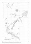
The hill of Panorama in Ptuj is one of the most important areas of Roman Poetovio. Chance finds a... more The hill of Panorama in Ptuj is one of the most important areas of Roman Poetovio. Chance finds and small-scale excavations in the past centuries have revealed the existence of significant archaeological remains that included buildings with numerous rooms and objects dedicated to a variety of deities, the remains of a sanctuary dedicated to the Nutrices, an Early Christian church, an aqueduct and a cemetery. The geophysical investigations have revealed the urban design with a rectilinear grid of streets and building plots.
The first few chapters of the book present the history of archaeological research on Panorama, the analytical approaches and the geophysical investigations with the methods employed and the final results. The main chapters correlate the archaeological data of differing quality and nature (chance finds, rescue excavations, old and modern archaeological investigations, geophysical surveys) and locate them with a series of plans. The comprehensive overview is supported by a Catalogue of stone monuments that presents the basic data, descriptions, bibliography, commentary and photographs of the stone objects recovered on Panorama.

Opera Instituti archaeologici Sloveniae 20, 2010
The region of Ptuj lies on one of the central traffic axes within the broader margins of the East... more The region of Ptuj lies on one of the central traffic axes within the broader margins of the Eastern Alps, and already in the distant past represented an important settlement centre. This monograph incorporates the knowledge hitherto gained abouth settlement history, from the Eneolithic to the Early Middle Ages in the eastern area of Ptuj, in Rabelčja vas. The emphasis is on the Roman Period, when the eastern district of the Roman town of Poetovio was beginning to spread here.
Within the area of Rabelčja vas, which comprises nearly one-third of the Roman town of Poetovio, over a period of two centuries more than 160 discoveries and researches have taken place. During the past four decades, extensive rescue excavations have been carried out here, which have revealed numerous prehistorical remains, and also the eastern, crafts quarter of the ancient town, together with the main road and extensive burial sites.
In the book, the archaeological sites are presented in the form of a catalogue and entered onto a survey map in the dimensions of 1: 2500 and 1: 5000, and onto detailed maps of larger dimensions. The catalogue is divided according to larger time periods into Prehistorical, Roman, Early Medieval and Late Medieval-Early Modern period sections. Great care has also been invested into the precise and substantiated positioning on the maps, and also to the interlinking of the sites with references in the literature. A brief presentation is given of the course of the research works, a description of the remains and the datings, which are consistently based on the already published data. In the concluding chapter, a presentation is given of the development of the settlement in the area of Rabelčja vas and within the space of the entire town of Ptuj, from the Eneolithic to the Early Middle Ages.
The complete text of the book is in Slovene, with the introductory and concluding chapters translated into English.

Opera Instituti archaeologici Sloveniae 17, 2009
The routes between the north Adriatic and the Apennine peninsula on the west and the Balkans and ... more The routes between the north Adriatic and the Apennine peninsula on the west and the Balkans and the central Danubian plains on the east ran across Razdrto ever since ancient times. In the late prehistory and in the early Roman era the pass of Razdrto was known under the name of Ocra as was the mountain above it.
Several Bronze age sites were discovered in the area of the Razdrto pass.
The posts in the Razdrto area from the end of the 2nd and first half of the 1st century BC (Mandrga, Preval) differ from the other sites along the east Alpine routes, as they were not spatially linked to any of the existing indigenous settlements and did not show any contact with the surroundings even with their small objects. Most of the remains can be explained as traces of Roman passengers who stopped at Razdrto for a shorter period of time and not as remnants of a significant Roman settlement.
A gravel covered road was constructed across the Razdrto pass in the second half of the 1st century BC or in the Augustan period. A roadside building was erected in the middle or late Augustan period and demolished in the mid 1st century AD.
The shift of transit from Razdrto to Hrušica (Ad Pirum) took place in the 1st century AD. Post 1st century AD written sources no longer mention the road across Ocra, and the archaeological remains dating after the mid 1st century AD are extremely modest at Razdrto.

Opera Instituti Archaeologici Sloveniae 3, 1997
Sredi Koprskega zaliva, na stiku med morjem in kopnim, izstopa osameli grič Sermin. Viden že od d... more Sredi Koprskega zaliva, na stiku med morjem in kopnim, izstopa osameli grič Sermin. Viden že od daleč, tako z morja kot tudi z okoliškega hribovja, leži na območju prehodov z Italskcga na Balkanski polotok, iz Istre v vzhodnoalpski prostor. O stanki starodavne naselbine na vznožju Sermina, znani že od 16. st., so bili v šestdesetih in sedemdesetih letih močno poško dovani ob velikih gradbenih delih, povezanih z razvojem pristanišča in železniške postaje. Šele skrom na zaščitna sondiranja od leta 1987 naprej so razsvetlila delček preteklosti in lahko samo slutimo razsežnosti izgublje nega in zamujenega. Knjiga o Serminu objavlja ugotovitve sondiranj Medobčinskega zavoda za varstvo naravne in kulturne dediščine iz Pirana v letih 1987 in 1988. Zrasla je iz dveh preddel: diplom ske naloge Vesne Svetličič o Prazgodovinskih najdbah iz Sermina (1996) in doktor skega dela Jane Horvat o Začetku rimske dobe na prosto ru zahodne in osrednje Slovenije (1993). Obravnavane prazgodovinske najdbe predsta vljajo le del prazgodovinskih najdb iz Sermina. Glavni na, ki je bila izkopana v letih 1990 in 1991, ni bila na voljo za študijsko obdelavo do izida knjige. Po drugi strani pa so raziskovanja v letih 1987 in 1988 dala večino znanega rim skega gradiva, zato je bilo m ogoče to obdobje tudi podrobneje predstaviti. Pri analiziranju prazgodovinskega gradiva je svetovala mentorica prof. dr. Biba Teržan, za veliko strokovno in prijateljsko pomoč pa se moramo zahvaliti še mag. Petru Turku. Z nasveti in kritiko so pomagali številni kolegi: dr. Dragan Božič, dr. Janez Dular, Darja Grosm an, M ilena Horvat, dr. Em anuela Montagnari Kokelj in dr. Brigitte Kull. Pri ovrednotenju rimskodobnega gradiva smo poiskali nasvete in pom oč pri dr. Janki Istenič, dr. Gerwulfu Schneiderju, dr. Marjeti Šašel Kos, Borisu Vičiču, Lučki Lavrenčič, Primožu Pavlinu, Snježani Karinja in Mateji Belak. Za pomoč pri prepoznavanju uvožene sredozemske keramike pa se moramo še pose bej zahvaliti dr. Johnu Hayesu, dr. Ivi Miki Curk, dr. Bojanu Djuriču, dr. Tamasu Bezeczkemu in dr. Marie-Brigitte Carre. Damijan Snoj in Tomo Kajfež sta nam omogočila vpogled v del gradiva s sondiranj v letih 1990 in 1991. Vrzeli v topografskih podatkih sta dopolnila Matej Zupančič in Drago Svoljšak. Pri izdelavi geografskih kart je sodelovala Vida Bitenc. Terenske raziskave je v skladu z zakonodajo omogočilo podjetje Istrabenz. Ministrstvo za znanost in tehnologijo in Ministrstvo za kulturo republike Slove nije pa sta podprla analizo gradiva.

by Bernarda Zupanek, Boris Vičič, Iris Bekljanov Zidansek, Petra Vojaković, Dimitrij Mlekuz Vrhovnik, Alenka Miškec, igor rižnar, bojan djuric, Kaja Stemberger Flegar, Jana Horvat, Lucija Grahek, and Anja Ragolic
This book represents the last chapter in the story unfolding in 2014 and 2015 that commemorated t... more This book represents the last chapter in the story unfolding in 2014 and 2015 that commemorated the
bimillenary of the foundation of Emona (Colonia Iulia Emona), the Roman-period predecessor of the
modern Ljubljana. The territory of Emona has witnessed numerous archaeological investigations over the last two
decades, both in the urban areas, the suburbs and the adjacent cemeteries.