David Rumsey Map Collection (original) (raw)

A Stranger Quest
Documentary - Art Film
For David Rumsey, maps constitute the fabric of memory. They carry images of boundless worlds and the people who live there — past, present, and even the future. In the film A Stranger Quest by Andrea Gatopoulos, David takes us on a journey through time and space as he recalls why he started collecting. Over decades the collection grew into the intricate, innovative, and intimate story of his life and all the lives that have touched him.
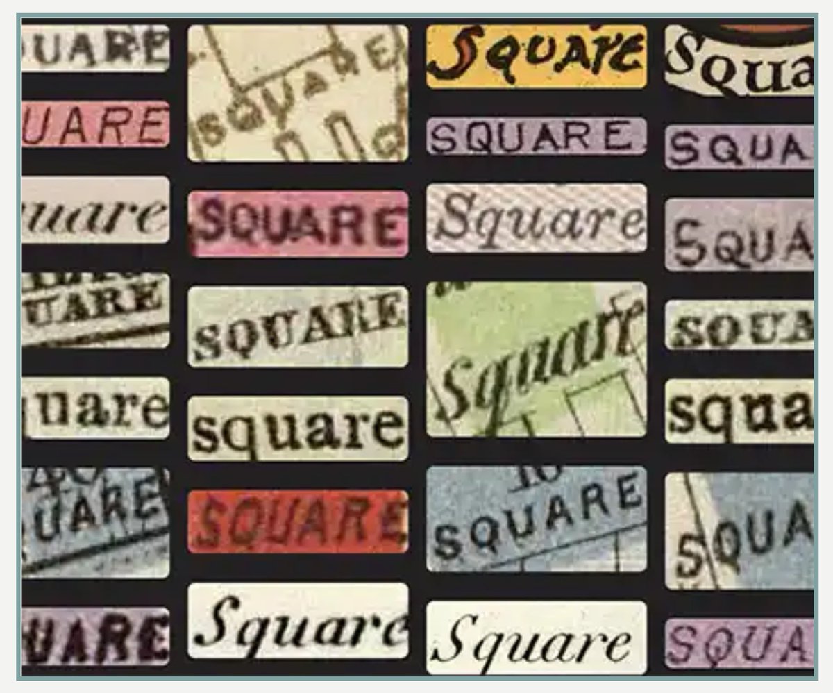
NEW: Search by Text-on-Maps! To learn more, see the About Text on Maps Help Guide.
Here are some of our favorites:
PrevNext
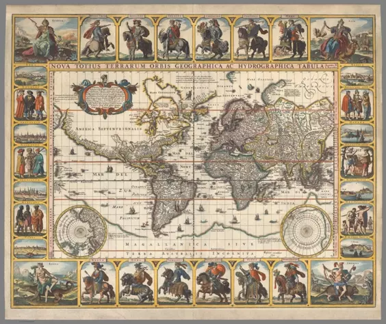 Nova Totius Terrarum Orbis geographica ac hydrographica tabula;Visscher, Nicolaes, 1649-1702.; Visscher, Claes Jansz; Piscator, N.J.;1652;11755.005
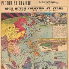
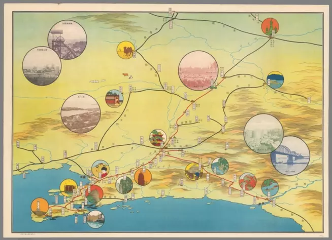 (Pictorial map of Japanese occupied Manchurian coast).;Anonymous;1936;14051.001
 Der Mensch Als Industriepalast (Man As Industrial Palace);Kahn, Fritz;1926;10579.000
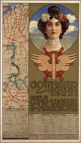 Gotthard-Bahn, Laghi di Como-Lugano & Maggiore, 1904;Chiattone, Gabriele;1904;8118.000
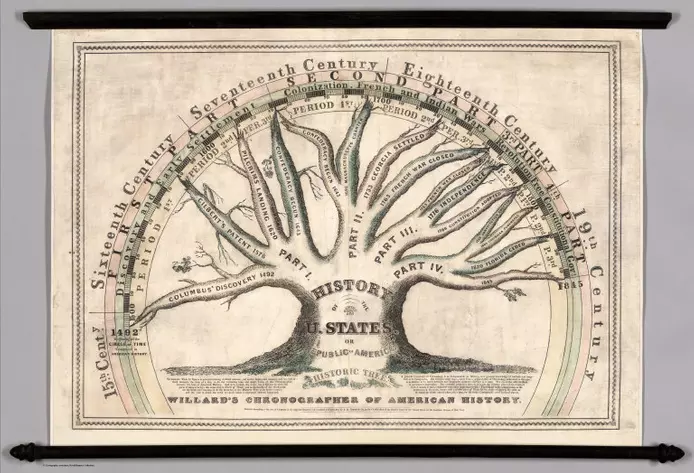 Willard's Chronographer of American History;Willard, Emma;1845;6700.000
{{title}}
Welcome to the David Rumsey Map Collection. Here you can explore maps through a variety of viewers. Read the Blog to learn more about collection highlights, such as Urbano Monte's manuscript world map from 1587. Visit the physical collection at the David Rumsey Map Center at the Stanford University Library. Or take a virtual tour of the Map Center, which hosts events such as the recent Barry Lawrence Ruderman Conference on Cartography : Indigenous mapping.
The historical map collection has over 141,000 maps and related images online. The collection includes rare 16th through 21st century maps of North America, South America, Europe, Asia, Africa, Australia, Antarctica, the Pacific, the Arctic, and the World. The online map collection is a searchable database that allows you to make your own journeys into spatial representations of the past. Here you can see the history of cartography through primary sources from 1500 into the 21st century.
NEW: Random Browse the collection (desktop and tablet only). 250 images at a time. Refresh the link to see 250 more. We invite you to get pleasurably lost.
|  | |
| |  | |
| |  | |
| |  | |
| |  | |
| |  |
| ------------------------------------------------------------------------------------------------------------------------------------------------------ | | ------------------------------------------------------------------------------------------------------------------------------------------------------------ | | ---------------------------------------------------------------------------------------------------------------------------------------------------------- | | ------------------------------------------------------------------------------------------------------------------------------------------------------- | | --------------------------------------------------------------------------------------------------------------------------------------------------------- | | ---------------------------------------------------------------------------------------------------------------------------------------------------- |
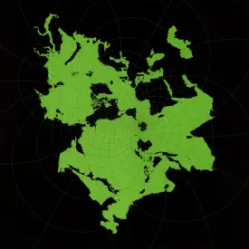
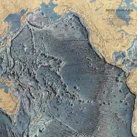
| Newspaper Maps | | Imaginary Maps | | Ethnography | | Title Pages | | Art Maps | | Pacific |
|
|
| ------------------------------------------------------------------------------------------------------------------------------------------------------ | | ------------------------------------------------------------------------------------------------------------------------------------------------------------ | | ---------------------------------------------------------------------------------------------------------------------------------------------------------- | | ------------------------------------------------------------------------------------------------------------------------------------------------------- | | --------------------------------------------------------------------------------------------------------------------------------------------------------- | | ---------------------------------------------------------------------------------------------------------------------------------------------------- |
| Newspaper Maps | | Imaginary Maps | | Ethnography | | Title Pages | | Art Maps | | Pacific |
|  | |
| |  | |
| |  | |
| |  | |
| |  | |
| |  |
| Views | | Timelines | | Aerial Photographs | | Automobile Maps | | Composite Maps | | Airlines |
|
|
| Views | | Timelines | | Aerial Photographs | | Automobile Maps | | Composite Maps | | Airlines |
|  | |
| |  | |
| |  | |
| |  | |
| |  | |
| | 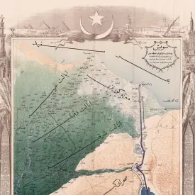 |
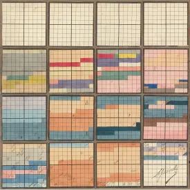
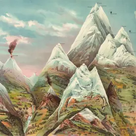
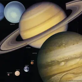
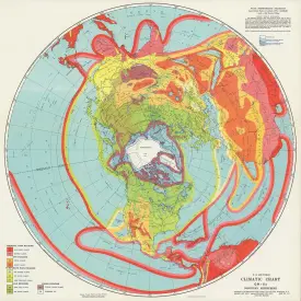
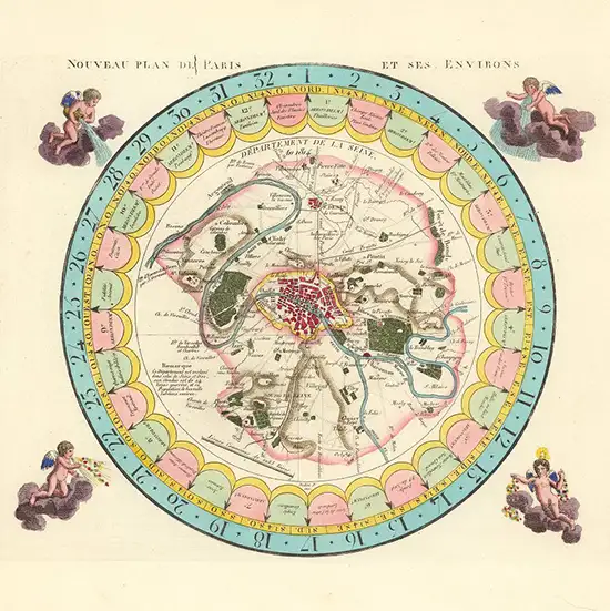
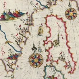
| Mountains Rivers | | Space | | Manuscript | | Climate | | Games and Puzzles | | Ottoman Maps |
|
|
| Mountains Rivers | | Space | | Manuscript | | Climate | | Games and Puzzles | | Ottoman Maps |
|  | |
| |  | |
| |  | |
| |  | |
| |  | |
| | 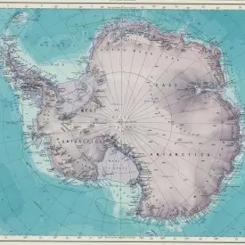 |
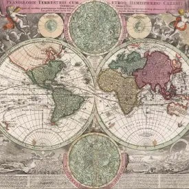
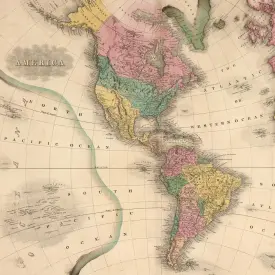
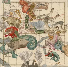
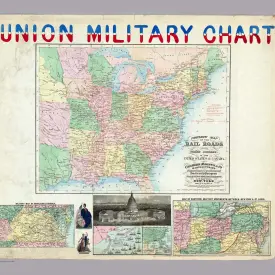
| World | | The Americas | | Celestial | | Maritime Charts | | U.S. Civil War | | Antarctica |
|
|
| World | | The Americas | | Celestial | | Maritime Charts | | U.S. Civil War | | Antarctica |
|  | |
| |  | |
| |  | |
| |  | |
| |  | |
| |  |
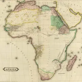
| Data Visualization | | Cities | | Globes | | Atlases | | Africa | | Children's Maps |
|
|
| Data Visualization | | Cities | | Globes | | Atlases | | Africa | | Children's Maps |
|  | |
| |  | |
| |  | |
| |  | |
| |  | |
| | 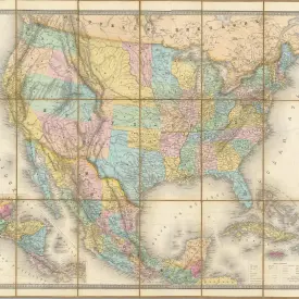 |
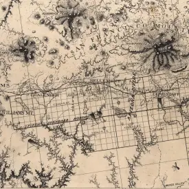
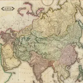
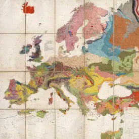
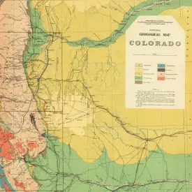
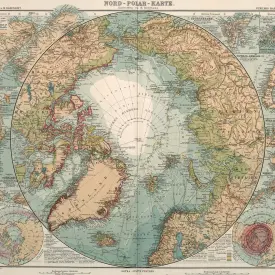
| Pictorial Maps | | Asia | | Europe | | Geology Maps | | Arctic | | United States |
|
| Pictorial Maps | | Asia | | Europe | | Geology Maps | | Arctic | | United States |
Advanced search allows refined inquiries for precise results, while browsing encourages serendipitous exploration, honoring the legacy of library shelves. Popular collection categories include data visualization, celestial maps, atlases, globes, school geography, maritime charts, city atlases, pocket maps, children's maps, and manuscript maps. Subject and place examples: Pictorial, Geology, California, New York City, U.S. Civil War, Afghanistan, Moon, Mountains and Rivers, Migration, Languages, Religions, Railroads, Climate, Agriculture, Economics, and Zoological. Browse search facets: What, Where, Who, When. The collection supports the study of topics such as history, ethnography, technology, environmental science, genealogy, and art. Learn more

TeleGeography, Inc. has been mapping global telecommunications since 1996. Their maps illustrate the remarkable growth of the Earth’s communication exoskeleton, formed by undersea cables and satellites. Explore 37 of their maps at: https://t.co/dQhm2gt4mS https://t.co/hqeZ87Abxn


1877 Eadweard Muybridge Panorama of San Francisco in 11 sheets. One of the landmarks of 19th-century American photography, and an iconic panoramic image of San Francisco, accompanied by the rare Key to Muybridge's work. High resolution image https://t.co/FwYuIua98P https://t.co/VoGr3Igb1L


A Stranger Quest, a documentary and art film combined by Andrea Gatopoulos, surveys the life of David Rumsey and his passion for maps. The film was released to the public in December 2024. Watch it in its entirety at https://t.co/YSgPR6rkpD https://t.co/oYRQ73UU5Z


60,000 new maps, views, texts, titles, diagrams, globes, timelines and more have been added to search for Text on Maps - doubling to 120,000 items from the original 60,000 we started with a year ago. Over 175 million words indexed! Try searching for Cairo https://t.co/481hMN9ahN https://t.co/jfG40qk2OQ


The Speed of the Earth, lights move at rotational speed of earth on axis, 1156ft/sec at lat 40.79571, lon -119.18323. Using GPS to time the flashes. A moving map. https://t.co/QZokOjB07V
The Speed of the Earth art installation seen from the man at Burning Man during the day: https://t.co/jxBdLUq6UE
Map of The Speed of the Earth on the outer playa at Burning Man. https://t.co/XPDnPZs7VX

"The Speed of the Earth" installation at Burning Man 2024 by Kevin Kelly and David Rumsey. A nearly mile long line of 30 solar powered LED strobes pulsing at the rotational speed of the earth, 784 mph. Lights use GPS to determine when to flash. Drone video at 400 ft elevation. https://t.co/sqibPJd3J1
Otto Neurath, Gerd Arntz, 1929, Die Bunte Welt. (The colorful world : Pictorial statistics for the youth). Brilliant data visualizations show school children the ethnic, religious, industrial, agricultural, political, and climatic variations of the world. https://t.co/gdw7RC6dqj https://t.co/25Olvv1lWF


Rand McNally made Air Trails maps for every U.S. state starting in 1929. Similar to their Auto Trails maps, the Air Trails maps showed the new air routes and airports serving them. They remain a record of the early air age in America, now mostly vanished. https://t.co/61oePZ4SiU https://t.co/dZPW3dUDlb


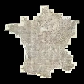
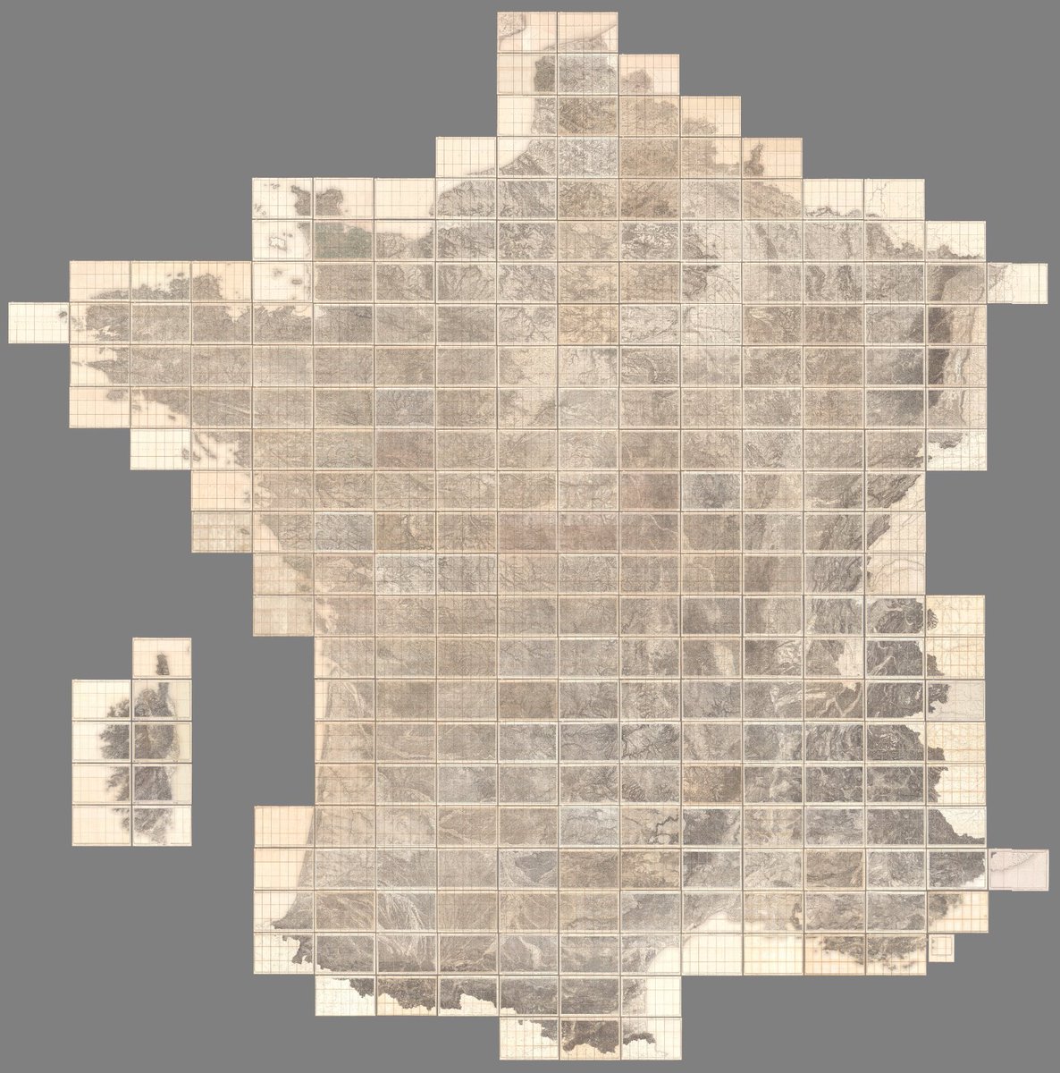
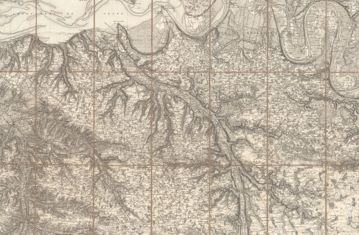
The 267 sheet Carte de France de l'État Major was produced between 1832 and 1876. At 1:80,000 scale it remains an extraordinary record of 19th century France. From city and town details to alpine glaciers, nothing is missed. A composite of all 267 sheets https://t.co/T8rqk4lBia https://t.co/TJbRUQzI1x


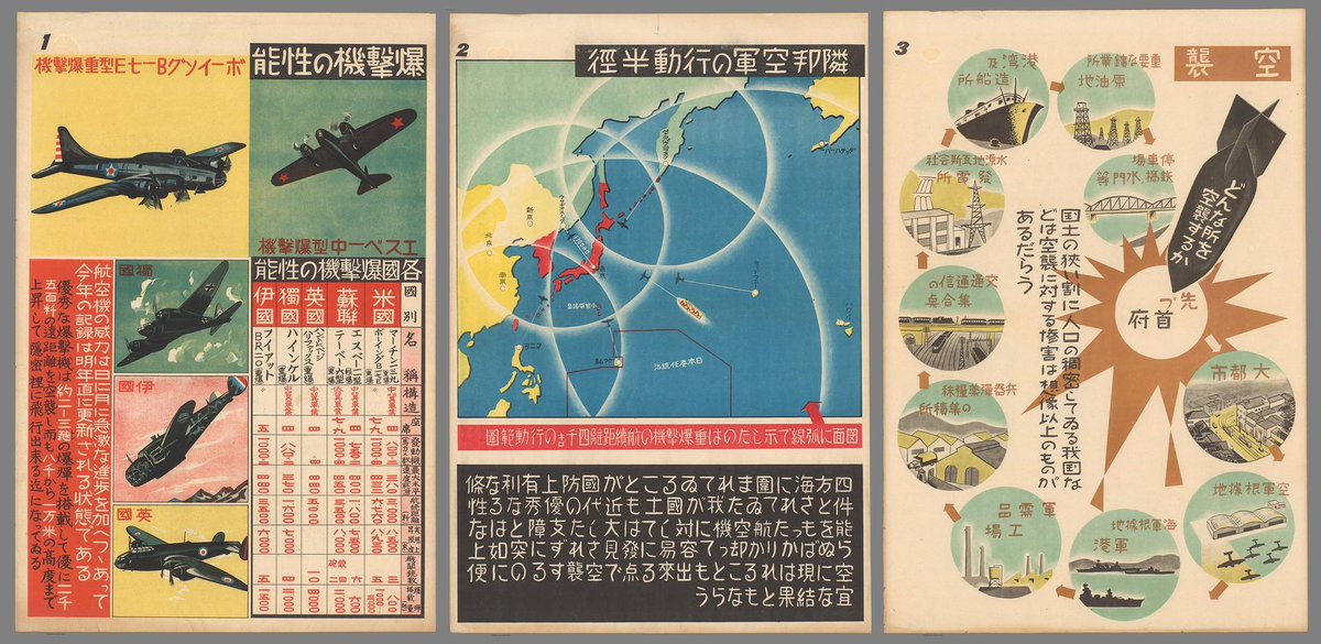
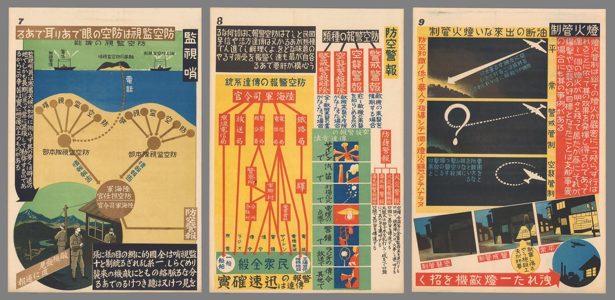
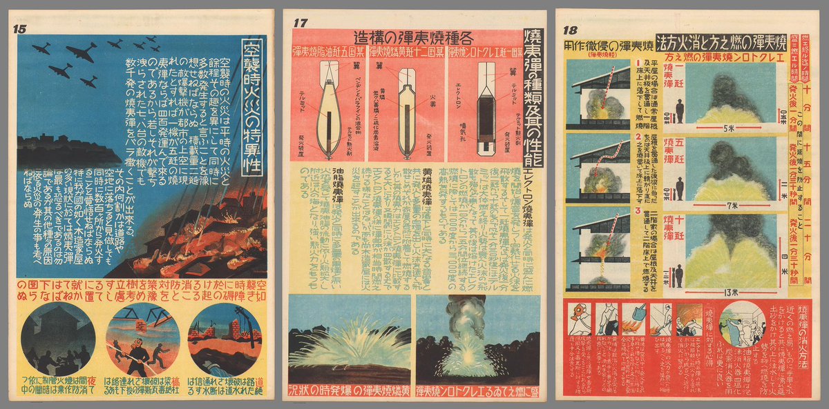
35 Japanese infographics from 1944 designed to help the public survive intense fire bombing raids by US planes during World War II. Made by the Great Japan Air Defense Association, they combine strong persuasive power through outstanding graphic design. https://t.co/utNKRLoZz7 https://t.co/KrUDYuBaml

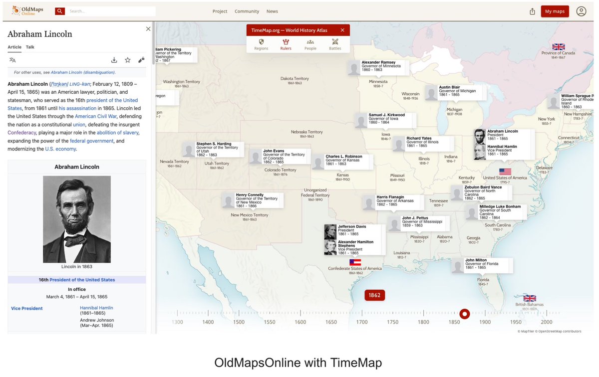
Join us for the public launch of the next generation of OldMapsOnline with the new TimeMap. Wednesday, May 15, from 9:30am to 12:30pm PDT at the David Rumsey Map Center, Stanford University. Attend in person or virtually. Details and registration here - https://t.co/1tKXAuzlQM https://t.co/caInMXK4XD
Collaboration between the Rumsey Map Center at Stanford and Monash University’s Embodied Visualisation Group has produced Globes, an App for the new Apple Vision Pro. Blog post by Dilpreet Singh who with Bernie Jenny and Kadek Satriadi developed the App. https://t.co/PZf9j8sL8z https://t.co/2JeAF7Zbgv

David Rumsey Map Center celebrates its 8th Anniversary April 1, 2024 with a special screening the film "A Stranger Quest" - a documentary about Rumsey and his passion for maps. Free to the public, 4:30pm, Stanford. Details, register https://t.co/dDJUHcCPed Film release late 2024.
1935 Mala Vlastiveda [The Little Civics Reader] Rare brilliant Czech school geography with innovative design and data visualization. Sutnar’s constructivist typography combines with the isotypes of Tschinkel who had worked with Arntz and Neurath in Vienna. https://t.co/ioj6JtSgSQ https://t.co/z2qC9WB6a5


A second trailer to "A Stranger Quest," a film by Andrea Gatopoulos about David Rumsey and his map world. Full release in 2024. YouTube link: https://t.co/7XGQ1MMhYe https://t.co/pwGSpW64uv
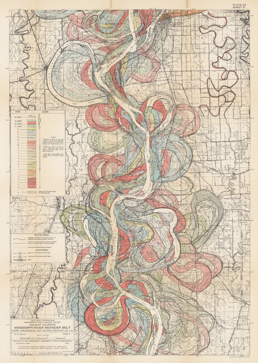
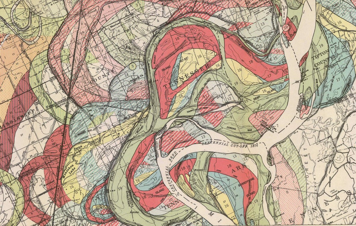
In 1945 Harold Fisk published 27 large scale geological maps of the Mississippi River. The 15 meander maps of the Mississippi from Cape Girardeau to Donaldsonville are extraordinary data visualizations. We have joined all 15 into one continuous map. https://t.co/sPLJdzbqAY https://t.co/DsFztK26lw


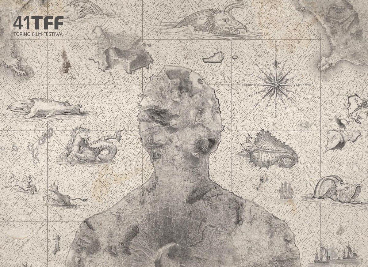
"A Stranger Quest," a film about David Rumsey and his passion for maps premiers at the Torino Film Festival November 30. Below is a trailer. Made by Italian filmmaker Andrea Gatopoulos, the film will be released in 2024. https://t.co/yT17D8rebL
A beautiful gift and quote from Michael Friendly@datavisFriendly: "Geschichtsbaum Europa says 4000 years of European history in one view! It is not very well known, but I think it is among the finest attempts to visualize history in the form of a tree..." https://t.co/4CdIfzoMOv https://t.co/8WGasq7CVP


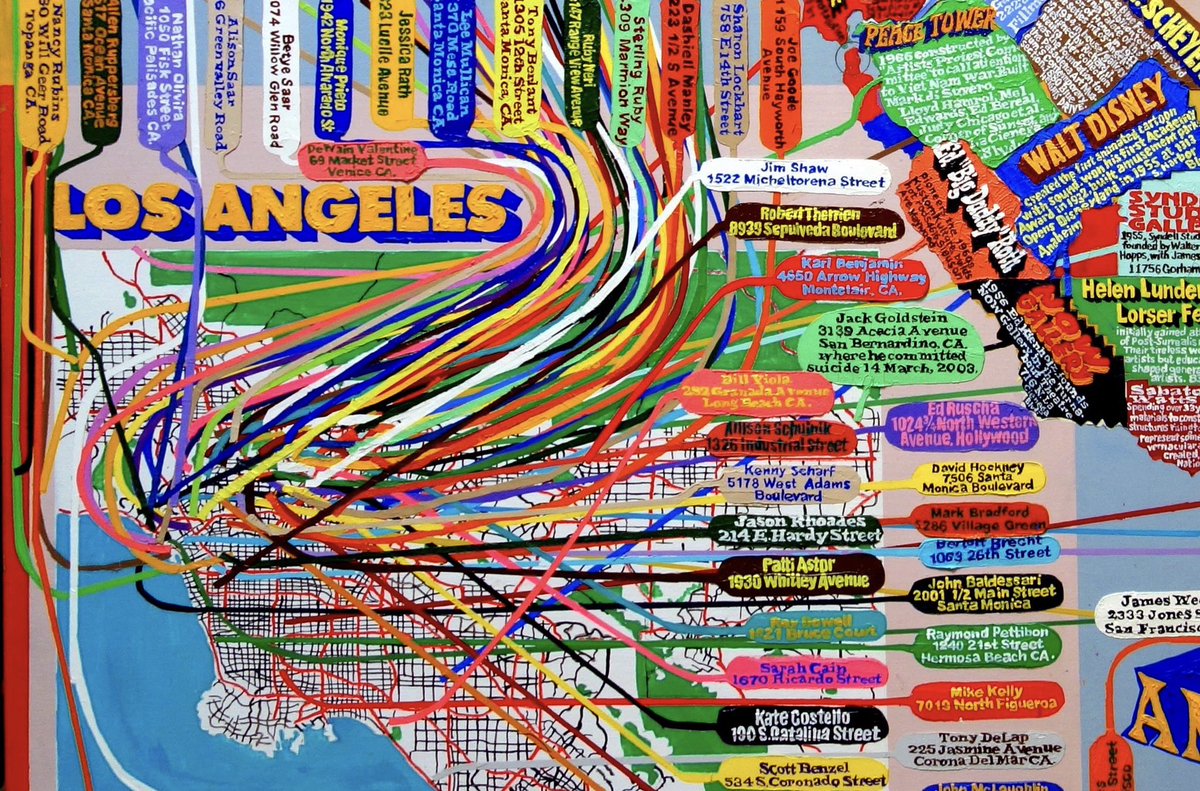
Painter Loren Munk makes data visualization art works that map the locations, histories, movements, and ontologies of the art world. His Soho map was recently featured in the New York Times. For 15 examples see https://t.co/ucp46RcMV0 https://t.co/cirbNFYVrn


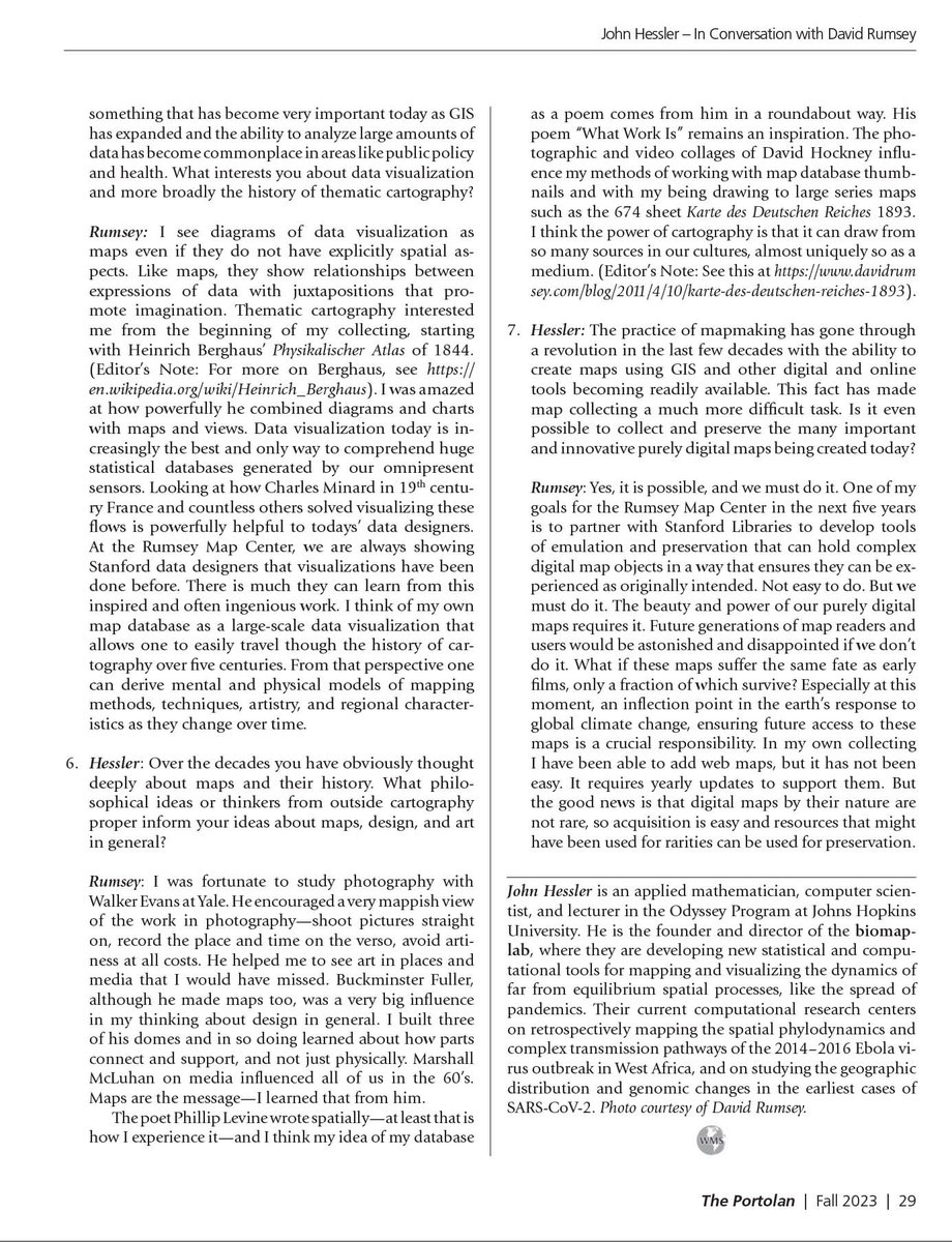
An interview with David Rumsey appears this month in the Portolan, the journal of the Washington Map Society. John Hessler asks Rumsey how his collecting began and evolved over decades, turning a private obsession into a public good. Full PDF at https://t.co/ZMomPbNrfh https://t.co/yIP8SBFxIz


Our new Machines Reading Maps tool that allows searching Text on Maps is now live at https://t.co/I78lXjjztf 100 million words indexed on 57,000 maps. Users can correct any errors. See our Text On Maps Help Guide for detailed descriptions on using this exciting new feature. https://t.co/KUUyCRMxTx


Manuscript maps from Piri Reis, to Frances Henshaw, to R. Crumb, to Anonymous Vietnamese, to over 1,000 more at https://t.co/CFo0nBnP94 https://t.co/Fi1bZaZFhK


Levi Walter Yaggy (1842-1912) made brilliant maps and views for education in the 1887 Geographical Study and the 1893 Geographical Portfolio. 34 color plates of the world and universe inspired wonder. See all https://t.co/0D7PvpTOGF. See https://t.co/IACS645IUS for Yaggy's life. https://t.co/r9YpkmC8bo


Richard Edes Harrison (1901-1994) made maps that radically changed our world view. As chief cartographer for Fortune Magazine, Harrison developed mapping concepts later found in GIS, data visualization, and thematic cartography. See 142 of his maps: https://t.co/T75e3bl5G1 https://t.co/k3ZBKQdRlt


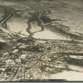
24 oblique highly detailed San Francisco aerial views. Anonymous photographer took pictures from a plane. Circa 1930. Printed by "Staples Quality Prints / 910 Market St. Opposite Fifth." Before Bay Bridge and Golden Gate Bridge were built. See group here:https://t.co/pDXizJBEZQ https://t.co/9KkaWKmr8Q


Video of partial results of searching for Himalaya, Mississippi River, Paris, Ruin, and Water in our new Machines Reading Maps tool. 100 million words indexed on 57,000 maps. Final version will be public in a month. Clicking results will open the full map with text highlighted. https://t.co/TJPBhg6Gtf
Mapping and data visualization of 19th century balloon journeys. "Travels in the Air," 1871, by James Glaisher. A new way of seeing the earth. With thanks to RJ Andrews @infowetrust for bringing this to us. https://t.co/SN2XA63bQe https://t.co/N9E5UnoeA0


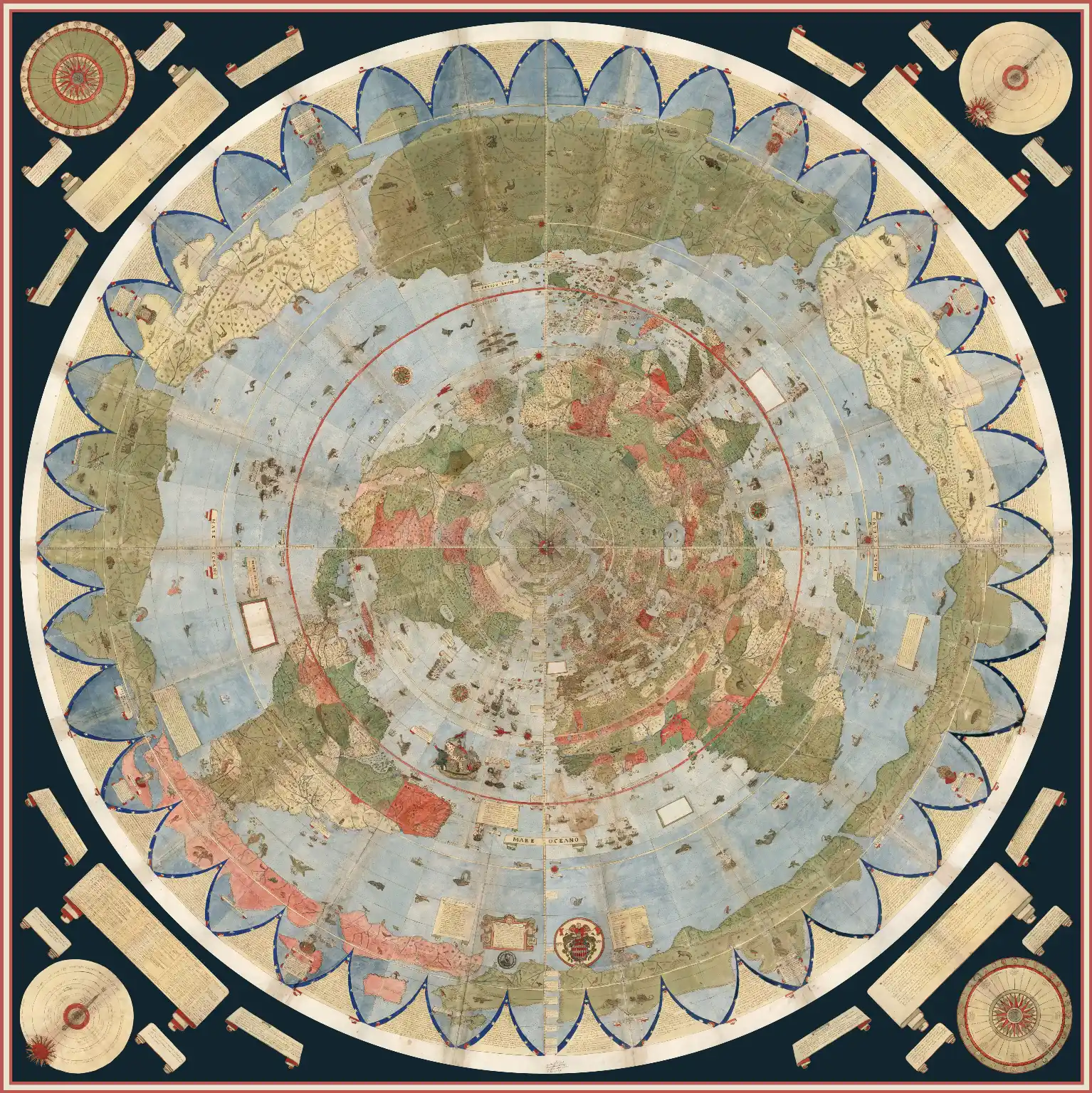 |
Largest Early World Map - Monte's 10 ft. Planisphere of 1587 An extraordinary 60 sheet manuscript world map made in 1587 by Urbano Monte has been added to the David Rumsey Map Collection at Stanford University. At 10 foot square, this map or planisphere is the largest known early map of the world. It was hand drawn by Monte in Milan, Italy, and only one other manuscript copy exists. The digitally joined 60 sheet map image below is the first time the map Monte made has been seen as one unified map - as Monte intended - in the 430 years since it was created. See all the individual sheets here. Monte's map reminds us of why historical maps are so important as primary resources: the north polar azimuthal projection of his planisphere uses the advanced scientific ideas of his time; the artistry in drawing and decorating the map embodies design at the highest level; and the view of the world then gives us a deep historical resource with the listing of places, the shape of spaces, and the commentary interwoven into the map. Science, art, and history all in one document. Until now, Monte’s manuscript map was seen as a series of 60 individual sheets. The only assembled version is the small single page key sheet of the series. Now that we have joined all 60 sheets digitally, we can appreciate in a new way the extraordinary accomplishment that Monte made. The assembled map, just over 10 feet in diameter, is one of the largest—if not the largest—world maps made in the 16th century. The degree of detail and decoration is stunning and the entire production is surely unique in the history of cartographic representation. Read Full Blog Post |
|---|
Georeferencer v4 is an improved and updated version of our prior Georeferencer v3. It allows you to overlay historic maps on modern maps or other historic maps. The overlaid maps reveal changes over time and enable map analysis and discovery. You can choose your own maps to georeference by Searching LUNA and using the Georeference This Map button or help us georeference the entire online map library using our Random Map link to georeference maps in our First Pilot Project of 6,000 maps of major cities and regions. Users who georeference the most maps will be recognized in the bar displays below. Recently Georeferenced maps can be viewed by image or by location.
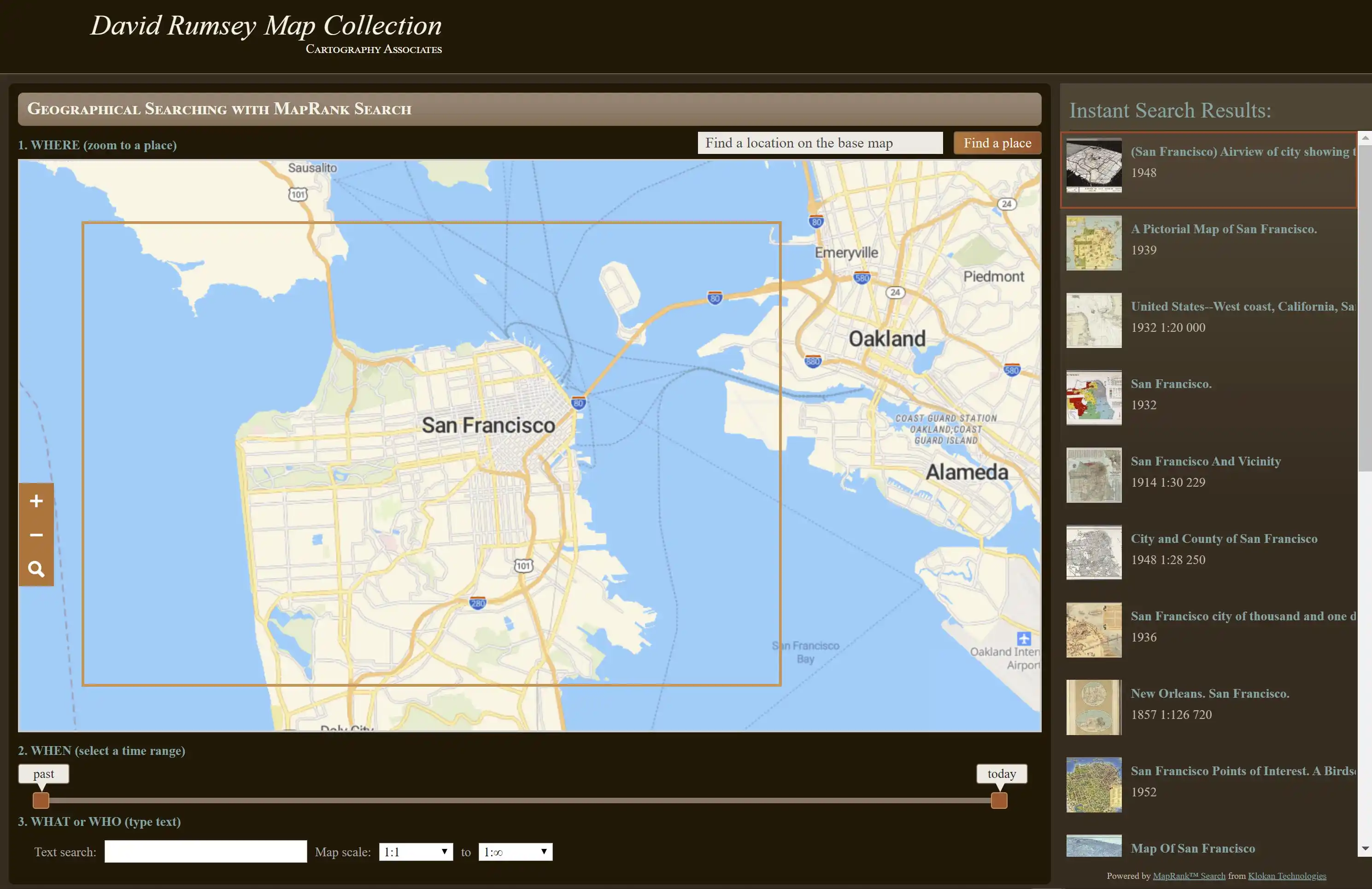
The MapRank search tool enables geographical searching of the collection by map location and coverage, in a Google Map window. Pan and zoom the Google Map to the area of the world you want maps of, and the results will automatically appear as a scrollable list of maps with thumbnail images in the right side window. The maps in the right side list are ranked by coverage, with the maps that have coverage closest to your search window listed at the top. Mousing over any map in the list will show the map's coverage as a light red rectangle on top of the Google Map. Clicking on a map in the list will open it in the Luna Browser. You can filter your results with the When timeline, the What or Who keyword text window, and the Map scale windows, as well as search by place name in the Find a place window. Learn more